This article is brought to you by OOFOS, whose mens sport sandals are made to help your feet recover after a long day of trail running, backpacking or whichever sport gets you on your feet and moving.
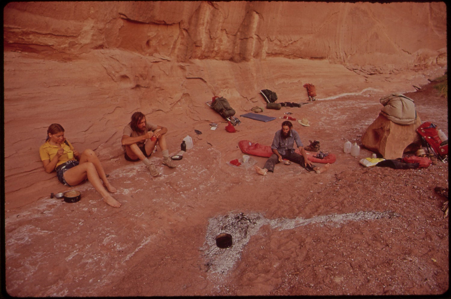
Two years ago, I backpacked 70 miles in the The Maze district in Canyonlands, and I assure you, it is not for the weak. Backpacker Magazine labeled this district of Canyonlands National Park as one of the top 10 deadliest hikes in America. Yet it hasn’t claimed any lives on record. So what makes it so dangerous?
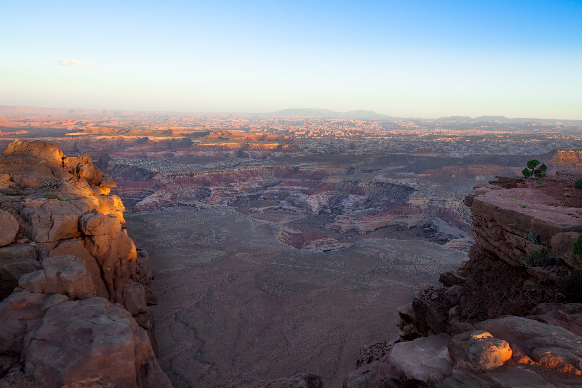
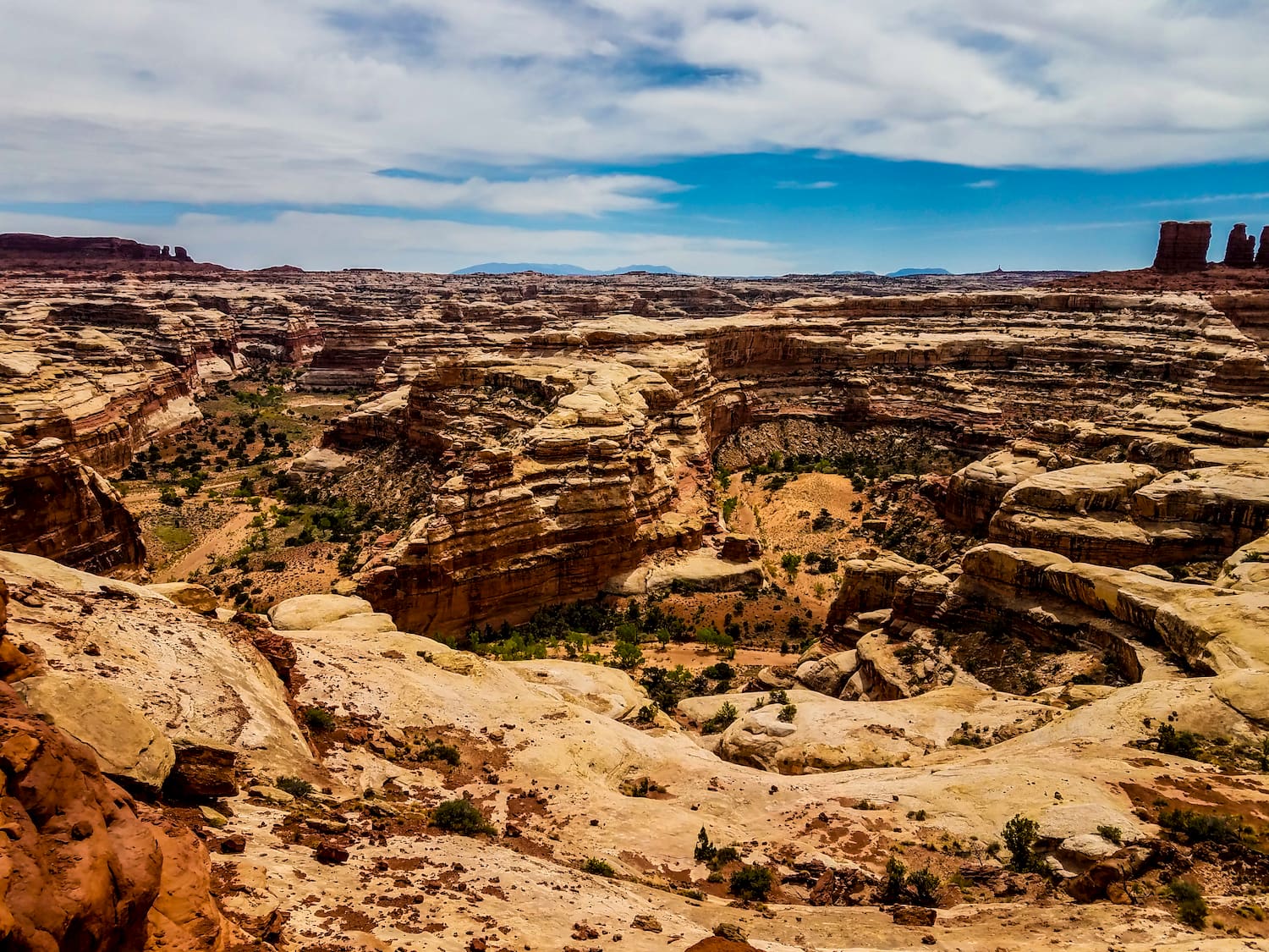
Situated in the southeastern desert of Utah inside Canyonlands National Park, The Maze lives up to its name—it is a slew of interwoven canyons, often with dead-ends, and is known as a “thirty-square-mile puzzle in sandstone.” The routes are trail-less and weave up and over canyons, making this region extremely difficult to navigate. You’ll hike in dry washes with high cliffs, making it difficult to get a vantage point. Water sources in The Maze are limited, too. If you’re lost and in a state of emergency, it can take rescuers up to three days to reach hikers because it’s so remote. So yeah, that’s why.
Why The Maze in Canyonlands Is One Of The Deadliest Hikes, And How You Can Safely Hike It
So why do people go? The massive, sandstone fins and interconnected canyons in ruby will enchant anyone that visits. Viewing the mighty convergence of the Colorado River and Green River from the top of a massive desert mesa is not something you forget about, either. While meandering through the canyons, you’ll find earth-toned petroglyphs carved on canyon walls that are not only beautiful aesthetically, but are fascinating evidence of ancient human history. For me, the beauty of The Maze outweighed the risks.
With the right gear, a well thought out itinerary and a savviness for navigation, hiking in The Maze is more than survivable, it is a remote, quiet and stunning place to spend a week come spring. It may be dangerous without the proper equipment and knowledge of the area, but that’s what this guide is for. We’ll give you the know-how to spend a week in The Maze in Canyonlands for a desert-filled adventure, but we always encourage more research and knowledge of topographic maps before navigating this desert playhouse.
Basic Info
Canyonlands is broken up into three districts, The Maze, Island in The Sky and The Needles. While each district offers unique experiences, many visitors find that Canyonlands remains one of Utah’s most underrated national parks, especially for van lifers and remote workers seeking solitude away from the crowds at nearby Arches. The Maze is the least accessible district of Canyonlands, so hikers must be self sufficient and deal with their own emergencies. The Maze sees only 2,000 people per year, compared to the 264,000 people that visit Island in The Sky, just to give you an idea of how remote it can be. Even backcountry rangers are required to follow strict communication protocols and leave a detailed itinerary with someone who monitors their trip into the backcountry.
The best time to visit Canyonlands is in the spring, when temperatures are lower and springs are more active. You should plan to visit for at least a week, because of how remote it is. You’ll log some serious hours just driving there. The trailheads are hours from the nearest ranger station and navigating four-wheel-drive roads to reach the trailheads requires time. The roads are not for inexperienced drivers, either.
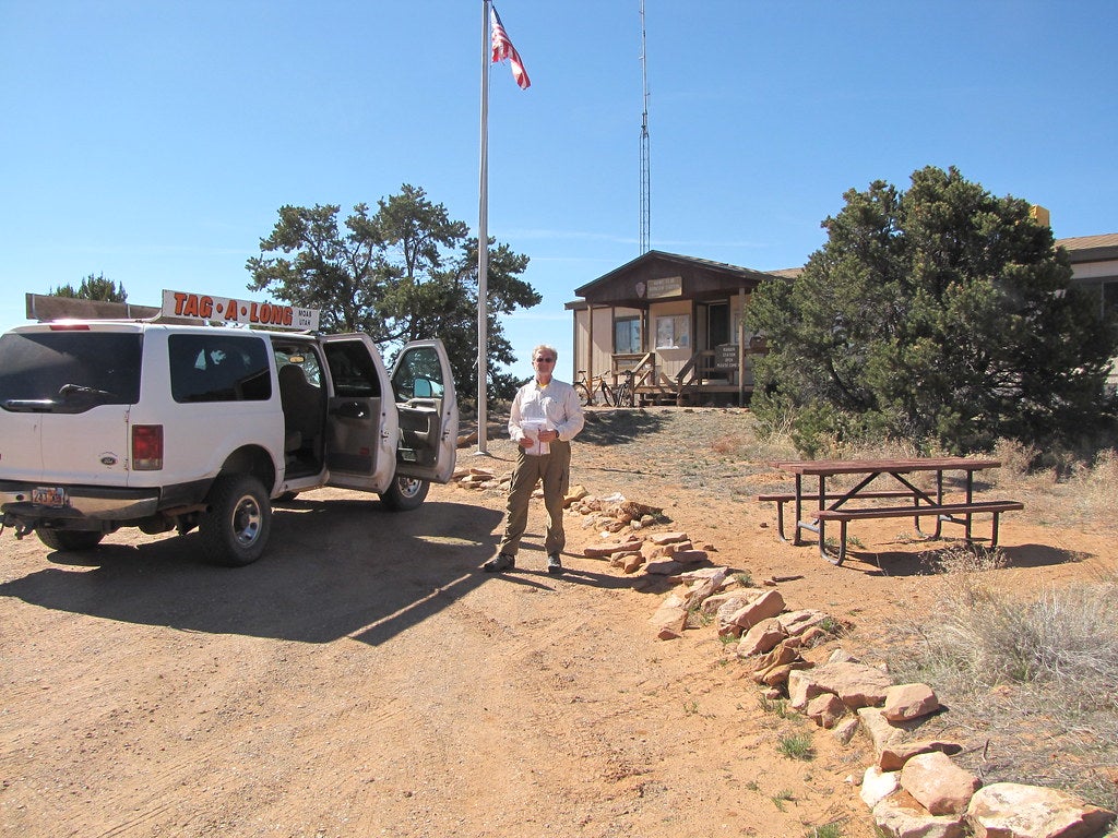
Getting to The Maze in Canyonlands and Snagging a Permit
Simply reaching the trailhead to start backpacking in The Maze is difficult, and another reason why the number of visits to The Maze is low. But if you have a four-wheel drive vehicle and you’re able to navigate challenging roads, you’ll be fine.
If you’re keen on backpacking in The Maze, you need a permit. Snag your permit at Hans Flat Ranger Station, a 2.5 hour drive from Green River, Utah. If you’re coming from I-70, take UT-24 south for 24 miles. Turn left just beyond the turnoff for Goblin Valley State Park. Drive on the two-wheel-drive road for 46 miles south east to the ranger station.
The Ranger Station is open year round from 8am-4:30pm daily. In the station, you’ll find friendly rangers eager to help you and will likely want to see your itinerary to make sure it is feasible and safe. There are no services in the station, but there are books and maps if you need.
You’ll acquire your permit for your trip here, but the National Park Service recommends that you reserve a permit in advance. The permit is $30 and allows 5 people on the permit, so choose your troops wisely.
Trailheads
From the ranger station, the canyons of The Maze are another 3-6 hours on four-wheel-drive roads. You must have a high clearance, low range, four-wheel-drive vehicle to attempt to get to any trailheads. If you do have a suitable vehicle, we recommend driving the top of the Flint Trail and beginning your trip from there.
Water
Water is scarce in The Maze in Canyonlands. You’ll have to a carry a good deal of the water you’ll need for the trip. Impassable topography make water resources difficult to reach as well, so it is extremely important to carry a topographic map.
There are several reliable springs in The Maze. The Hans Flat Ranger Station keeps track of the status of most of the springs, so check in with the rangers to see where your water sources will be.
We recommend at least 4 liters of water per person for each day while in a harsh desert environment like The Maze. If you plan to carry all of your water for a 3 days trip, that would be 3 gallons of water. If you do not plan to carry that much water, make sure to talk to the rangers about water sources and make a detailed not on topographic maps where to find these water sources.
Navigation The Trail
Once you’re on the trail, the real games begin. Some routes are marked with cairns throughout the canyons from mesa top to the canyon bottom, though routes through washes are often unmarked. When you decide on a route, these cairns can help guide you, but they should not be landmarks you rely on to navigate The Maze in Canyonlands. Many of the canyons look similarly, so understanding and utilizing topographic maps is key.
You should chart your route with a GPS, but still always carry a map.
Planning Your Trip
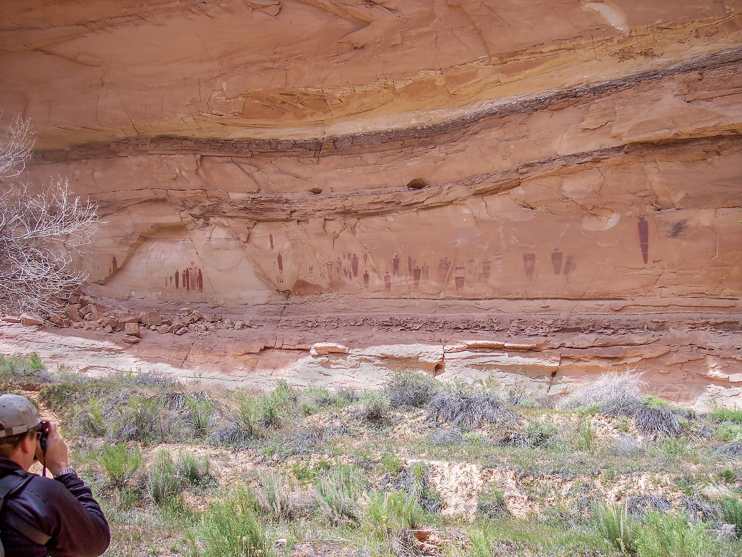
Before you head into the thick of The Maze, head to Horseshoe Canyon, just outside the park, for a glimpse at the Great Gallery archaeological site. It is one of the most celebrated pictograph panels in the U.S. It is an awe-inspiring testament to an ancient past.
Once you’ve headed into The Maze, there are many route possibilities. Check out a map and decide which route is best for you. Some highlights that are worth checking out are The Chocolate Drops, Confluence Peninsula (confluence of the Green River and the Colorado River), and The Harvest Scene.
This article about hiking and camping in The Maze in Canyonlands was brought to you by Morsel Spork

Morsel Spork makes sporks to enjoy your favorite dehydrated dinners.
The Dyrt is the only camping app with all of the public and private campgrounds, RV parks, and free camping locations in the United States. Download now for iOS and Android.Popular Articles:
Articles on The Dyrt Magazine may contain links to affiliate websites. The Dyrt receives an affiliate commission for any purchases made by using such links at no additional cost to you the consumer.