![]()
The Pacific Coast Highway (PCH) stretches approximately 1,650 miles from the wilds of Olympic National Park in Washington to the sunny shores of San Diego, California. Established along existing highways like U.S. 101 and California’s Highway 1, this route lets travelers drive the edge of the continent. You can start at either end – each direction offers a different experience in climate and scenery. Heading southbound reveals a slow transition from misty rainforests to Mediterranean-like beaches, while northbound travelers move from arid coasts toward lush, foggy woods.
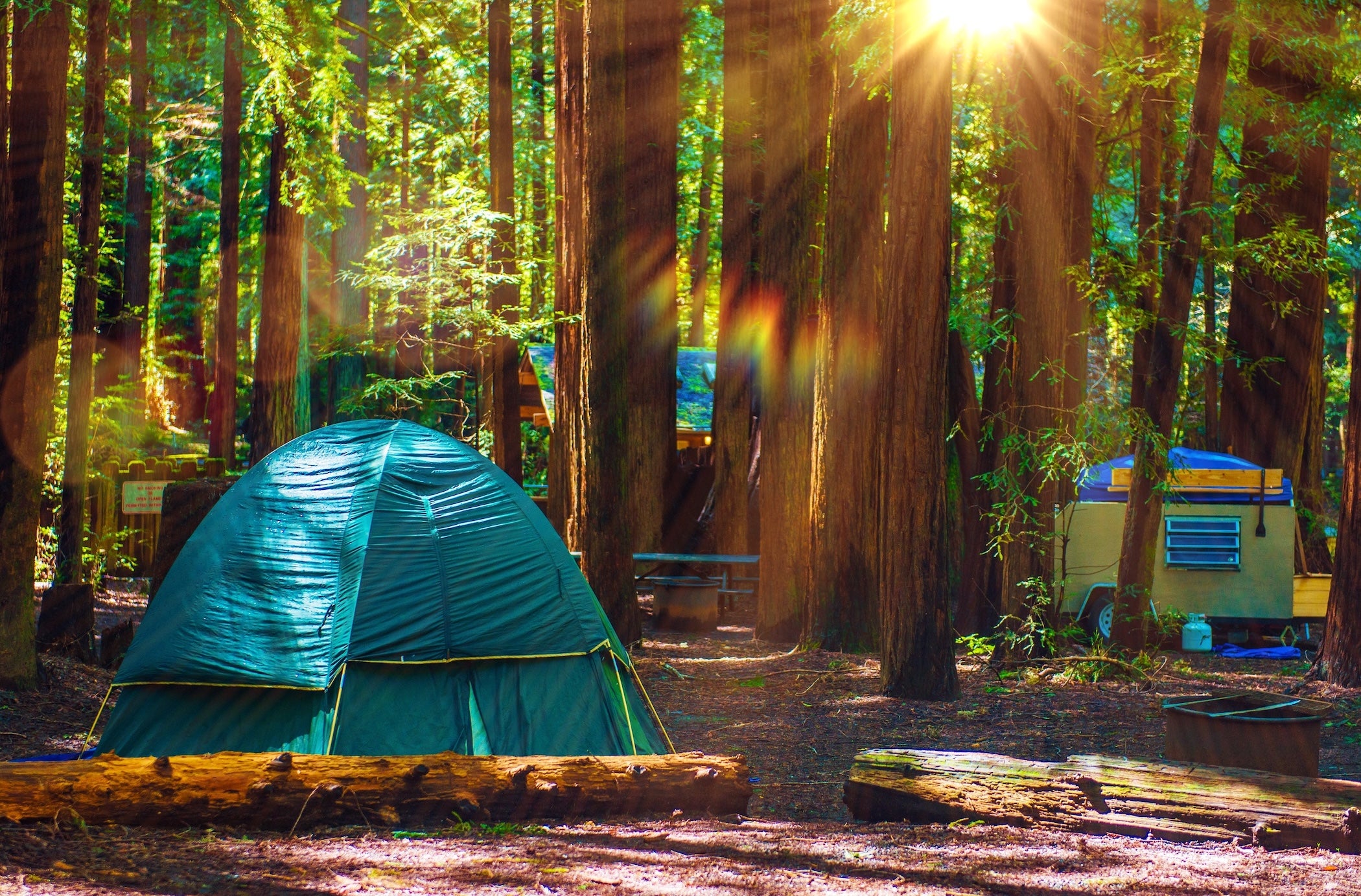
Along the way, the road passes rugged cliffs, giant redwood forests, and dozens of seaside towns. Many members of The Dyrt community turn the PCH into multi-week camping adventures because it links iconic parks with accessible campgrounds up and down the coast. Summer brings long days and mostly dry weather (along with coastal fog in some areas). Late spring and early fall often offer fewer crowds and mild temperatures. This overview guide covers the full route and connects you to detailed segment guides for deeper trip planning.
Route Overview and Quick Facts
| Total Distance | ≈1,650 miles |
| States Crossed | WA, OR, CA |
| Recommended Time | 2 to 3 weeks |
| Best Seasons | June to September (peak summer and early fall) |
| Route Type | Mostly two-lane coastal highways (US 101, CA-1) |
| Vehicle Needs | Standard vehicles and RVs (steep, winding sections in places) |
| Notable Features | Rainforests, ocean cliffs, redwood groves, beaches, coastal towns |
| Main Challenges | Coastal fog and wind, curvy narrow roads, summer traffic, occasional landslides or closures |
What Makes This Route Special
The Pacific Coast Highway is often cited as one of America’s most famous and beautiful road trips. Unlike inland historic routes, PCH is celebrated for its natural diversity: it spans from the temperate rainforests of Washington’s Olympic Peninsula to near-desert landscapes in Southern California. Much of the coastline remains undeveloped and protected within parks or public lands, giving travelers an intimate connection to nature at every turn. You can walk among 300-foot tall redwoods in the morning and watch the sunset over a sandy beach the same day. The journey also weaves through cultural landmarks, passing quaint fishing villages, artistic beach towns, and major cities like San Francisco and Los Angeles that add urban flavor to the otherwise remote scenery. Generations of road trippers have made memories along this highway, whether surfing iconic breaks, visiting historic lighthouses, or simply pulling off at bluffside viewpoints to gaze at the Pacific. The route’s blend of scenery, wildlife, and relaxed coastal culture makes it a uniquely immersive way to experience the West Coast.
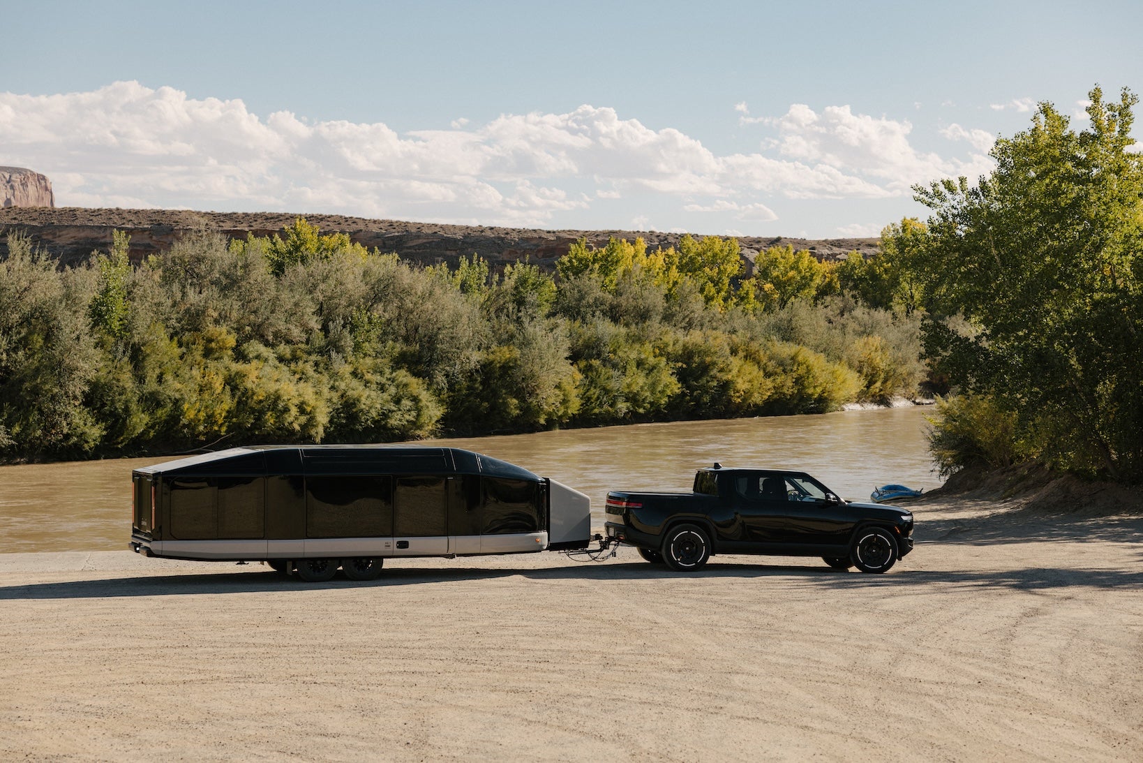
Travel Lighter with Lightship RV
Planning an RV road trip? Lightship is rethinking what’s possible on the road. The all-electric, self-propelled Lightship AE.1 is designed with TrekDrive™ technology to help extend range and make longer routes feel more approachable, especially on winding roads like California’s Highway 1. It’s built for destinations that sit farther between charging or fuel stops, and for camping that feels quieter, lighter, and more connected to the places you’re exploring.
Regional Highlights Along the Pacific Coast Highway
Washington: Olympic Peninsula to Columbia River
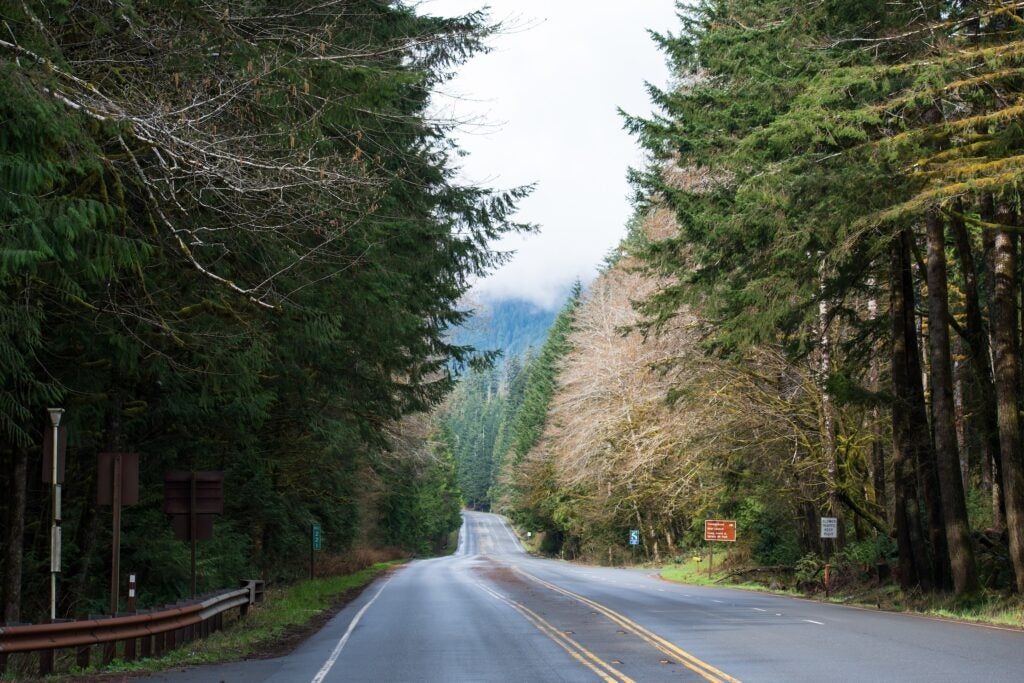
The journey begins in Washington’s Olympic Peninsula, where US-101 nearly circles Olympic National Park and its 922,000 acres of rainforests and shoreline. Early miles wind past driftwood-strewn beaches (like Ruby Beach) and mossy forests filled with ferns. Small logging and fishing communities such as Forks, Queets, and Aberdeen provide basic services. As the highway heads south, it hugs the edge of the Pacific with occasional sweeping views of rocky sea stacks offshore. Near the state’s southwestern tip, drivers enter Cape Disappointment State Park, overlooking the turbulent mouth of the Columbia River. This spot marks Washington’s end of the road – two historic lighthouses and lush headlands greet travelers before they cross the impressive Astoria-Megler Bridge into Oregon.
Oregon Coast
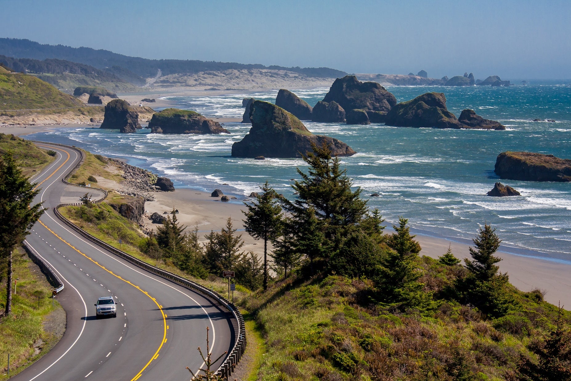
Oregon’s coastline is a scenic highlight of the PCH, protected by a state law ensuring free public beach access, “The People’s Coast.” From Astoria, the route heads south along nearly continuous ocean views. The northern section passes Cannon Beach, famous for Haystack Rock and artistic village charm, and threads through cliffs and coves in places like Ecola State Park. Recreation has largely replaced industry here – old fishing towns now cater to visitors with seafood spots and galleries. In mid-coast, the highway skirts the massive dunes near Florence, where off-road riders and hikers explore the Oregon Dunes National Recreation Area. Farther south, the road weaves through dense forests and past rugged capes. Towns like Newport, Coos Bay, and Bandon offer respites with harbors and coastal history. By the time US-101 reaches Oregon’s border at Brookings, it has showcased rocky tide pools, picturesque lighthouses, and long stretches of sand, all part of this 363-mile designated scenic byway.
Northern California Redwoods
Crossing into California, the highway enters a land of giant trees and wild coastline. In the far north, US-101 winds through Redwood National and State Parks, home to the tallest living trees on earth. Drivers can detour onto the Avenue of the Giants to camp or stroll beneath 300-foot redwoods. Roadside attractions echo an earlier era – you’ll see kitschy drive-through tree sites and vintage roadside stands celebrating old Route 101 tourism. The remote shoreline here, including spots in Prairie Creek Redwoods, also offers chances to spot migrating whales just offshore. As the route continues, US-101 meets the Pacific again around Humboldt County’s rugged beaches and dairy farms. Near Leggett, Highway 1 splits off from 101 and twists out to the Mendocino Coast, revealing steep cliffs and secluded coves. By the time the PCH reaches the San Francisco Bay Area, it has traversed quiet Victorian-era towns (like Mendocino and Fort Bragg) and crossed the iconic Golden Gate Bridge into San Francisco, a major milestone roughly halfway along the journey.
Central California (Big Sur & Central Coast)
South of San Francisco, Highway 1 becomes the star as it snakes along the Central California coast. After passing Santa Cruz and Monterey’s historic waterfronts, the road enters the legendary Big Sur region. Here, sheer mountains plunge into the ocean, and the highway clings dramatically to cliffsides for about 90 miles. Drivers cross photogenic spans like Bixby Bridge and can stop for short hikes to waterfalls such as McWay Falls in Julia Pfeiffer Burns State Park. Services are very sparse in Big Sur (and prices are high), making this stretch feel like a step back in time. Continuing south, the terrain softens near San Simeon, where the opulent Hearst Castle overlooks the shoreline from the hills. The route then threads through classic beach towns like Morro Bay and Pismo Beach. Approaching Santa Barbara, the coastline takes on a Southern California vibe with warmer breezes and palm-dotted beaches. Santa Barbara’s Spanish-style architecture and the Santa Ynez Mountains form a beautiful backdrop as the PCH transitions into its final segment.
Southern California Coast and Cities
The last leg of the Pacific Coast Highway blends natural beauty with urban energy. After Santa Barbara, Highway 1/US-101 curves inland briefly, then returns to the ocean around Malibu. This famed stretch of sand and surf signals the approach to greater Los Angeles. The route passes shoreline landmarks like the Santa Monica Pier (the historic terminus of Route 66) and beaches known for surf culture. Navigating through Los Angeles, PCH turns into city boulevards with traffic and stoplights, but soon continues south along Orange County’s coastline. Here, travelers find popular spots such as Huntington Beach (“Surf City USA”) and art-centric Laguna Beach. The climate stays mild and sunny, and beach life is a constant theme. Further south, entering San Diego County, the highway (often signed as Historic Route 101) strings together laid-back beach communities like Oceanside, Encinitas, and La Jolla. The journey concludes in San Diego, a city that offers a lively mix of beaches, parks, and cultural sites near the Mexican border. From the quiet forests of Washington to the vibrant shores of San Diego, the Pacific Coast Highway delivers an unparalleled cross-section of West Coast scenery and culture.
Top 10 Best Places to Camp Along The Pacific Coast Highway
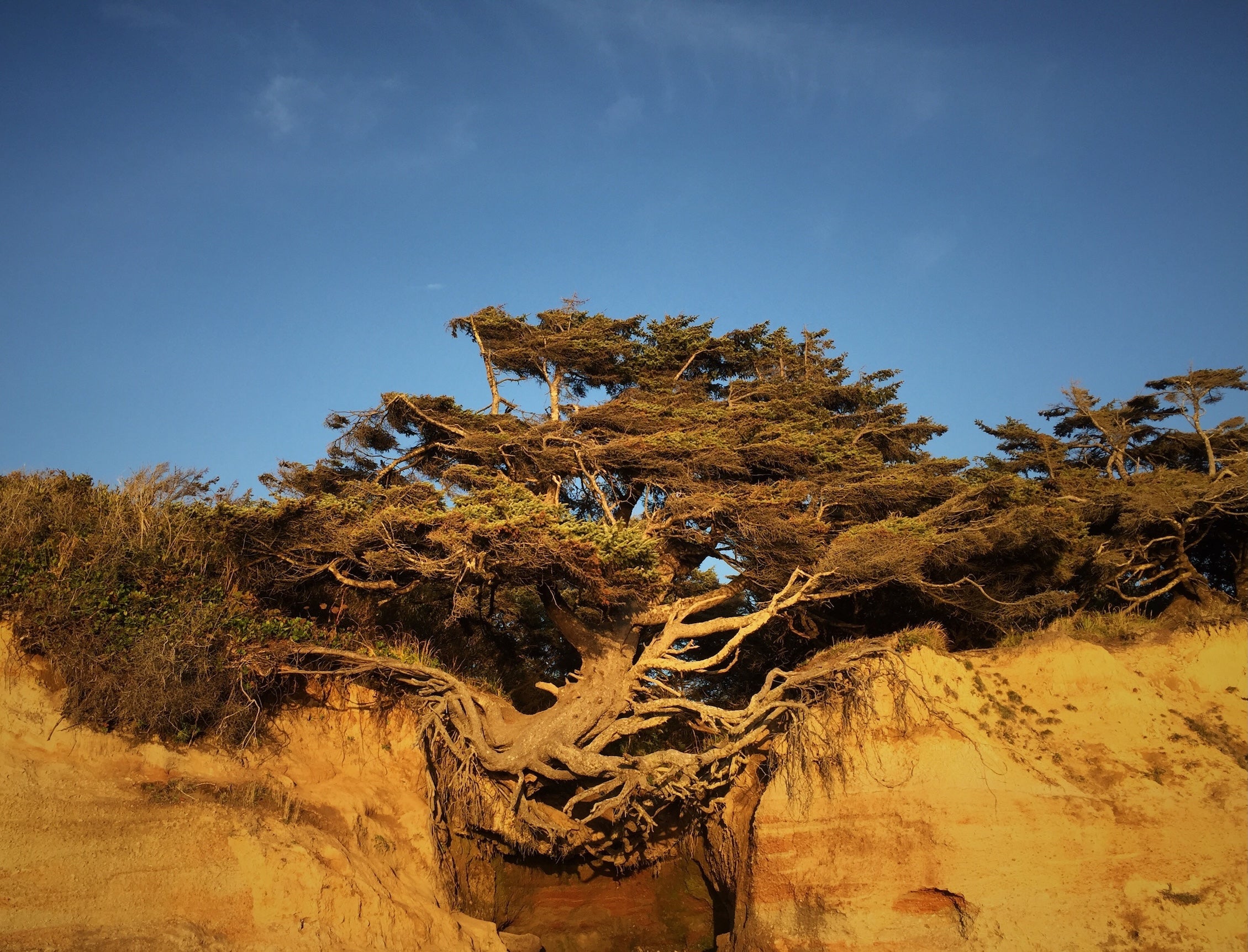
- Kalaloch Campground – Olympic National Park, Washington. Perched on a bluff above the Pacific, with beach access steps away. A favorite for its ocean sunsets and proximity to the famous Tree of Life at Kalaloch Beach.
- Cape Disappointment State Park – Ilwaco, Washington. A spacious coastal park at the Columbia River’s mouth. Offers two lighthouses, forested campsites, and trails straight to the beach – a perfect last stop in Washington.
- Nehalem Bay State Park – Manzanita, Oregon. Large campground tucked behind sand dunes with easy beach paths. Popular for its biking trails and access to a quaint beach town, yet it still feels peaceful and uncrowded.
- Harris Beach State Park – Brookings, Oregon. Well-equipped campground at the south end of Oregon’s coast. Known for tide pools and sea stacks just offshore. Families appreciate the clean facilities and short walk to a beautiful beach.
- Gold Bluffs Beach Campground – Orick, California. A remote, sandy campground in Prairie Creek Redwoods State Park. Camp among dunes with roaming elk nearby and hike to Fern Canyon. Tent sites only – an unforgettable back-to-nature experience on the northern coast.
- Kirk Creek Campground – Big Sur, California. A cliffside National Forest campground with sweeping ocean views at every site. Primitive amenities, but the setting is unbeatable – wake up to Pacific panoramas and access to trails and secluded beach coves.
- El Capitán State Beach – near Santa Barbara, California. Offers bluff-top camping under sycamore trees with stair access to a sandy beach. A relaxed spot to enjoy ocean sunsets, it’s conveniently close to Santa Barbara’s shops and eateries.
- San Elijo State Beach Campground – Cardiff-by-the-Sea, California. A lively beachfront campground in north San Diego County. Loved for surf breaks right out front and walkability to local cafes. Sites on the bluff have stellar ocean views and nightly sound of waves.
- River Bend County Park – Otis, Oregon. A peaceful riverside campground just inland from the Oregon Coast, with roomy sites and an easygoing vibe that’s perfect for a quieter night between beach towns.
- Julia Pfeiffer Burns State Park – Big Sur, California. A classic Big Sur basecamp near McWay Falls and the cliffside Highway 1 views, with redwoods, coastal trails, and that “you’re really on the PCH” feeling.
Activities and Attractions Overview
The Pacific Coast Highway is packed with things to do and see, from natural wonders to cultural stops. In Washington, Olympic National Park’s coastal section offers beach hikes and tide-pooling amid sea stacks. At the Columbia River, history buffs can visit Lewis and Clark’s Fort Clatsop replica near Astoria. Along the Oregon coast, highlights include the iconic 235-foot Haystack Rock at Cannon Beach, dune buggy rides on the towering sand dunes near Florence, and touring lighthouses such as Heceta Head. California brings even more variety: drive through ancient redwood trees on the Avenue of the Giants, walk across (or simply marvel at) San Francisco’s Golden Gate Bridge, and wind through Big Sur’s dramatic overlooks. Don’t miss the wildlife viewing opportunities – you might spot gray whales migrating offshore (especially in winter and spring) or a colony of elephant seals basking at Piedra Blancas near San Simeon. Cultural attractions range from the opulent Hearst Castle tour to classic beachfront boardwalks in Santa Cruz and Santa Monica. Every segment of the trip offers unique stops, and the segment guides provide more in-depth lists of recommended attractions for each region.
Explore Route Segments in Depth
For more detail, use the segment guides below. Each one breaks the route into manageable stretches with day-by-day suggestions, campground notes, and activity highlights.
- Olympic National Park to Astoria
- Astoria to Brookings
- Crescent City to San Francisco
- San Francisco to Santa Barbara
- Santa Barbara to San Diego
Planning Your Pacific Coast Highway Road Trip
Charging Stations, Fuel and Services
Fuel and essential services are generally available at regular intervals along the Pacific Coast Highway, especially near towns. However, some stretches require advanced planning. One notable example is the Big Sur coast, there is roughly a 90-mile section between Monterey and Cambria with very limited fuel access and only one or two expensive stations. Top off your tank in Monterey/Carmel or San Luis Obispo County before committing to that segment.
For electric vehicle travelers, including those using all-electric trailers like the Lightship AE.1, it’s smart to plan any daily charging stops in advance. Many coastal towns now offer Level 2 or DC fast chargers, but coverage is uneven in remote areas. Use tools like A Better Route Planner or PlugShare to map stations that match your vehicle specs. Some state parks and urban RV parks offer charging amenities, though reservations are often required during peak months.
In Washington and Oregon, coastal towns are typically spaced 30–50 miles apart, but some stations may have limited hours in the offseason. In California, fuel prices tend to be higher (often exceeding $5 per gallon) so budgeting for fuel or charging is key. Grocery stores and supply stops can be found in larger towns like Port Angeles, Astoria, Coos Bay, Eureka, and Santa Barbara. Always carry extra drinking water and snacks, particularly if camping in remote parks where amenities may be minimal. Cell service can be spotty on long stretches, so downloading offline maps and route data is highly recommended.
Seasonal Considerations
The West Coast’s climate varies by latitude and elevation, so timing the trip is important. Summer (July and August) brings reliably dry weather in Washington and Oregon and warm sunshine in California, but also the biggest crowds. Notably, a marine layer can cause fog along the coast in summer, especially in central California (“June Gloom” is common in early summer). Spring and fall are shoulder seasons offering a balance: April-May and September-October often have mild temperatures and fewer tourists, though northern sections may receive rain in spring. Winter (November through February) is the rainiest period in the Pacific Northwest – expect frequent storms and the possibility of road closures due to mudslides or downed trees, particularly on curvy sections of Highway 1. Portions of the route, like mountain passes around Olympic National Park or higher elevations near Big Sur, can see occasional light snow or ice in winter, but the coastal route is mostly at sea level and snow is rare. Always check ahead for road advisories; for example, California’s Highway 1 in Big Sur experiences landslide closures in some winters. If traveling outside of summer, pack layered clothing and rain gear for the north, and be flexible with your schedule in case Mother Nature causes delays.
Connectivity
Cell phone coverage comes and goes on this route. In and around cities or sizable towns, you’ll generally have good signal. However, long rural stretches have dead zones. Expect limited to no coverage on parts of the Olympic Peninsula (especially the west side within Olympic National Park), in sections of the southern Oregon coast, and throughout Big Sur in California. It’s a good idea to download offline maps and campground info in advance. The Dyrt PRO offers the ability to save maps and campsites for offline use, which can be invaluable when you’re out of service. GPS navigation may reroute you inland if it loses signal, so double-check your route manually when in doubt (sticking to Highway 101/1 is usually straightforward). Many campgrounds and RV parks advertise Wi-Fi, but don’t count on high speeds, particularly in remote areas. If connectivity is critical for you, plan stops in towns or visitor centers that offer Wi-Fi. Overall, treat the PCH as an opportunity to unplug a bit – enjoy the scenery, and know that emergency services can still be reached by dialing 911 even when your phone shows no data signal (it will roam any available network for emergency calls).
Budget Considerations
Road tripping the Pacific Coast Highway can suit a variety of budgets—from shoestring campers to those opting for boutique stays. Camping remains one of the most affordable lodging choices, with some free dispersed camping options in national forests or BLM areas, particularly in Washington and northern California. State park campgrounds in Oregon and Washington typically range from $20-$35 per night, while California’s state beach campgrounds often cost $35-$50 and can book out months in advance. Reserve early if traveling in peak season.
If you’re mixing in occasional hotels, expect the highest rates in summer and in tourist-heavy towns like Cannon Beach or Carmel. Food-wise, local seafood shacks and casual cafes dot the coast, and budgeting for a few chowder or fish taco stops adds to the experience. Stock up on groceries in major towns and make use of your cooler; picnic lunches at pullouts with ocean views are both budget-friendly and memorable.
Fuel is typically a significant trip expense due to the route’s length. Oregon generally has the lowest prices, while California tends to be the highest. If you’re driving an electric vehicle or using a self-propelled electric trailer like the Lightship AE.1, you may save considerably on fuel costs, especially in states with strong charging infrastructure. Planning efficient charging stops can offset a portion of your lodging or food budget.
Lastly, factor in any required permits or park entry fees. National parks like Olympic require entrance passes, while many California and Oregon state parks charge for day use or parking. An America the Beautiful Pass covers federal sites, though not state-run areas. A little planning helps avoid surprises and keeps your trip running smoothly.
State DOT Resources
Additional Resources
- The Dyrt PRO
- Pacific Coast Highway travel features
- Travel Oregon – Pacific Coast Scenic Byway
- BLM camping guidelines
- Leave No Trace principles
- A Better Route Planner
- Lightship RV: All-Electric Travel, Reimagined
The Dyrt is the only camping app with all of the public and private campgrounds, RV parks, and free camping locations in the United States. Download now for iOS and Android.
Popular Articles:
Articles on The Dyrt Magazine may contain links to affiliate websites. The Dyrt receives an affiliate commission for any purchases made by using such links at no additional cost to you the consumer.