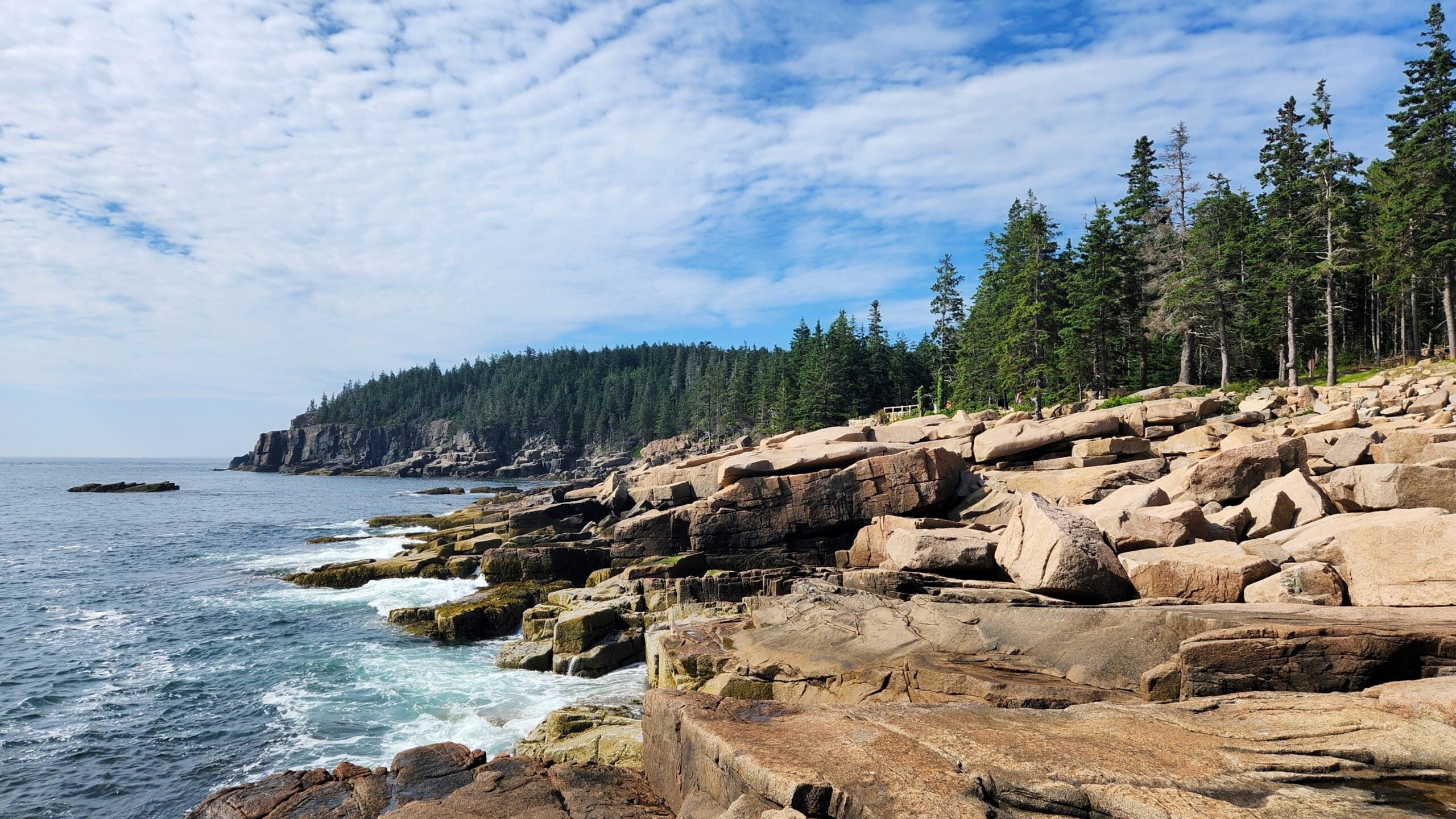
Taking on the Great Northern Road Trip means crossing the entire United States along its northern tier – from the rocky Atlantic coast of Maine to the shores of the Pacific Northwest. This route traces historic pathways near the Canadian border, following much of U.S. Highway 2 for over 3,200 miles. It’s a journey defined by vast natural diversity and a sense of remoteness. Over roughly two weeks of driving, you transition from New England’s forests and coastal islands to Midwestern lake country, across the open Great Plains, and onward through the Rocky Mountains to the lush Cascades. It’s America’s northernmost cross-country drive, offering a quieter alternative to the busy interstates far to the south. The payoff is a coast-to-coast adventure rich in scenery, history, and outdoor experiences.
Route Overview & Quick Facts
Distance: Approximately 3,200–3,300 miles (5,150 km) total coast-to-coast
Start/End: Bar Harbor, Maine (Atlantic Coast) to Seattle, Washington (Pacific Coast)
States Crossed: Maine → New Hampshire → Vermont → Ontario & Quebec, Canada (detour) → Michigan → Wisconsin → Minnesota → North Dakota → Montana → Idaho → Washington*
Primary Route: US Highway 2 forms the backbone (mostly two-lane rural highways). Includes short stretches on local roads and an international segment through Canada to bypass the Great Lakes.
Recommended Duration: 10 to 14 days of driving time (60+ hours), allowing 2+ weeks with sightseeing stops. More time is beneficial to fully explore parks and attractions.
Best Seasons: Late spring through early fall. Summer offers the best weather and fully open mountain roads. Early October rewards travelers with brilliant fall foliage in New England and the Great Lakes regions. Winter travel is not advised due to snow, icy passes, and seasonal road closures.
*Note: The route detours through Canada between Vermont and Michigan. Plan for a passport and border crossing if following the most northern path.

What Makes This Route Special
This transcontinental route is often called the “Great Northern” in honor of the 19th-century Great Northern Railroad that first linked these far-flung regions. Like that pioneering railway, the road trip stitches together an incredible patchwork of American landscapes and cultures. You’ll go from Acadia’s rugged island shores to New England’s White Mountains, then onward through the Great Lakes northwoods and prairies where bison and Lakota once roamed. Midway, the route crosses the Mississippi’s headwaters and Paul Bunyan’s mythical stomping grounds in Minnesota. Out west, you climb into the Rockies at Glacier National Park, traverse the Continental Divide, and descend through Idaho’s panhandle into Washington’s Cascades. It’s arguably the most varied cross-country drive in the nation.
Unlike the better-known Route 66 or I-90, the Great Northern feels more remote and introspective – the kind of journey that inspired Robert Pirsig’s Zen and the Art of Motorcycle Maintenance during a similar northern trek in the 1960s. There’s a profound sense of solitude and freedom on long stretches of US-2, where small towns are sometimes 50+ miles apart, and the sky seems to stretch forever. This drive lets you truly “get away from it all” and discover an America off the beaten path.
Regional Highlights Overview
The Great Northern is easiest to think of in segments, each with its own character and highlights. We’ve broken the route into five manageable parts:
Segment 1: Bar Harbor, ME to Burlington, VT
Key Stops: Bar Harbor (Acadia National Park), Bangor, Maine Highlands, White Mountain National Forest (NH), Montpelier, Burlington (Lake Champlain)
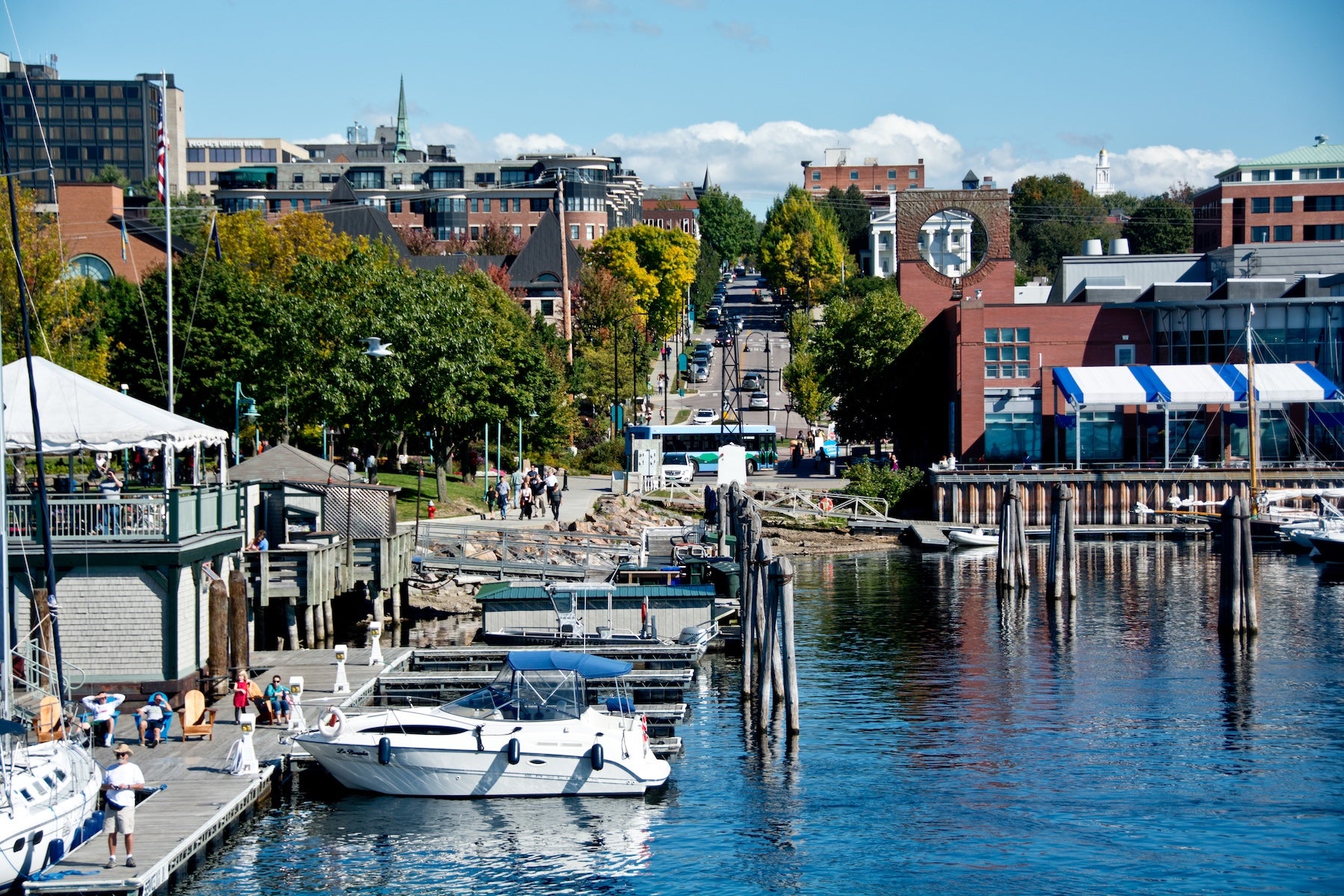
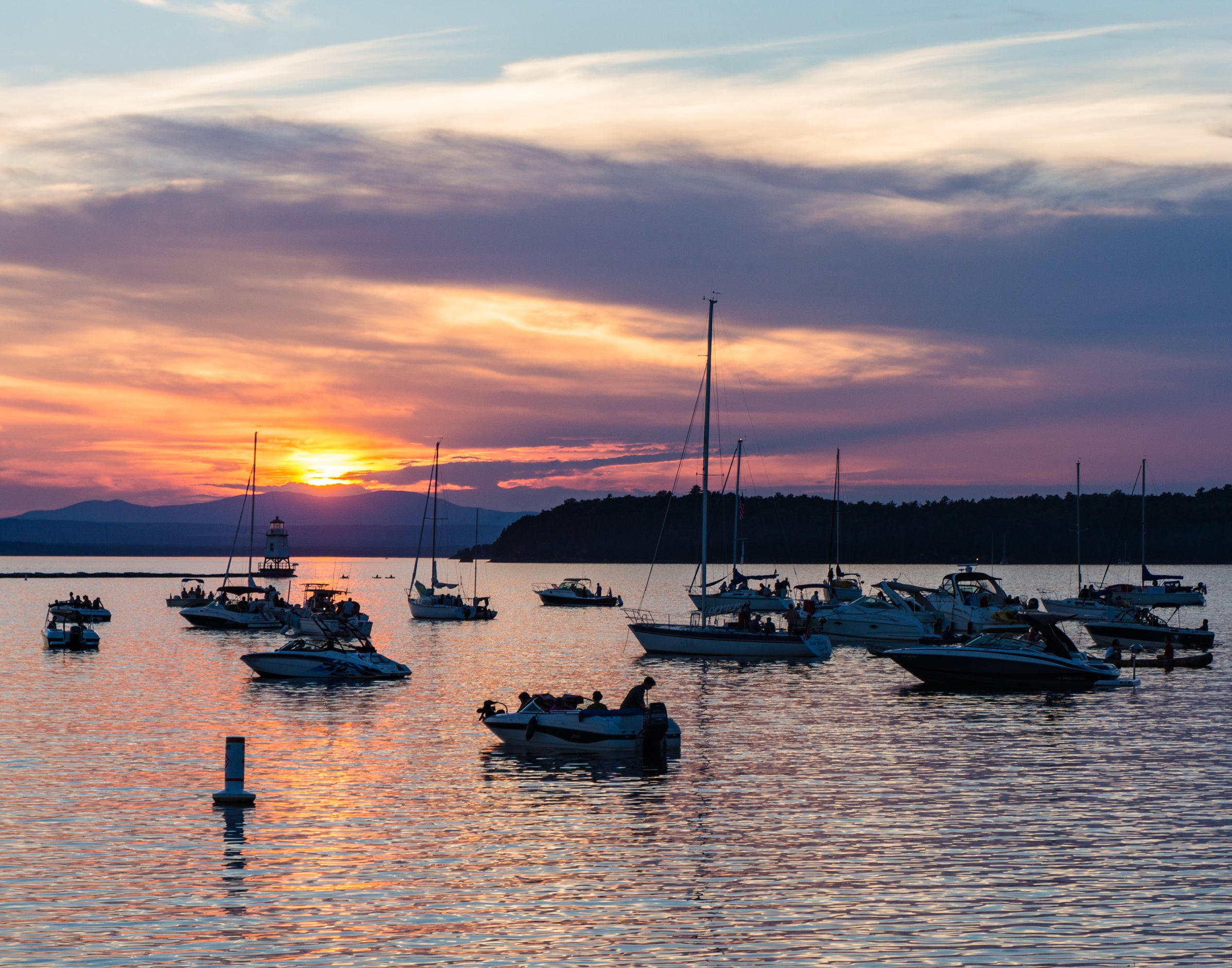
Starting at Bar Harbor, you’ll experience the salty air and granite cliffs of Acadia National Park right away. Maine’s coastal scenery and quaint Down East towns set a charming tone. Heading inland, US-2 winds through pine forests and rural hamlets – watch for moose along the roadsides in the Maine woods. Crossing into New Hampshire, the route traverses the White Mountains. This portion is especially scenic, with a climb through Crawford Notch and sweeping views of Mt. Washington on clear days. There are opportunities to stop for short hikes to waterfalls or ride the historic Mount Washington Cog Railway nearby. After passing through a sliver of Vermont’s Northeast Kingdom, you’ll roll into the Lake Champlain region. Burlington, a lively college town on the lake, makes a great segment endpoint. Enjoy the pedestrian-friendly downtown and waterfront views of the Adirondacks across the water.
Terrain & Road Conditions: Primarily two-lane highways with some curvy mountain sections in NH. Road quality is generally good, but be prepared for slower travel through the mountains. This segment is relatively short (about 400 miles), but mountain weather can change quickly – have layers and rain gear handy. In fall, brilliant foliage draws leaf-peepers, so expect some traffic then. Winter travelers will find portions of NH Route 16 and US-2 subject to snow; check New Hampshire DOT for conditions and any seasonal closures.
Critical Notes: If headed west beyond Vermont, you’ll need a valid passport or equivalent to continue through Canada. The border crossing at Rouses Point, NY/Quebec is small and usually quick. Fill up on fuel before crossing – gas stations are available in Burlington and St. Albans, VT, but become sparse in rural Quebec until you reach the Montreal area.
Segment 2: Burlington, VT to Sault Ste. Marie, MI (via Canada)
Key Stops: Montreal, Ottawa (optional side trip), Algoma Country (Lake Superior coast), Sault Ste. Marie
From Vermont, the most direct Great Northern route dips into Canada. After crossing near Rouses Point, you can reach metropolitan Montreal in about an hour. This detour is well worth it – Montreal offers a cultural counterpoint with its French-speaking heritage, historic Old Montreal district, and famous food (don’t miss trying poutine or a Montreal bagel). Continuing west, you’ll traverse Ontario’s forested countryside. Consider a stop in Ottawa or the lakefront city of Sudbury if time permits. The drive along the northern shore of Lake Huron’s North Channel is gorgeous and remote. Eventually, you’ll arrive at Sault Ste. Marie, the twin border cities where Ontario meets Michigan’s Upper Peninsula. Crossing back into the U.S. here brings you to the midway point of the journey.
Terrain & Road Conditions: Mostly highway driving (Autoroute 20/401 and Trans-Canada Highway). The St. Lawrence Lowlands are flat to gently rolling. Northern Ontario becomes more rugged with granite outcrops, lakes, and dense woods – classic Canadian Shield country. Roads are well-maintained, but services thin out west of Ottawa. Keep an eye on fuel; there are stretches where gas stations can be 60+ miles apart, especially at night. In winter, heavy snowfall can impact highways in Ontario’s snowbelt – check Ontario’s 511 road conditions and be prepared for possible closures or required snow tires.
Critical Notes: Border crossing procedures apply twice on this segment. Allocate time for customs, especially re-entering the U.S. at Sault Ste. Marie (it’s usually a brief wait). There is no fee to cross the International Bridge at Sault Ste. Marie for passenger vehicles. The bridge offers a great view of the Soo Locks below, where ships move between Lake Superior and Lake Huron. Also note the change to metric units in Canada – speed limits are in km/h. Cell service and data roaming can be an issue; consider downloading offline maps (like The Dyrt PRO) to navigate Canadian portions without incurring roaming charges. Lastly, Ontario prohibits bringing in firearms and certain foods; check border guidelines if you’re carrying camping provisions.

Segment 3: Sault Ste. Marie, MI to Duluth, MN
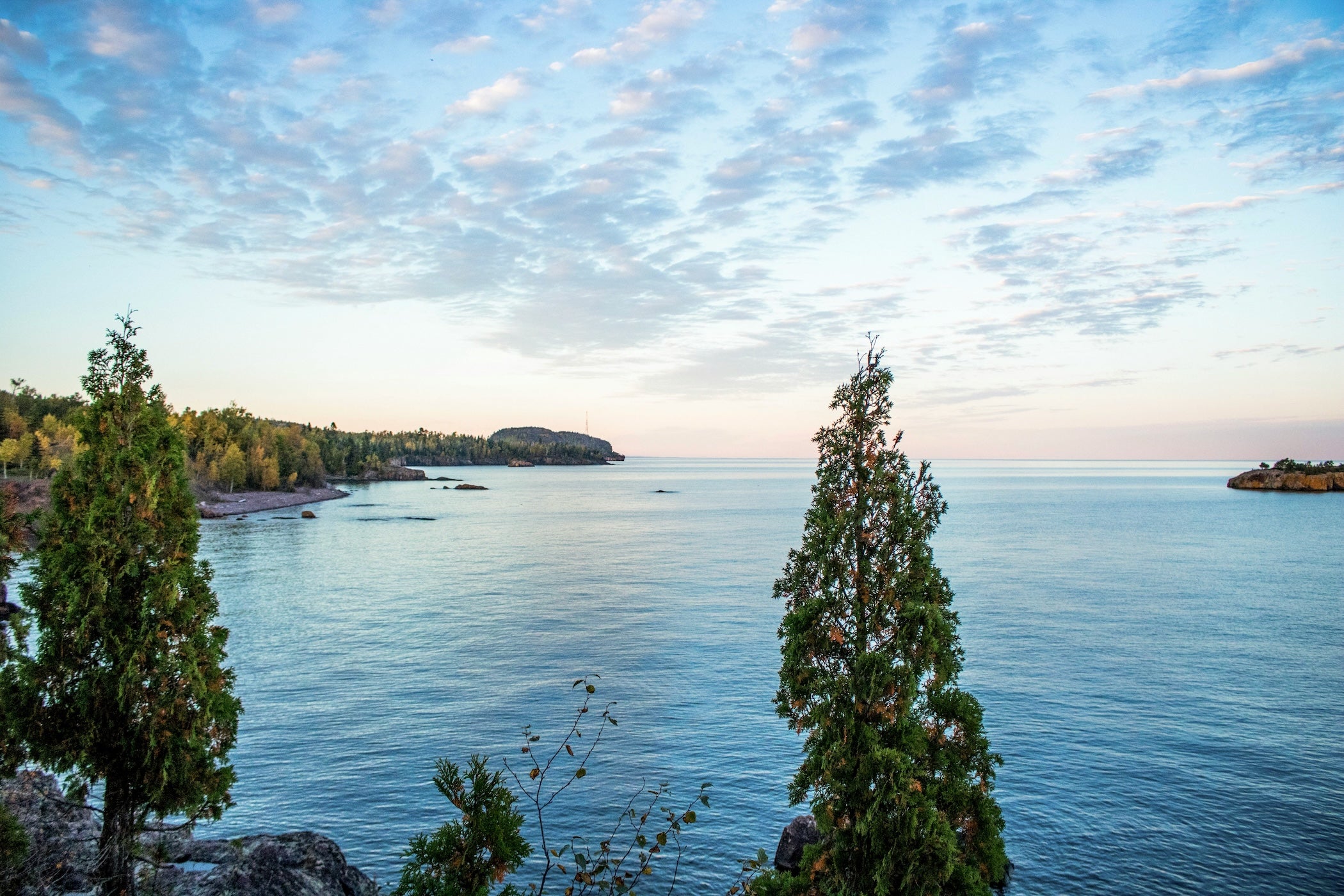
Key Stops: Upper Peninsula of Michigan (Tahquamenon Falls detour), Pictured Rocks National Lakeshore, Marquette, Ironwood, Apostle Islands National Lakeshore (WI), Duluth
Back in the USA, the journey continues across Michigan’s wild Upper Peninsula. From the Sault, head west on US-2 through vast stretches of spruce, birch, and aspen forest. Consider a side trip north to Pictured Rocks National Lakeshore on Lake Superior – the Twelvemile Beach Campground there is often rated one of the nation’s best for its lakefront sites. US-2 skirts along Lake Michigan’s northern shore for a bit, offering beach access at places like Hiawatha National Forest. Farther west, you’ll pass through small U.P. towns like Manistique and Ironwood. Crossing into Wisconsin, US-2 runs near the Lake Superior shoreline. A worthwhile detour is taking Highway 13 around the Bayfield Peninsula to see the Apostle Islands National Lakeshore – a beautiful archipelago known for sea caves and lighthouses. Rejoining US-2, you’ll cross into Minnesota at Duluth, a historic port city dramatically perched on hills above the lake. Duluth’s Canal Park area and Aerial Lift Bridge are popular stops to watch ships and learn about Great Lakes maritime history.
Terrain & Road Conditions: Mostly gently rolling terrain with frequent water views. The Upper Peninsula feels remote; cell service can be spotty in the eastern U.P. US-2 is two lanes with occasional passing lanes. Wildlife is abundant – watch for deer (and crossing moose signs), especially at dusk. In winter, this region gets heavy lake-effect snow. Michigan and Wisconsin both keep US-2 plowed, but it’s wise to check MDOT and WisDOT updates. The iconic Mackinac Bridge is just east of this segment; if you detour to see it, note that high winds can close the bridge to high-profile vehicles. Otherwise, no major passes or grades on this stretch.
Critical Notes: The Upper Great Lakes have biting insects (mosquitoes, blackflies) in late spring and early summer – pack bug spray and head nets if camping. Also, be aware of the time zone change: most of the U.P. and Wisconsin are in Central Time. Duluth is a good resupply point; after Duluth, services will thin out again in North Dakota.
Segment 4: Duluth, MN to Glacier National Park, MT
Key Stops: Mississippi Headwaters (Itasca State Park), Fargo (ND), Rugby, ND (Geographic Center of North America), Minot, ND, Fort Peck Lake (MT detour), Glacier National Park (MT)
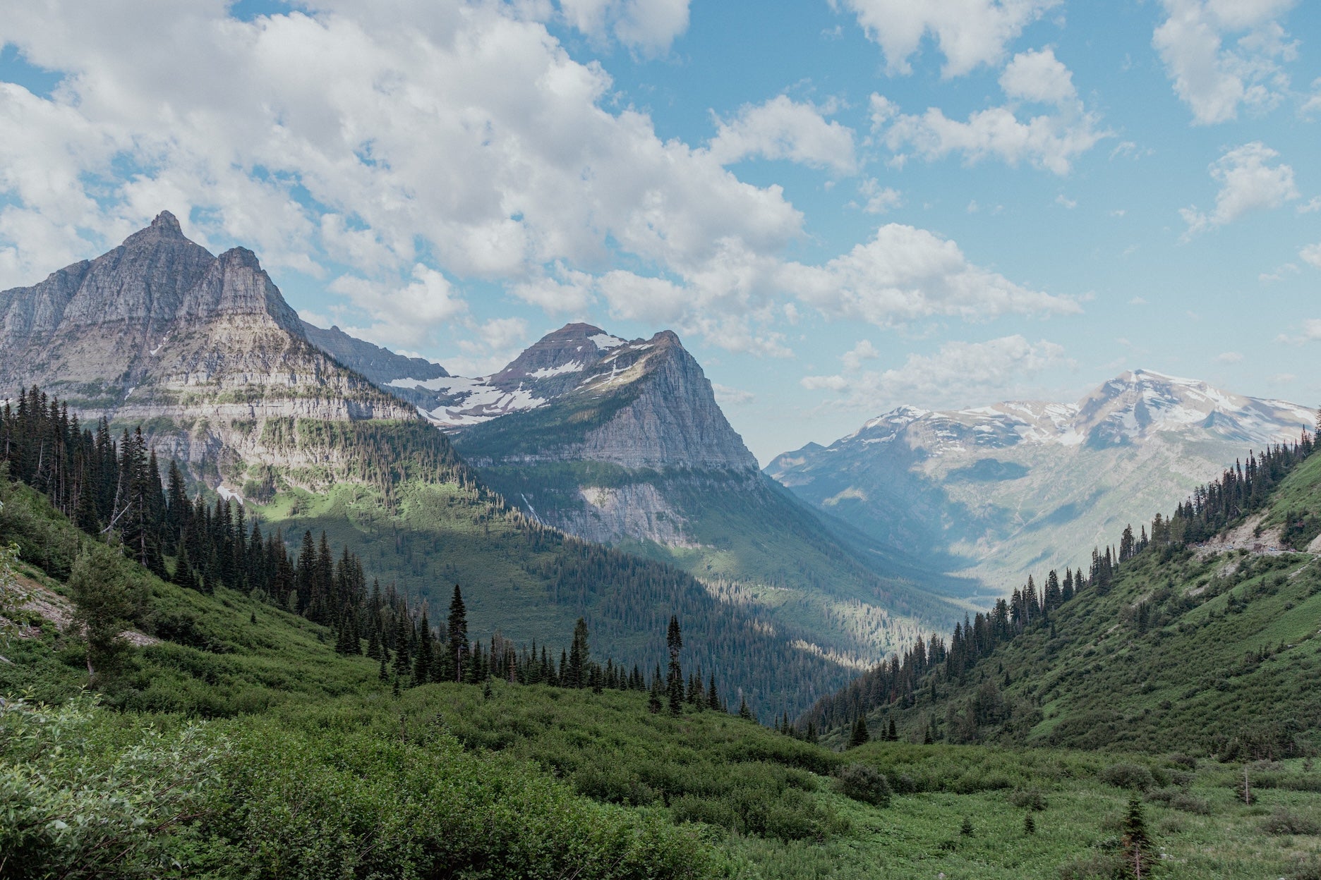
West of Duluth, US-2 strikes out across the northern Great Plains. In Minnesota, you might stop at Itasca State Park (about an hour south of US-2) to see the modest headwaters of the Mississippi River – you can literally walk across the river’s source. As you enter North Dakota, the landscape opens up into farm fields and prairie. It’s big-sky country, and you may understand what Pirsig meant about those “four days on the prairie” testing one’s perspective. A fun roadside stop is in Rugby, ND, marked as the geographic center of North America (selfie with the stone monument!). In Minot or Williston, ND, you’re in oil boom territory – expect truck traffic and busy services. Crossing into eastern Montana, the plains gradually start rising toward the Rockies. US-2 closely parallels the BNSF “Hi-Line” railway here; small railroad towns like Wolf Point, Glasgow, and Havre offer a glimpse of rural high-plains life. As the Rockies come into view, you’ll reach the gateway to Glacier National Park. The town of East Glacier Park or nearby St. Mary makes a logical end for this segment, setting you up to explore Glacier.
Terrain & Road Conditions: Flat to gently rolling terrain dominates until Montana. Roads are straight and sight-lines long – it’s easy to underestimate distances. North Dakota and eastern Montana can feel endless; take breaks to stay alert. Wind can be an issue on the open plains, occasionally strong enough to affect high-profile vehicles. Summertime travelers should be prepared for heat (90 °F days are common) and storms; thunderstorms can build quickly, bringing heavy rain or hail. Check NDDOT and MDT (Montana DOT) for any summer road construction, as two-lane traffic can back up when there are flaggers. In winter, blizzard conditions can close sections of US-2 entirely – heed warnings and carry a winter car kit if attempting it (many would detour south to I-94 in bad winter weather).
Critical Notes: This segment is the most remote of the entire trip. Fuel up frequently – a good rule is never let your tank drop below half in North Dakota and Montana. Services (food, lodging, mechanics) are concentrated in the larger towns (Grand Forks, Minot, Williston, Havre). Cell service is surprisingly decent near towns but fades to “No Service” in stretches of northern Montana. It’s strongly recommended to have offline maps downloaded. Also note that Glacier National Park has entry reservation requirements in summer for Going-to-the-Sun Road. If you plan to drive that famous alpine road (a worthwhile detour south from US-2 at West Glacier), reserve a timed entry permit or arrive very early. US-2 itself crosses Marias Pass (5,213 ft) at the Continental Divide, which is kept open year-round as Glacier’s lower-elevation pass – still, carry chains in spring or fall in case of sudden snow.
Segment 5: Glacier National Park, MT to Seattle, WA
Key Stops: Glacier National Park (MT), Kootenai Falls (MT), Sandpoint (ID), Couer d’Alene (ID, optional detour), Leavenworth (WA), Seattle
The final leg is a spectacular finish. In Montana, US-2 threads through the Rocky Mountains west of Glacier NP. Consider a short hike at Kootenai Falls (near Libby, MT) to see a swinging bridge and waterfalls featured in the film The Revenant. Entering the skinny top of Idaho, US-2 passes tranquil Lake Pend Oreille and the resort town of Sandpoint. This area offers a nice mix of mountain and lake scenery – if you have time, Farragut State Park or Round Lake State Park in Idaho are peaceful stops for a picnic or an overnight. Crossing into Washington State, you immediately climb into the Cascade Mountains via Stevens Pass (elevation 4,061 ft). The drive along the Skykomish River valley is gorgeous, with dense evergreen forests and glimpses of snowy peaks. A fun stop before the pass is the Bavarian-themed village of Leavenworth, WA, known for its alpine look, bratwurst, and year-round Christmas-style charm. From Stevens Pass, it’s a steady descent toward the Puget Sound region. The road widens as you approach Everett and Seattle, marking a return to urban environs. Finish your journey with a celebratory view of the Seattle skyline – perhaps from Kerry Park or by riding up the Space Needle – you’ve just crossed the continent!
Terrain & Road Conditions: Mountainous but on good roads. Western Montana and north Idaho have curvy stretches along rivers – drive cautiously and enjoy the scenery. Stevens Pass in Washington is a well-traveled highway pass (US-2 is the state’s northernmost all-season cross-Cascades route). In summer it’s an easy drive aside from potential traffic behind slower RVs. Winter conditions on Stevens Pass can be severe; Washington State DOT requires carrying tire chains in winter and will enforce traction device usage during storms. Always check WSDOT pass reports in fall/winter. On the west side of the Cascades, rain and fog are common – your last 50 miles into Seattle might be in typical Northwest drizzle. The trip ends on city freeways (I-5 into Seattle), often congested, so time your final approach outside of rush hour if possible.
Critical Notes: As you re-enter populated areas, watch your speed and be alert for increased traffic and pedestrians (especially around Leavenworth on weekends). If you have an extra day, consider detouring in Washington to drive part of the North Cascades Highway (State Route 20) or visit Snoqualmie Falls near I-90 before heading into Seattle. Upon reaching Seattle, you might feel a mix of triumph and bittersweet completion – it’s a lot to absorb. Give yourself a day or two to rest and explore the city before the journey’s end. And if you plan to head back east, you’ve got the knowledge to tackle the return trip on a different route, or even turn around and experience the Great Northern in reverse!
Top 10 Best Places to Camp Along The Great Northern
- Blackwoods Campground (Acadia National Park, ME — New England Coast): A popular national park campground set in coastal forest on Mount Desert Island, with easy access to Acadia’s famous hiking trails and rocky Atlantic shoreline.
- Dolly Copp Campground (White Mountain National Forest, NH — White Mountains): A spacious forest campground near Mount Washington with wooded sites, modern facilities, and quick access to some of the Northeast’s best alpine hiking.
- Grand Isle State Park Campground (Grand Isle, VT — Lake Champlain): An island campground overlooking Lake Champlain known for beautiful sunsets, breezy waterfront campsites, and easy access just off U.S. 2.
- Twelvemile Beach Campground (Pictured Rocks National Lakeshore, MI — Lake Superior): A rustic campground perched above a wide Lake Superior beach, offering dramatic shoreline views, dark skies, and access to the famous cliffs of Pictured Rocks.
- Copper Falls State Park Campground (Mellen, WI — Northwoods): A scenic northwoods campground near waterfalls and deep river gorges, with shaded sites and trail access to some of Wisconsin’s most impressive natural scenery.
- Bear Paw Campground (Itasca State Park, MN — Mississippi Headwaters): A peaceful lakeside campground near the source of the Mississippi River, with wooded sites, clean facilities, and miles of biking and hiking trails nearby.
- Turtle River State Park Campground (near Grand Forks, ND — Northern Plains): A wooded campground tucked into a quiet river valley, offering modern facilities, hiking trails, and a surprisingly scenic stop in eastern North Dakota.
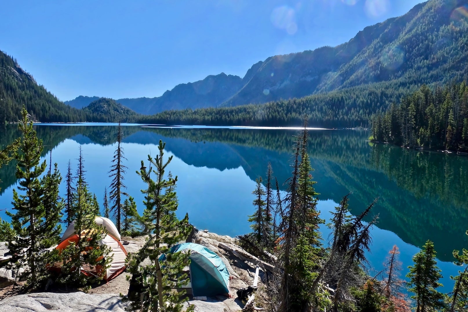
- Many Glacier Campground (Glacier National Park, MT — Northern Rockies): One of Glacier’s most spectacular campgrounds, surrounded by towering peaks and alpine lakes with trailheads leading directly into the park’s wild backcountry.
- Pearrygin Lake State Park Campground (near Winthrop, WA — North Cascades): A scenic high-desert lake campground just east of the Cascades with swimming beaches, paddle-friendly water, and sweeping views of the surrounding hills. Spacious sites and warm summer weather make it a popular basecamp for exploring the Methow Valley.
- Lake Wenatchee State Park Campground (Lake Wenatchee, WA — Cascade Mountains): A scenic mountain campground set along a turquoise alpine lake, offering swimming, paddling, and sweeping views of the surrounding Cascades.
Activities & Attractions
The Great Northern Road Trip isn’t just about the drive – it’s about what you can see and do along the way. Here are some major themes and must-do activities to enrich your journey:
National Parks & Natural Wonders: This route bookends with two crown jewels – Acadia National Park in Maine and Glacier National Park in Montana. Plan at least a half-day in Acadia (drive Park Loop Road, hike Cadillac Mountain or Ocean Path). In Glacier, Going-to-the-Sun Road is a bucket-list drive (if open) and many trailheads are accessible from US-2 or the east side. Other highlights: Pictured Rocks National Lakeshore in Michigan for cliffside vistas and kayak tours, Apostle Islands in Wisconsin for boating among sea caves, and the expansive Badlands-like terrain around Fort Peck Lake in Montana.
Hiking & Outdoor Adventures: Virtually every segment offers great hiking. In New Hampshire, hit a short section of the Appalachian Trail or a day-hike in Crawford Notch (Arethusa Falls is a moderate 2-3 hour hike to a spectacular waterfall). Minnesota’s Itasca Park has gentle trails through old-growth pine and a climbable fire tower with views for miles. In Montana, consider a hike at Glacier’s Two Medicine area or a stroll on the Kootenai Falls Swinging Bridge. For cyclists, portions of the route overlap with the Northern Tier bicycle route – you’ll see touring cyclists, especially in summer. Kayaking and canoeing opportunities abound too: paddle on Lake Champlain, Lake Superior’s sheltered bays, the Missouri River near Williston, or Lake Wenatchee in Washington.
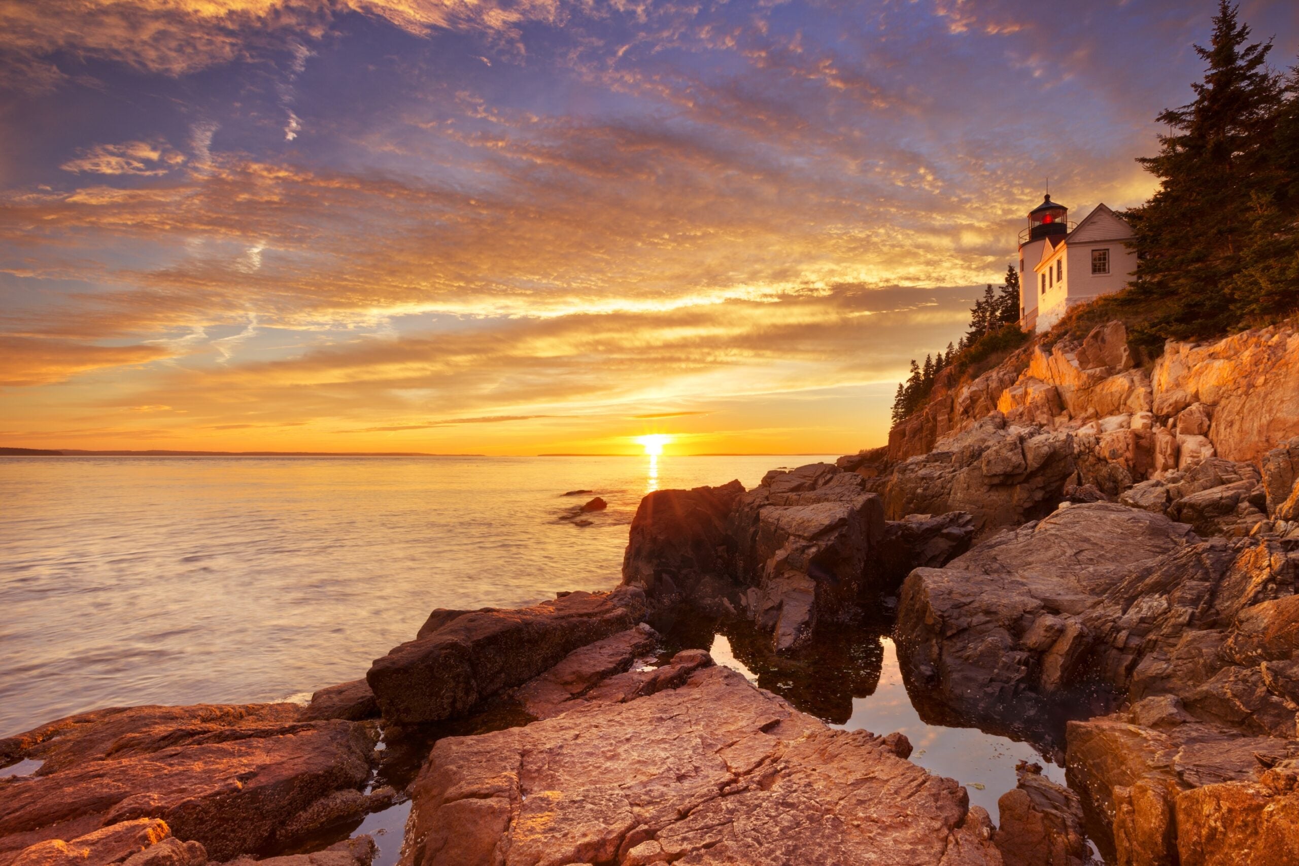
The Bass Harbor Head Lighthouse in Acadia National Park, Maine, USA. Photographed during a spectacular sunset.
Scenic Viewpoints & Roadside Stops: Don’t just drive through – some of the best memories come from the quirky stops. Snap a photo at the Center of North America monument in Rugby, ND. Say hello to the giant Paul Bunyan and Babe statues in Bemidji, MN (a fun nod to the region’s logging lore). Pull over at the top of Rogers Pass (Montana) or Stevens Pass (Washington) to breathe the mountain air and take in the vista. In New England, small highway pullouts reveal covered bridges and rushing streams. Along US-2 in eastern Montana, historical markers tell of Lewis and Clark’s passage and native Blackfeet history – worth a read to connect with the land’s story.
Cultural and Historical Sites: From French-settled Quebec to industrial Great Lakes ports, the cultural tapestry is rich. In Bar Harbor, learn about the Wabanaki People at the Abbe Museum before you go. In Vermont, US-2 runs past the Shelburne Museum (south of Burlington) which is an eclectic collection of Americana and New England history artifacts. Train buffs will enjoy the Izaak Walton Inn in Essex, MT – a historic railroad hotel on the Great Northern line. For recent history, see the wild contrasts of boomtown USA in Williston, ND, where oil has brought rapid change to the prairie. And of course, Seattle offers a big-city finale with art, music, and tech history (consider the Museum of Pop Culture or a simple wander through Pike Place Market for a taste of Seattle’s heritage).
Food & Local Flavor: Part of the fun of a long road trip is trying regional specialties. Feast on Maine lobster rolls and wild blueberry pie before leaving New England. In the Midwest, a classic Friday fish fry or a pasty (hearty meat hand-pie beloved in Michigan’s U.P.) makes a great roadside meal. Don’t miss a scoop of ice cream at Bridgeman’s in Duluth or a slice of Juneberry (serviceberry) pie if you find one in North Dakota. Montreal’s detour offers world-class dining; even a smoked meat sandwich or fresh bagel can be a trip highlight. In Seattle, treat yourself to a celebratory dinner – perhaps fresh Pacific salmon or a cup of rich coffee at the original Starbucks. These local tastes make the miles even more rewarding.
Segment Guide Links
For more detail, use the segment guides below. Each one breaks the corridor into manageable distances with day-to-day suggestions, campground notes, and activity highlights.
- Bar Harbor, ME to Burlington, VT – New England’s coastal and mountain introduction.
- Burlington, VT to Sault Ste. Marie, MI (via Canada) – The international stretch through Quebec and Ontario.
- Sault Ste. Marie, MI to Duluth, MN – Upper Great Lakes forests, lakeshores, and small towns.
- Duluth, MN to Glacier National Park, MT – The long haul across the Northern Plains into Big Sky Country.
- Glacier National Park, MT to Seattle, WA – Rocky Mountains, Inland Northwest, and Cascade finale.
If you plan to explore each segment in depth, you might treat them as separate adventures with rest days in between. This breakdown also helps in case you’re not doing the entire drive at once – you can tackle it one region at a time.
Planning Info
Taking time to prepare for the Great Northern Road Trip will pay dividends in safety and enjoyment. Here are practical tips and resources to consider before and during your journey:
Road Conditions & DOT Resources: Weather can be extreme on this northern route, so always check road conditions. Save the Department of Transportation (DOT) traveler info websites for each state: Maine/New England 511, Vermont 511, Michigan DOT, Wisconsin 511, Minnesota 511, North Dakota Travel Info, Montana MDT Road Report, Idaho 511, and Washington WSDOT. These sites provide live updates on closures, construction, and weather alerts. Mountain passes like Stevens Pass in WA have specific traction tire and chain requirements in winter – WSDOT will post “chains required” alerts when applicable.
Weather & Seasonal Preparedness: Expect everything from fog and rain on the coasts to dry heat in the Plains and possibly snow in the Rockies – sometimes all on the same trip. Pack layers for temperature swings. Even in midsummer, nights in the northern Rockies and northwoods can drop into the 40s°F. If traveling October–April, equip your vehicle with winter tires or carry chains, a snow shovel, and emergency blankets. Blizzards can develop quickly on the plains (North Dakota’s stretch of US-2 is notorious for ground blizzards). Always have extra food and water in the car in case you get stuck or delayed.
Fuel, Services & Cell Coverage: Gas up frequently in the West – distances between towns are greater than in the East. While there are no 300-mile gaps in services, you might go 70–80 miles without a gas station in parts of MT/ND. Cell phone coverage is decent near cities and along much of US-2, but there are significant dead zones (e.g., stretches of MT near the Rockies, parts of Maine’s North Woods). Download offline navigation maps ahead of time. The Dyrt PRO offers downloadable campground and map data, which can be very handy when signal drops. A paper road atlas is a smart backup too.
Permits & Regulations: No special permits are needed to drive US-2, but if your vehicle is over 8 feet tall or towing, be aware of low clearance bridges on older sections (rare on this route, mostly an issue on some regional detours). In Glacier National Park, as mentioned, summer entry requires a timed ticket for Going-to-the-Sun Road. Check Glacier’s NPS site for details and secure reservations in advance. Campground reservations for national and state parks en route are highly recommended during peak season – recreation.gov handles federal sites, while state parks have their own systems (e.g., ReserveAmerica for many states). If you plan to camp in national forests or do dispersed camping, typically no permit is needed, but observe stay limits and fire regulations (get a free fire permit in some western states if backcountry camping).
Costs & Budgeting: Tolls are minimal on this northern route. You’ll mainly encounter fees for national park entry (Acadia and Glacier charge entrance fees of ~$30, or use an $80 America the Beautiful Pass for all parks) and camping fees. Gasoline will likely be one of the biggest expenses – prices may be higher in remote areas. Canada’s portion requires spending in Canadian dollars; credit cards are widely accepted, but inform your bank of travel. If you make the round-trip, consider an oil change or vehicle check in Seattle before heading back. Lastly, keep some cash for small-town cafes or farm stands – part of the charm is enjoying local treats like a maple creemee in Vermont or a frybread taco on a Montana reservation.
Safety & Etiquette: Wildlife crossings are a real concern – in the evenings, slow down and use high beams (when no oncoming traffic) to spot deer, especially in Wisconsin and Minnesota. In bear country (Glacier and western Montana), never leave food or coolers unattended – use bear boxes and follow park guidelines. When driving through Native American reservations (e.g., Blackfeet Nation along US-2 east of Glacier), remember you are a guest; be respectful, and observe any posted rules or speed limits in villages. The same goes for Canada – know the basic km/h conversions (100 km/h ≈ 62 mph) to avoid speeding inadvertently. Finally, practice Leave No Trace principles at campsites and viewpoints. This route traverses some pristine environments; keeping them clean ensures they remain a joy for those who follow.
Additional Resources
Planning a cross-country trek can be daunting, but plenty of resources are available to help you. Below are official sites and useful guides related to the Great Northern Road Trip:
- RoadTrip USA – Great Northern (US-2) Guide – Detailed narrative by Jamie Jensen, with state-by-state highlights and history of US-2.
- NPS: Acadia National Park – Official park site for Acadia (maps, current conditions, reservations).
- NPS: Glacier National Park – Official site for Glacier (road status, entry tickets, campground info). Critical for checking Going-to-the-Sun Road status.
- The Dyrt Magazine – Road Trips Section – Articles and tips for camping road trips. Look for user-generated reviews of campsites along US-2.
- U.S. Passport Info – Guidance on documents for re-entering the U.S. if you take the Canada shortcut. (Ensure everyone in your party has a passport or enhanced ID.)
- 511 Alberta & 511 Ontario – Provincial road condition sites, if you adjust the route through Canadian highways (helpful for conditions around Sault Ste. Marie or alternate routes).
- NOAA Weather – Use the point forecasts on weather.gov for specific areas (e.g., White Mountain NF, ND plains, Glacier NP) to get a more localized weather outlook. Weather can vary dramatically along the route.
- Leave No Trace Principles – Refresh on LNT to minimize your impact when camping and hiking. This route passes through many sensitive natural areas where responsible travel is important.
The Great Northern road trip is an adventure of epic scale, but with the right planning and a spirit of flexibility, it’s entirely achievable. Whether you’re drawn by the call of open roads, the promise of uncrowded landscapes, or the chance to connect with America’s northern communities, this journey delivers. Pack your gear, plot your stops, and get ready to create some road trip memories from Bar Harbor to Seattle. As the saying goes, “On the road again…” – the Great Northern is calling. Happy travels!
The Dyrt is the only camping app with all of the public and private campgrounds, RV parks, and free camping locations in the United States. Download now for iOS and Android.Popular Articles:
Articles on The Dyrt Magazine may contain links to affiliate websites. The Dyrt receives an affiliate commission for any purchases made by using such links at no additional cost to you the consumer.