Heading out from the Lake Superior harbor city of Duluth, one of the most beautiful and under-appreciated travel destinations in the Midwest, this Great Northern road trip segment spans Minnesota, North Dakota, and Montana. Over roughly 1,200 miles, you’ll transition from the Northwoods and lake country into the wide-open plains of the Upper Midwest, and finally to the soaring peaks of Glacier National Park. It’s a journey that truly defines “getting away from it all.” Plan for about 4 days to fully experience this leg, which is rich in natural wonders (from the Mississippi’s headwaters to big-sky prairies) and ends amid the alpine splendor of Glacier’s east side. For a complete guide to the entire Great Northern route, see our overview article.
Segment Overview
On this segment, you’ll trace approximately 1,195 miles from the Great Lakes to the Rocky Mountains. Starting at Duluth’s Lake Superior shoreline, follow US Highway 2 across northern Minnesota’s forests and lake country, through the rural expanse of North Dakota’s prairies, and along Montana’s legendary “Hi-Line” railroad corridor. Expect a gradual change from thick woods to vast, windswept plains “empty to look at” yet rich with frontier history. Summer and early fall are the best times to drive this stretch, with long daylight hours and generally dry weather. Travelers should be prepared for remote sections with limited services and potentially spotty cell coverage in North Dakota and Montana’s rural areas. The payoff is huge: unspoiled landscapes, starry nights, and the breathtaking approach to Glacier National Park’s glacial valleys.
Quick Stats
| Total Distance | Est. Drive Time | Recommended Duration |
| ~1,195 miles | ~21 hours (nonstop) | 4 days |
| States Traversed | Primary Route | Cell Service |
| MN, ND, MT | US-2 (Great Northern) | Good in towns; spotty in remote stretches |
| Fuel Stops: Regular gas in all major towns (max ~70–80 miles between services; plan ahead in N. Dakota & Montana) | ||
Day-by-Day Itinerary
Day 1: Duluth to Itasca State Park (approx. 180 miles)
Morning: Start in Duluth, MN, enjoying views of the iconic Aerial Lift Bridge and Lake Superior’s vast horizon. From Duluth, head west on US-2 through dense pine forests and past numerous lakes. This stretch takes you into Minnesota’s “Great Northwoods” region – the mythical home of Paul Bunyan. Consider a pit stop in Bemidji (about 120 miles from Duluth), the first city on the Mississippi River. Snap a photo with the legendary Paul Bunyan and Babe statues in Bemidji and grab lunch in this charming northwoods town.
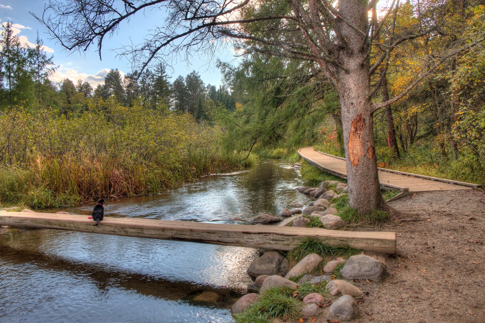
Afternoon: Continue west to Itasca State Park’s Bear Paw Campground area (approximately 60 miles from Bemidji). As you enter Itasca State Park, you’ll be surrounded by towering red pines and tranquil lakes. A must-do activity is visiting the Mississippi River Headwaters – where the mighty Mississippi begins as an 18-foot wide, knee-deep stream. Walk across the smooth stones at the headwaters, an “only in Minnesota” experience. If time permits, hike or bike a portion of the park’s trail system or climb the historic fire tower for a panoramic view. Bear Paw Campground is an ideal overnight stop – set on Lake Itasca with miles of trails and wildlife viewing right at your doorstep. In the evening, relax by the campfire and relish the woodland serenity.
Day 2: Itasca State Park to Turtle River State Park, ND (approx. 160 miles)
Morning: Wake up to birdsong at Itasca. Before departing, you might rent a canoe to paddle on Lake Itasca or take a short morning hike among the old-growth pines. Then, head back north to US-2 and continue westward. You’ll traverse Minnesota’s lake country into the Red River Valley. As you approach Grand Forks, ND, the landscape flattens out into fertile farmlands. Cross the Red River at Grand Forks into North Dakota – a milestone as you enter your second state. In Grand Forks (about 120 miles from Itasca), top off your gas and pick up any groceries; it’s a sizeable city with plenty of services.
Afternoon: From Grand Forks, drive about 22 miles west on US-2 to reach Turtle River State Park. Nestled in a wooded valley along a rare stretch of forested river, Turtle River State Park is a welcome oasis amid North Dakota’s prairies. Enjoy an easy nature walk under oak and aspen trees or cast a line in the Turtle River (known for trout fishing). The park has modern facilities and even cabins, making it a comfortable stop. Camp here for the night to enjoy the quiet, starry skies. (Cell reception is generally available here, in case you need to check in back home.) Wind down with a campfire – you’re likely to hear crickets and maybe even owls from the surrounding woods, a peaceful end to a lighter driving day.
Day 3: Turtle River State Park to Lewis & Clark State Park, ND (approx. 360 miles)
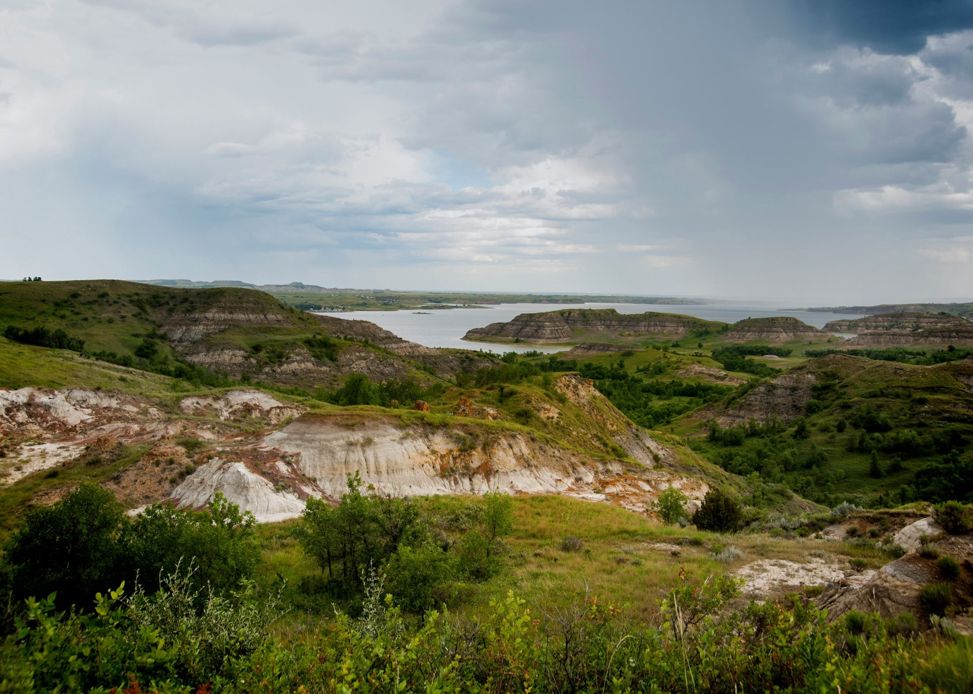
Morning: Get an early start for a big day crossing North Dakota. US-2 stretches straight across the prairie, often as a four-lane highway with light traffic. Your first stop is Devils Lake (about 100 miles west of Turtle River). As North Dakota’s largest natural lake, Devils Lake offers a scenic break. If time allows, drive into Grahams Island State Park on the lake for a picnic or a quick hike – and note the high water marks. (Devils Lake infamously has no outlet; in recent decades it rose over 30 feet, even flooding and elevating US-2 onto a causeway!) Near the town of Devils Lake, history buffs might detour 14 miles south on ND-57 to visit Fort Totten State Historic Site, a well-preserved 19th-century fort. Back on US-2, continue west through Rugby. Be sure to stop in Rugby, ND for a photo at the Geographical Center of North America monument – a stone cairn marking the continent’s heart. It’s a quick, quirky roadside attraction right off US-2.
Afternoon: Proceed through Minot (a good refueling point and last major city until Montana) and on toward the Montana border. You’ll notice the land becoming increasingly remote and dotted with grain elevators and oil pump jacks. About 15 miles before Montana, consider a stop at Fort Union Trading Post National Historic Site, just off ND-1804 north of US-2 at the state line. This reconstructed fort was the most important fur trade post on the Upper Missouri River in the 1800s. Crossing into Montana (and the Mountain Time Zone, so set your clocks back one hour), you’ll soon reach the confluence of the Missouri and Yellowstone Rivers near Fort Union – a significant landmark of the Lewis and Clark expedition. Your destination tonight is Lewis & Clark State Park, about 20 miles south of US-2 near Williston, ND’s northwest corner (you’ll backtrack a bit east on ND-1804 to reach it). Situated on a bay of colossal Lake Sakakawea, this park offers modern campgrounds and hot showers. Unwind by watching the sunset over the Missouri River’s lake-like expanse. This area blends prairie and badlands terrain, and is known for its fishing and birding opportunities. Enjoy a night under the prairie sky with the comforts of a developed campground after a long day’s drive.
Day 4: Lewis & Clark State Park, ND to Many Glacier, MT (approx. 400 miles)
Morning: Today’s drive takes you across Montana’s “Hi-Line.” Head back to Williston and rejoin US-2 west into Big Sky Country. The road closely parallels the BNSF railway and slices through vast cattle ranches and wheat fields. Towns are spaced roughly 60–80 miles apart – names like Culbertson, Wolf Point, and Glasgow will mark your progress. Plan a fuel stop in Glasgow or Malta, and don’t miss the chance to stretch your legs. For a unique pit stop, consider the Sleeping Buffalo Hot Springs near Saco – a quirky roadside hot springs resort that’s just a couple miles off US-2. Around midday, the distant outline of the Rocky Mountains may appear on the western horizon, growing more pronounced as you pass through Havre and then Shelby (junction with I-15).
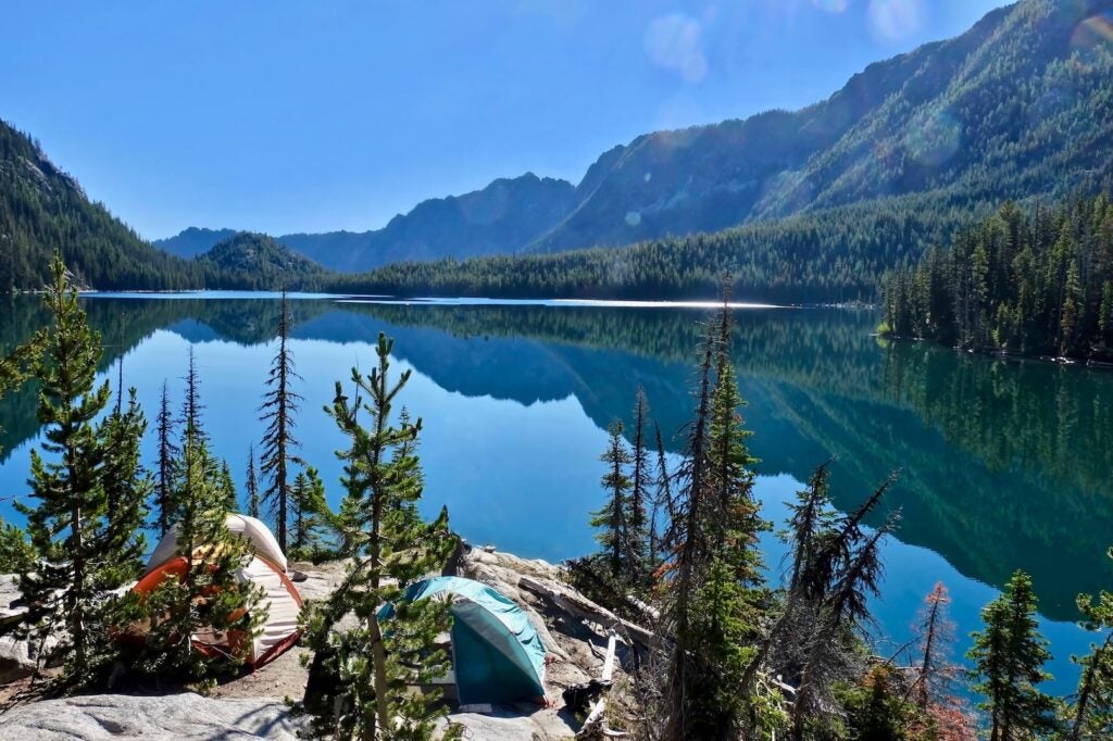
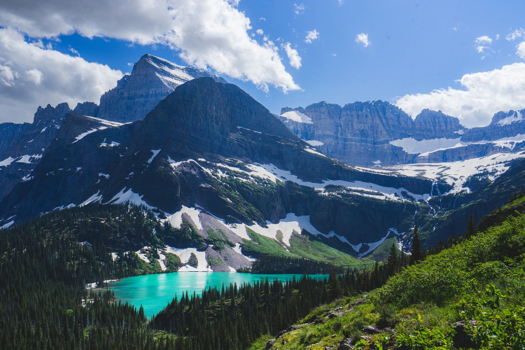
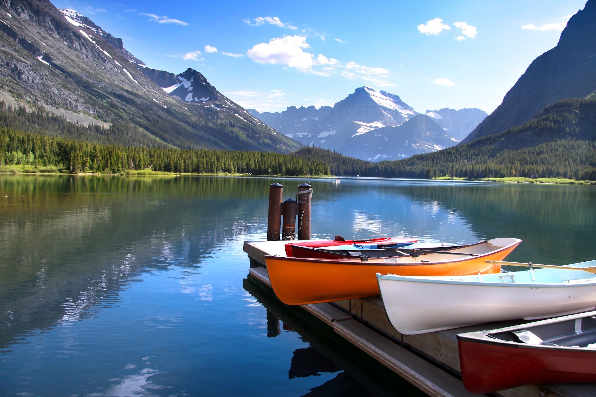
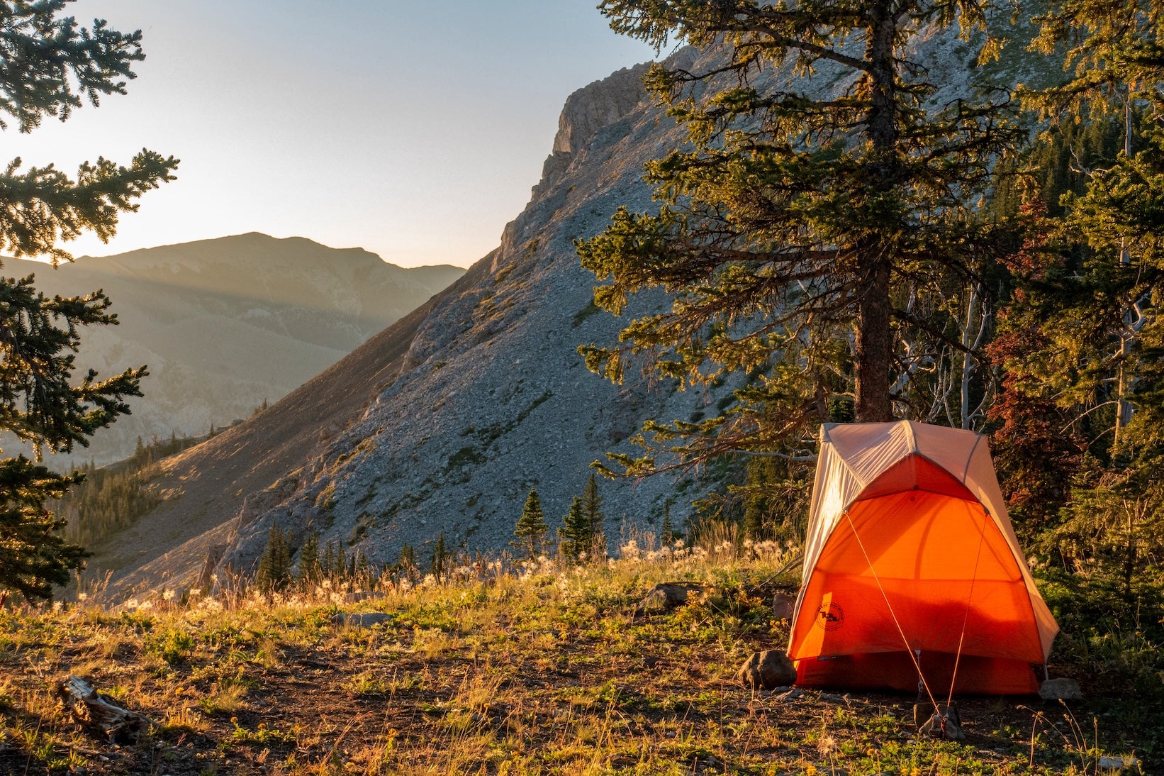
Afternoon: At Cut Bank, MT, you’ll leave the plains behind. US-2 begins to undulate as you near the Rocky Mountain Front. Turn north on US-89 at Browning, entering the Blackfeet Reservation. The dramatic rise of Glacier National Park’s peaks greets you just beyond Browning – a thrilling sight after days of flat terrain. Before heading into the park, you could stop at the Museum of the Plains Indian in Browning for cultural context. Continue north on Hwy 89 to Babb, then west on the Many Glacier Road. This winding 12-mile road leads into the heart of Glacier National Park’s Many Glacier Valley, often called the “Switzerland of North America.” Prepare to be awe-struck by steep peaks and possibly wildlife along the road (watch for bears and moose). Settle in at Many Glacier Campground, ideally with a reservation (it’s popular!). This campground places you at the doorstep of world-class hiking trails to Iceberg Lake, Grinnell Glacier, and Redrock Falls begin nearby. Evenings here are magical: you might hear distant waterfalls or see the alpenglow on Mount Grinnell. There’s no cell service at camp (and none of the modern distractions) – just you and the stars. Congratulations, you’ve completed the Duluth-to-Glacier segment and earned some time to explore Glacier National Park!
Campgrounds to Consider
- Bear Paw Campground — Itasca State Park (Laporte, MN): A scenic lakeside campground within Minnesota’s oldest state park, Bear Paw offers spacious wooded sites and quick access to the Mississippi headwaters. Campers enjoy clean facilities with hot showers and numerous hiking/biking trails leading through wildflower meadows and old-growth forest. Don’t miss climbing the nearby Aiton Heights fire tower for a bird’s-eye view of the park.
- Turtle River State Park Campground (Arvilla, ND): A green haven 22 miles west of Grand Forks, this state park campground sits in a wooded valley along the Turtle River. The park features modern amenities (electric hookups, showers) and a mix of tent sites, RV pads, and cozy cabins. Visitors love the well-kept trails that wind through oak and ash forest – a great chance to spot deer and listen to songbirds. It’s a peaceful stop with easy access from US-2.
- Grahams Island State Park Campground (Devils Lake, ND): Located on an island in Devils Lake (reached by causeway), this campground is a top pick for fishing and lake fun. Over 150 campsites (from primitive tent spots to full-hookup RV sites) mean there’s something for everyone. Amenities include showers, a boat ramp, fish-cleaning stations, and even a playground and dog park. Sunset views over North Dakota’s largest lake are spectacular – just bring bug spray, as the lake’s shoreline can attract mosquitoes in summer.
- Lewis & Clark State Park Campground (near Williston, ND): Perched on a bay of Lake Sakakawea (Missouri River), this campground is known for its blend of comfort and recreation. It features spacious gravel pads for RVs and plenty of tent sites, plus amenities like clean showers, a camp store, and even a swimming beach. Many sites have lake views framed by the rugged buttes of northwestern North Dakota. It’s popular for boating and fishing – there’s a large boat ramp and marina nearby. Reservations are recommended in peak summer due to its popularity.
- Nelson Reservoir (USBR) Campground (Saco, MT): A free, first-come-first-served camping area managed by the Bureau of Reclamation. Nelson Reservoir offers primitive waterfront sites along a calm reservoir just off US-2. There are no hookups (vault toilets are available), but you can park right by the shore and enjoy wide-open prairie skies and brilliant sunsets reflecting on the water. It’s a great overnight option for self-sufficient campers looking to break up the long drive across Montana. Mosquitoes can be intense mid-summer, so come prepared with repellent. The reward is solitude and star-gazing aplenty.
- St. Mary / East Glacier KOA (St. Mary, MT): A private campground at Glacier National Park’s east gateway, offering resort-like amenities in a jaw-dropping setting. The KOA has everything from tent sites to full-service RV sites and cabins. Campers appreciate the well-maintained facilities – hot showers, laundry, a camp store (with ice cream and pizza delivery!), and even a swimming pool with mountain views. The location is minutes from the St. Mary entrance and Going-to-the-Sun Road, making it ideal for exploring Glacier. While the open sites mean limited shade, the panoramic vistas of Glacier’s peaks more than compensate. It’s family-friendly and dog-friendly, with a playground and dog park on-site. Reservations are advisable, as this KOA is very popular during the summer.
- Many Glacier Campground (Glacier National Park, MT): A beloved national park campground set deep in Glacier’s wilderness, Many Glacier is surrounded by towering peaks and is frequently rated one of the best campgrounds in the U.S. Sites are tucked amid aspen and pine groves at the foot of Mt. Grinnell, and Swiftcurrent Lake is a short stroll away. Expect basic facilities (potable water, restrooms, but no showers or hookups) and remember that all sites are reservable in advance (same-day first-come sites have been discontinued, so book early). The payoff is unparalleled access to hiking trails – Iceberg Lake, Grinnell Glacier, and others start nearby – plus frequent wildlife sightings (keep an eye out for bears, moose, and bighorn sheep). There’s no cell service at the campground, and only limited supplies at the tiny camp store, so come prepared. If you secure a spot here, you’ll wake up in one of Glacier’s most scenic valleys, ready for adventure.
Top Activities & Attractions
Mississippi Headwaters – Itasca State Park: Walk across the very beginning of the Mississippi River at Lake Itasca, stepping stone to stone over waters only a few inches deep. The Headwaters area features interpretive signs, a historic marker post, and a short trail. It’s an unforgettable moment to “cross the Mississippi” without getting wet!
Paul Bunyan & Babe Statues – Bemidji, MN: These 18-foot-tall figures of the legendary lumberjack Paul Bunyan and his blue ox, Babe, stand on the Bemidji waterfront. Erected in 1937, they’re a fun roadside photo op celebrating Minnesota folklore. The nearby visitor center can stamp your “Paul Bunyan Passport.”
Fort Totten State Historic Site – ND: Located south of Devils Lake, Fort Totten is a well-preserved 1867 military post later converted to a Native American boarding school. Stroll the grounds (open daily in summer, $8 admission) to see original brick buildings and learn about frontier life. In July, it hosts performances and a powwow celebrating local Dakota culture.
Geographical Center of North America – Rugby, ND: Mark the midway point of the continent at this quirky roadside monument. A 21-foot stone cairn with U.S., Canada, and Mexico flags marks the spot determined by a 1931 geological survey. It’s free to visit and makes for a quick, fun photo stop along US-2.
Fort Union Trading Post NHS – ND/MT Border: Step back into the fur trade era at this partially reconstructed fort on the Missouri River. National Park Service rangers offer insights into the bustling trade between Plains Tribes and European-American traders here from 1828 to 1867. Don’t miss the Bourgeois House (visitor center) with exhibits. Open year-round (summer daily 9-5; free entry).
Bear Paw Battlefield – near Chinook, MT: A solemn National Historic Landmark on the plains south of Chinook, this is the site of the Nez Perce surrender in 1877. A self-guided trail (~1.25 miles) winds through the battlefield; informative plaques tell the story of Chief Joseph’s band’s final conflict (“From where the sun now stands, I will fight no more forever”). It’s remote but impactful – allow about an hour to visit. (Open year-round, no fees.)
Many Glacier Area – Glacier National Park, MT: The culmination of this segment is a destination in itself. Take a ranger-led boat tour across Swiftcurrent and Josephine Lakes for a unique perspective on the peaks. Hit the trail to Iceberg Lake (9.7 miles round-trip, moderate) to see floating icebergs even in midsummer, or hike to Redrock Falls (3.6 miles round-trip, easy) for an easier outing. Keep binoculars handy – grizzly bears and mountain goats are often spotted on the hillsides here. In the evening, drive or walk to the Swiftcurrent Lake shoreline behind the Many Glacier Hotel for a stunning sunset view of Mount Grinnell reflected in the water.
Travel Tips for This Segment
Fuel & Supplies: Gas up in larger towns whenever possible (Bemidji, Grand Forks, Minot, Havre). The longest stretch without services is typically 70–80 miles, especially in eastern Montana. US-2 travel is rewarding but “you need to plan your stops” for gas, food, and restrooms on this remote route. Carry water and snacks in case services are closed in small towns.
Weather & Seasons: Summer brings long days and generally good driving weather. However, thunderstorms can pop up on the plains – be ready for sudden wind or rain. Spring and fall are pleasant but can be windy and much cooler at night. Winter travel is not advised without serious preparation (blizzards and subzero temperatures are common on the Northern Plains).
Cell Service: You’ll have strong cell signals around cities (Duluth, Grand Forks, Minot) and decent coverage along US-2 in Minnesota and eastern North Dakota. In western ND and across Montana’s Hi-Line, expect patchy reception or dead zones between towns. Don’t rely on streaming maps – download offline maps ahead of time. Once in Glacier National Park, note that Many Glacier and St. Mary areas have little to no coverage, so plan meet-ups and communications accordingly.
Wildlife Caution: Watch for deer (and occasionally moose) along wooded stretches near Itasca and Turtle River, especially at dawn/dusk. In Montana, pronghorn antelope and even free-range cattle may appear near the highway. Keep your speed in check and stay alert – collisions can be dangerous in these sparsely populated areas. In and near Glacier, follow all bear safety guidelines: carry bear spray when hiking, make noise on trails, and store food securely at camp.
Reservations & Permits: If traveling in peak summer, reserve popular campgrounds well in advance – Many Glacier Campground now requires reservations for all sites, and the St. Mary KOA and Itasca State Park sites fill quickly on summer weekends. Also, if you plan to drive Glacier’s Going-to-the-Sun Road from St. Mary (a highly recommended detour beyond this segment), be aware that the National Park Service may require a timed-entry reservation during summer months (check the Glacier National Park official site for current vehicle reservation rules). Lastly, remember you gain an hour crossing into Mountain Time in western ND/MT – helpful when planning your day’s schedule!
Additional Segments & Resources
This Duluth-to-Glacier portion is just one chapter of the epic Great Northern road trip. Be sure to read our Great Northern Route overview for a big-picture look at the coast-to-coast journey and links to other segments (like the route leading into Duluth from the east, and the continuation westward from Glacier Park). Each segment guide offers tailored tips and highlights, so you won’t miss a thing. As you venture on, consider tools like The Dyrt PRO for offline campground finding, and follow Leave No Trace principles to keep these wild places pristine. Happy travels on the Great Northern!
The Dyrt is the only camping app with all of the public and private campgrounds, RV parks, and free camping locations in the United States. Download now for iOS and Android.Popular Articles:
Articles on The Dyrt Magazine may contain links to affiliate websites. The Dyrt receives an affiliate commission for any purchases made by using such links at no additional cost to you the consumer.