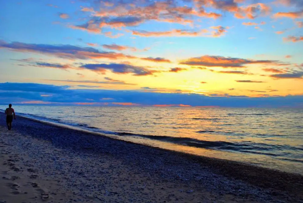
The journey from Sault Ste. Marie, Michigan to Duluth, Minnesota is a memorable segment of the Great Northern road trip. This 400+ mile stretch hugs Lake Superior’s wild south shore, connecting historic maritime towns, dense northwoods forests, and stunning waterfalls. It’s a route defined by Great Lakes scenery – from the Soo Locks on the St. Marys River to the rocky Apostle Islands – and is best enjoyed over about 4 days. Along the way, you’ll encounter pristine national lakeshores, quaint harbor villages, and plenty of hiking and camping opportunities. For a broader context and to plan the entire route, see our complete Great Northern road trip overview.
Route Overview: Sault Ste. Marie to Duluth
This segment traces the Lake Superior shoreline westward across Michigan’s Upper Peninsula into northern Wisconsin and Minnesota. You’ll start in Sault Ste. Marie, then wind through remote stretches of hardwood forest and coastal sand dunes before reaching Duluth’s busy port. The landscape transitions from the rolling hills of the eastern Upper Peninsula to the rugged cliffs and peaks around Lake Superior’s shore. Expect two-lane highways (paved and well-maintained) with occasional winding sections near the lake. Summer and early fall are the prime seasons for this drive – offering long daylight hours, mild temperatures, and vibrant fall colors by late September. Winters here are harsh with snow-covered roads and some park facilities closed, so plan accordingly if traveling outside of May–October.
Quick Stats: Sault Ste. Marie–Duluth Segment
| Total Distance | ~430 miles |
| Estimated Drive Time | Approx. 9 hours (without stops) |
| States Traversed | Michigan, Wisconsin, Minnesota |
| Primary Routes | MI-28, MI-123, MI-94/H-58, US-41, WI-13, US-2 |
| Recommended Duration | 4 days |
| Cell Service | Spotty (limited in forests and shoreline areas) |
| Fuel Stops | Major towns (Paradise, Munising, Marquette, Ashland); few services in between |
4-Day Itinerary: Sault Ste. Marie to Duluth Road Trip
Day 1: Sault Ste. Marie, MI to Munising, MI (Pictured Rocks)
Morning: Begin in Sault Ste. Marie by visiting the famous Soo Locks, where colossal freighters traverse the 21-foot drop between Lake Superior and Lake Huron. Head west on Highway M-28 through dense forests toward Paradise, MI (about 60 miles). In Paradise, a short detour north on Whitefish Point Road (11 miles) leads to the Great Lakes Shipwreck Museum at Whitefish Point. This museum and lighthouse offer a fascinating look at Lake Superior’s maritime history, including artifacts from the Edmund Fitzgerald. Backtrack to Paradise for a quick refuel or snacks.
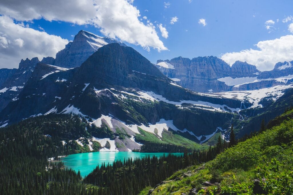
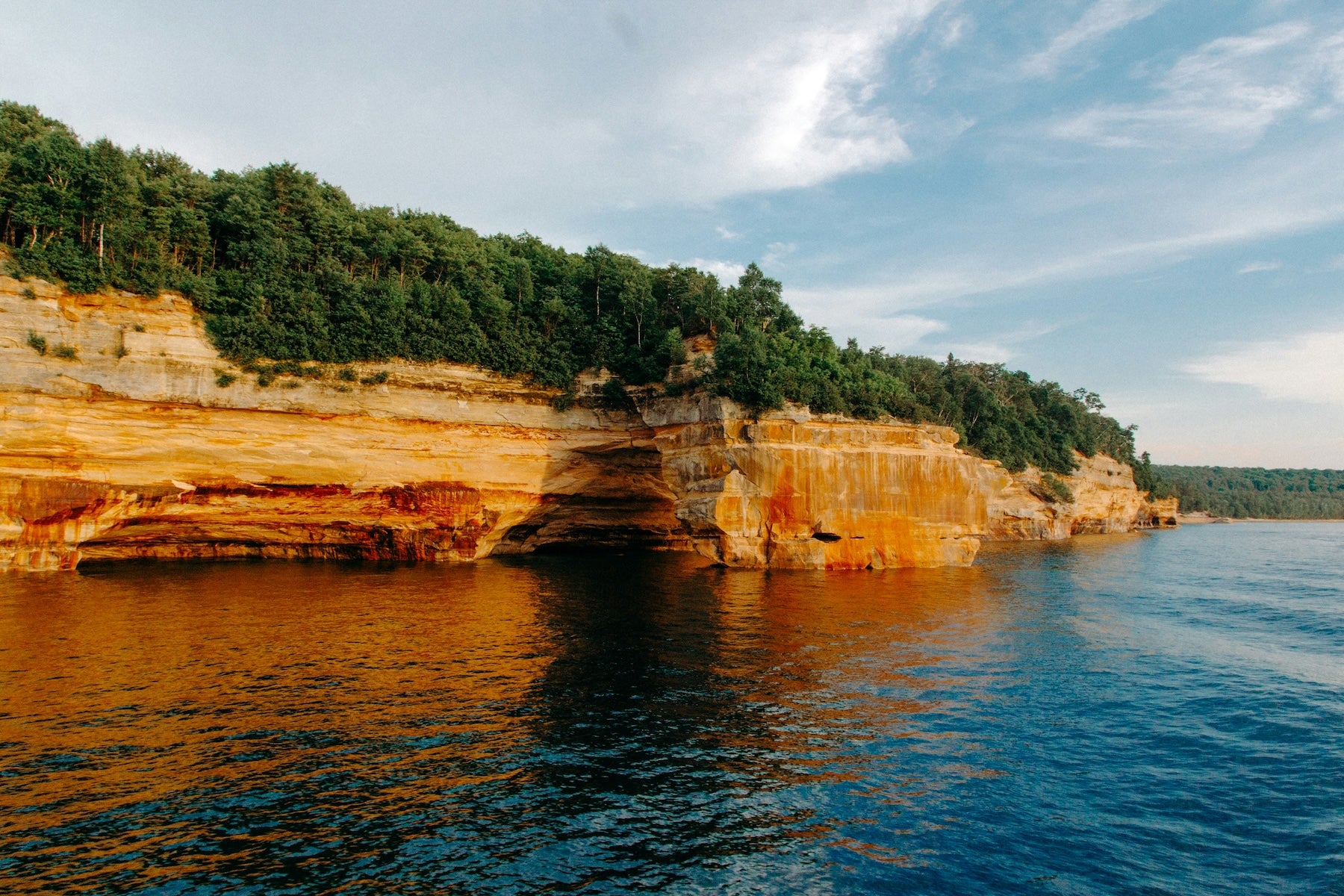
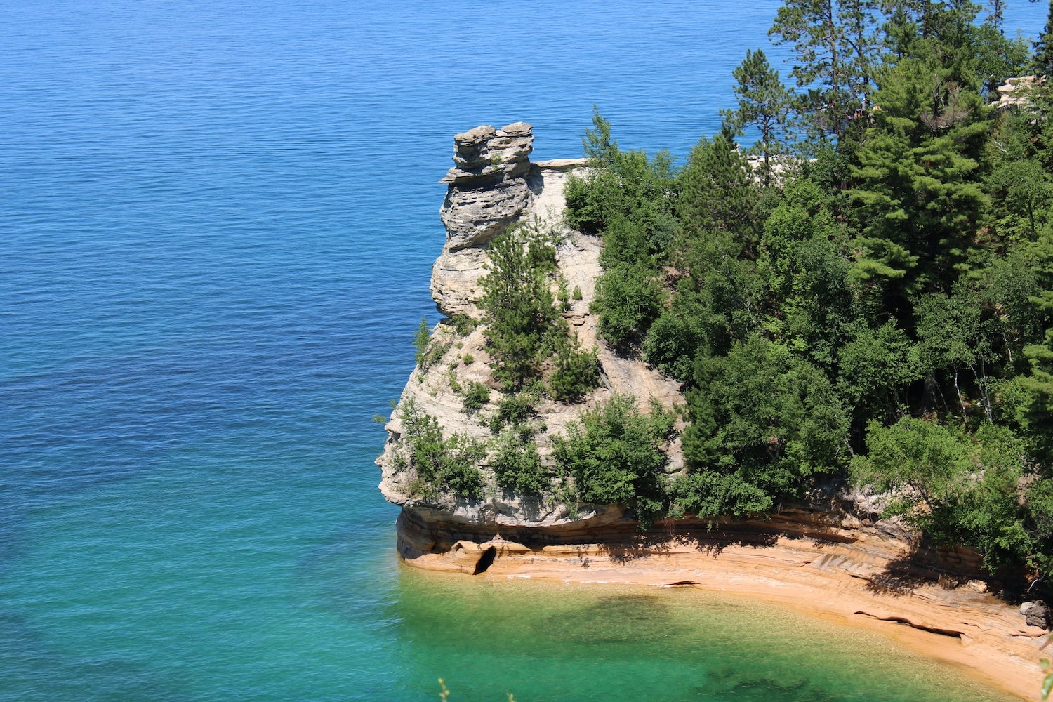
Afternoon: Continue on M-123 to Tahquamenon Falls State Park (just 15 minutes from Paradise). Stretch your legs on the short boardwalk trail to the impressive Upper Falls – one of the largest waterfalls east of the Mississippi. There’s a family-friendly brewery and pub near the falls where you can grab lunch with a view of the rapids. After lunch, drive back to M-28 and head west. The route passes through small towns like Newberry (last major gas stop for a while) before reaching Munising by early evening. Along the way, consider turning off M-28 onto County Road H-58 at Shingleton to enter Pictured Rocks National Lakeshore from the east. This scenic lakeshore road winds 40 miles past highlights like the Log Slide Overlook and Twelve Mile Beach. Arrive in Munising, a harbor town at the western end of Pictured Rocks, and settle in for the night. Overnight in Munising or camp within Pictured Rocks (Munising has hotels and the popular Munising Tourist Park campground).
Day 2: Munising, MI to Porcupine Mountains (Ontonagon, MI)
Morning: Start the day with more of Pictured Rocks. If weather permits, take a morning boat tour from Munising to see the multicolored sandstone cliffs up close (reservations recommended). Alternatively, hike a short trail like the 1.2-mile round-trip to Miners Falls or the overlook at Miners Castle. By late morning, depart Munising westward on M-28/US-41 toward Marquette (43 miles). Marquette is the Upper Peninsula’s largest city and makes a great lunch stop – there are local cafés and a waterfront park by the historic ore docks. Fuel up here, as the next leg is remote.
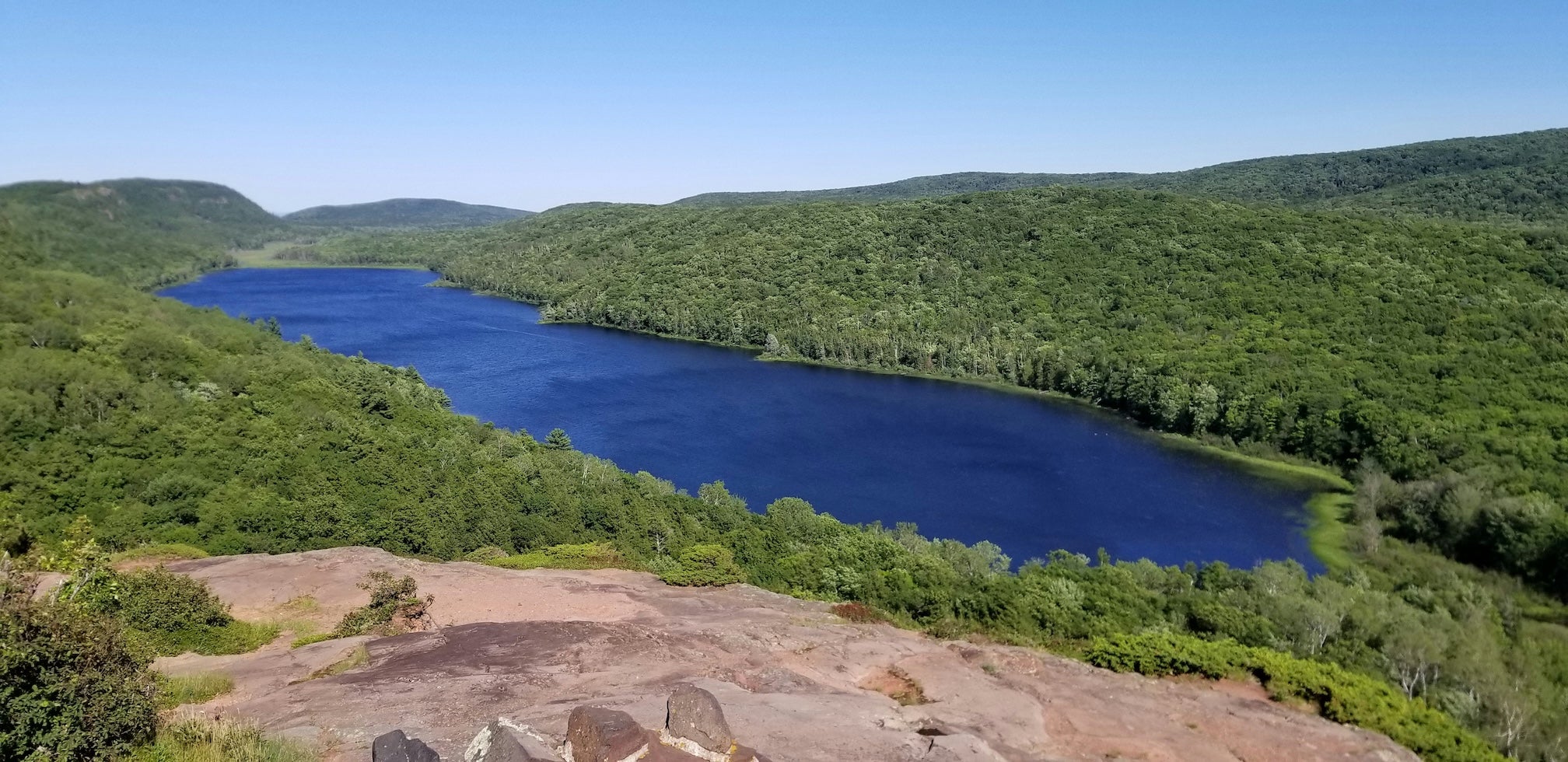
Afternoon: From Marquette, follow US-41 along Lake Superior’s coast to L’Anse and Baraga, skirting Keweenaw Bay’s scenic shoreline. Transition onto M-38 west to Ontonagon (if you need groceries or supplies, Ontonagon has a couple of small stores). In the late afternoon, enter Porcupine Mountains Wilderness State Park – nicknamed “the Porkies.” A park road (M-107) leads to the Lake of the Clouds overlook, a must-see viewpoint especially near sunset. It’s a short walk from the parking area to an expansive vista over an inland lake and untouched forests. Optional easy hikes in the area include the 1/2-mile Union Mine Interpretive Trail. Overnight at Porcupine Mountains – camping at Union Bay Campground (on Lake Superior) is popular, or find lodging in nearby Silver City/Ontonagon.
Day 3: Porcupine Mountains, MI to Bayfield, WI
Morning: Wake up to fresh lake breezes in the Porcupine Mountains. If time allows, drive to the park’s quieter southern side (about 20 miles) to explore the Presque Isle Scenic Area, where short trails loop past a series of photogenic waterfalls (Manido, Manabezho, and Nawadaha Falls). By late morning, depart the Porkies and head south on Highway M-64 to US-2, then west into Wisconsin. The road crosses into Wisconsin at Ironwood – keep an eye out for the giant fiberglass statue of Hiawatha peeking through the trees in Ironwood’s roadside park. Continue through the Gogebic Range into Ashland, Wisconsin.
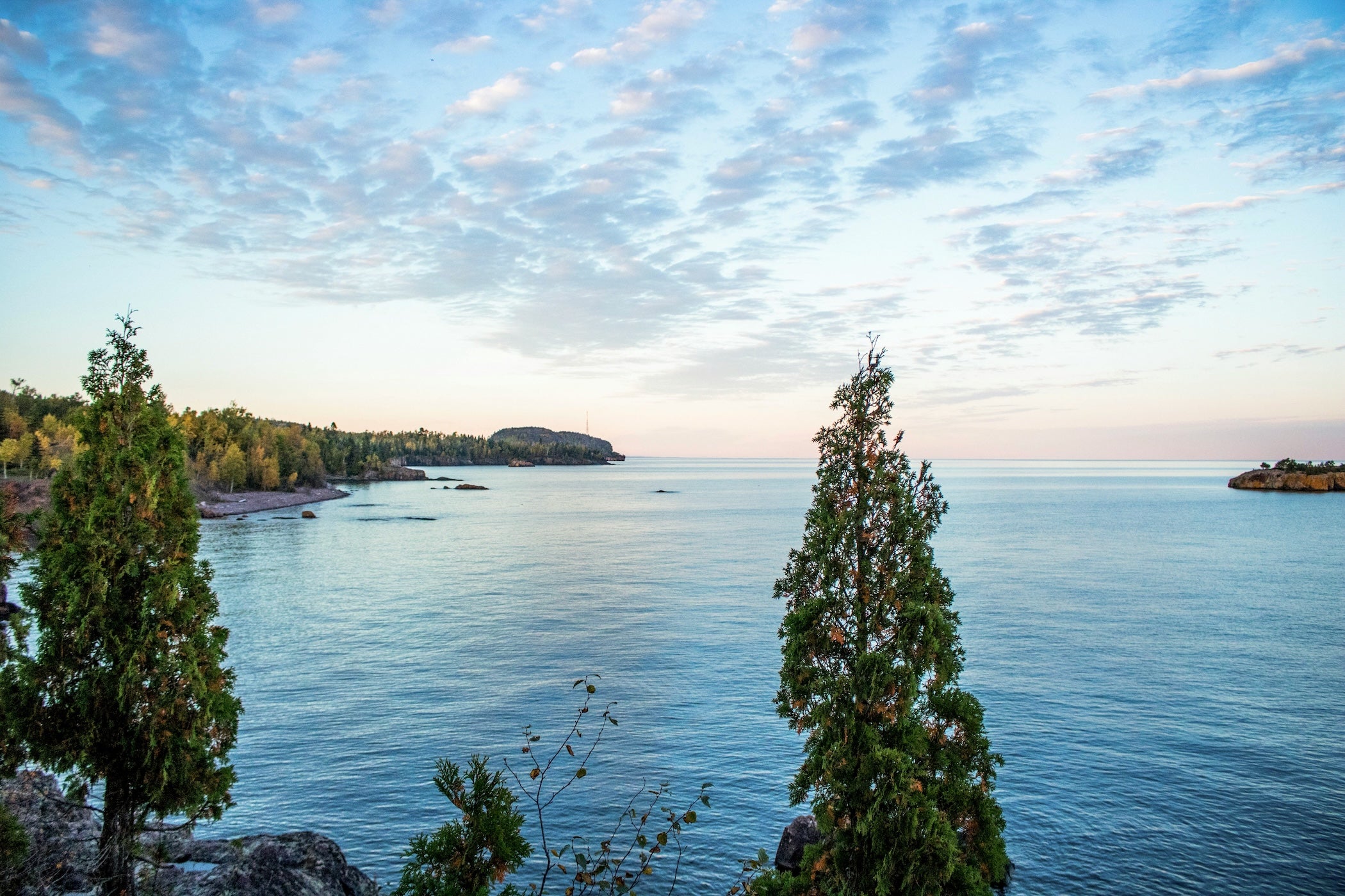
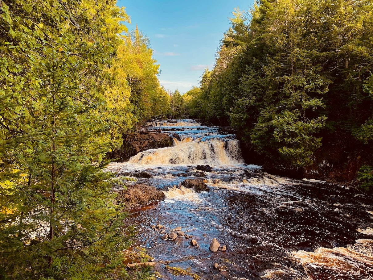
Afternoon: Ashland sits on Chequamegon Bay and is a good place to fuel up and grab lunch. Take a quick drive through downtown to see Ashland’s famous historic murals painted on building facades. From here, a scenic detour awaits: if you have a couple of hours, drive 24 miles south on State Highway 13 to Copper Falls State Park (near Mellen, WI). An easy 1.7-mile trail (the Doughboys Nature Trail) leads to Copper Falls and Brownstone Falls, two dramatic waterfalls in a rocky gorge. After the hike, backtrack to Ashland and continue north on Hwy 13 up the Bayfield Peninsula. This stretch is designated as the Lake Superior Scenic Byway, offering peekaboo lake views and charming little villages. Arrive in Bayfield by early evening. Bayfield is a picturesque harbor town and the gateway to the Apostle Islands – enjoy a stroll by the marina and perhaps a fresh fish dinner. Overnight around Bayfield (options include campgrounds near the lake or quaint B&Bs in town).
Day 4: Bayfield, WI to Duluth, MN
Morning: Start in Bayfield with a dose of Lake Superior adventure. If you can spare the time, consider a morning kayak tour or boat cruise to the Apostle Islands National Lakeshore to see sea caves and historic lighthouses (the tours typically last 3–4 hours, so alternatively just visit the Apostle Islands Visitor Center in Bayfield for exhibits). Next, continue west on Hwy 13 through the peninsula’s northern communities. In Red Cliff (just north of Bayfield), you’ll pass the tribal lands of the Red Cliff Band – the roadside offers views of cliffs and the lake on your right. Further along, stop in Cornucopia, WI, a tiny fishing village with a sandy beach. This is a great spot to stretch and perhaps grab homemade fudge or smoked fish from a local shop. From Cornucopia, Hwy 13 turns south and meanders through quiet forests and farms, eventually rejoining US-2.
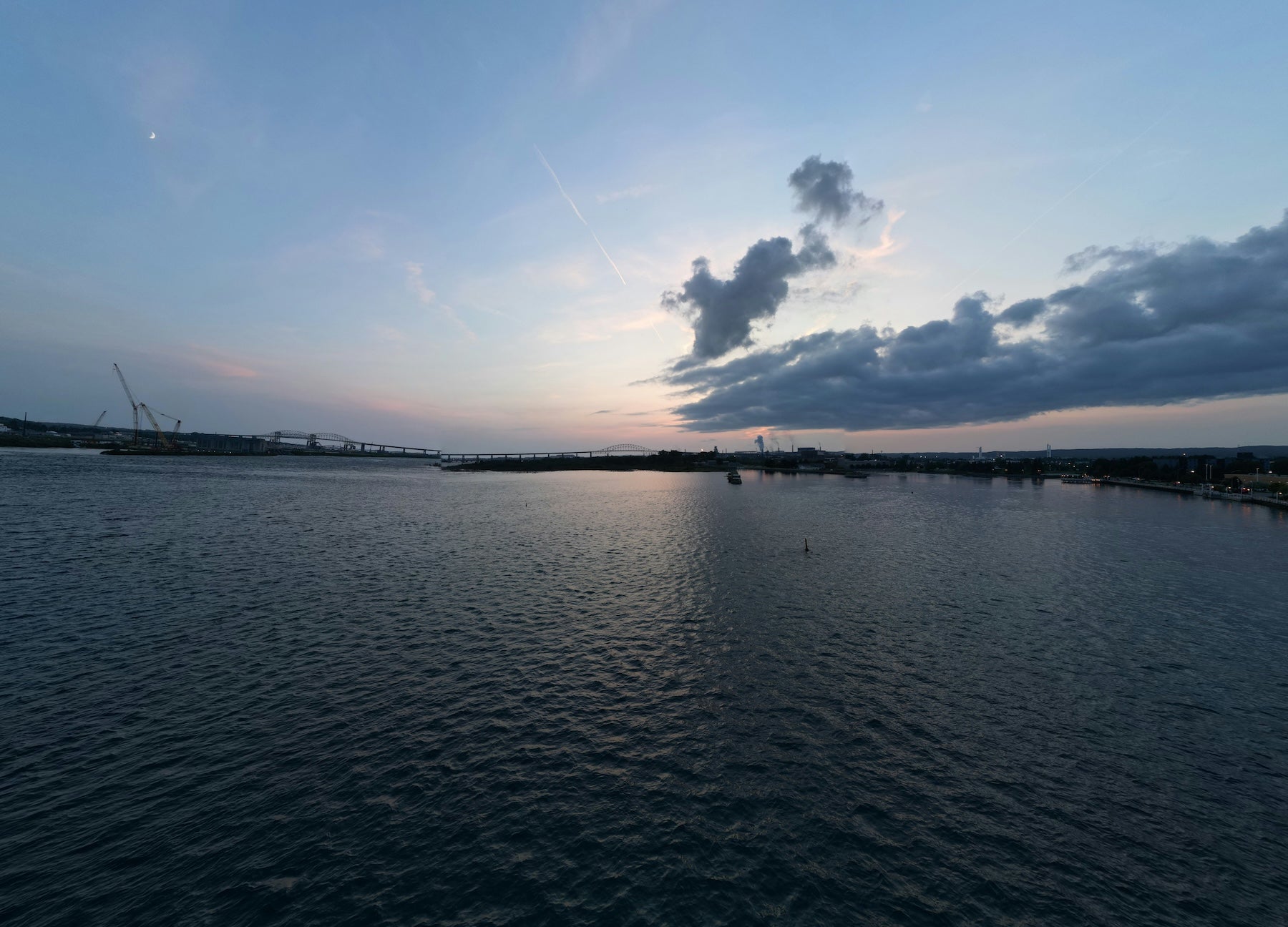
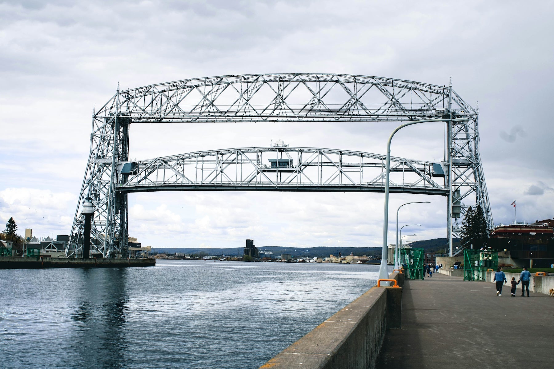
Afternoon: Merge onto US-2 west for the final hour into the Duluth area. Before reaching the city, you can make a quick side stop at Amnicon Falls State Park (just south of US-2 in Wisconsin), known for its photogenic covered bridge and waterfalls – it’s only a 1-2 mile detour if time permits. Otherwise, continue into Superior, WI and cross the Blatnik Bridge into Duluth, MN. As you enter Duluth, you’ll see the cityscape terrace up steep hills overlooking Lake Superior. Take some time to visit Canal Park in downtown Duluth, where you can watch ships pass under the iconic Aerial Lift Bridge and visit the Lake Superior Maritime Visitor Center (free admission). This port city marks the end of this segment. Overnight in Duluth or move on to the next stage of your Great Northern journey.
Best Campgrounds Between Sault Ste. Marie and Duluth
- Twelvemile Beach Campground (Pictured Rocks NL, MI) – Located near Grand Marais, this rustic National Park Service campground sits atop a sandy bluff overlooking Lake Superior. It offers tent and small RV sites with picnic tables and fire rings. Campers love falling asleep to the sound of waves and hiking directly from camp along the North Country Trail. No hookups (vault toilets and hand-pump water only), but the lakefront setting is hard to beat.
- Tahquamenon Falls State Park – Lower Falls Campground (Paradise, MI) – Set in a lush forest near the Tahquamenon River, this campground gives easy access to the park’s famous waterfalls. Sites can accommodate tents or RVs and are modern (electric hookups, showers, flush toilets available). It’s family-friendly and you might spot wildlife like deer or foxes around dusk. Staying here lets you explore the falls in the peaceful early morning or evening hours without the daytime crowds.
- Munising Tourist Park Campground (Munising, MI) – A city-run campground right on the Lake Superior shoreline. It features both tent and RV sites, including some waterfront spots with incredible sunset views. Amenities include electric hookups, hot showers, and a sandy beach area. It’s only a few miles from the Pictured Rocks boat tour docks, making it a convenient base to explore the national lakeshore. The open layout means sites aren’t very private, but the lake scenery and location make up for it.
- Union Bay Campground (Porcupine Mountains SP, MI) – This is the primary campground in Porcupine Mountains Wilderness State Park, near Silver City. Perched by Lake Superior, Union Bay offers 100+ sites (most with electric hookups) suitable for tents and RVs. Campers enjoy modern bathhouses, a playground, and gorgeous lake sunrises. It’s a perfect base for hiking the park’s trails – the popular Lake of the Clouds overlook is a short drive away. Note that cell service here is limited, and sites book up quickly in peak season.
- Copper Falls State Park Campground (Mellen, WI) – Tucked in northern Wisconsin’s hardwood forest, this quiet campground is within walking distance of Copper Falls and Brownstone Falls. It has a mix of tent and small RV sites under tall pines, plus a few camper cabins. There are basic comforts like flush toilets, showers, and a small playground. Evenings are peaceful, and you might hear the rush of distant waterfalls from your site. It’s an excellent stopover if you detour to enjoy the park’s hiking loops and scenic gorge.
- Little Sand Bay Campground (Town of Russell, WI) – This county-owned campground lies on Lake Superior between Bayfield and the Apostle Islands mainland sea caves. It’s a favorite for kayakers and boaters launching to the islands. The campground has a mix of tent sites and RV sites (some with hookups), plus hot showers and a boat ramp. Sites are mostly wooded with a short path to a sandy beach. Staying here puts you about 15 minutes from Bayfield and right next to a National Park Service ranger station, making it easy to plan island excursions.
- Buffalo Bay Campground (Bayfield, WI) – Part of the Red Cliff Reservation’s Legendary Waters Resort, this campground offers the unique combo of lakeside camping and access to resort amenities. Many sites provide electric/water hookups and front-row views of the Apostle Islands. Campers can use modern restrooms located in the adjacent marina/hotel complex and even grab a meal at the on-site restaurant. A highlight here is watching the sunrise over Lake Superior or taking a short walk to the nearby Frog Bay Tribal National Park, which has a quiet trail through old-growth forest to the shoreline.
Top Activities & Attractions Along the Route
Natural Highlights
Pictured Rocks National Lakeshore – Hike to iconic viewpoints like Miner’s Castle or Chapel Rock, or take a guided kayak/boat tour to see towering multicolored cliffs and hidden beaches. Don’t miss short walks to waterfalls such as Munising Falls (0.4-mile round trip) and Chapel Falls (1.5 miles one-way) for a taste of the area’s beauty.
Tahquamenon Falls – Marvel at the Upper Falls, which cascades nearly 50 feet and spans 200 feet across. A paved path leads to several overlooks. A few miles downstream, the Lower Falls consist of a series of smaller cascades you can view up close by rowboat or from viewing platforms. Both spots offer picnic areas and trails through fragrant cedar forests.
Porcupine Mountains Wilderness State Park – Drive up to Lake of the Clouds Overlook for sweeping vistas of untouched wilderness. For hikers, the Escarpment Trail (4 miles one-way) provides dramatic ridge-top views, while the Presque Isle River trails showcase waterfalls in a serene gorge. This park is also known for wildlife – keep an eye out for eagles, foxes, or even a black bear (from a safe distance) on quieter trails.
Apostle Islands National Lakeshore – Explore sea caves and crystal-clear waters by kayak at Meyer’s Beach (guides available for safety). If time permits, ferry to Madeline Island (Big Bay State Park has beaches and scenic cliff trails) or join a boat cruise to view lighthouses on islands like Raspberry or Devils Island. The combination of turquoise water and forested islands makes this area a crown jewel of Lake Superior.
Cultural & Historic Sites
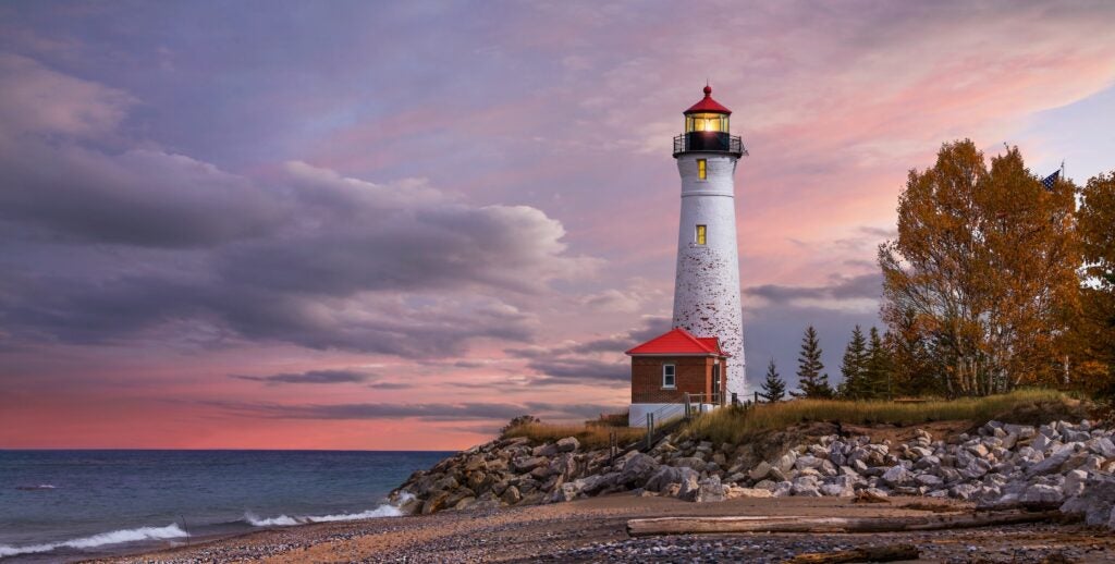
Great Lakes Shipwreck Museum – Located at Whitefish Point, this museum displays shipwreck artifacts and the preserved Edmund Fitzgerald bell, honoring Lake Superior’s maritime heritage. A visit here offers insight into the perils early mariners faced on the “Great Lakes graveyard.” The adjacent 1861 lighthouse can be toured for panoramic lake views.
Soo Locks & Museum – In Sault Ste. Marie, watch giant freighters navigate the locks that connect Superior to the lower Great Lakes. The viewing platform and visitor center provide historical context on the locks’ construction and operation. Time your visit and you might see an ocean-bound ship rising or dropping with the water level – a hit with kids and adults alike.
Ashland’s Historic Murals – As you pass through Ashland, WI, take a quick driving tour of the expansive murals downtown. These professionally painted scenes on brick buildings depict the region’s history – from Ojibwe legend and the lumber era to early miners and lake fishermen. It’s a free open-air art exhibit that brings local heritage to life.
Canal Park, Duluth – At the end of the segment, Canal Park offers both leisure and learning. Stroll the Lakewalk to see the Aerial Lift Bridge in action and visit the Lake Superior Maritime Visitor Center (free entry) for exhibits on shipping and storms on Superior. Nearby, the decommissioned William A. Irvin ore ship is sometimes open for tours, showcasing Duluth’s industrial history.
Outdoor Recreation & Unique Stops
Hiking & Waterfalls – This route is packed with short hikes to waterfalls. In addition to Tahquamenon and the Porkies, consider a quick stop at Haven Falls (near Lac La Belle off M-26 if you detour toward Keweenaw) or Morgan Falls (south of Ashland). Many trailheads are right off the highway, making it easy to stretch your legs and discover a cascading creek or scenic overlook without a major time investment.
Lakenenland Sculpture Park – Driving west of Munising toward Marquette, watch for a whimsical roadside attraction: Lakenenland. It’s a free, self-guided drive-through park filled with over 80 large scrap-metal sculptures ranging from mythical creatures to UP satire. Created by a local artist, it’s open year-round and is especially fun for families (and a welcome break for kids after hours in the car).
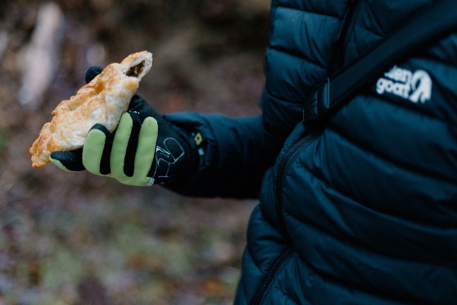
Local Food & Treats – Don’t miss the chance to try a Yooper pasty (a hearty handheld meat-and-potato pie) sold at bakeries and cafes across the UP. In Cornucopia, WI, a quirky general store offers fresh smoked trout and whitefish – a true taste of Lake Superior. And if you have a sweet tooth, stop at the Legendary Waters resort’s cafe in Red Cliff or the candy shop in Bayfield for homemade fudge made with local berries.
Scenic Byways & Photo Ops – Nearly the entire route doubles as a scenic drive, but a few spots beg for photos: the “Welcome to Paradise” sign in Paradise, MI (a fun selfie stop), the vista at Eagle Bluff on Hwy 13 overlooking Lake Superior near Bayfield, and the picturesque Cornucopia harbor with its collection of colorful fishing boats. Plan brief pauses to soak in these one-of-a-kind roadside vistas.
Travel Tips for This Segment
Fuel and Supplies: Gas stations are sparse in the Upper Peninsula, so top off your tank in Sault Ste. Marie or Newberry. Paradise has a small gas pump, but after that you won’t find major services until Munising and Marquette. On the Wisconsin side, fill up in Ashland or Washburn before taking Hwy 13 around the peninsula (very limited gas in the small villages). Carry some extra snacks and water, as grocery options are limited outside of the larger towns.
Weather and Seasonality: Lake Superior’s weather can change quickly – even in summer, fog and sudden temperature drops are common near the shore. Pack layers and a rain jacket. In bug season (late spring/early summer), bring insect repellent or head nets, especially for the woods around Tahquamenon and the Porkies. If traveling in fall, you’ll be treated to spectacular foliage, but note that by late October some campgrounds and tours will have closed for the season. Winter travel is not recommended without preparation; heavy lake-effect snow can make portions of M-28 and local roads challenging.
Road Conditions: The main highways (M-28, US-2) are paved and in good condition, but some scenic spur roads like H-58 through Pictured Rocks are narrower with sharp curves – drive cautiously and watch for deer. In the Porcupine Mountains, the park’s South Boundary Road is a twisting route better driven in daylight. Wisconsin’s Hwy 13 along Lake Superior is also well-paved but has few guardrails, so maintain a safe speed on bends near the cliffs.
Reservations and Permits: In peak season (July–August), book campground sites and Apostle Islands tours in advance, as they fill up quickly. Michigan state parks require a Recreation Passport (entry fee) for vehicle access – you can purchase this at park entrances. The Dyrt app’s offline maps (available with The Dyrt PRO) can be very handy here, since cell service drops out in Pictured Rocks, Tahquamenon, and the Porcupine Mountains. Always practice Leave No Trace principles at campsites and trails – these natural areas are pristine, and keeping them that way ensures a great experience for the next traveler.
Additional Segments & Resources
This Sault Ste. Marie–to–Duluth section is just one part of the full Great Northern road trip. In the east, the previous segment covers the route leading into Sault Ste. Marie, and to the west, the journey continues from Duluth toward North Dakota and beyond. Be sure to check out those segment guides for a comprehensive journey across the northern United States. For more route planning help, our Great Northern road trip overview offers a summary of the entire drive. Happy travels – and don’t forget that The Dyrt’s camping community and resources (like PRO offline maps and thousands of campground reviews) can help you make the most of every stop on this epic road trip.
The Dyrt is the only camping app with all of the public and private campgrounds, RV parks, and free camping locations in the United States. Download now for iOS and Android.Popular Articles:
Articles on The Dyrt Magazine may contain links to affiliate websites. The Dyrt receives an affiliate commission for any purchases made by using such links at no additional cost to you the consumer.