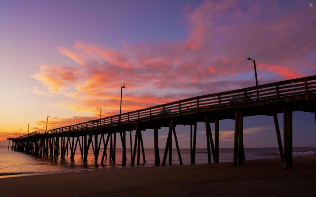
Spanning roughly 300 miles, this road trip segment from Virginia Beach, VA to Wilmington, NC showcases North Carolina’s famed Outer Banks barrier islands. In contrast to the interstate, you’ll cruise a thin ribbon of highway across these narrow islands, with ocean surf on one side and calm sound waters on the other. Two ferry rides – including a 2.5-hour crossing from Ocracoke Island – make this stretch especially memorable. Along the way you can climb historic lighthouses, visit the spot where the Wright Brothers first flew, and camp just steps from empty beaches. Plan on about four days to fully experience the seaside villages, national seashores, and coastal Carolina vibe. For a complete guide to the entire Atlantic Coast Highway, see our complete Atlantic Coast Highway road trip overview.
Overview: Outer Banks Segment Highlights
This segment kicks off near the busy Virginia Beach/Norfolk area and leads south into the Outer Banks – a chain of narrow barrier islands between the Atlantic and the mainland sounds. Expect long stretches of two-lane roadway (NC-12) flanked by dunes and marsh, with occasional small towns. Portions are remote with limited services, especially within Cape Hatteras National Seashore. The best travel times are spring or fall for milder weather; summer brings fun beach crowds but also more traffic (and the risk of hurricanes in late summer). Keep an eye on ferry schedules and weather alerts, as high winds or storms can temporarily close portions of the route.
Quick Stats: Virginia Beach to Wilmington
| Total Distance | ≈320 miles (via Outer Banks route) |
|---|---|
| Estimated Drive Time | ~8 hours (driving) plus ~3.5 hours on ferries |
| States | Virginia, North Carolina |
| Primary Routes | NC-12, US-70, US-17 |
| Recommended Duration | 4 days / 3 nights |
| Cell Service | Spotty on remote islands; generally good near towns |
| Fuel Availability | Gas in larger Outer Banks towns (fill up in Nags Head, Avon, Ocracoke) |
4-Day Itinerary: Virginia Beach to Wilmington via Outer Banks
Day 1: Virginia Beach, VA to Cape Hatteras, NC
Approx. 140 miles (3.5 hours driving) – Depart Virginia Beach and head south toward North Carolina. After crossing into NC, follow US-158 east over the Wright Memorial Bridge onto the Outer Banks. Start with the Wright Brothers National Memorial in Kill Devil Hills, where a short walk up Big Kill Devil Hill leads to the spot of the first flight (allow about an hour to visit the monument and museum). Farther south in Nags Head, stop at Jockey’s Ridge State Park – home to the East Coast’s tallest sand dunes – to hike up the sand for panoramic views or watch kite fliers and hang gliders catching the breeze.
Continue along NC-12 into Cape Hatteras National Seashore, a two-lane road threading between ocean and sound. Keep an eye out for herons and other waterfowl in the marshes as you pass Pea Island National Wildlife Refuge. Midday, consider stopping in the village of Avon for lunch at a local seafood shack or to top off your supplies. By afternoon you’ll reach Buxton, home of the iconic Cape Hatteras Lighthouse. If time permits, climb this black-and-white spiral lighthouse (open seasonally) for a sweeping view of sea and sound. Continue on to Hatteras Village at the island’s end. Camp overnight nearby – the NPS Frisco Campground or a private Hatteras campsite both keep you close to the ferry docks – so you’re ready to catch the morning ferry to Ocracoke.

Day 2: Cape Hatteras to Ocracoke Island, NC
Approx. 30 miles (plus ferry) – Start early to catch the free Hatteras–Ocracoke ferry (runs frequently; about a 1-hour crossing). The ferry ride offers a relaxing break and great views across Hatteras Inlet – you might even spot pelicans or dolphins en route. Once on Ocracoke Island, drive off the ferry and down NC-12 through miles of undeveloped seashore. Consider a quick stop at the Ocracoke Pony Pens, where a small herd of “Banker” wild horses is cared for in a park enclosure. By late morning, you’ll roll into Ocracoke Village, a laid-back, bike-friendly community at the island’s southern tip.
Spend the afternoon soaking up Ocracoke’s slow pace. Visit the 1823 Ocracoke Lighthouse (one of the nation’s oldest, though not open for climbs) and wander the village’s quaint streets lined with local shops and cafes. History buffs can seek out the tiny British Cemetery, where sailors from a WWII shipwreck are honored, or learn about Blackbeard’s last stand off Ocracoke’s coast. Of course, beach time is a must – the ocean beach here is undeveloped and often uncrowded, with a lifeguarded section in summer for swimming. In the evening, grab fresh seafood for dinner and watch the sunset over Silver Lake Harbor. Camp overnight at the NPS Ocracoke Campground, set just behind the dunes about three miles outside the village. (Be sure to reserve tomorrow’s ferry to the mainland in advance, as space fills up in peak season.)
Day 3: Ocracoke Island to Carolina Beach, NC
Approx. 150 miles (plus 2.5-hour ferry) – Wake up early on Ocracoke to board the state ferry for Cedar Island on the mainland. (Reservations are strongly recommended for this 2¼-hour voyage.) Enjoy the downtime on deck – the ride gives you a chance to rest and watch for dolphins and seabirds as you cross Pamlico Sound. By late morning, you’ll dock at Cedar Island and continue your journey on land. The road (NC-12/US-70) winds through rural “Down East” fishing villages and salt marsh as you head toward Morehead City. If time allows, consider a pit stop in Beaufort, NC – a historic seaport with a quaint waterfront downtown – for lunch or a stroll by the harbor. Otherwise, continue west on NC-24 through Swansboro and into Jacksonville, where the route joins US-17 south.
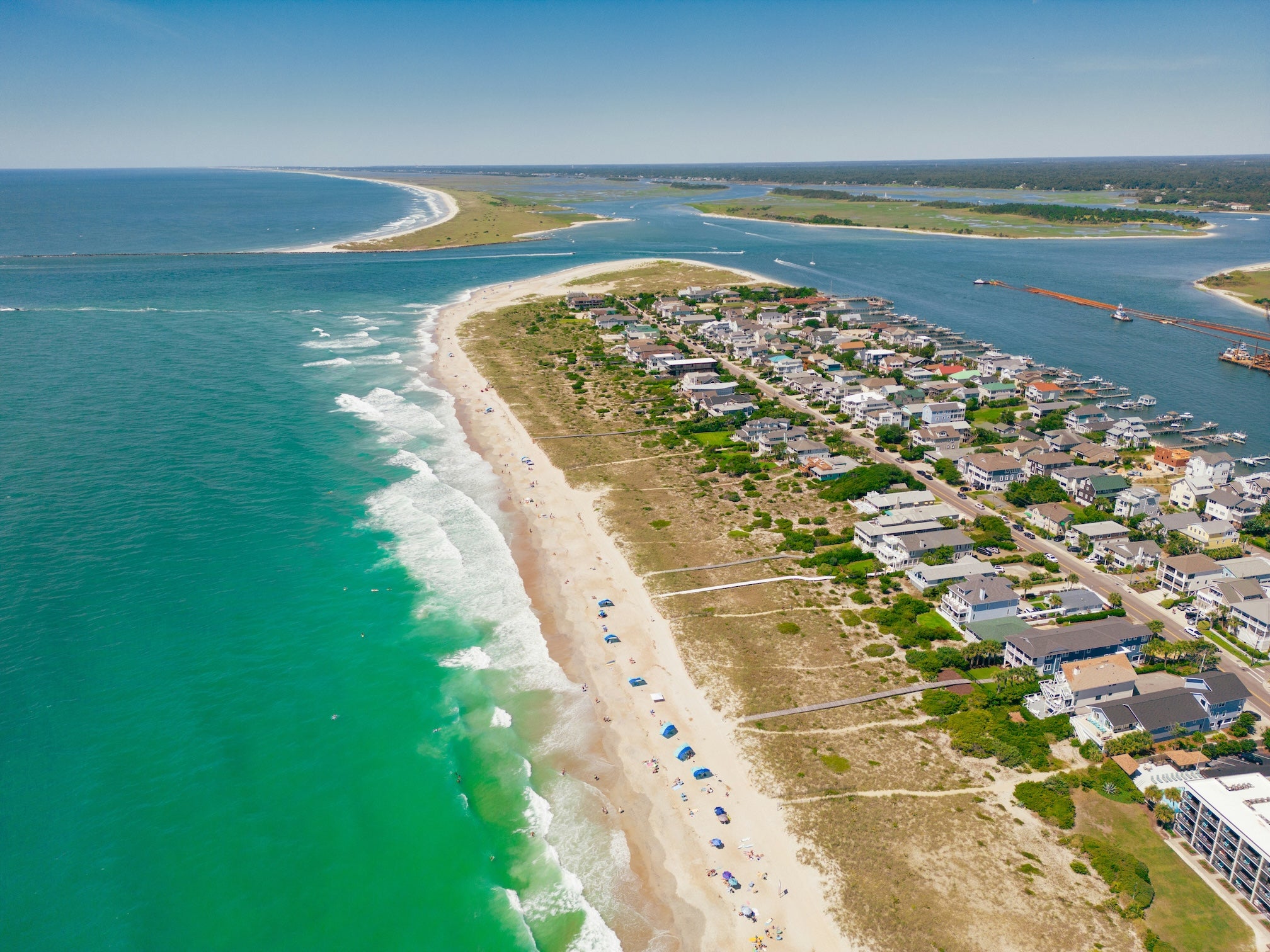
The drive from Jacksonville to Wilmington is a faster-paced highway. By late afternoon, you’ll cross the Cape Fear River into the Wilmington area. Rather than heading straight into downtown, detour 15 miles south to Carolina Beach, where you can camp for the night and be poised to explore Wilmington tomorrow. Carolina Beach State Park Campground offers shady sites along the Cape Fear River and even has trails where you might spot wild Venus flytrap plants in their native habitat. After a long travel day, you can relax at camp or pop over to the Carolina Beach Boardwalk for a dose of classic beach town fun (think arcade games and ice cream) to cap off the evening.
Day 4: Carolina Beach to Wilmington, NC
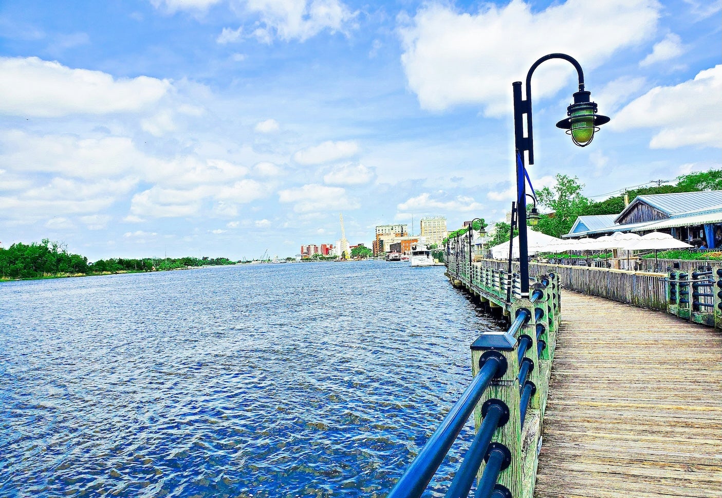
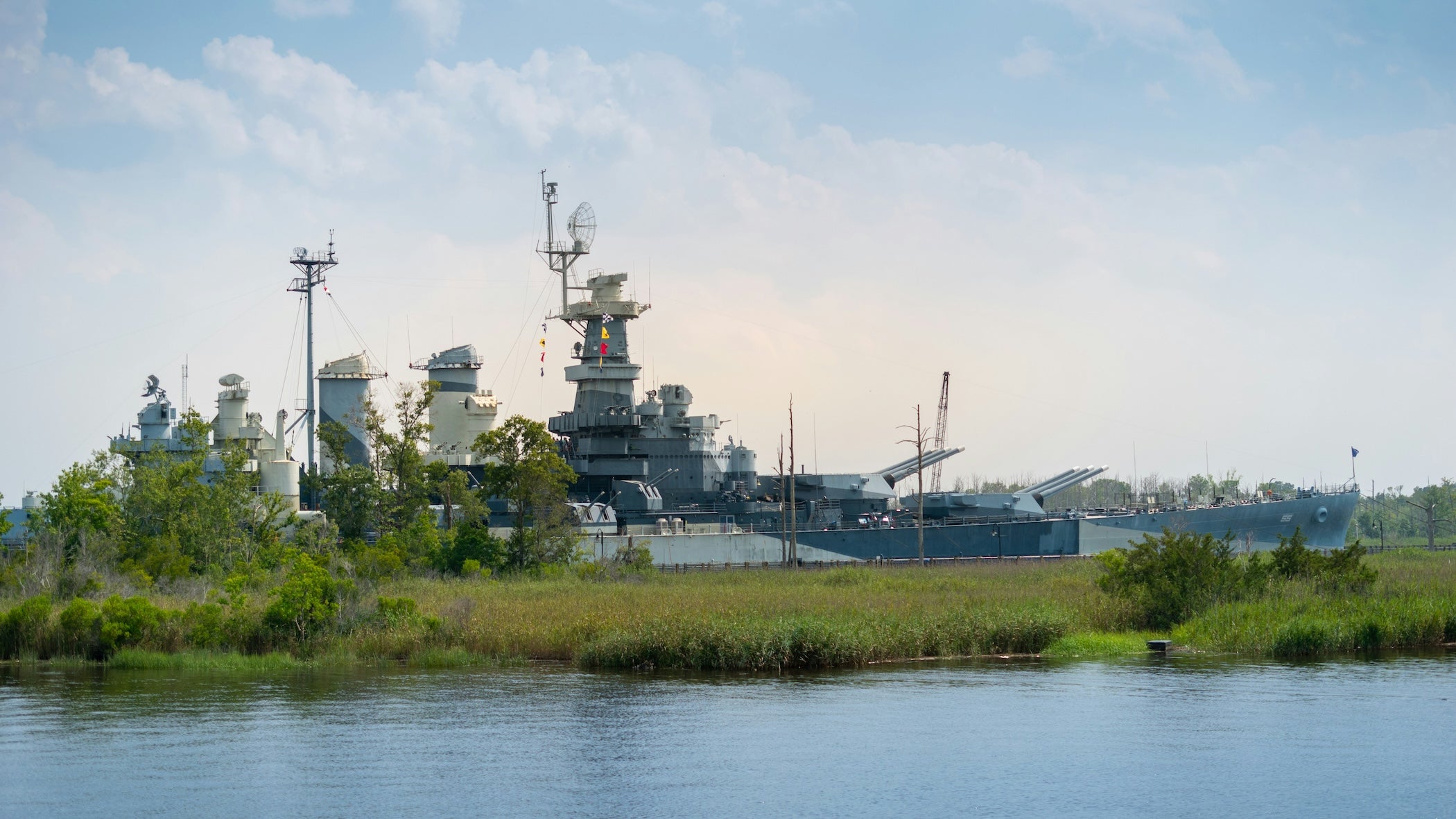
Approx. 15 miles (0.5 hours driving) – After breaking camp, drive north on US-421 over Snow’s Cut Bridge and into Wilmington – you’ll be in the heart of downtown within 30 minutes. Wilmington is a historic port city that’s easy to explore on foot. Start at the Riverwalk, a scenic riverfront boardwalk along the Cape Fear River, and watch boats glide by as you browse shops and cafes. History enthusiasts can cross over to tour the USS North Carolina battleship, a World War II warship moored as a museum (plan ~2 hours to explore its decks and exhibits). Back in downtown, stroll the brick-lined streets of the Victorian historic district to see centuries-old homes and shady oak trees draped in Spanish moss. There are plenty of eateries and breweries if you’d like to toast the end of this segment. Wilmington’s lively riverfront is a fitting finale to your Outer Banks adventure.
Best Campgrounds Along the Route
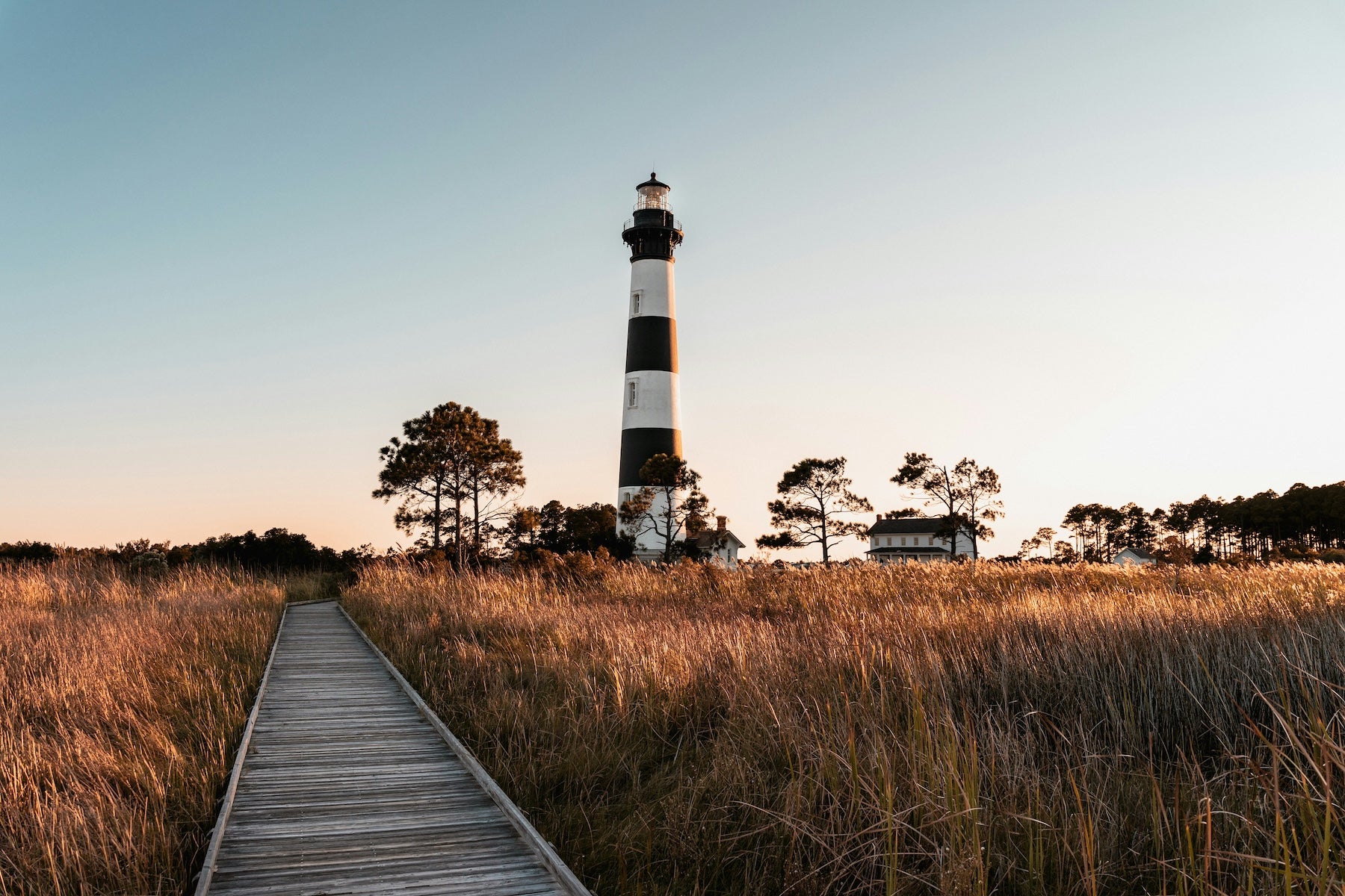
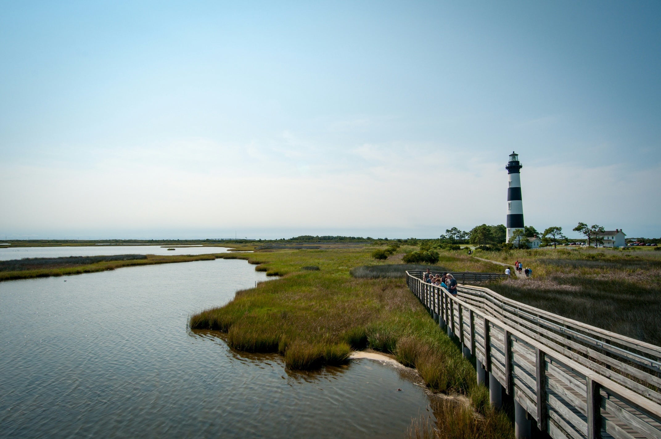
Oregon Inlet Campground – Nags Head, NC. This National Park campground at the north end of Cape Hatteras National Seashore (near Nags Head) sits just behind the dunes. A short walk over sandy hills brings you to a wide beach, and Bodie Island Lighthouse is only a few miles away. It’s basic but comfortable: there are paved pads, picnic tables, flush toilets, and warm showers, plus a handful of sites with RV hookups. Being close to town, it’s a convenient oceanfront camping spot to start the Outer Banks journey.
Ocean Waves Campground – Waves, NC. Ocean Waves is a small family-run campground in Waves (Hatteras Island) offering 68 sites with full hookups. It’s beloved for its short walk to a quiet beach – a sandy path leads right over the dunes from the campground. Despite its small size, it packs in amenities: there’s a swimming pool, free Wi-Fi, a game room, and clean hot showers and restrooms. The vibe is friendly and laid-back. Being centrally located on Hatteras Island, you’re within easy reach of attractions like Cape Hatteras Lighthouse to the south and Pea Island Wildlife Refuge to the north.
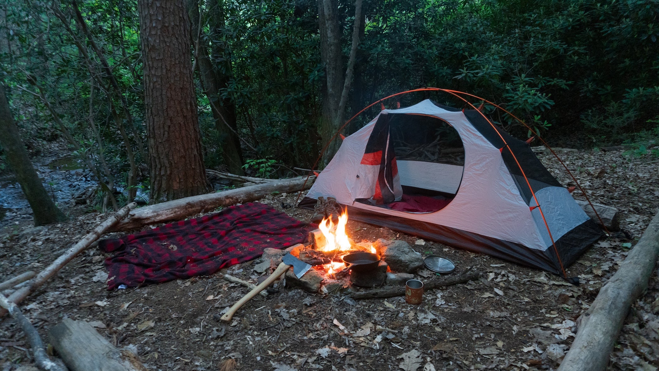
Frisco Campground – Frisco, NC. This NPS campground in Frisco (Cape Hatteras National Seashore) is known for campsites tucked among sand dunes and shrubs, offering more privacy and even some ocean-view spots. Boardwalks from the loops take you over the dunes to the beach. It has 127 sites (no hookups) open roughly March–November, with potable water, flush toilets, and cold-water beach showers available. Campers love the peaceful atmosphere – at night you can often see the beam of Cape Hatteras Lighthouse in the distance and an incredible canopy of stars overhead. Frisco is just a few minutes’ drive from Hatteras Village and the Ocracoke ferry docks.
Ocracoke Campground – Ocracoke Island, NC. Accessible only by ferry, this National Seashore campground lets you camp just over the dunes from the Atlantic Ocean. All 136 sites are on sandy pads behind the barrier dunes (no hookups for RVs). You’ll fall asleep to the sound of crashing waves and wake to salty ocean breezes. Amenities are rustic but sufficient: each site has a picnic table and grill, and there are flush toilets, drinking water, and cold showers. The dark skies here make for excellent stargazing on clear nights. Ocracoke Village is about 3 miles away – close enough to bike in for groceries or fresh seafood – yet the campground feels remote and wild.
Cedar Point Campground – Croatan National Forest, NC. Cedar Point sits along the White Oak River near Swansboro, on the mainland coast. It’s a peaceful federal campground (around 40 sites, with electrical hookups) nestled between a pine forest and a coastal marsh. A highlight here is the Tideland Trail – a boardwalk loop through the marsh right next to the campground, perfect for birdwatching and photographing sunsets over the water. Sites are spacious and suitable for RVs, and campers have access to modern bathhouses with hot showers. It’s only about 5 miles from Emerald Isle’s beaches and just a few minutes to stores in town, so you can enjoy a quiet natural setting without being far from conveniences.
Carolina Beach State Park Campground – Carolina Beach, NC. Tucked in a coastal pine forest along the Cape Fear River, this state park campground is a tranquil basecamp for exploring the Wilmington area. There are 79 campsites (some with full RV hookups) plus a handful of cabins, all shaded by tall loblolly pines. It’s known for its easy nature trails – you can actually find wild Venus flytrap plants along the Flytrap Trail here. Campers appreciate the clean bathhouses with hot showers and the on-site marina (boat ramp) that offers access to fishing in the river. You’re just a five-minute drive from Carolina Beach’s oceanfront and boardwalk, so it’s the best of both worlds: quiet nature at camp with a lively beach town close by.
Top Things to Do on This Segment
Nature & Outdoor Recreation: The Outer Banks are a paradise for outdoor lovers. Cape Hatteras National Seashore protects long stretches of undeveloped beach – perfect for shelling, surf fishing, or a sunrise stroll on the sand. Birdwatchers should visit Pea Island National Wildlife Refuge (there are roadside observation platforms ideal for spotting herons, egrets, and migratory waterfowl). For more active fun, try surfing or kiteboarding: popular spots like the beach off Cape Hatteras Lighthouse (Atlantic side for waves) and Canadian Hole near Avon (sound side for steady winds) are renowned in the watersports world. Paddling opportunities abound too, from kayaking the calm Pamlico Sound to canoeing through salt marsh creeks. And don’t forget to seek out unique flora – Carolina Beach State Park’s Flytrap Trail leads you to wild Venus flytraps and pitcher plants, a rare sight in their natural habitat.
History & Culture: This segment is rich in coastal history. In Kitty Hawk, the Wright Brothers National Memorial marks the exact dunes where powered flight took off in 1903 – a fascinating stop for anyone interested in aviation. Lighthouses also tell part of the story here: you can climb Cape Hatteras Lighthouse (the tallest brick lighthouse in the U.S.) for panoramic island views, and visit Ocracoke’s whitewashed lighthouse, one of the oldest still-operating beacons in America. Down in Wilmington, you’ll encounter Civil War history: the sprawling Battleship North Carolina invites you aboard to see how sailors lived and fought during WWII, and just south of town, the Fort Fisher historic site preserves earthen fort remnants from the Confederacy’s last Atlantic stronghold. Scattered along the route are smaller gems too – from the Graveyard of the Atlantic Museum in Hatteras (filled with shipwreck lore) to Ocracoke’s little preservation museum sharing local stories – each adding depth to your journey.
Travel Tips for the Outer Banks Drive
- Ferries: Reserve the longer Ocracoke–Cedar Island ferry in advance (especially during summer) via NCDOT, and arrive at the dock at least 30 minutes early. The shorter Hatteras–Ocracoke ferry is free and first-come, first-served – expect lines on peak weekends, so plan accordingly.
- Fuel Up: Gas stations are sparse on the Outer Banks. Fill up in Kitty Hawk/Nags Head or in Buxton on Hatteras Island before venturing into the more remote sections. Ocracoke has only one small gas station (with limited hours), so don’t risk running low.
- Weather & Tides: Storms and high tides can cause temporary road closures on NC-12. During hurricane season (June–November), keep an eye on forecasts and have a backup plan in case ferries or roads are suspended. After heavy weather, check NPS alerts for any route updates or closures.
- Bring Bug Spray: Biting insects (mosquitoes and no-see-ums) are common in marshy and wooded areas, especially in summer. A good repellent will make your evenings around the campsite much more pleasant (and itch-free).
- Beach Driving: Driving on the beach is allowed in parts of Cape Hatteras National Seashore, but you’ll need a 4WD vehicle and an ORV permit. If you plan to drive on the sand, lower your tire pressure and carry traction boards – it’s easy to get stuck in the soft sand if you’re not prepared.
- Navigation: Cell service can drop out on Ocracoke and in stretches of the National Seashore. Download offline maps (The Dyrt PRO’s offline campground maps are handy) or have paper maps on hand so you’re not reliant on signal for directions.
Continuing the Atlantic Coast Road Trip
This Virginia-to-North Carolina segment is just one chapter of the Atlantic Coast Highway adventure. When you’re ready, check out the full Atlantic Coast Highway road trip itinerary for details on the remaining segments beyond Wilmington (all the way to Florida!). As you continue south, travel responsibly – practice Leave No Trace on those unspoiled beaches – and consider using The Dyrt PRO for offline maps and campground insights. Enjoy the journey!
The Dyrt is the only camping app with all of the public and private campgrounds, RV parks, and free camping locations in the United States. Download now for iOS and Android.Popular Articles:
Articles on The Dyrt Magazine may contain links to affiliate websites. The Dyrt receives an affiliate commission for any purchases made by using such links at no additional cost to you the consumer.