EIt started with a cool map in the hands of a young woman that read, simply, “Superstition & Four Peaks Wilderness Areas.”
Standing next to her in the long line at the Tucson REI, my curiosity overwhelmed me. I asked, “Where ya headed with that cool map?” She answered that the map lead to a magical place just a stone’s throw from Phoenix. She was planning a spring backpacking adventure to explore it further.
“You must go,” she said. “It’s simply beautiful.”
We always get the best advice from other adventurers, so the Superstition Mountains quickly made their way on my list. They did not disappoint.
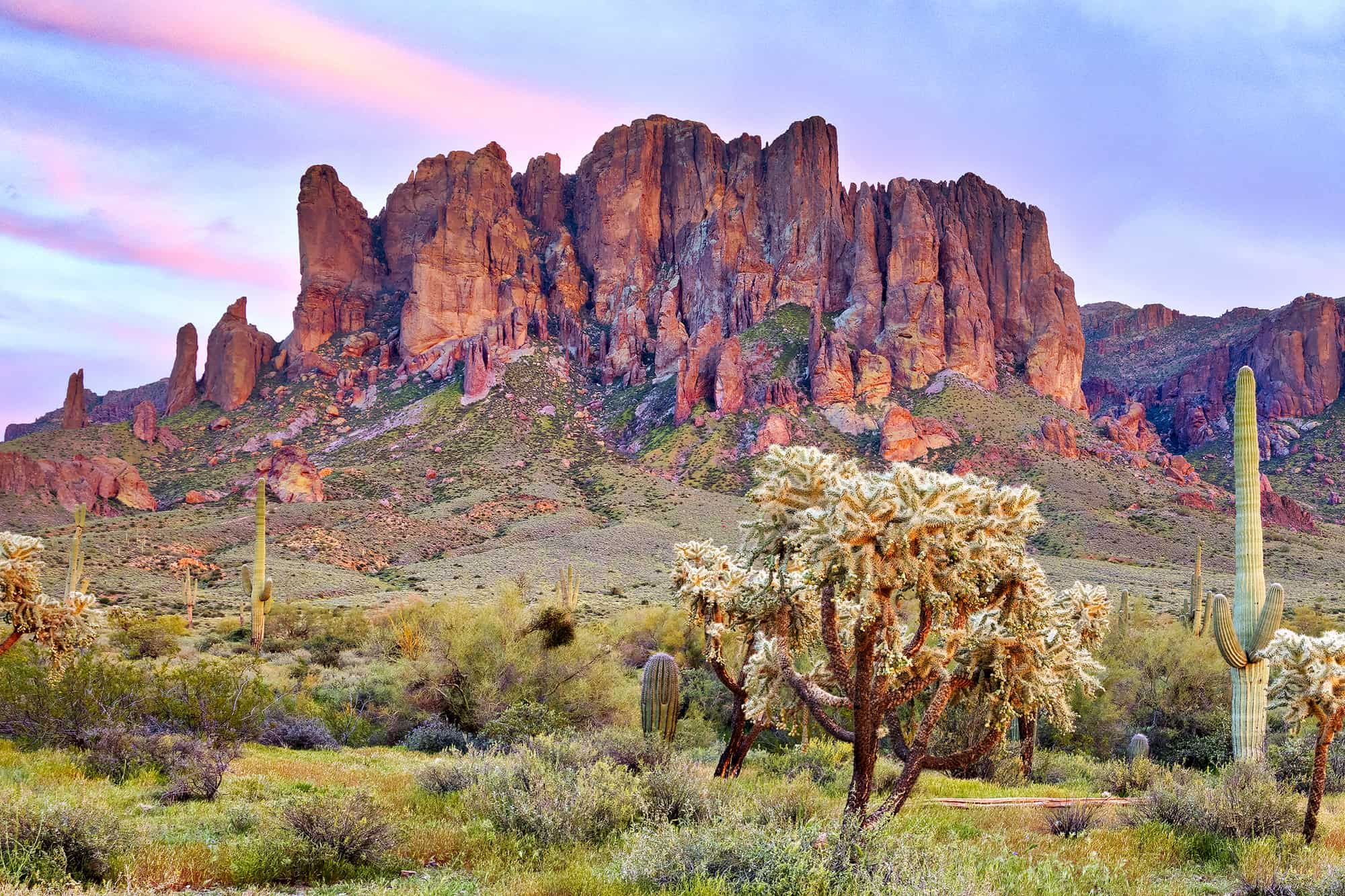
The Superstition Mountains: What’s in a Name?
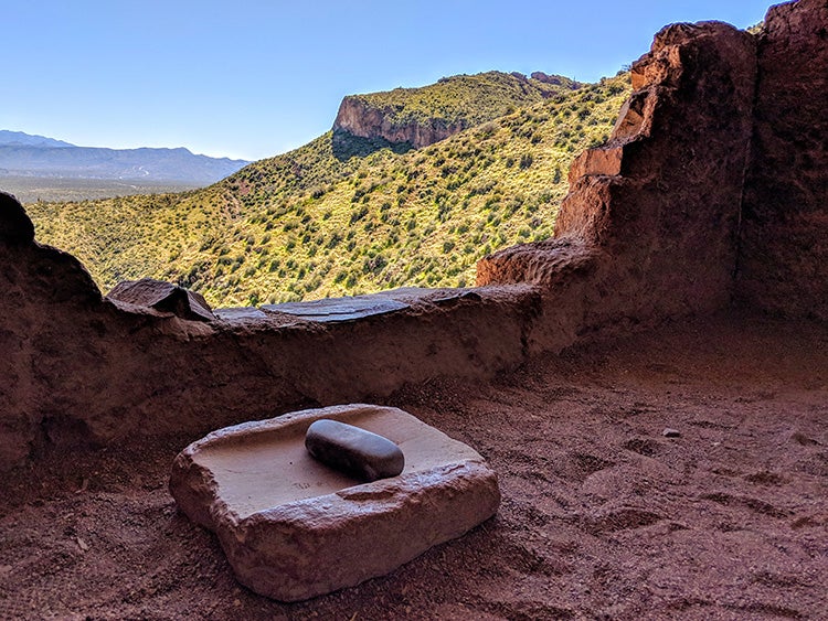
Image from The Dyrt camper Shari G.
The Superstition Mountains, as the name implies, are shrouded in legends and myth. The area’s history of ancient floods, pre-Columbian farming, boom and bust mining, stagecoach travel and 20th-century hydro power, is still evident today to the curious and informed. Lying to the north of U.S. Route 60 and to the south of the Salt River Hydroelectric Project, the Superstitions feel timelessly tucked away.
The dams along the Salt River form four major reservoirs—Roosevelt, Apache, Canyon and Saguaro—and generate electricity for the metropolitan area. In between, the river flows through narrow canyons. Attracting visitors and wildlife alike to this altered oasis in the middle of the high Sonoran Desert. Like many places in the arid southwest, water is wealth.
A different kind of wealth drew explorers to the area in the 1800s. Rumors of gold, silver and other minerals attracted miners to stake claims in the rugged mountains. The popular legend of the Lost Dutchman’s gold mine continues to capture the imagination of visitors and treasure seekers.
The legend holds that Jacob Waltz, a German immigrant, discovered a mother lode of gold. He only revealed its location on his deathbed in 1891. Since then, many mines have claimed the title, though none have ever been verified.
Native History
Native people called this place home for millennia, and their stories inspire the mountains’ name, including the Hohokam, and later the Salado of Tonto Basin, who established cliff dwellings high above their well irrigated fields. Successful in farming, hunting and gathering in this challenging environment, the natives left around 1400 C.E., but the reason why remains a mystery.
The Pima people, also known as the Akimel O’odham, tell a legend of a great flood that washed away the selfish who would not change their ways. To the east of the area lies the Fort Apache Reservation, and their legends lend a mystique to these mountains.
According to some, a hole leading to the underworld lies within the Superstitions. The winds blowing from it cause the major dust storms in the region. No matter who lived here, their stories are rife with mystery and shadow.
Today’s visitors come in search of their own mythical vibe, the recreational type, by simply driving along the winding Arizona State Route 88, known as the Apache Trail, taking to the water or walking into the backcountry for solitude, adventure and some of the best camping in Arizona.
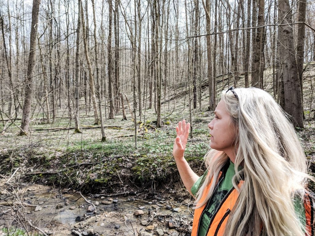
How and When to Go to the Superstition Mountains
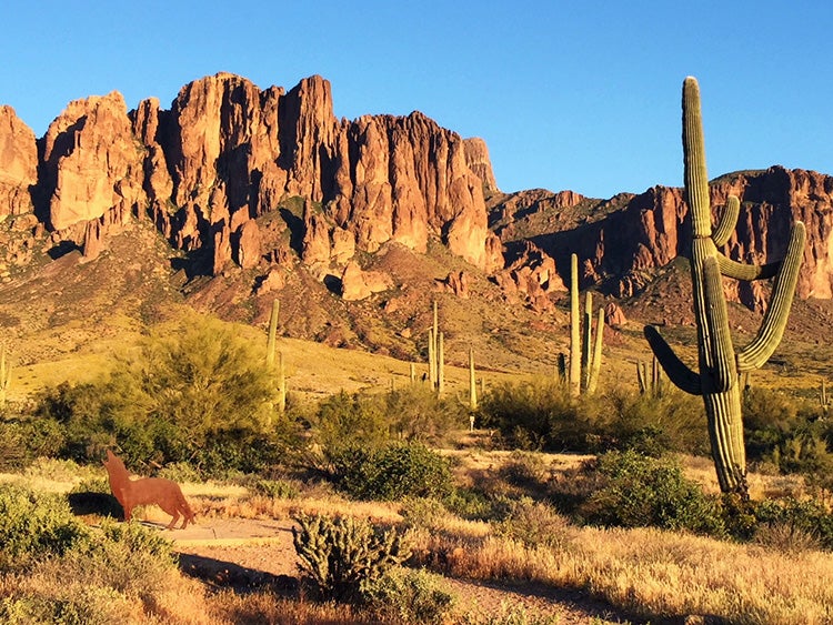
Image from The Dyrt camper Debbie W.
Tucked within the Tonto National Forest, the Superstition Mountains can be accessed in many different ways. From the Phoenix area, visitors drive through Apache Junction along State Route 88 (Apache Trail) or take the long way around on U.S. Route 60 to the town of Miami, near Globe. Either route provides access to hiking trailheads.
From Apache Junction to Tortilla Flat (population six, Arizona’s smallest community with a post office and voting precinct) the Apache Trail is a paved, winding, two-lane scenic drive. Five miles farther, the road transforms into a rugged washboard gravel surface.
Driving requires patience and good suspension all the way to Roosevelt Dam. GPS navigation will tell you it’s a mere 29 miles. In reality, it is a three-hour crawl along a steep and rugged road, which is not recommended for trailers more than 22 feet long.
Many visitors come to the area during the winter months, enjoying the moderate climate of Arizona, where daytime highs hover in the 60s and 70s. Like all mountain ranges, the weather in the Superstition Mountains can change dramatically. Snow from the infrequent winter storms can temporarily blanket the mountain range into March. So being prepared for all kinds of weather is a good idea.
Summer sees a different kind of weather, mostly hot and dry. Visitors cool off in the lakes, taking to the water in all kinds of boats. Each lake provides a traditional marina with a boat launch, marine fuel and boat slips for rent.
The monsoon thunderstorm season can be a danger to both hiker and motorist as flash floods appear with little warning. The road crosses multiple washes between Tortilla Flat and Apache Junction and all along the Apache Trail.
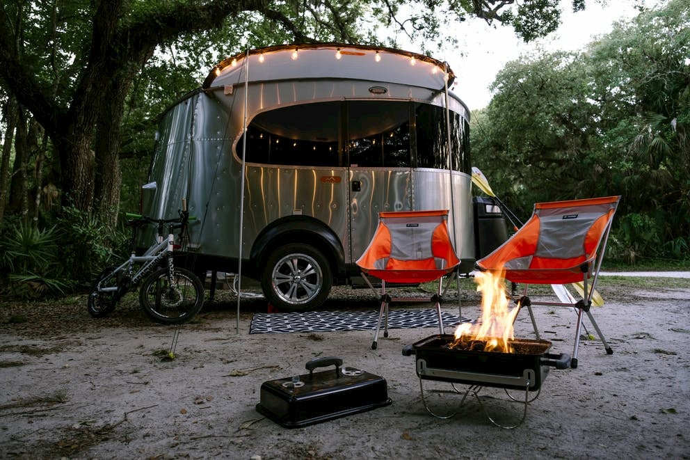
Where to Camp
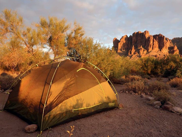
Image from The Dyrt camper Michaela D.
Backcountry Opportunities
Just like the map title suggests, this area is best appreciated from a backcountry campsite. Backpacking along the many trails can provide challenging terrain combined with inspirational nights of clear skies and bright stars. The long-distance Arizona National Scenic Trail winds through the Superstition Mountains along the Rogers Trough Trail. A few backcountry sites also lie along the Salt River corridor, offering the chance to boat in and camp in the deep canyon.
From the West (near Apache Junction)
Established campgrounds along the west side of the Apache Trail offer places to camp for up to 14 days.
Lost Dutchman State Park provides the easiest access, just 10 minutes from Apache Junction. It has 138 campsites, about half of which provide all the usual amenities of a state park. Reservations recommended.
Canyon Lake Marina offers lakeside camping with electrical and water hookups at a premium. Reservations recommended.
Tortilla Campground is open October through March. During that time, it offers water and sewage hookups (no electrical) and sweeping mountain vistas for very reasonable rates.
We arrived here with the intention of staying a night or two. Our weekend trip turned into a week of discovery and outdoor fun. Sites are first come, first served.
On either side of the village of Tortilla Flat, there are numerous free, dispersed sites available. But the road conditions worsen significantly when the pavement ends.
From the East (near Roosevelt Dam)
Just a few miles below Roosevelt Dam and along the Apache Trail, Burnt Corral offers a traditional Forest Service camping area, day use area and boat launch. Upper and Lower Burnt Corral, 3-Mile Wash, Crabtree Wash and Davis Wash are designated “shoreline access areas” allowing for overnight parking and launching small boats but no services. These areas require a daily or annual pass, which can be purchased at the automatic fee machine at Burnt Corral or at the marina. Sites are first come, first served.
Apache Lake Marina offers a motel, restaurant, RV park and beachfront camping. All camping types require reservations except for tent camping.
The road between the dam and these campgrounds is maintained but is winding, steep and narrow. And the road surface can be questionable depending on rainfall or traffic.
From the South (U.S. Route 60)
Just a short drive off U.S. 60, there are several Forest Service campgrounds, in addition to Peralta Canyon and Devil’s Canyon campgrounds, allowing for a southern approach into the mountains.
What To Do
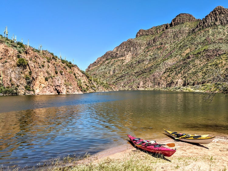
Image from The Dyrt camper Sheri G.
There are limitless opportunities for outdoor adventures, as well as ways to combine a few of your favorites.
- For the hiker or backpacker, the Superstition Mountains hold many miles of nearly isolated trails. Early spring and late fall are possibly the busiest times with the best weather. Locating water sources and enjoying the abundant wildflowers are best in spring.
- Both road cycling (for those comfortable with the narrow road and lack of shoulder) and mountain biking are incredibly popular.
- Riding the trails on horseback can make for a fun day, with abundant guided and on-your-own opportunities.
- OHV trails are not located in the wilderness area, but there several area forest roads allowing access.
- Slot Canyoneering abounds in the region and gives many the chance to hike, climb, wiggle and rappel through challenging passageways.
- Established climbing routes take advantage of the more stable of the region’s volcanic rocks and are another way to really get away from it all. More than 90 percent of the 131 routes are traditional climbs, with a few sport climbs here and there.
- Each of the four lakes provide opportunities for all kinds of water activities. Areas off the main section of lake will be less populated by motor boats. And it is possible to paddle upriver from each lake. These steep canyon sections are stunning areas for viewing wildlife and feeling a million miles away from anywhere.
“Less Active” Activities
- The tiny village of Tortilla Flat offers daily live music, an Old West saloon and restaurant, a general store and the typical ice cream/gift shop.
- The Dolly Steamboat provides year-round narrated nature, twilight dinner and astronomy cruises on Canyon Lake, taking visitors up the beautiful Salt River Canyon.
- Tonto National Monument, along the southwestern shore of Roosevelt Lake, is a must-see but does involve a short, steep climb up to see the ancient cliff dwellings.
- The legend of these mountains lives on at the Superstition Mountain Museum in Apache Junction.
Whatever you do, one trip will have you planning your next visit, and perhaps buying a really cool map.
Related Articles:
Related Campgrounds
- Pinegrove Campground, Mountainaire, AZ
Popular Articles:
Articles on The Dyrt Magazine may contain links to affiliate websites. The Dyrt receives an affiliate commission for any purchases made by using such links at no additional cost to you the consumer.