Camping and hiking enthusiast Amy G. used The Dyrt to plan a reunion Appalachian Trail hike with her best friend. You can find and save campgrounds to a list to plan your own adventures.
The Appalachian Trail is legendary among hikers of all stripes. It’s known for the rugged terrain, the diverse landscapes it winds through, and above all, the shear challenge it poses to those hoping to complete its entire 2,190-mile stretch from Maine to Georgia.
It is no surprise then, that when trying to decide where to hike on the east coast, the Appalachian Trail was an easy choice for The Dyrt Ranger, Amy G. and her friend Angie.
Amy and Angie have been friends for years, and although they now live in different states, they still love meeting up to hike together. For their most recent adventure, they chose a 61-mile, 6-day section hike on the Georgia portion of the Appalachian Trail. Based in two different states, this required some careful planning.
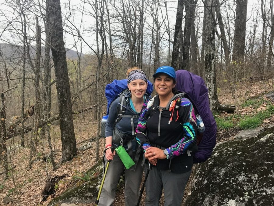
Amy (left) and Angie (right) on Sassafrass Mountain
Section Hiking the Appalachian Trail
Originally, Amy and Angie’s reunion didn’t involve the Appalachian Trail at all. They had planned to do a 60-mile section hike of the 310-mile Superior Hiking Trail in Minnesota, and Amy’s husband and his best friend would tag along as well. Due to a long Minnesota winter, that particular section hike quickly lost its appeal, leaving Amy and Angie in search of a new destination. The Appalachian Trail became an obvious choice from there. “Angie lives very close to the trail, so it was a natural fit,” recalls Amy.
Completing the entire 2,190-mile Appalachian Trail is a huge challenge for even the most experienced of hikers. The Appalachian Trail Conservancy estimates that only 1 in 4 who attempt the entire trail in one go (a complete thru-hike) make it all the way. For those who do make it, this thru-hike typically takes anywhere from five to seven months.
Amy and Angie are experienced hikers, but like many others, the hefty time commitment of a thru-hike wasn’t feasible. A 60-mile section would be the perfect balance between challenging and manageable. Many people choose to section hike the Appalachian Trail like this. If all of the sections are completed within one year, these hikers are technically allowed to consider it a complete thru-hike and apply to join the 2,000-miler listing for the year.<
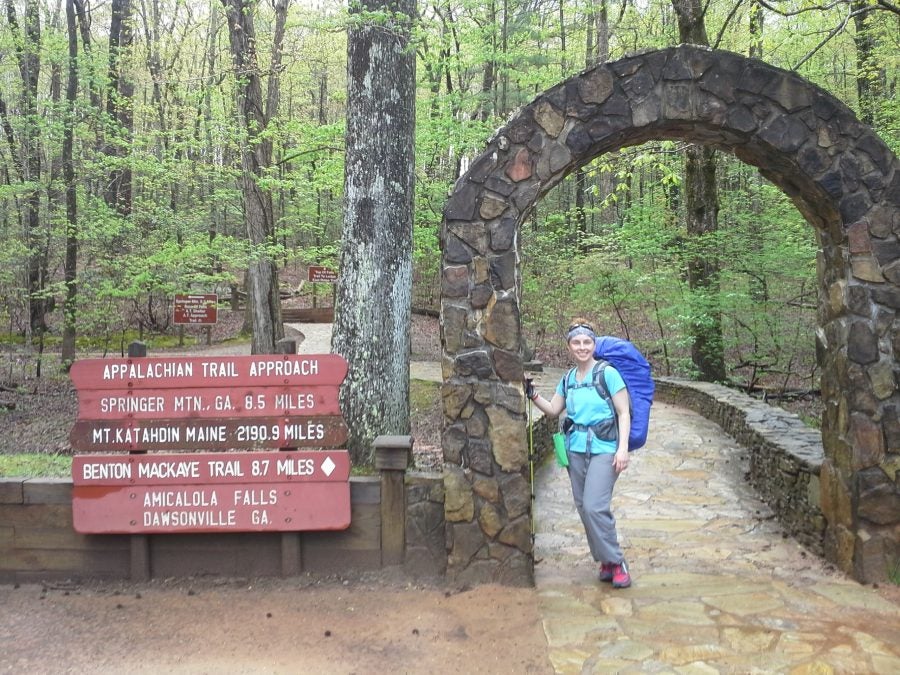
Amy at the trail start at Amicalola State Park
Planning and Preparing for the Hike
The preparation for the Appalachian Trail hike proved to be a little trickier for Amy, because she would be flying in from out of state. Currently, she lives in Minnesota, while Angie lives in Georgia. Getting all of her gear to Georgia was Amy’s biggest feat.
In advance, she shipped some of her bigger supplies to Angie. She then packed her hiking backpack and supplies inside of a duffle and checked the bag at the airport. This allowed her to bring items that she wouldn’t have been able to carry onto the plane. “I zipped it shut, tied it up, and kissed it goodbye at the checkin,” said Amy.
Amy explained that, “…we plan ahead, have a gameplan and execute, but have fun doing it.” They do this, “knowing, in advance that things change, plans change, and it’s absolutely necessary to roll with the punches. ”
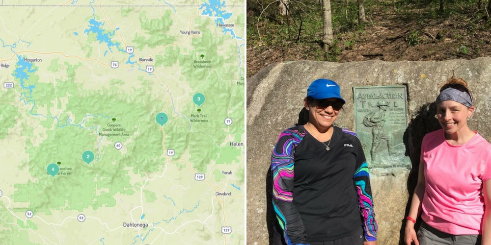
To plan their stopping points along the route ahead of time, Amy made a list of all of the campgrounds she and Angie would be staying at along the way, using The Dyrt’s Saved Campground List function.
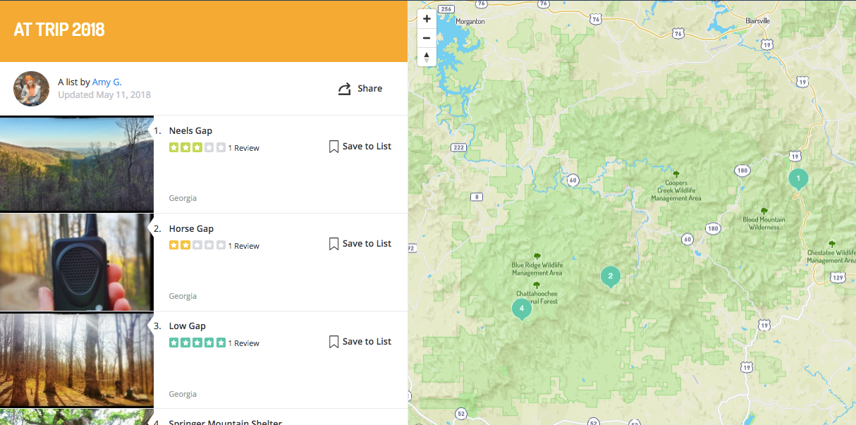
You can view Amy’s list of Appalachian Trail campgrounds, here.
Angie picked Amy up from the airport in Georgia the night before they hit the trail. They were ready to go.
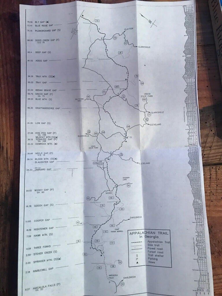
Angie’s Trail Map
Day 1: Amicalola Falls State Park and Springer Mountain
Before hitting the trail, they made a stop at a cafe in town for their last leisurely non-instant meal. After filling up, at long last, they headed to their starting point: Amicalola Falls State Park in Georgia.
The official starting point in Georgia (or end point, depending on whether you are hiking north or south along the trail) is at Springer Mountain in the Chattahoochee National Forest. Some hikers opt to park at the Springer Mountain parking area for a 1-mile hike to the summit, while others take a longer route. Amy and Angie planned to hike North, and opted to take the longer route to the Springer Mountain summit, starting at Amicalola Falls State Park.
At the park, hikers check in at the visitor center. Amy explained this ensures that people know you are out on the trail, in case there is any sort of emergency. Amy said this spot is perfect for taking time to “get the skinny on the weather and download apps for your phone that are helpful.” She recommends the Guthook app, which she said is incredibly helpful for trail hiking “as far as maps are concerned.”
The first day was a big one for Amy and Angie. “We climbed over 600 stairs, right off the bat, to climb to the top of the falls,” said Amy.
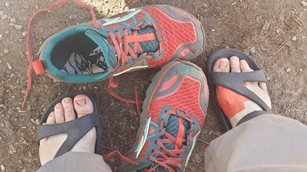
Amicalola Falls is Georgia’s tallest waterfall and a gorgeous spot to rest, providing views of the Appalachian Trail. From the falls, they hiked to Springer Mountain and stopped to take photos, sign the log-book, and grab a spot in the shelter. “We met a few thru-hikers that we became friends with over the next few days,” said Amy. “You tend to see the same folks over and over. It’s kinda cool to know you have kindred spirits on the trail.”
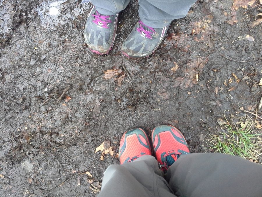
Amy and Angie’s feet — officially on the trail!
Day 2: Horse Gap
Day 2 presented Amy and Angie with a wet and foggy start. In order to get a jump on their mileage and ditch the rain, they decided to pass the hut where most of the others stayed that night and set up camp at Horse Gap instead. “We hung a bear bag and called it a night,” said Amy. Luckily, the weather stayed mild through the night.
Weather is just one of several potential issues that hikers have to plan for when thru- or section hiking. Amy recalled that throughout most of their trip they were lucky to have good weather, with the exception of rain days 2 and 3. “Temps were in the 40’s at night (with wind) and 60’s to 70’s during the day. Fairly perfect hiking weather!”
They did encounter a few other frustrations, which is to be expected. Trail elements and tasks like rough terrain, steep climbs, and setting up camp can, at times, prove to test the whits of any hiker. Anticipating and planning as much as possible can reduce the risk of anything too unexpected turning into an unmanageable situation. Amy said they had a plan in place to mitigate these things. For example, “we had a game plan for hills and steep ascents. And we followed it every single time. There wasn’t a single upward moment where we got frustrated. Tired, yes, but because we had a plan in place, it was totally doable. And we did it!”
The Appalachian Trail Conservancy website provides resources for hikers to physically and mentally prepare for all of the obstacles, like these, that they might be presented with on the Appalachian Trail.
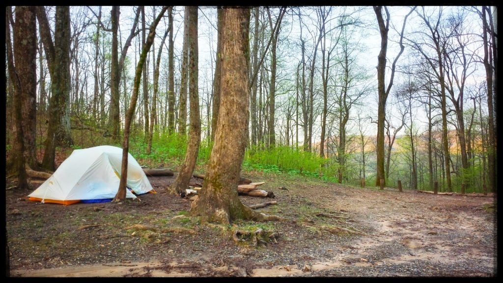
Amy’s photo of Horse Gap
Day 3: Woody Gap and The Storm
Sassafras Mountain was the first stop on day 3. Amy noted that this part of the hike was, “not as hard as some made it sound.” They didn’t know it yet, but the difficulty would come later. Eventually, after climbing the mountain, the rain started to come down harder. Amy and Angie decided to stop at Gooch Gap and wait it out. Some of the other hikers were there, so they turned it into an enjoyable situation, exchanging stories and getting to know one another better.
After the rain let up, they made it to Woody Gap. Before they could set up camp the rain was pouring down and some lightning had set in. It got way too cold, so luckily, with some cell phone service, they were able to find a ride to a local hostel through the Appalachian Section Hikers Facebook page. They were rolling with the punches as the trail threw them their way. Just like they planned.
A convenient ride to the hostel was just one of several encounters Amy and Angie had with trail angels. These are individuals who help out hikers on long thru- and section hiking trails. Trail angels leave water, offer rides, or even bring food to stops along the trail. Often, they have hiked the trail previously, or have family members who are hiking the trail. “Someone about 15 miles away agreed to pick us up and drop us at the hostel we found,” said Amy. “Turned out the gentleman was a cop and his wife was a teacher. We were in good hands! The hostel was great. We had it to ourselves with a private bath and breakfast.”
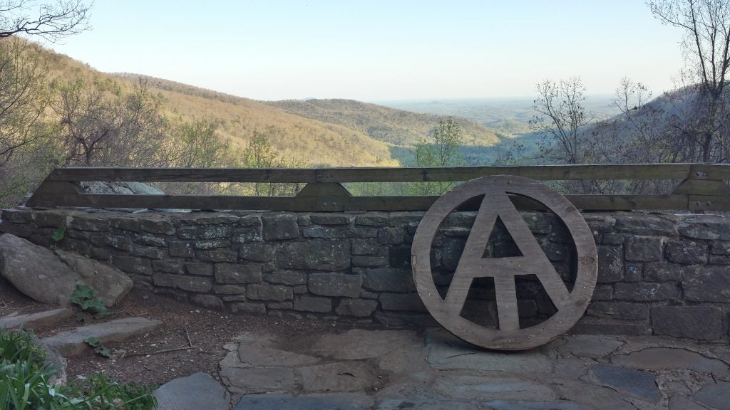
Photo by Amy of Neels Gap Overlook
Day 4:Back to Woody Gap and on to Neels Gap
After their warm night back in civilization, the police officer was kind enough to pick them up again and give them a ride back to Woody Gap, and they were happy to resume their adventure. This was the hardest day of the hike, according to Amy. They couldn’t afford any additional hiccups. The highest peak along the Georgia section of the trail, Blood Mountain, lay ahead. They could either traverse it or hike around it via Freeman Pass. They opted to take Freeman Pass.
After conquering Blood Mountain, Amy and Angie made it to Neels Gap. This is yet another notable location on the Appalachian Trail. It is known for being the only location on the trail that passes through a building. The building is Mountain Crossings at Walasi-Yi, a store, hostel, and mail drop site for hikers. “It’s kind of famous” said Amy. “Hikers love this spot.”
On day 4 they were both officially given their trail names by some fellow hikers. It is tradition for other hikers to bestow a special trail name upon new hikers on the trail. Amy said that her trail name is “Rosie the Riveter, because I have a can do attitude on the trail. Thank you to The Mayor for giving me my trail name.”
Camping behind Neels Gap that night, their tent was fixed on a slant due to a lack of any other options nearby. “I was rolling toward her all night long,” remembered Amy. She said that there were also mice running rampant everywhere. They could hear them trying to get into their gear. “I heard this little bugger climbing in my pack.” She turned on a flashlight to watch him, and he just stared back at her, completely undeterred. “I heard some noise, looked up and saw him chewing on the buckle of my pack flap. I grabbed my bag (sans the mouse) brought it inside, and inspected the damage.” She remembers thinking, there it is, while looking at a tiny hole with a peanut nestled inside. “The mouse left me a peanut. No joke.”
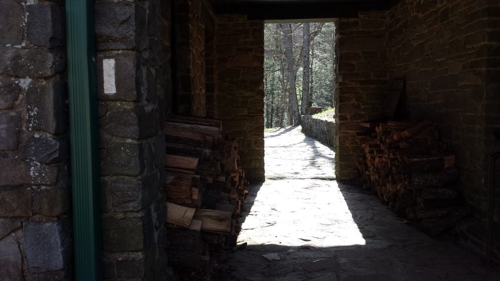
Photo by Amy of Mountain Crossing at Neels Gap
Day 5: Trail Angels
The next day they made their way to the last camping destination, the Low Gap Campground. Though crossing Blood Mountain felt like a challenge, this 11.2-mile stretch was the hardest according to Amy. The weather was on their side, but the rocky terrain along this portion of the trail, combined with steep hills, made for a brutal day.
Towards the end, at Hogpen Gap, they found some grace thanks to anonymous trail angels. Under a trail sign, they found a gallon of water and brownies to enjoy while recovering from the strenuous climb. “This happens a lot on the trail,” said Amy. “When you need it the most, and expect it the least, it’s there for you.”
Amy and Angie had the pleasure of meeting a Southbound Appalachian Trail thru-hiker, Wildflower, here as well. She was finishing up the last 40 miles. Her 77-year-old uncle, who had completed other portions of the trail alongside her, was waiting for her and her dog, so that he could finish the last leg with them. Knowing how hard the trail is to thru-hike, “…we were honored to even say hello to her on the trail as we passed by,” said Amy.
It was their last night on the AT, so as a parting gift, Amy and Angie gave some of their fellow hikers the rest of their food. Next they set up camp and settled in for the last night on the trail. “We all kind of fell into zombie mode,” said Amy. “Everyone was exhausted from the day of rocks and hills.”
Amy resting her feet at Unicoi Gap
Day 6: Journeys End at Unicoi Gap
The following morning, they set out for their final destination: Unicoi Gap. They encountered more rocks, but in exchange for the struggle, they got to enjoy beautiful weather for the rest of the hike. Amy recalled what she will remember most are the wildflowers along this patch of trail.
These are “memories for a lifetime,” said Amy. Memories that she and Angie can add to all of the others they have made over the years on the trail.
Hiking has kept these friends together, after meeting years before on a movie set in Atlanta. They now live in separate states. Amy is a pastry chef in Minnesota, while Angie still works in the film industry in Georgia. They know one another well, and hiking has been a strengthening bond and a way to reconnect despite the distance over the years. Amy notes that it has allowed them to see and appreciate all of the qualities they each bring to the table.”I’m good at setting up tents and hanging bear bags,” said Amy. “She’s great at reading maps and setting a good hiking pace. We compliment each other well on the trail.”
Amy and Angie admit there were some moments where stress arose. The Appalachian Trail is going to test your limits. Recognizing one another’s strengths and weaknesses, and knowing one another well enough to see when frustration was setting in helped a lot recalled Amy. “Sometimes it’s best just to step back,” said Amy. “Let it happen and see how you can help.”
She remembered one night in particular when things felt tense. They were both incredibly tired and hungry. Setting up the tent on a slope tested both of their limits. “We were like hungry bears getting grumpy,” said Amy. “But we just agreed to get it done, and it happened, and then we ate, and it was good!”
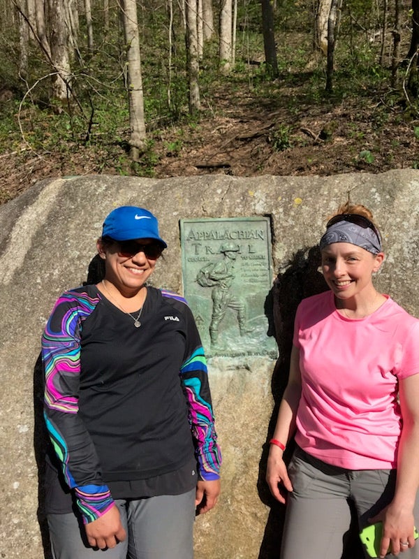
Angie (left) and Amy (right) at the end of the trail
Onward
The end to their hike was bittersweet. Both were ready for a reprieve, but knew they would miss the experience. “At the gap where we stopped, there was a plaque that we had our photo taken in front of,” said Amy. “Then, we had a ride pick us up and he brought beer and chocolate.” Their ride offered to throw their packs in the back of the truck for them, but they simultaneously refused. “Neither of us wanted to leave that moment behind,” said Amy. “It was our job and duty to finish the hike by lifting our packs just once more. That, somehow, made it complete.”
Angie and Amy are already talking about hiking another section of the Appalachian Trail. “We have 20 miles of Georgia to finish and then we are into South Carolina,” said Amy. They have also considered taking on the 54.2-mile Loyalsock Trail in Pennsylvania. In the past this trail has seemed a bit rough. “However, after our AT adventure, we are certain it’s something that we are capable of.”
Related Articles:
- Camping Guide to Indian State Hot Springs
- Pinhoti Trail
- Amicalola Falls State Park
Popular Articles:
Articles on The Dyrt Magazine may contain links to affiliate websites. The Dyrt receives an affiliate commission for any purchases made by using such links at no additional cost to you the consumer.