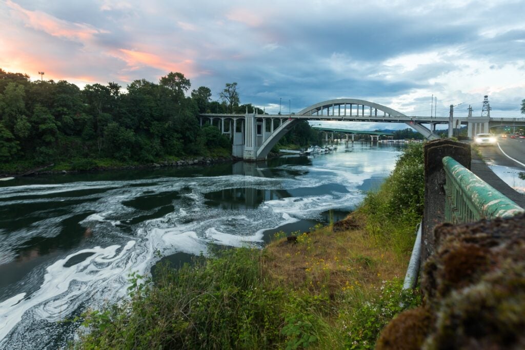
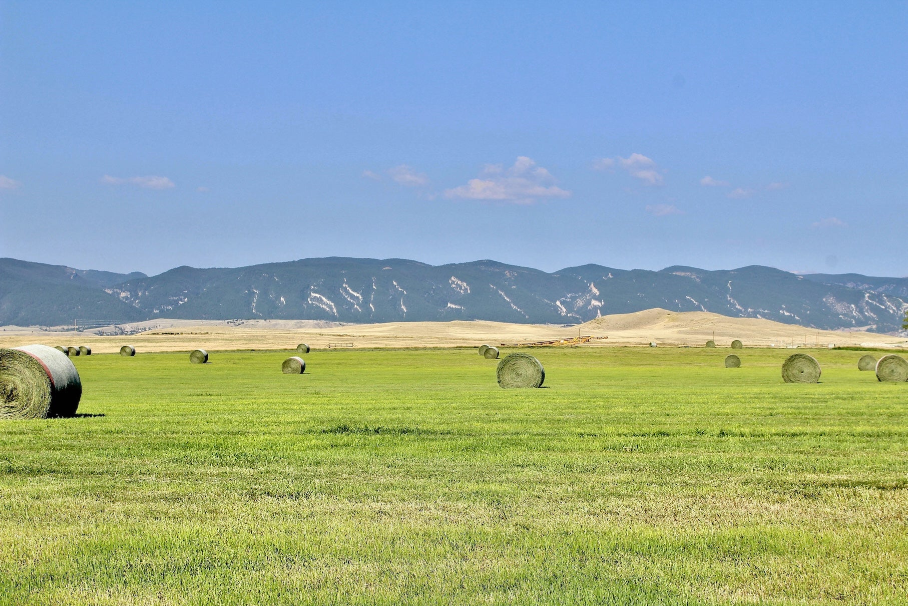
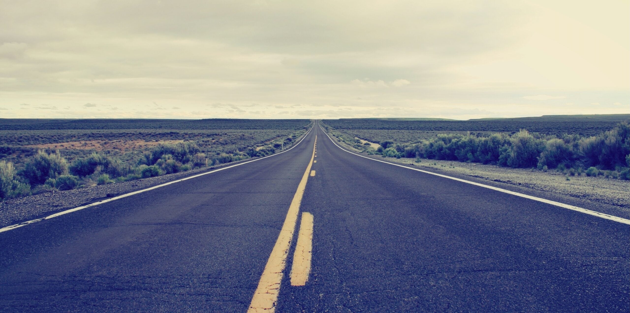
The Oregon Trail road trip spans roughly 2,000 miles from the Missouri River to Oregon’s Willamette Valley, covering six states between Independence, MO and Oregon City, OR. It’s traditionally traveled east-to-west, but modern adventurers drive it in either direction. Along the way, the route transitions from midwestern prairies to arid high plains, over the Continental Divide, and down the Columbia River Gorge.
This journey is steeped in history – following paths carved by 19th-century pioneers – and it remains an iconic cross-country adventure today. Expect to encounter historic frontier forts, unique geological landmarks, and welcoming small towns. The Dyrt’s camping community has ventured along these roads for generations, sharing tips on the best campsites and local finds. Late spring through early fall is the most popular season, when weather is mild and mountain passes are usually clear. This overview guide covers the entire Oregon Trail route and links out to detailed segment guides for those planning an in-depth trip.
Route Overview & Quick Facts
| Route | Oregon Trail (Historic National Trail) |
| Start / End | Independence, Missouri / Oregon City, Oregon |
| Distance | ~2,100 miles (approx. 3,380 km) |
| States Crossed | Missouri, Kansas, Nebraska, Wyoming, Idaho, Oregon |
| Recommended Duration | 2–3 weeks (allowing time for stops and exploration) |
| Best Seasons | Late spring through early fall (to avoid winter snow in mountains & spring mud) |
| Road Conditions | Mix of interstates (I-80, I-84) and U.S. highways (US-26, US-30) approximating the historic trail. Mostly paved; mountain segments have steep grades. |
| Vehicle Needs | No special vehicle needed in fair weather – any car or RV can handle it. In winter, 4WD or tire chains recommended in mountain areas. |
| Notable Features | Platte River Valley plains, Continental Divide at South Pass (7,412 ft), Snake River gorge, Blue Mountains, Columbia River Gorge |
| Primary Challenges | Long stretches between services in WY & ID, extreme weather (summer heat, sudden storms), high winds on open plains, and occasional steep mountain passes. |
What Makes This Route Special
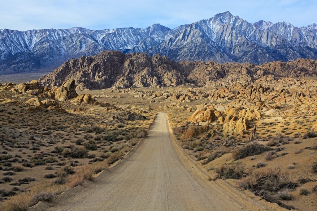
Driving the Oregon Trail today is like traveling back through American history. This route closely follows the path of pioneer wagon trains that ventured west in the 1840s–1860s. Every segment offers insight into the challenges and triumphs of those early travelers – from the wide Missouri River crossing to the daunting Blue Mountain climbs. The landscapes are incredibly varied: you’ll go from fertile prairie farmland to rugged high deserts and then into lush Pacific Northwest forests. There’s rich cultural history at every turn: old trading forts, wagon ruts still visible in the earth, and museums that bring pioneer stories to life. Unlike a typical interstate drive, the Oregon Trail road trip favors more scenic byways and historic sites. It’s not officially designated as one continuous scenic byway, but many portions are recognized for their historic and natural significance (for example, Wyoming’s Highway 28 over South Pass and the Columbia River Highway in Oregon). Literature and film have immortalized parts of this journey – and you might recall challenges like fording rivers or climbing steep slopes from the classic Oregon Trail game. In short, this route is special for its blend of heritage and adventure that truly connects travelers with the American West.
Regional Highlights Overview
Segment 1: Independence, MO to North Platte, NE
Starting at Independence’s frontier courthouse, this first leg traverses the rolling prairies of Kansas into Nebraska. Pioneers’ campgrounds like Alcove Spring mark where the lush, tallgrass prairie yields to the drier Great Plains. Following the Platte River west, you reach Fort Kearny – the first Army post to protect Oregon Trail emigrants. The day ends around North Platte after ~7 hours on the road.
Segment 2: North Platte, NE to Casper, WY
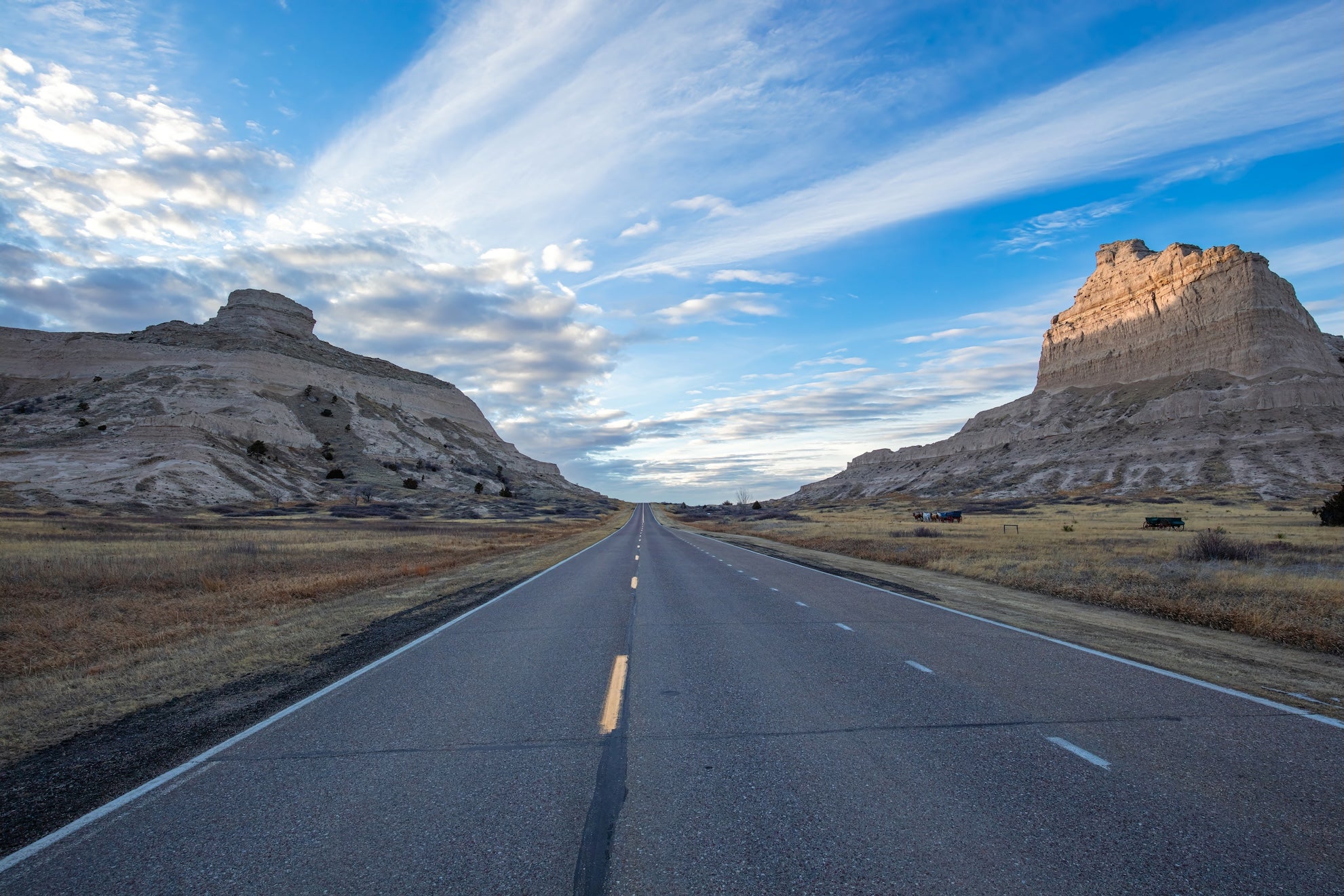
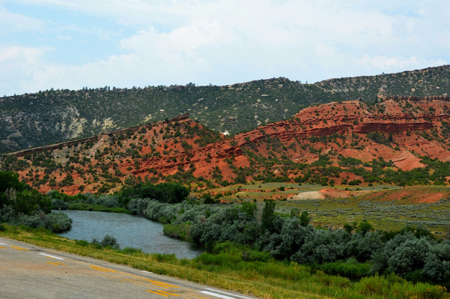
This leg follows the North Platte River from Nebraska into Wyoming, passing a parade of famous trail landmarks. Covered wagons navigated past Courthouse and Jail Rocks, Chimney Rock, and Scotts Bluff on the plains. After crossing into Wyoming, visit Fort Laramie National Historic Site and see wagon ruts carved in stone at Guernsey. The 300-mile drive (about 5–6 hours) ends in Casper.
Segment 3: Casper, WY to Pocatello, ID
Heading west from Casper, you’ll traverse Wyoming’s arid high plains and cross the Continental Divide at South Pass. Along the way, touch history at Independence Rock, where pioneers carved their names into stone. After the vast Wyoming basins, you descend into Idaho, stopping at Soda Springs’ bubbling mineral pools and the Oregon Trail Center in Montpelier. This stretch ends in Pocatello after ~450 miles (~7 hours).
Segment 4: Pocatello, ID to Pendleton, OR
From Pocatello, the route follows the Snake River through southern Idaho’s sagebrush plains. Highlights include Shoshone Falls (“Niagara of the West”) near Twin Falls and Three Island Crossing State Park where pioneers forded the Snake:contentReference[oaicite:8]{index=8}. After a city respite in Boise, head into Oregon. At Farewell Bend on the Snake, the trail climbs over the Blue Mountains en route to Pendleton (a 7-hour, ~450-mile journey).
Segment 5: Pendleton, OR to Oregon City, OR
Travelers trace the Columbia River west from Pendleton into the lush Columbia River Gorge. In pioneer days, wagon trains either floated the Columbia at The Dalles or braved the Barlow Road around Mount Hood. Today the drive through the gorge is spectacular. In about 4 hours, you’ll arrive in Oregon City’s Willamette Valley, where the End of the Oregon Trail Interpretive Center awaits.

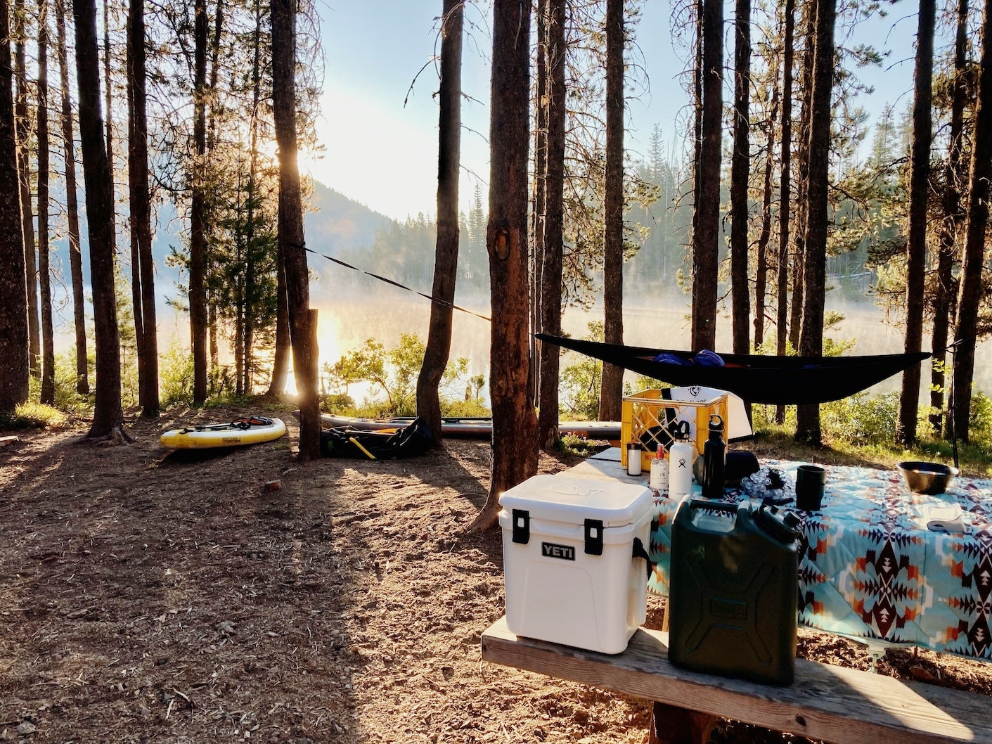
Top 10 Best Places to Camp Along The Oregon Trail
- Rock Creek Station SRA (Fairbury, NE) – A quiet campground at a historic stage station site near the KS/NE border. It’s adjacent to a preserved Oregon Trail stop where you can hike to see wagon ruts. Basic facilities, very peaceful setting.
- Fort Kearny SRA (Kearney, NE) – Shaded campground by sandpit lakes, just a few miles from the original Fort Kearny. Offers both electric sites and tent sites. Great for an overnight after visiting the fort and nearby pioneer museum. (Popular during spring crane-migration season!)
- Chimney Rock Pioneer Crossing (Bayard, NE) – Small private campground with an unbeatable view of Chimney Rock right from your RV or tent. Full hookups available. It’s a simple spot, but waking up to the famous spire in your sightline is priceless.
- Guernsey State Park (Guernsey, WY) – Reservoir-side camping near Fort Laramie (about 25 miles away). This state park has multiple camp areas; many sites are spacious and tree-sheltered. Don’t miss the park’s cliffside Oregon Trail wagon ruts and Register Cliff nearby (names carved by pioneers).
- Sinks Canyon State Park (Lander, WY) – Rustic campground in a stunning canyon just outside Lander. The “sinks” of the Popo Agie River (where the river vanishes into underground caverns) are a short walk away. Tent and small RV sites only; expect no cell service, but lots of stars at night.
- Massacre Rocks State Park (American Falls, ID) – A scenic campground along the Snake River. Many sites have water/electric hookups and views of the river canyon. Hikers can follow trails to see Oregon Trail remnants like Register Rock, where emigrants etched their names. Hot showers are available. Note that it can be windy in the afternoons.
- Three Island Crossing State Park (Glenns Ferry, ID) – A family-friendly state park campground on the Snake River, featuring an Oregon Trail interpretive center on-site. Offers grassy campsites (with hookups) and even cabins. The famous river crossing site is visible from the overlook trail. Easy access off I-84.
- Farewell Bend SRA Campground (Huntington, OR) – Located at the Snake River’s Brownlee Reservoir, this campground was near the spot pioneers bid “farewell” to the Snake River. It has modern facilities (showers, hookups, cabins). Great fishing and a historic interpretive display make it a nice stop before tackling the Blue Mountains.
- Ainsworth State Park (Cascade Locks, OR) – A convenient wooded campground in the Columbia River Gorge, about 30 minutes east of Portland. Full hookups and walk-in tent sites are available. You’re minutes away from waterfalls like Horsetail and Multnomah Falls. It’s an excellent base to explore the Gorge’s trails; just expect some train noise at night (earplugs help).
- Milo McIver State Park Campground (Estacada, OR) — This campground is close enough to Oregon City for an early finish. It is a good choice for bigger sites, river walks, and disc golf. Challenge the sometimes wild (but always picturesque) Clackamas River with rafts, canoes or kayaks. The Clackamas Fish Hatchery is located at McIver Park, and self-guided tours of the hatchery guide visitors through the life-cycle of Chinook salmon and steelhead.
Activities & Attractions Overview
This journey offers more than just a drive – it’s an immersion in both natural beauty and American history.
Outdoor attractions: You’ll pass spectacular landmarks like Chimney Rock and Scotts Bluff, traverse mountain forests, and skirt along mighty rivers (Platte, Snake, Columbia). Hiking opportunities abound: short trails lead to viewpoints of wagon ruts, waterfalls in the Columbia Gorge, and high desert vistas.
Historical sites: Plan on visiting museums and interpretive centers – highlights include Independence’s Frontier Trails Museum, Fort Laramie in Wyoming (walk the old fort grounds), the Oregon Trail Center in Montpelier, ID, and the excellent National Historic Oregon Trail Center near Baker City, OR. Many small towns along the way celebrate trail heritage with monuments or annual festivals.
Cultural stops: Don’t miss unique roadside attractions such as Courthouse and Jail Rocks in western Nebraska or Soda Springs, ID (with its bubbling natural springs that amazed pioneers). For recreation, you can mix in some fishing or boating at state parks like Guernsey or Farewell Bend. Whether you’re into photography, history, or hiking, the Oregon Trail road trip delivers a bit of everything. (The detailed segment guides linked below dive deeper into local activities and hidden gems.)
Explore Route Segments in Depth
Ready for a closer look at each section of the journey? Our in-depth segment guides break the route into manageable chunks, with day-by-day itinerary suggestions, mileage, and camping details. Explore the segments here:
- Independence MO to Nebraska Plains
- Across Nebraska’s Platte Valley
- Wyoming High Desert & South Pass
- Idaho’s Snake River Plain
- Blue Mountains to Oregon City
Planning Your Oregon Trail Road Trip
Fuel & Services: Plan ahead for fuel in the longer stretches. In Wyoming and parts of Idaho, towns can be over 100 miles apart. For example, if you take WY-28 over South Pass, the last gas is in Lander – next reliable fuel is far west near Farson. Fill up whenever you can and carry water and snacks in the car. Some remote highways have little more than the occasional ranch or rest area.
Weather & Seasons: This route is best in late spring, summer, and early fall. Spring brings wildflowers on the plains but also muddy backroads and high water at historic ford sites. Summer is dry and hot on the plains (90°F+ common), yet snow can linger at higher elevations until June. Autumn (Sept–Oct) offers cooler days and beautiful fall colors in the mountains. Winters are generally not suitable for the full trip – sections of the trail corridor (especially in Oregon’s Blue Mountains and Wyoming) receive heavy snow and ice. If traveling in shoulder seasons, check mountain pass conditions and be prepared with tire chains.
Connectivity: Cell service is decent near cities, but very spotty in rural stretches of WY and ID. Do not rely on constant connectivity – download offline maps (The Dyrt PRO offers offline campground maps, which can be a lifesaver). A paper road atlas or gazetteer is also handy for detours.
Road Conditions & Driving: The primary route uses well-maintained roads. However, if you venture onto original trail segments (some are drivable dirt roads) or scenic byways, be cautious of mud and washboard conditions. Watch weather forecasts – thunderstorms can flood low spots. In Oregon, I-84 through the Columbia Gorge occasionally closes for landslides or wildfire concerns in summer, and the Blue Mountains segment enforces chain laws in winter.
Budget Considerations: This can be an economical adventure. Many public campgrounds range from free to $25/night (state parks and private RV parks on the higher end with hookups). There are also opportunities for free dispersed camping on BLM/National Forest lands in Wyoming and Idaho (with no facilities, pack out trash). Fuel will be a major cost – roughly 2,000 miles of driving. Try to budget for slightly higher gas prices in remote areas. Stock up on groceries in bigger towns (Kearney, Casper, Boise) as small-town general stores can be pricey and have limited selection. Overall, with mostly camping and picnicking, the Oregon Trail road trip can be done on a modest budget.
Additional Resources
- NPS: Oregon National Historic Trail – Official National Park Service resources, maps, and historical information for the Oregon Trail.
- Oregon-California Trails Association (OCTA) – Non-profit preserving trail history; detailed guides and maps, plus an app with driving tours.
- The Dyrt PRO – Offline campground maps and trip planner. Handy for finding last-minute campsites and navigating areas without cell service.
- Leave No Trace Principles – Essential outdoor ethics to follow, especially when dispersed camping or exploring natural sites along the trail.
- State DOT Road Conditions: MO, KS, NE 511, WY 511, ID 511, OR TripCheck (check weather, closures, and travel alerts for safe planning).
Popular Articles:
Articles on The Dyrt Magazine may contain links to affiliate websites. The Dyrt receives an affiliate commission for any purchases made by using such links at no additional cost to you the consumer.