The TransAmerica Trail’s Pacific Northwest segment spans from the salty shores of Astoria, Oregon to the mountain crest of Lolo Pass on the Idaho–Montana border. This portion of the cross-country route covers roughly 800 miles through two states, blending coastal highways, lush river valleys, and remote mountain roads.
Highlights include Oregon’s famous coastline, the volcanic Cascade Range, the gold-rush towns of Eastern Oregon, and the rugged river canyons of Idaho. It’s a journey best savored over several days (often 4–5) to allow time for scenic detours and outdoor adventures. For a complete guide to the entire route, see our complete TransAmerica Trail road trip overview.
Segment Overview
Landscape: Starting at the Pacific Ocean in Astoria, travelers experience a dramatic transition from Oregon’s foggy coast into the fertile Willamette Valley, over the Cascade Mountains, and across arid Eastern Oregon. Entering Idaho, the route follows winding river corridors (Little Salmon, Clearwater, Lochsa) up to the forested heights of Lolo Pass.
What to Expect: Frequent curves and mountain grades, historic small towns, and long stretches with limited services. Summer offers the best weather, while late fall through spring can bring rain in Oregon and snow at higher elevations. McKenzie Pass (Oregon) typically closes in winter, and parts of US-12 in Idaho can have snow and ice. Always check road conditions and seasonal closures.
Quick Stats: Astoria to Missoula
| Total Distance | States Covered | Recommended Duration |
|---|---|---|
| ~800 miles (1,287 km) | Oregon, Idaho | 4–5 days |
| Primary Route | Cell Service | Fuel Stops |
| US-101, OR-126/OR-26, OR-7, OR-86, US-95, US-12 | Spotty (limited in mountains) | Astoria, Tillamook, Eugene, John Day, Baker City, Cambridge, Riggins, Kooskia |
Day-by-Day Itinerary
Day 1: Astoria, OR to Willamette Valley (via Oregon Coast)
Distance: ~200 miles (5 hours without stops).
Route: Start in Astoria and head south on US-101 along the Oregon Coast. The highway is two-lane with some summer traffic, but the ocean vistas are worth it.
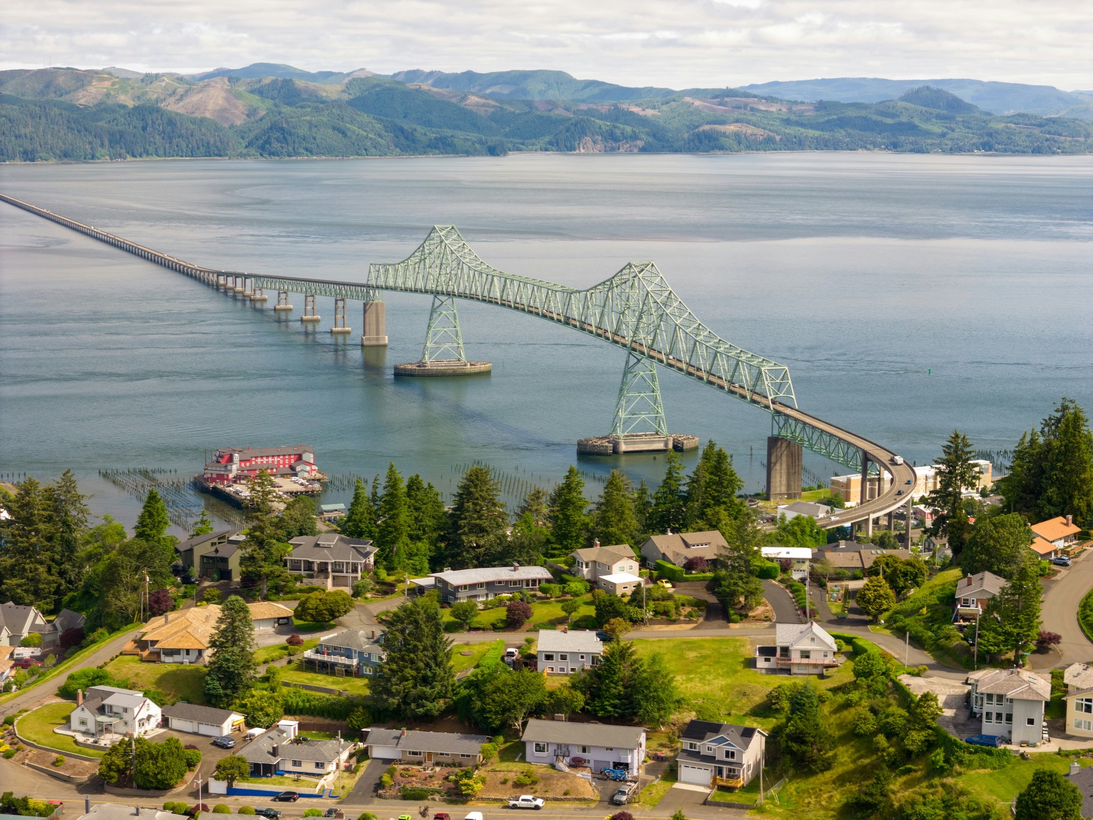
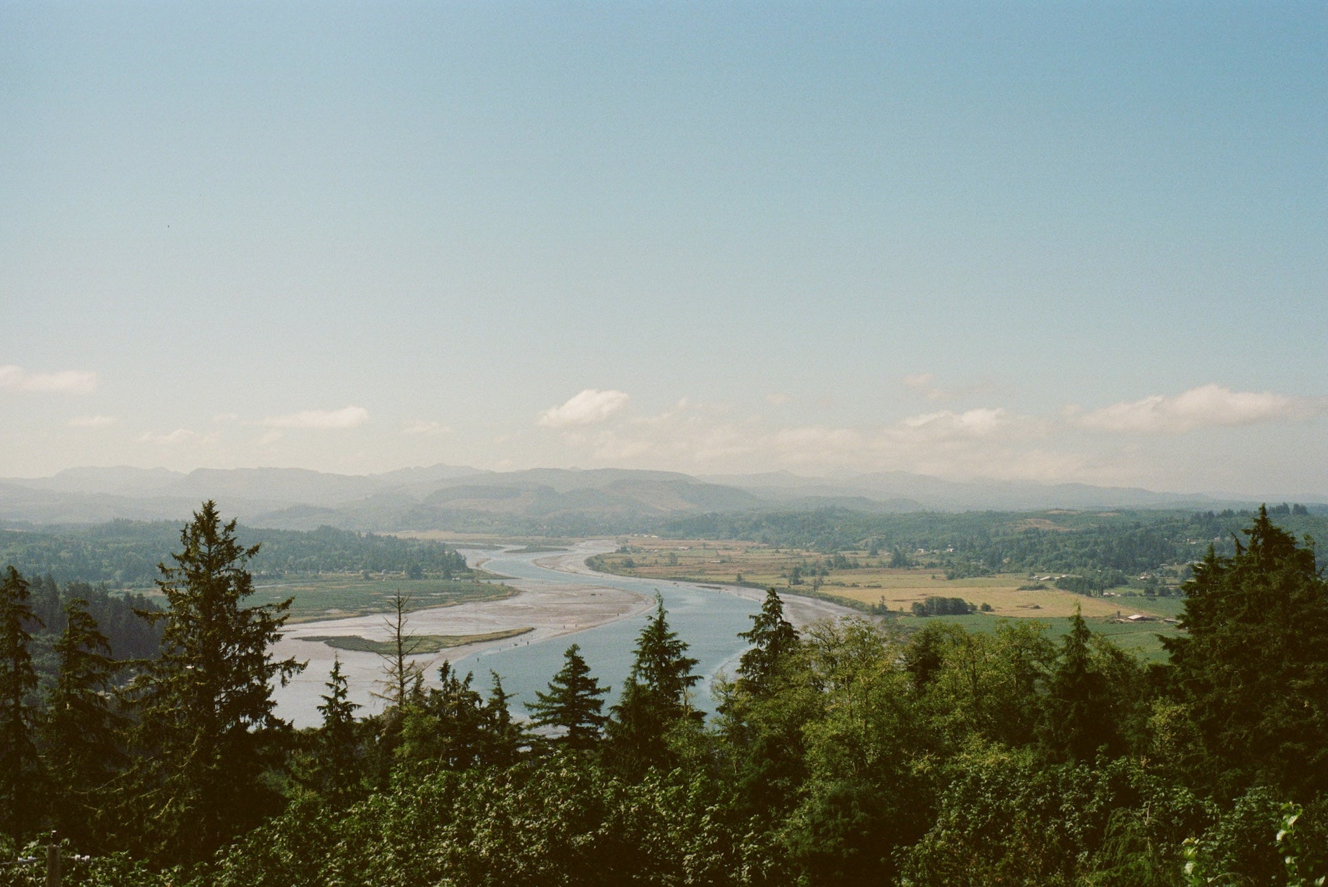
Morning: Climb up to the Astoria Column for a panoramic view of the Columbia River meeting the Pacific. Back at sea level, Fort Stevens State Park offers beach access to the famous wreck of the Peter Iredale and trails around historic fort batteries.
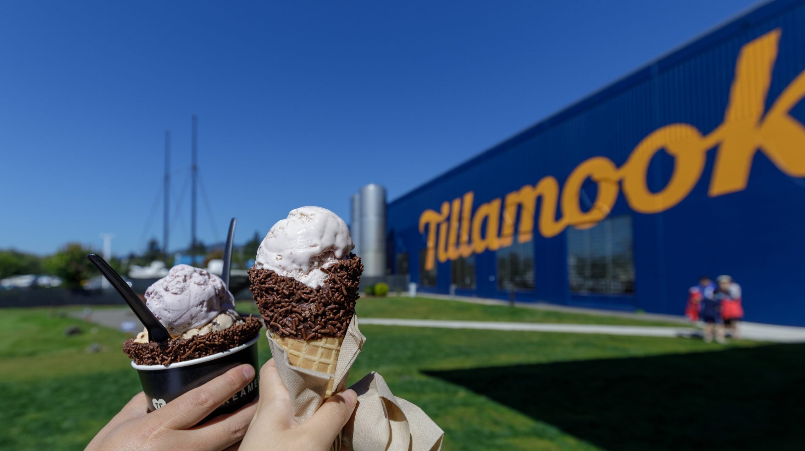
Afternoon: Continue through quaint coastal towns like Seaside and Cannon Beach. Cannon Beach’s iconic Haystack Rock is an easy stop right off 101 – grab lunch or a coffee in town and enjoy the view. By early afternoon, reach Tillamook. Stretch your legs at the Tillamook Creamery, where you can sample cheese and ice cream. From Tillamook, leave the coast and drive east on OR-6 through the forested Coast Range. Winding roads lead into Oregon’s Willamette Valley.
Evening & Overnight: Arrive near the Eugene area in the valley. Eugene is a convenient overnight stop with plenty of services. Consider camping along the McKenzie River just east of town at a forested site like Paradise Campground (about an hour outside Eugene) for a head start into the mountains the next morning. Fuel up in Eugene before heading into the Cascades.
Day 2: Willamette Valley to Eastern Oregon (Coburg to John Day)
Distance: ~240 miles (6 hours driving).
Route: From Coburg/Eugene, follow OR-126 or OR-242 east into the Cascade Mountains. OR-242 is the historic McKenzie Pass Highway – a narrow, winding road (open summer only) that climbs through dense forest to lava-rock vistas at its 5,325 ft summit.
Morning: If open, take McKenzie Pass and stop at Dee Wright Observatory, a lava stone lookout with views of the Three Sisters volcanoes. (If McKenzie Pass is closed, use OR-126 over Santiam Pass instead.) Descend into Central Oregon on the east side of the Cascades, where pine forests give way to sagebrush. Pass through the western-themed town of Sisters (a good coffee and bakery stop).
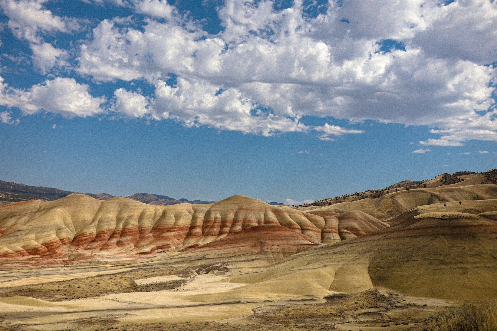
Afternoon: Continue on US-26 through Ochoco National Forest. Consider a detour to the Painted Hills Unit of the John Day Fossil Beds National Monument – a 30-minute side trip north of Mitchell – to see multi-colored claystone hills. Back on US-26, roll into the John Day Valley. The town of John Day has the Kam Wah Chung State Heritage Site (a preserved 19th-century Chinese apothecary) if you arrive before closing.
Evening & Overnight: Camp at Clyde Holliday State Recreation Site Campground in nearby Mount Vernon, which offers grassy sites along the John Day River. This sets you up well for an early start into Eastern Oregon’s high desert. Stock up on groceries in John Day – towns will be sparse tomorrow.
Day 3: John Day to Hells Canyon (Eastern OR)
Distance: ~220 miles (5–6 hours).
Route: Head east on US-26 then north on OR-7 toward Baker City. This stretch traces an old Oregon Trail route through open range and pine hills.
Morning: Arrive in Baker City by late morning. Take a short drive up to the National Historic Oregon Trail Interpretive Center outside of town, where you can walk past actual wagon ruts and learn about pioneer history. Back in Baker City, fuel up and grab lunch (this is the last full-service town before Idaho).
Afternoon: Continue east on OR-86 toward Hells Canyon. The highway becomes very remote and winding as it descends toward the Snake River. You’ll pass through Halfway, a tiny farming community, then follow the Snake River’s Brownlee Reservoir. Take it slow on the final miles – the road has sharp curves as it drops into the canyon. Enjoy the late-day light on the canyon walls and consider pulling off for photos at a viewpoint above Oxbow.
Evening & Overnight: Cross the Snake River into Idaho (via Oxbow or Brownlee Dam crossings) and set up camp at Hells Canyon Park on the river. This peaceful campground run by Idaho Power sits right on the water and has showers – a welcome comfort after a long, dusty drive. Be aware there’s no grocery store here, so hopefully you stocked up in Baker City. Unwind under a brilliant night sky; the area’s isolation makes for incredible stargazing.
Day 4: Hells Canyon to North-Central Idaho
Distance: ~210 miles (5–6 hours).
Route: Climb out of Hells Canyon and connect to US-95 North at Cambridge, Idaho. The road out of the canyon (ID-71) is steep and curvy, gaining elevation quickly. Cambridge marks your return to civilization (small-town style) with a gas station and cafe.
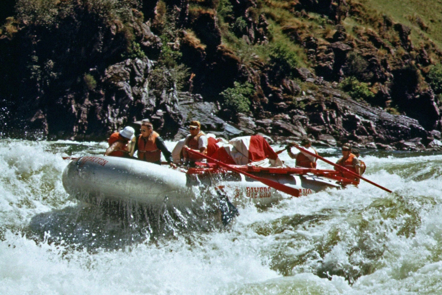
Morning: Follow US-95 through rolling ranchland to New Meadows. As you near Riggins, the highway begins a dramatic descent into the Salmon River Canyon. Take the old winding White Bird Hill Road (exit at White Bird) instead of the newer cut if you want a more scenic, slower drive – it offers sweeping views of the canyon and leads down to the historic White Bird Battlefield site (part of Nez Perce National Historical Park). Rejoin US-95 and stop in Riggins around midday. This little town on the Salmon River is a hub for rafting and fishing. Grab lunch at a local diner – portions are hearty and the vibe is pure Idaho friendliness.
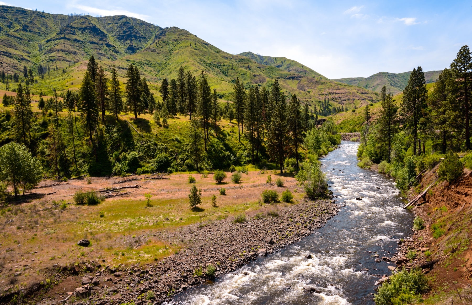
Afternoon: Turn east on US-12 at Kooskia, merging onto the Northwest Passage Scenic Byway. You’ll follow the Middle Fork of the Clearwater River, then the Lochsa River, for the rest of the day. This stretch is a 70-mile continuous gentle climb with endless river views and very few services. Keep an eye out for wildlife; elk and black bears inhabit these forests, and you may spot rafters running the rapids in summer. If time permits, park at the trailhead for Jerry Johnson Hot Springs (milepost 152) for a short hike to natural hot spring pools in the woods.
Evening & Overnight: Settle in at Wilderness Gateway Campground along US-12. This spacious forest service campground sits by the Lochsa River and even has an equestrian loop. Enjoy a campfire and fall asleep to the sound of the river. There is no cell service here – it’s a true wilderness experience.
Day 5: Lochsa River to Lolo Pass, ID
Distance: ~70 miles (2 hours).
Route: Continue east on US-12 for the final push to Missoula.
Morning: The road from Wilderness Gateway to the pass winds through one of Idaho’s most pristine river canyons. You’re still following the Lochsa, which lives up to its name (Nez Perce for “rough water”) with Class IV rapids visible from roadside pullouts. Early morning mist might hang over the water and evergreens – a peaceful start to the day. As you gain elevation, notice the change in forest from cedar and fir to alpine spruce near the top. Historical markers dot the route, including references to the Lewis and Clark Expedition’s difficult traverse of these mountains in 1805. Consider a quick stop at the Lochsa Historical Ranger Station (near Powell) – a small 1920s ranger cabin museum open in summer.
Arrival at Lolo Pass: By late morning, you’ll reach Lolo Pass (elevation 5,225 feet), which marks the Idaho/Montana state line. There’s a rustic visitor center at the summit where you can stamp your National Parks passport and learn about the Lolo Trail used by the Nez Perce. This is the end of the segment. From here, the next stretch of the TransAmerica Trail continues into Montana, heading toward Missoula and beyond. Take a breather, snap a photo by the Lolo Pass sign, and get ready for the adventures ahead on the next segment of your road trip (TransAmerica Trail road trip guide for Montana and beyond)
Best Campgrounds from Astoria to Lolo Pass
- Fort Stevens State Park Campground – Astoria, OR: A massive public campground near Astoria, set between the Pacific Ocean and the Columbia River. Offers tent sites, RV hookups, and cabins. Campers love the easy beach access (don’t miss the shipwreck on the sand) and miles of bike trails. Hot showers and a historic military fort on-site make this a comfortable and interesting first stop.
- Paradise Campground – McKenzie Bridge, OR: A classic Forest Service campground along the McKenzie River beneath old-growth trees. This peaceful spot off Highway 126 has no hookups but offers riverfront tent sites, drinking water, and vault toilets. Wake up to the sound of the river and hop on the McKenzie River Trail right from camp. It’s a great base if you’re exploring nearby hot springs or waterfalls in the Cascades.
- Clyde Holliday State Recreation Site Campground – John Day, OR: An oasis of green in Eastern Oregon’s dry landscape. This small state park campground features lush lawns, shade trees, and the gentle John Day River running alongside. It has restrooms with hot showers – a treat in the high desert. Sites are spacious and include fire rings and picnic tables. Conveniently located just off Highway 26, it’s a relaxing spot to overnight after driving through the John Day Fossil Beds area.
- Farewell Bend State Recreation Area – Huntington, OR: A scenic campground on the banks of the Snake River’s Brownlee Reservoir, near the Oregon-Idaho border. It offers tent and RV sites (some with full hookups), plus cabins and yurts. Travelers appreciate the clean facilities, including flush toilets and showers, and the park’s quiet ambiance despite being close to I-84. This is a historic locale – pioneers on the Oregon Trail camped here, “bidding farewell” to the Snake River. Today it’s perfect for boating, fishing, or simply resting before continuing into Idaho.
- Hells Canyon Park – Oxbow, ID: A remote riverside campground nestled in Hells Canyon along the Snake River. Operated by Idaho Power, it features grassy sites (many with shade structures) and modern comforts like potable water, flush restrooms, and showers. Camp right by the river and enjoy evening campfires under star-filled skies. It’s a prime spot for fishing or launching a boat to explore the reservoir. The isolation means very little light pollution or noise – just the sound of the flowing Snake River. Come prepared with all supplies; the nearest store is miles away.
- Riverside RV Park – Riggins, ID: A privately owned campground in Riggins situated on the Little Salmon River. It’s RV-friendly with full hookups, but also welcomes tent campers. Sites are gravel or grass right by the riverbank, offering soothing sounds of rushing water. There are no on-site showers, but the location makes up for it – you can walk to cafes and shops in downtown Riggins, and world-class fishing is steps from your campsite. It’s an ideal overnight if you want a short stroll to a steak dinner or need to resupply in town.
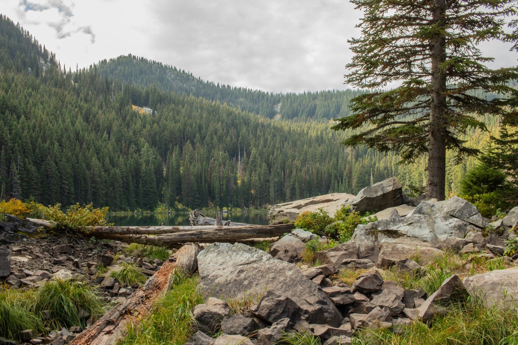
- Wilderness Gateway Campground – Lochsa River, ID: A spacious campground in the Clearwater National Forest along US-12, about 25 miles west of Lolo Pass. With 90+ sites, it has both primitive and a few electric spots, plus an entire loop for horse campers. Tall cedar and fir trees provide ample shade and privacy between sites. Amenities include vault toilets, drinking water, and a dump station. Trails from the campground lead into the Selway-Bitterroot Wilderness (including a hike to Stanley Hot Springs for the adventurous). Campers love the river access – you can cool off in the Lochsa on hot days. It’s a wonderful last night stop before climbing to Lolo Pass.
Top Activities & Attractions
Natural Highlights
Explore short trails to stunning viewpoints and unique natural sites along the route. In Oregon, the Dee Wright Observatory atop McKenzie Pass provides a 360° view of volcanic peaks and an otherworldly lava field. Further east, the Painted Hills (near Mitchell) display vibrant stripes of yellow, red, and black soil – especially beautiful in late afternoon light. In Idaho, nature takes center stage along the Lochsa River: take a break at Jerry Johnson Hot Springs (a 1.5-mile forest hike reveals a series of natural hot pools) or enjoy a picnic by the rushing rapids at any pullout on US-12. Don’t forget to gaze up on clear nights – the lack of city lights in Hells Canyon and the Lochsa corridor means incredible stargazing opportunities.
Cultural & Historic Sites
This segment is rich in history, from Indigenous heritage to pioneer trails. Near Astoria, you can visit Fort Clatsop (Lewis and Clark National Historical Park), where the explorers camped in 1805–06 (a slight detour from Astoria, but worthwhile for history buffs). In Baker City, the Sumpter Valley Dredge is a preserved gold mining dredge that speaks to Oregon’s 1860s gold rush era. Just outside Grangeville, Idaho, a roadside pullout overlooks the White Bird Battlefield – the site of an 1877 conflict between the Nez Perce and U.S. Cavalry. Stop at the overlook for interpretive signs that bring this history to life. Additionally, the entire drive on US-12 is part of the historic Lolo Trail corridor followed by the Lewis and Clark Expedition; at Lolo Pass Visitor Center, you’ll find exhibits on their arduous journey through the Bitterroots.
Outdoor Recreation
Opportunities for adventure abound. Consider a morning hike on the McKenzie River Trail in Oregon – even a short segment lets you see clear blue pools and waterfalls (like Sahalie Falls) in the Cascade foothills. Anglers might cast a line for trout on the John Day River at Clyde Holliday or try their luck fishing for steelhead on the Snake River at Hells Canyon Park. Whitewater enthusiasts can book a rafting trip in Riggins to tackle the Salmon River’s famed rapids (half-day and full-day trips are available in summer). If you have bikes, Astoria to Eugene has sections of quiet backroads perfect for cycling, and later in the trip the gentle grade of the Clearwater/Lochsa might tempt you to pedal a bit of the path blazed by the Bikecentennial riders of ’76.
Unique Roadside Stops
Keep an eye out for the fun and quirky. In Tillamook, the Tillamook Creamery isn’t just about cheese – the self-guided tour and free samples make it a delicious pit stop (plus, ice cream cones as big as your head). For a dose of nostalgia, stop at the Halfway Whistle Stop in Halfway, Oregon – a combination general store, gas station, and local hangout where time seems to have paused in the 1950s. In Lowell, Idaho (junction of the Lochsa and Selway Rivers), you’ll find a lone cafe and tavern known as ’The Lochsa Lodge’ – a rustic establishment where you can grab a huckleberry milkshake and sign the guestbook. It’s a slice of classic roadside Americana in the middle of the wilderness. These little diversions add character to the journey and memories to your trip.
Travel Tips for This Segment
Fuel & Supplies: Gas up whenever you can, especially before long stretches. Notable gaps: it’s over 150 miles from Eugene to the next major fuel in Prineville or John Day; likewise, after Baker City you won’t find a gas station until Cambridge, Idaho (about 120 miles if taking the Hells Canyon route). Carry extra water and snacks through Eastern Oregon and Hells Canyon – convenience stores are few and far between.
Road Conditions: Portions of this segment are remote and winding. Use lower gears on steep descents like White Bird Hill and watch for wildlife on the road at dawn and dusk. McKenzie Pass (OR-242) is closed in winter and not recommended for large RVs (vehicle length limits apply), so plan to take Santiam Pass if needed.
Weather: Coastal Oregon often brings morning fog or drizzle – have rain gear handy. In summer, Eastern Oregon can exceed 90°F, so pack sun protection and stay hydrated. Thunderstorms occasionally pop up in Idaho’s canyons, causing brief heavy rain; be cautious of slick roads.
Connectivity: Cell service is limited in the mountains. Expect dead zones along US-12 between Kooskia and Lolo Pass and in Hells Canyon. Consider downloading offline maps (The Dyrt PRO’s offline campground maps can be a lifesaver).
Safety: Let someone know your route if you’re traveling solo, and keep an eye on your fuel gauge in the long stretches. Lastly, respect wildlife and free-range cattle on open roads – give them plenty of space if you encounter them on the highway.
Continuing the Journey: Additional Segments & Resources
This Pacific Northwest portion is just one chapter of the epic TransAmerica Trail road trip. From the summit of Lolo Pass, the next segment leads into Big Sky Country as the trail continues east. Make sure to check out our other segment guides – each covers a unique region, from Montana’s Rockies to the Great Plains and beyond. You can explore the full TransAmerica Trail road trip itinerary in our overview article and plan your adventure end-to-end. As always, practice Leave No Trace principles and travel prepared. The Dyrt’s community reviews and PRO tools (like offline maps) are great resources to help you navigate campgrounds and public lands along the way. Happy trails as you venture onward!
The Dyrt is the only camping app with all of the public and private campgrounds, RV parks, and free camping locations in the United States. Download now for iOS and Android.Popular Articles:
Articles on The Dyrt Magazine may contain links to affiliate websites. The Dyrt receives an affiliate commission for any purchases made by using such links at no additional cost to you the consumer.