![]()
Central California’s stretch of the Pacific Coast Highway from San Francisco to Santa Barbara packs an incredible range of scenery into roughly 330 miles. This four-day coastal road trip takes you from the Golden Gate’s urban shores through misty redwood forests, past Big Sur’s cliff-hugging curves, and into the sunny embrace of Santa Barbara’s “American Riviera.” Along the way, you’ll experience classic Highway 1 highlights: historic waterfront towns, soaring bridges above the surf, hidden beach coves, and unforgettable sunsets. This segment balances adventure and ease, with manageable daily drives that leave plenty of time for hiking under ancient trees, snapping photos at rugged overlooks, wandering historic missions, and savoring the catch of the day in laid-back beach towns. Buckle up and get ready to explore one of California’s most iconic road trips: coastal vibes, natural wonders, and a healthy dose of Highway 1 magic await.
For broader context and planning beyond this section, see the Pacific Coast Highway Roadtrip Guide.
Segment Overview
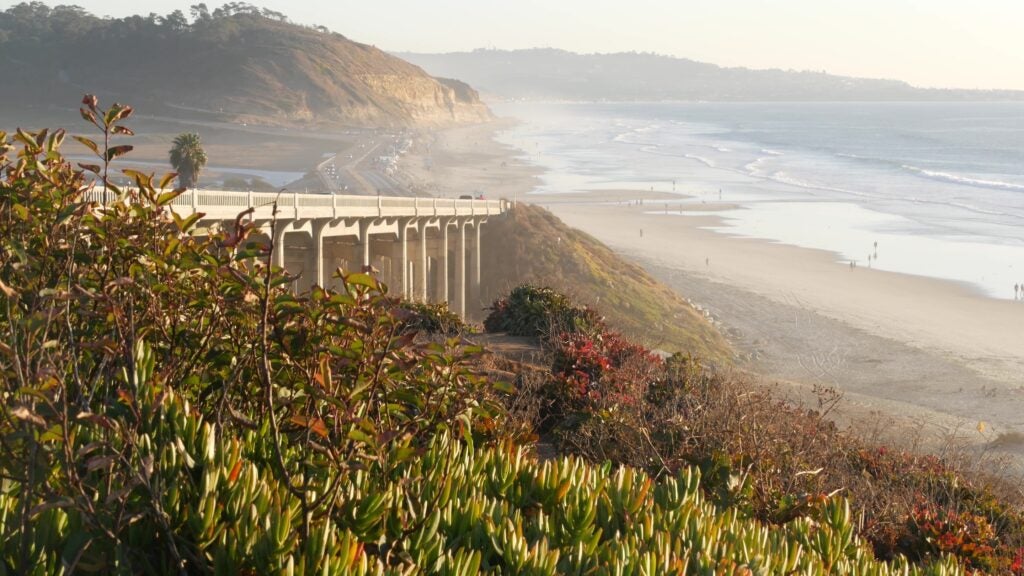
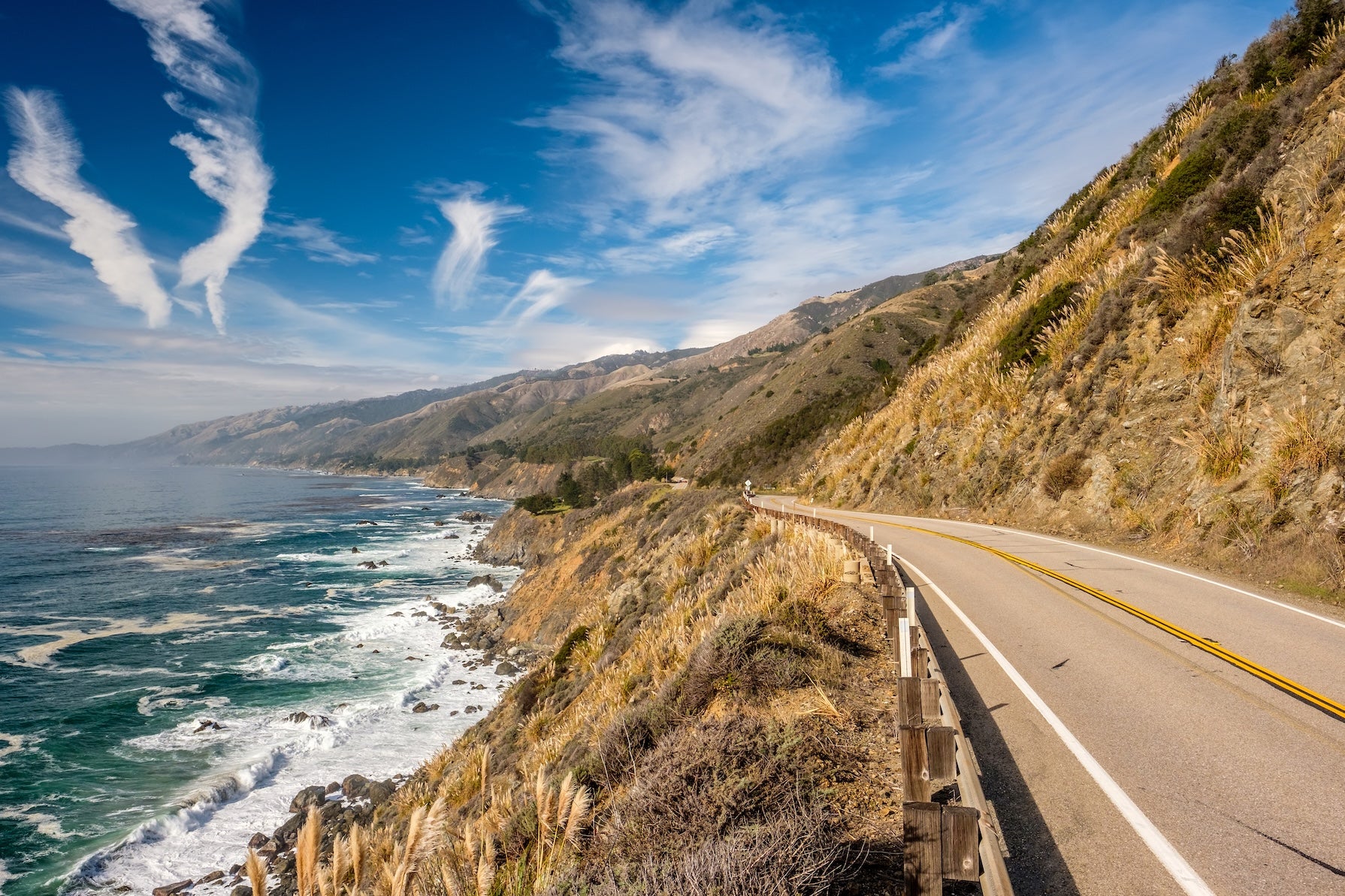
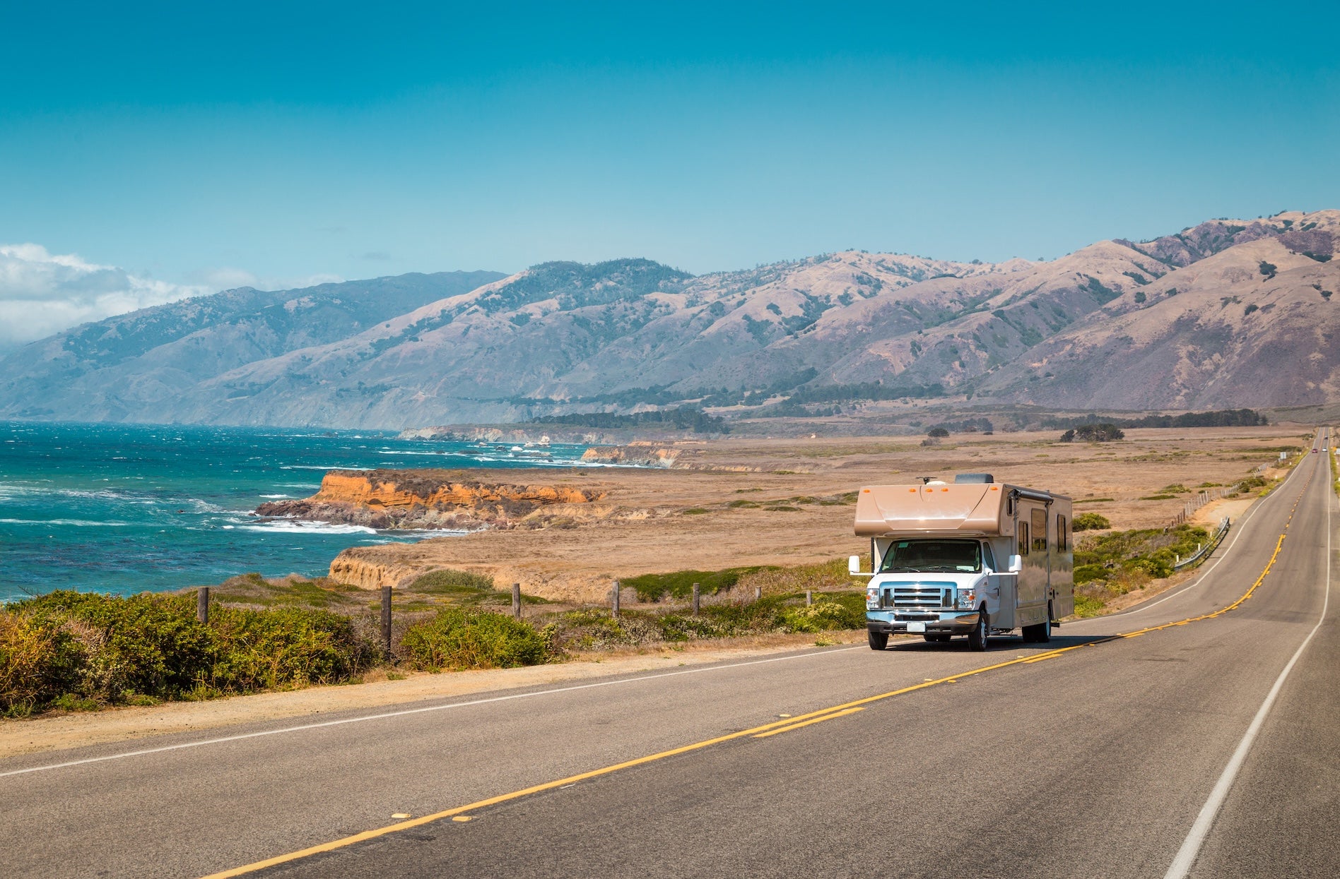
Beginning near San Francisco’s Pacific shoreline, this segment of Highway 1 heads south through breezy seaside communities and wild blufftop landscapes. You’ll cruise past Half Moon Bay’s beaches and the surfing haven of Santa Cruz before tracing Monterey Bay to the historic Cannery Row and aquarium in Monterey. South of Carmel, the route enters Big Sur, a world-famous 90-mile stretch of dramatic cliffs and dense forests. Here Highway 1 clings to mountainsides high above the ocean, with frequent pull-offs for panoramas. Keep an eye out for landmarks like Bixby Bridge – an elegant 260-foot arch spanning a coastal canyon since 1932. Big Sur’s remote section has no services (fuel up beforehand) and limited cell signal, but rewards travelers with waterfalls, redwood groves, and unspoiled beaches. Beyond Big Sur, the road levels out through the ranchlands of San Simeon (home to Hearst Castle) and the artsy village of Cambria. Farther south, you’ll pass Morro Bay’s towering volcanic rock and the dunes of Pismo Beach. The journey wraps up in Santa Barbara, where coastal mountains meet the sea in a Mediterranean-like setting of Spanish mission history and palm-lined shores. Four days allows time to enjoy each area at a comfortable pace, turning the drive into a rich coastal California experience.
Quick Stats
| Segment | San Francisco to Santa Barbara, CA |
| Distance | ~330 miles |
| Drive Time | Approx. 8 hours (no stops) |
| Recommended Duration | 4 days |
| Roads | CA Highway 1 (Pacific Coast Highway); US-101 (briefly) |
| Best Seasons | Late Spring through Fall (mild weather, lower closure risk) |
| Notable Features | Redwood forests, Big Sur sea cliffs, historic towns, beaches |
| Fuel | Gas up in Monterey or Cambria – Big Sur has a 90-mile stretch with very limited fuel |
| Cell Service | Spotty in remote areas (especially Big Sur); download offline maps in advance |
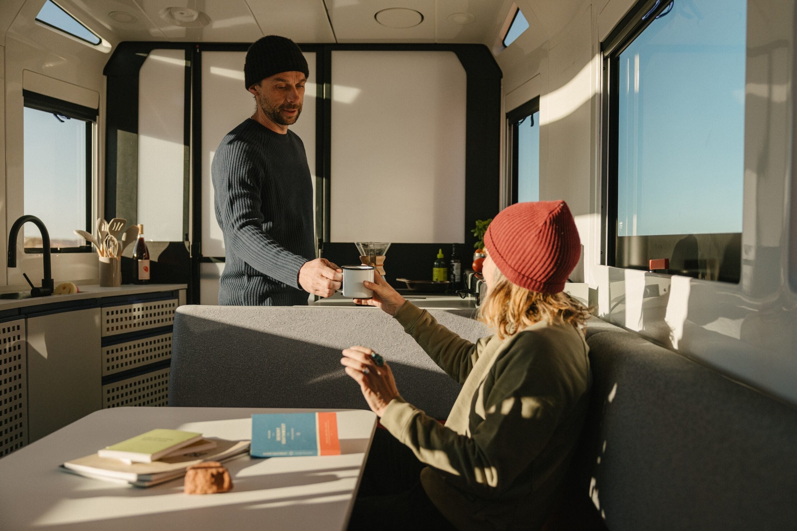
Travel Lighter with Lightship RV
Planning an RV road trip? Lightship is rethinking what’s possible on the road. The all-electric, self-propelled Lightship AE.1 is designed with TrekDrive™ technology to help extend range and make longer routes feel more approachable, especially on winding roads like California’s Highway 1. It’s built for destinations that sit farther between charging or fuel stops, and for camping that feels quieter, lighter, and more connected to the places you’re exploring.
Day-by-Day Suggestions
Day 1: San Francisco to Santa Cruz (75 miles, ~2 hours drive)
Start your journey in San Francisco and head south on Highway 1, also known as the Pacific Coast Highway. As the city skyline fades, make a quick stop at Pacifica’s Devil’s Slide Trail – a converted old highway segment offering cliffside ocean views and a chance to stretch your legs. Continuing past Montara, you’ll reach Half Moon Bay, a coastal town famed for its pumpkin farms and surf breaks. If it’s lunchtime, consider a picnic or fish tacos from a local taqueria in Half Moon Bay’s historic downtown. South of town, Highway 1 hugs broad beaches and bluffs blanketed in wildflowers in spring. Don’t miss Pigeon Point Lighthouse near Pescadero – at 115 feet tall, it’s one of America’s tallest lighthouses and has a scenic overlook for spotting harbor seals. As you approach Santa Cruz, the landscape shifts to agriculture and artichoke fields. In Davenport, a tiny hamlet north of Santa Cruz, pull over at Shark Fin Cove – a short walk from the highway reveals a rugged beach cove with a shark-fin shaped rock emerging from the waves. Arrive in Santa Cruz by late afternoon to enjoy its classic beach town vibe. Stroll the Santa Cruz Beach Boardwalk (a seaside amusement park dating to 1907) or take a sunset walk on the Santa Cruz Wharf, where you might spot sea lions lounging below. Camp for the night in the Santa Cruz area – New Brighton State Beach Campground in Capitola is a convenient option, tucked on a wooded bluff with beach access just south of Santa Cruz. (Note: If you prefer redwoods, Santa Cruz’s Henry Cowell Redwoods State Park campground is another choice, but check status – as of late 2025 it’s been undergoing renovations.)
Day 2: Santa Cruz to Big Sur
Leave Santa Cruz in the morning and follow Highway 1 along the northern curve of Monterey Bay. In Moss Landing, you might pause to kayak or observe sea otters in Elkhorn Slough, a rich estuary sanctuary. Continue to Monterey, a former Spanish capital turned charming coastal city. History buffs can visit the 18th-century Monterey Presidio or Custom House, while others may enjoy the Monterey Bay Aquarium on Cannery Row, famous for its jellyfish and open-sea exhibits. A quick detour along the scenic 17-Mile Drive through Pebble Beach (toll road) provides jaw-dropping ocean vistas and a look at the Lone Cypress and upscale golf courses. Next, swing through Carmel-by-the-Sea, an artsy village known for storybook cottages and a gorgeous mission. Grab lunch in Carmel – perhaps a bowl of chowder on the pier or artisanal sandwiches from a local cafe – before bracing for the Big Sur coast ahead. As Highway 1 leaves Carmel, it winds into the cliffs with the Santa Lucia Mountains on one side and the Pacific on the other. Pull off at the Bixby Creek Bridge turnout on the south end for the classic photo of this 1932 concrete arch spanning 260 feet above the canyon. South of Bixby, each bend reveals new drama – sea stacks off the shore, waves crashing against sheer bluffs, and pockets of redwood forest in misty ravines. Consider an afternoon hike in Andrew Molera State Park or Pfeiffer Big Sur State Park. Pfeiffer Big Sur has a network of trails; the Pfeiffer Falls Trail (2 miles round-trip) leads through redwoods to a waterfall, and the Valley View overlook adds panoramic coastal views. By evening, settle into a Big Sur campground. For a forest setting with amenities, Pfeiffer Big Sur State Park Campground offers sites along the Big Sur River beneath towering redwoods – just know it’s popular and books up months ahead. If you prefer oceanfront camping, drive a bit further to Kirk Creek Campground (Los Padres National Forest). Kirk Creek is a small bluff-top campground where every site overlooks the Pacific – you’ll fall asleep to pounding surf under an unbelievably starry sky (with zero light pollution). Note that Kirk Creek is more remote (no water or hookups, so come prepared). Big Sur nights can be chilly even in summer, so bundle up by the campfire and enjoy the silence – aside from ocean waves and the occasional bark of a sea lion.
Another standout option in this stretch is Julia Pfeiffer Burns State Park Campground, tucked into the hills above the coast just south of Big Sur Village. While smaller and more secluded than Pfeiffer Big Sur, it offers peaceful, shaded sites with access to redwood canyons and sweeping ocean overlooks. Campers love its quiet feel and proximity to McWay Falls, one of the most iconic viewpoints along Highway 1. Reservations are competitive, especially spring through fall.
Day 3: Big Sur to Pismo Beach
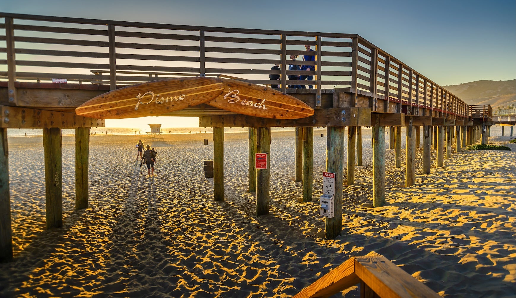
Wake up in Big Sur to the scent of coastal sage and perhaps the hooting of quail. This will be a longer day, but full of iconic stops. Start early and continue south on Highway 1. In the morning light, consider a stop at Julia Pfeiffer Burns State Park to see famous McWay Falls. Normally a short walk leads to an overlook of the 80-foot waterfall pouring onto a beach, but note that as of 2025-2026 the overlook trail is closed for repairs (viewing is only possible from a highway turnout). Even without the falls, the park’s ambiance – lush redwoods on one side, sparkling ocean on the other – is worth a pause. A few miles south, you can walk a brief trail at Limekiln State Park to see historic 19th-century lime kiln ruins and another waterfall; day-use access has recently reopened. As you near Big Sur’s southern end, the road bends inland around Ragged Point. This area marks the transition from steep cliffs to more gentle shoreline. Be sure to stop at the Piedras Blancas Elephant Seal Rookery north of San Simeon. From accessible boardwalks, you can observe hundreds of elephant seals basking on the beach and sparring in the surf – this is the only major elephant seal colony that’s free and open year-round to the public. Depending on season, you might see massive bulls fighting (winter) or molting juveniles (spring). It’s a wildlife spectacle you won’t forget, so bring binoculars and zoom lenses! A few minutes further is Hearst Castle (Hearst San Simeon State Historical Monument), perched in the hills above the ocean. If time permits, take a tour of media tycoon William Randolph Hearst’s lavish estate – you’ll shuttle up from the visitor center to explore opulent rooms and pools of this 1920s era “enchanted hill” (tours take ~2 hours; advance tickets recommended). If you skip Hearst Castle or have extra time, the seaside hamlet of Cambria offers charming galleries, wine tasting rooms, and the coastal boardwalk at Moonstone Beach – a great lunch stop. As you continue south, you’ll pass Morro Bay, recognizable by the enormous Morro Rock guarding its harbor. Stretch your legs at Morro Rock Beach or consider a short detour into Morro Bay State Park to walk the marina boardwalk and visit the nature center (the park’s campground is a lovely spot nestled by the bay, if you’re ahead of schedule). The day’s drive ends around Pismo Beach in the Five Cities area. Pismo Beach is famous for its broad sandy shoreline and dunes – off-road enthusiasts run ATVs at the Oceano Dunes SVRA, while the Monarch Butterfly Grove (active in winter) offers a calmer nature walk among eucalyptus trees filled with butterflies. In town, reward yourself with a classic California treat: try the clam chowder in a sourdough bread bowl at Splash Café (a local institution). Camp for the night at Pismo State Beach North Beach Campground, which features spacious sites just over the dunes from the ocean. There are no hookups, but hot showers and a dump station are available. Falling asleep to the sound of crashing waves is a perfect way to cap off the day.
Day 4: Pismo Beach to Santa Barbara
On the final day, you’ll travel from the Central Coast into Southern California’s gateway. If you’re up early, take a sunrise stroll on Pismo’s beach – you might dig your toes in the sand or even try your hand at clamming (Pismo Beach once was “Clam Capital” – you’ll see a giant clam statue in town). When you’re ready, continue south on Highway 101 (PCH merges with 101 here) toward Santa Barbara. The freeway cuts slightly inland through the Santa Maria Valley’s vineyards and ranches. For a more coastal and secluded route, you have the option to split off onto Highway 1 at Oceano toward Guadalupe and Lompoc, then rejoin 101 at Gaviota; this path is longer and rural, passing farm fields and Vandenberg Space Force Base lands (note: limited services along this alternate route). Otherwise, staying on 101 takes you through the small cities of Arroyo Grande, Santa Maria (famed for its barbecue), and Buellton (home of pea soup and wineries). Either way, consider stopping in the Lompoc area to visit La Purísima Mission State Historic Park if time allows, it’s one of California’s most fully restored 18th-century missions, offering a glimpse into early Spanish colonial life.
As you approach the coast again at Gaviota, you’ll know you’re back by the ocean when the smell of salt air returns. The last 30 miles into Santa Barbara hug a coastline of dramatic folded cliffs. Two lovely beachside state parks here make great final stops: Refugio State Beach (lined with palm trees along a pretty cove) and El Capitán State Beach. If you didn’t camp last night, you might stop at El Capitán for a picnic or quick trail, a short path connects the day-use area to tide pools at low tide. Roll into Santa Barbara by afternoon. This city offers a fantastic blend of culture and beach relaxation to end your trip. Wander Stearns Wharf, the oldest working pier in California, for views of sailboats and maybe a scoop of local ice cream. Along State Street you’ll find shops and sidewalk cafes under red-tile roofs. For a bit of history, visit Old Mission Santa Barbara (“Queen of the Missions”), established 1786, or the Spanish-revival County Courthouse with its panoramic clock tower. If you’re ready to toast the journey’s end, Santa Barbara’s Funk Zone neighborhood near the waterfront is filled with urban wine tasting rooms and breweries. Alternatively, grab some authentic Mexican food – the city is known for its taquerias and the famous Santa Maria–style barbecue tri-tip.
Although this segment concludes in Santa Barbara, you might be inspired to keep cruising further down the coast on Highway 1. (Los Angeles is about 90 more miles southeast.) Either way, you’ve just experienced some of coastal California’s greatest hits – from foggy redwood groves to sun-drenched beaches – all in one epic road trip.
Campgrounds to Consider
- New Brighton State Beach Campground (Capitola, CA): Located just south of Santa Cruz, this family-friendly campground sits on a bluff overlooking Monterey Bay. A short trail leads down to a wide beach, perfect for morning walks. The campground has over 100 sites (some with RV hookups) amid shady pines and eucalyptus. Reserve in advance for summer weekends, as it’s popular for its mix of forest and ocean fun.
- Pfeiffer Big Sur State Park Campground (Big Sur, CA): The “Grand Daddy” of Big Sur campgrounds, Pfeiffer Big Sur State Park offers 189 sites nestled along the Big Sur River and under old-growth redwoods. It’s right off Highway 1 in the heart of Big Sur, making it an ideal base to explore local trails and beaches. Expect friendly camp hosts and occasional evening ranger programs in summer. No hookups here, and summer reservations fill exactly 6 months out. Tip: Watch for raccoons at night – secure your food!
- Kirk Creek Campground (Los Padres NF, Big Sur, CA): For jaw-dropping scenery, Kirk Creek is hard to beat. This National Forest campground sits on a bluff 100 feet above the Pacific, with every site boasting an ocean view. You’ll find only basic amenities – picnic tables, fire rings, vault toilets, and no potable water (bring your own) – but the payoff is a front-row seat to Big Sur’s wild beauty. Campers rave about watching the sunset blaze into the ocean and falling asleep to the sound of crashing waves. A trail across Highway 1 leads into the Ventana Wilderness if you’re up for hiking, and a short walk from camp descends to a rocky beach cove. Note: There are no RV hookups or dump stations. Kirk Creek is popular and often booked up to 6 months ahead via Recreation.gov. If it’s full, neighboring Plaskett Creek Campground (2 miles south) offers more sites in a grassy meadow (and is more family-oriented), though without the cliffside views.
- Hearst San Simeon State Park Campgrounds (San Simeon/Cambria, CA): Just south of the Hearst Castle entrance, Hearst San Simeon State Park operates two adjacent campgrounds – San Simeon Creek and Washburn Primitive. The San Simeon Creek Campground has 115 developed sites (flush toilets, water, token showers) spread between ocean-adjacent and creekside loops. It’s a short walk from your camp to a driftwood-strewn beach where you can beachcomb with views of Piedras Blancas Light Station. The upper Washburn area, by contrast, is 1 mile inland on a hill with ocean views; it offers 68 more rustic sites (pit toilets, no showers) that are often quieter. Camp here to be conveniently located for Hearst Castle tours or exploring the quaint town of Cambria just to the south. Note that even with the coastal location, many sites are exposed with limited shade (bring a canopy if desired).
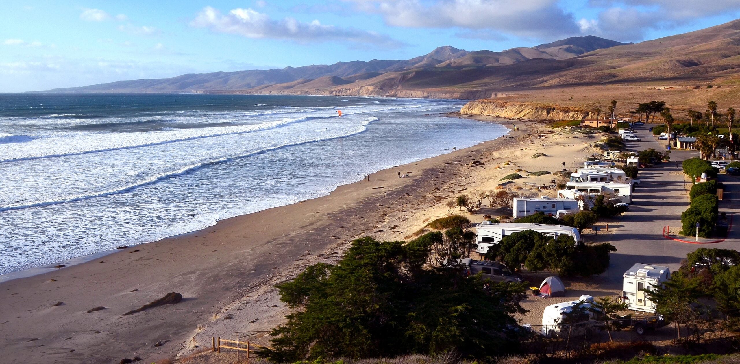
- Morro Bay State Park Campground (Morro Bay, CA): If you prefer estuary views and amenities over beach camping, Morro Bay State Park is a gem. Tucked between the bay’s shoreline and a golf course, this campground has 130 sites in a grassy eucalyptus grove. Many sites offer views of Morro Bay’s tidal wetlands, with Morro Rock visible in the distance. The campground provides flush toilets, showers, and even a few full hookup sites for RVs (which are in high demand). Kayak rentals, a bayside cafe, and the Morro Bay State Park Museum of Natural History are all within walking distance. From your campsite, you can walk a short path to the marina and rent a kayak or stand-up paddleboard to explore the calm bay waters where herons, otters, and harbor seals reside. Hiking trails in the park lead up Black Hill for panoramic views. Because it’s near town, campers appreciate the easy access to grocery stores and restaurants in Morro Bay. This campground is extremely popular year-round (Morro Bay’s climate is mild), so reserve as early as possible. It made The Dyrt’s 2025 Top 10 Best Campgrounds in the Pacific Region – a testament to its enjoyable setting.
- North Beach Campground – Pismo State Beach (Pismo Beach, CA): For classic beach camping, North Beach Campground delivers. This state beach campground is just steps from the sand in Pismo Beach. The 103 sites are on flat, open ground with a few shrub windbreaks – not much privacy, but the trade-off is being able to walk directly from your campsite over the dunes to a 6-mile stretch of beach. Facilities include flush toilets, coin showers, and water spigots. There are no hookups for RVs, but a dump station is available (for a $10 fee). Kids love the adjacent play area and creek, and in winter the famed Monarch Butterfly Grove (free entry) is right next door – thousands of butterflies cluster in the eucalyptus trees from November to February. Surfing, swimming, fishing, and even clamming are popular activities here. In the summer, park rangers host Junior Ranger programs and campfire talks at the small amphitheater. Given its convenient location (walking distance to downtown Pismo’s eateries and surf shops), North Beach fills up fast in peak season – reservations are wise. For a slightly quieter experience, ask for a site at one end of the loop to avoid the central foot traffic to the beach. Fall nights can bring heavy dew (or fog), so pack a waterproof tent fly. Don’t be surprised if you hear ocean waves all night and roosters from nearby farms at dawn, it’s all part of the coastal camping atmosphere!
- El Capitán State Beach Campground (Santa Barbara, CA): This campground sits about 20 minutes west of downtown Santa Barbara but feels pleasantly removed from the city. Set on bluffs above a sandy cove, El Capitán’s campsites are spread among sycamore and oak groves that offer welcome shade on warm days. Each of the 142 sites has a picnic table and fire ring, and most can accommodate tents or small RVs (no hookups, though a few sites can fit big rigs). Keep in mind the campground is close to Highway 101 and a railroad line – light sleepers might notice some noise, but the sound of crashing waves usually dominates. Reservations are essential in summer and holidays; in the off-season, some sites convert to first-come, first-served (Nov – Feb, roughly). El Capitán is a great final night stop if you’re ending your trip in Santa Barbara – you get the beauty of camping under the stars by the ocean, with only a short drive into town. (Nearby Refugio State Beach Campground, 7 miles up the coast, is a similar option with palm-tree-lined beachfront sites – also very popular.)
Top Activities & Attractions
Hiking & Nature
- Redwood Grove Loop (Henry Cowell Redwoods SP): If you have time in Santa Cruz, this 0.8-mile flat loop winds through an old-growth redwood grove with 1,500-year-old giants. It’s an easy, awe-inspiring walk among trees up to 277 feet tall. There’s even a hollow tree (the Fremont Tree) you can stand inside. No dogs on this trail; day-use fee required.
- Point Lobos State Natural Reserve: Just south of Carmel, Point Lobos offers some of the best short hikes in California. Try the Sea Lion Point Trail (0.6 mile) to view barking sea lions on offshore rocks, or the Cypress Grove Trail (0.8 mile) to wander through rare Monterey cypress trees along dramatic cliffs. Arrive early – the limited parking often fills by mid-morning. Entry fee ~$10 (covers your car for all state parks that day).
- Tanbark Trail & Partington Cove (Big Sur): For a moderate hike, the Tanbark Trail in Julia Pfeiffer Burns State Park climbs through redwood canyons to Tin House ruins (6 miles round-trip, 1,800 ft gain). It’s a workout but rewards you with ocean vistas. On the same stretch of coast, the Partington Cove Trail is a short, steep hike (1 mile round-trip) that leads through a tunnel to a hidden rocky cove once used by smugglers – a fun quick excursion to stretch your legs.
- Elephant Seal Boardwalk (San Simeon): This isn’t a hike per se, but the wooden boardwalk at the Piedras Blancas rookery lets you walk along the bluff and witness elephant seals up close in their natural habitat. It’s flat, accessible, and absolutely fascinating. Docents are often on hand to answer questions. Best viewed in winter when thousands of seals are present, but some seals lounge here all year.
- Oso Flaco Lake Trail (Guadalupe-Nipomo Dunes): If you detour toward Guadalupe on Highway 1, the Oso Flaco Lake Trail is a hidden gem. This 1.7-mile round-trip boardwalk trail crosses a freshwater lake (look for waterfowl) and continues through dunes to a remote beach. It’s an easy walk, suitable for families. Bring binoculars for birdwatching. ($5 parking fee at trailhead.)
Scenic Viewpoints & Detours
- Devil’s Slide Trail: A paved 1.3-mile trail on a former stretch of Highway 1 south of Pacifica, offering sweeping views of the Pacific and chances to spot whales. Parking at either the north or south trailhead is free. Interpretive signs along the way share the history of this once-treacherous road section. It’s a great way to safely enjoy the coastal cliffs.
- Bixby Bridge Vista Points: The turnout on the south end of Bixby Bridge (Castle Rock Viewpoint) provides the iconic photo angle of the bridge with coastline backdrop. It’s often crowded, so consider arriving in the early morning for solitude or at sunset for golden lighting (just be prepared for many photographers). There are also a few dirt pullouts on the north side of the bridge; from there you can look back toward the bridge against the hills. Always park safely and completely off the highway.
- McWay Falls (Highway 1 Overlook): Normally seen from the Julia Pfeiffer Burns State Park overlook, McWay Falls is currently only visible from a small highway-side viewpoint due to trail closure. Drive slowly around Julia Pfeiffer Burns State Park (about 37 miles south of Carmel) and look for cars parked on the shoulder. Even with the limited view, the sight of an 80-foot waterfall dropping onto a secluded beach is worth a stop, it’s one of the most photographed spots on PCH. Use caution when pulling in and out of traffic here.
- Nitt Witt Ridge (Cambria): For a quirky detour, visit Nitt Witt Ridge, a folk art house built into a hillside in Cambria by a garbage collector/artist between 1928–1989. Tours are by appointment (small donation requested). You’ll see abalone shells, toilet bowl planters, and other found objects integrated into a terraced home. It’s like the eccentric counterpoint to Hearst Castle – which, legend has it, provided some fixtures to Nitt Witt Ridge. This isn’t along Highway 1 itself but a quick 5-minute drive into Cambria’s residential streets.
- Santa Barbara Waterfront Bike Path: Once you reach Santa Barbara, consider renting a cruiser bicycle (several shops along Cabrillo Blvd) and riding the coastal bike path. The path runs about 4 miles round-trip from Leadbetter Beach past Stearns Wharf to East Beach, showcasing palm-lined parks, sandy beaches, and views of the Channel Islands on clear days. It’s a relaxing way to take in Santa Barbara’s scenery. Stop at the Chromatic Gate (a colorful archway art installation) for a photo, and keep an eye out for dolphins often seen from Shoreline Park.
Historic & Cultural Attractions
- Santa Cruz Beach Boardwalk: California’s oldest surviving amusement park, operating since 1907. It’s free to enter – you pay per ride. Even if you’re not into rides, it’s worth visiting to see the vintage 1924 Giant Dipper wooden roller coaster (still thundering along) and to grab some saltwater taffy or a corn dog. In summer, free concerts happen on Friday nights. The boardwalk captures a nostalgic slice of California beach culture.
- Monterey’s Cannery Row & Old Fisherman’s Wharf: Cannery Row, made famous by John Steinbeck’s novel, is now a waterfront street of shops, eateries, and the Monterey Bay Aquarium (world-class, known for its kelp forest and open-ocean tank). It’s touristy but fun – try samples at the sweet shops or a wine tasting room. Nearby Fisherman’s Wharf offers a chance to taste local clam chowder (vendors often hand out free samples outside restaurants). You might catch sight of sea lions and otters in the harbor while you dine on seafood with a view.
- Hearst Castle: A National Historic Landmark, Hearst Castle is a museum like no other. Media mogul William Randolph Hearst built this opulent estate from 1919–1947, filling it with art and antiques from Europe. The Grand Rooms Tour is a great intro, showcasing the ornate Assembly Room, Refectory (dining hall), and Roman Pool. Tours start at $30 and last about 1 hour 15 minutes (plus bus ride up). After the tour, enjoy the panoramic view from atop “La Cuesta Encantada.” Even kids will be wowed by the swimming pools – Neptune Pool is outdoor with Greco-Roman flair, and the indoor Roman Pool is tiled in cobalt blue and gold. Pro tip: Reserve tours in advance, especially in summer.
- La Purísima Mission State Historic Park: If your route takes you through Lompoc, this mission is worth a visit. It’s the most extensively restored mission in California, set on 2,000 acres with ten original buildings reconstructed. You can wander through the church, living quarters, blacksmith shop, and gardens at your own pace. There are even livestock (longhorn cattle, horses, sheep) like a living history farm. It’s usually quiet, giving a real sense of 1820s mission life. The park is open 9am–5pm; entry fee is ~$6 per vehicle.
- Old Mission Santa Barbara: In Santa Barbara, the mission founded in 1786 is an architectural and historical jewel. Dubbed “Queen of the Missions,” it has a beautiful twin-bell-tower facade and views over the city. Self-guided tours ($15) include the lovely mission church, cemetery, and museum rooms with Chumash artifacts and early California memorabilia. The mission’s rose garden across the street is a peaceful spot for a picnic. If you enjoy history, also check out El Presidio de Santa Barbara downtown – a small site preserving remnants of the 1782 Spanish fort, including two original adobe buildings.
Food & Drink Highlights
- Phil’s Fish Market (Moss Landing): A humble-looking seafood spot by the harbor renowned for its cioppino (tomato-based fisherman’s stew). Portions are huge and packed with fresh catch. It’s a great lunch stop between Santa Cruz and Monterey. The BBQ oysters and fish & chips also get high marks. Can get busy on weekends – be prepared to wait in line, or call in a to-go order and enjoy it on the beach.
- Nepenthe (Big Sur): The most iconic dining in Big Sur, Nepenthe is perched on a cliff 800 feet above the ocean. It’s been run by the same family since 1949 and was a gathering place for artists and bohemians. The terrace view is stunning on a clear day or even atmospheric in fog. Try the famous Ambrosia Burger or the homemade berry pie. Prices aren’t cheap, but the experience is memorable – especially at sunset with a glass of local wine. If Nepenthe is too crowded, their lower cafe, Café Kevah, serves coffee, pastries, and lighter fare with the same view (mornings/afternoons only).
- Madonna Inn (San Luis Obispo): For a dose of roadside kitsch, detour a few minutes off Highway 101 in San Luis Obispo to visit the Madonna Inn café or bakery. The Madonna Inn is a flamboyantly decorated hotel famous for its themed rooms and bright pink dining room. Even if you just stop for their excellent pink-frosted champagne cake or a cup of coffee, it’s worth seeing the eccentric decor (and check out the men’s restroom urinal fountain – a quirky attraction in itself!).
- Santa Maria–Style Barbecue (Santa Maria or Santa Barbara Co.): This region is known for its own style of barbecue – typically tri-tip steak grilled over red oak and seasoned simply with garlic, salt, and pepper. It’s often served with pinquito beans, salsa, and grilled French bread. In Santa Maria, try Jocko’s (in nearby Nipomo) or Shaw’s – both institutions. If you’re in Santa Barbara on a weekend, look for BBQ pop-ups at wineries or farmers markets. It’s a delicious taste of Central Coast tradition.
- Funk Zone, Santa Barbara: Santa Barbara’s Funk Zone is a walkable area of converted warehouses near the beach, now home to wine tasting rooms, breweries, and eateries. You can sample local wines from the Santa Ynez Valley without leaving town – popular spots include Santa Barbara Winery (SB’s oldest winery) and Municipal Winemakers. For beer, Figueroa Mountain Brewing has a taproom. The food scene here ranges from fresh seafood (try The Lark for farm-to-table dining) to casual tacos at Mony’s. It’s an ideal place to park once and stroll, sipping and sampling as you celebrate your road trip’s end.
Travel Tips for This Segment
- Gas & Fuel: Plan your fuel stops carefully in Big Sur. Gas is available in Monterey/Carmel and then not again until Cambria/Morro Bay (except one small station at Gorda where prices exceed $7–$8/gallon). To avoid sticker shock or running low, fill up in Carmel or Big Sur Village before tackling the long stretch. Likewise, if heading north, top off in Cambria or Paso Robles. Carry extra fuel if you’re driving an RV or during winter when stations might close if power outages occur.
- Road Conditions & Closures: Highway 1 is prone to closures from landslides, especially in Big Sur during winter storms. Always check current road conditions before you go. Caltrans QuickMap is an excellent official resource for live updates on closures and delays (including mudslide repair schedules), consult it online or via the app. If a closure occurs, be prepared for a lengthy detour (often Hwy 101 is the alternate). Obey all closure signs and do not attempt to bypass barricades; fines are heavy and conditions beyond can be dangerous.
- Cell Service & Navigation: Cell coverage drops to zero in many parts of Big Sur, and even around parts of Cambria hills. Don’t rely on streaming maps or phone GPS alone. Download offline maps for your route (consider using The Dyrt PRO or Google Maps offline). Print or note key directions. A paper map or road atlas as backup isn’t a bad idea. In emergencies, call boxes are located along Highway 1, but it could be many miles between them. When you do get a signal (e.g., near Big Sur Ranger Station or Ragged Point), send any needed messages ahead of the next dead zone.
- Reservations & Permits: Reserve state park campgrounds as early as possible – California’s coast campgrounds can book up six months in advance at ReserveCalifornia.com. A few camps offer first-come sites in winter or mid-week; arrive by late morning to snag one. No special permit is required to drive PCH, but if you plan to hike in the Ventana Wilderness (Big Sur backcountry) or camp at primitive sites there, check with Los Padres National Forest for any required (free) permits or fire restrictions. Hearst Castle tours require a ticket; booking ahead online is strongly advised, especially in summer. For popular hikes like Point Lobos, there’s no permit but parking is limited – going early or late in the day avoids waiting.
- Weather & Clothing: This coastal route crosses several microclimates. Dress in layers, as you might experience cool fog and wind in the morning (Big Sur’s famed “June Gloom” fog can linger into early afternoon) and warm sunshine by afternoon. Even summer nights can be damp and chilly near the ocean – bring a warm jacket or fleece for evenings around camp. Conversely, inland detours (like Paso Robles wine country or even the short inland stretch of 101) can get hot (90s °F) in summer. Wind can be strong on exposed bluffs, so a hat or sunglasses to protect from sun and glare are useful. And don’t forget reef-safe sunscreen – UV can be high even when it’s breezy and cool.
- Driving Tips: Highway 1’s tight curves demand attention. Take it slow around bends – it’s not a road to rush, and local drivers know tourists will be going slowly. Use turnouts to let faster cars pass (this courtesy keeps everyone happy on the road). Large RVs should be extra cautious; some hairpin turns north of Big Sur Station are narrow. If you’re uncomfortable with heights or big drops, consider driving north-to-south as we outline. That way you’ll be on the inland side of the road for most drop-offs, which some find less intimidating. Avoid driving this segment at night if possible; aside from missing the views, there can be wildlife on the road (deer, raccoons) and very little shoulder or guardrail in some sections.
- Wildlife Caution: Keep an eye out for animals on the road, especially at dawn or dusk. Deer frequently cross near Big Sur’s forested areas. In open ranch areas, you might even encounter free-range cattle on or near the highway. Also, watch for California condors – these huge endangered birds have been reintroduced in Big Sur; if you see one feasting on roadkill, slow down and give it space (hitting one would be disastrous for all involved). Never feed wildlife (squirrels at pullouts can be very bold – guard your snacks!). Properly store food at camps to avoid visits from raccoons or even bears (rare on the immediate coast but occasionally seen in Santa Cruz Mountains). Finally, respect marine wildlife: observe elephant seals from the boardwalk (they may look lazy, but they can move fast and bite), and keep distance from any sea otters or harbor seals you might see while kayaking.
- Leave No Trace & Safety: This coastline is a treasured environment, so practice Leave No Trace principles. Dispose of trash properly (or pack it out if bins are full). Do not climb over barriers at McWay Falls or any cliff edges – every year visitors get injured or worse by venturing into closed areas or unstable cliffs. Tides can be extreme on beaches; be cautious of “sneaker waves” and never turn your back on the ocean when near the surf. If you’re camping outside developed sites, note that dispersed camping is largely prohibited along the immediate Big Sur coast and in state parks. Some dispersed sites exist on Los Padres NF lands inland (often requiring a rough road or long hike). When in doubt, stick to official campgrounds to avoid legal issues and impact on the environment. Fire restrictions are common in summer; heed all campfire rules (most Big Sur sites only allow fires in designated rings). And as always, secure your food from critters – the coast’s clever raccoons, chipmunks, and even jays will pilfer any snacks left unattended!
Additional Segments & Resources
Keep these resources handy to enhance your trip:
- The Caltrans QuickMap is indispensable for real-time road conditions, traffic, and closure info on California highways. California State Parks’ websites offer up-to-date park alerts.
- The Julia Pfeiffer Burns State Park page notes current McWay Falls trail status and other Big Sur area closures.
- If you want to tour Hearst Castle, you can reserve tickets or find information on hours and tour types at the official Hearst Castle website.
- The Los Padres National Forest’s Big Sur Station (located at Big Sur Ranger Station) is a good stop for maps and local insights on trail conditions, forest road closures, and any fire restrictions in effect – their info is also available on the USFS Los Padres website.
This San Francisco to Santa Barbara guide is one part of the 19-day Pacific Coast Highway adventure. If you’re continuing onward, or if you started here in the middle, be sure to check out the other segment guides on The Dyrt for a complete picture:
- Segment 1: Olympic National Park, WA to Astoria, OR (4-day road trip)
- Segment 2: Astoria, OR to Brookings, OR (4-day road trip)
- Segment 3: Brookings, OR to San Francisco (4-day road trip)
- Segment 4: San Francisco, CA to Santa Barbara, CA (3-day road trip)
- Segment 5: Santa Barbara to San Diego (4-day road trip)
Safe travels and happy camping as you explore the Pacific Coast Highway!
The Dyrt is the only camping app with all of the public and private campgrounds, RV parks, and free camping locations in the United States. Download now for iOS and Android.Popular Articles:
Articles on The Dyrt Magazine may contain links to affiliate websites. The Dyrt receives an affiliate commission for any purchases made by using such links at no additional cost to you the consumer.