![]()
This Oregon Coast segment of the Pacific Coast Highway road trip runs from Astoria at the mouth of the Columbia River to Brookings near the California border. Covering roughly 340 miles along US-101, this stretch highlights nearly every type of coastal landscape Oregon is known for, including rocky headlands, wide sandy beaches, wind-shaped dunes, and dense coastal forests. Small harbor towns, historic lighthouses, and short hikes with ocean views appear frequently, making this a good segment for families and travelers who want variety without long daily drives. Most travelers plan about four days here to allow time for beaches, overlooks, and state parks. For broader planning beyond this section, see the Pacific Coast Highway road trip overview.
Northern and Southern Oregon Coast Overview
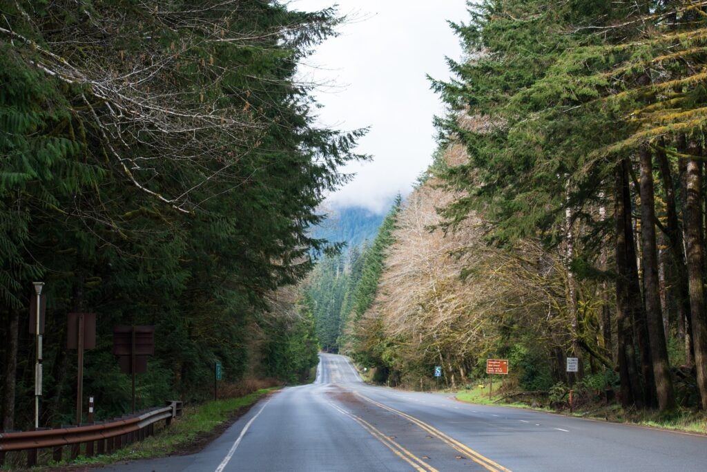
This segment spans the full length of Oregon’s coastline, moving from the forested headlands of the north coast to the rockier, more remote shores near Brookings. US-101 stays close to the ocean for much of the drive, though short inland stretches pass through farmland and forest. Roads are mostly two lanes with regular curves and elevation changes. Summer brings the most reliable conditions, though fog and wind remain common year-round. Spring and fall offer fewer visitors but more variable weather. Services are frequent near towns but thin out along the southern coast.
Quick Facts: Astoria to Brookings
| Total Distance | Approximately 340 miles |
| Estimated Drive Time | About 8 hours without stops |
| State Covered | Oregon |
| Main Highway | US-101 |
| Recommended Time | 4 days |
| Cell Service | Spotty outside towns |
| Reliable Fuel Stops | Astoria, Tillamook, Newport, Florence, Coos Bay, Gold Beach |
Travel Lighter with Lightship RV
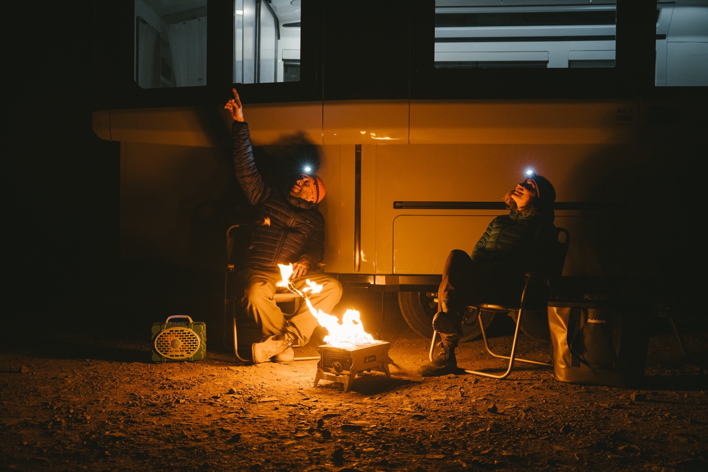
Planning an RV road trip? Lightship is rethinking what’s possible on the road. The all-electric, self-propelled Lightship AE.1 is designed with TrekDrive™ technology to help extend range and make longer routes feel more approachable, especially on winding roads like California’s Highway 1. It’s built for destinations that sit farther between charging or fuel stops, and for camping that feels quieter, lighter, and more connected to the places you’re exploring.
Day-by-Day Astoria to Brookings Itinerary
Day 1: Astoria to Nehalem Bay via Cannon Beach
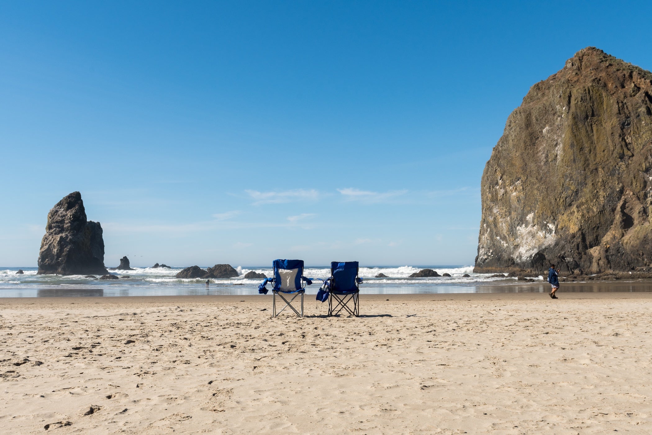
Plan for about 80 miles of driving today, though frequent stops make it an easy full day. Leave Astoria southbound on US-101 and reach Cannon Beach in under an hour. Haystack Rock dominates the shoreline and is best visited near low tide, when tide pools appear around its base. Ecola State Park, just north of town, provides short forest walks and elevated viewpoints overlooking the coast.
Continuing south, the road winds through forested headlands with occasional ocean pullouts. Stop at the Neahkahnie Mountain overlook north of Manzanita for a broad view of the coastline. By late afternoon, arrive at Nehalem Bay, where beaches stretch for miles along a sand spit between ocean and bay.
Overnight at Nehalem Bay State Park Campground. Campsites sit just behind the dunes with easy beach access and paved paths for walking or biking. Deer and elk are often seen near camp in the evening.
Day 2: Nehalem Bay to Newport via Tillamook and Depoe Bay
Today covers roughly 100 miles of coastline. Drive south into Tillamook for fuel and supplies before continuing along the Three Capes region. Cape Meares and Cape Kiwanda provide short walks to headlands and beaches, with the option to climb a steep dune for a wide view of the ocean.
Further south, pause in Depoe Bay, where gray whales are frequently spotted just offshore. A short walk along the seawall provides good vantage points. Continue toward Newport, stopping at Devil’s Punchbowl for a brief overlook of the collapsed sea cave.
Camp near Newport at Beverly Beach State Park Campground, which sits in a forested ravine with a pedestrian tunnel leading to the beach. South Beach State Park just south of town is a good alternative with easy access to Yaquina Bay and nearby attractions.
Day 3: Newport to Bandon via Cape Perpetua and the Oregon Dunes
This is one of the most varied days, with about 120 miles of driving. South of Newport, detour into the Cape Perpetua Scenic Area. The upper viewpoint provides the highest roadside overlook on the Oregon coast, while lower stops like Thor’s Well and Cook’s Chasm are accessible via short trails.
Continue toward Florence and pass the Sea Lion Caves before reaching the Oregon Dunes National Recreation Area. South of Florence, Jessie M. Honeyman Memorial State Park allows direct access to massive sand dunes and freshwater lakes. Coos Bay is the best resupply stop before heading farther south.
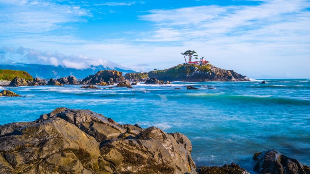
Overnight near Bandon at Bullards Beach State Park Campground. The campground sits near the Coquille River with access to a long, open beach and a short walk to the historic lighthouse.
If you’re looking for a quiet inland reset, consider detouring east from Florence toward Eugene and the McKenzie River corridor. River Bend County Park sits along the river with shaded sites and easy water access. It’s not coastal, but it offers a calmer forest setting if you want a break from wind and fog before returning to US-101.
Day 4: Bandon to Brookings via Samuel H. Boardman Corridor
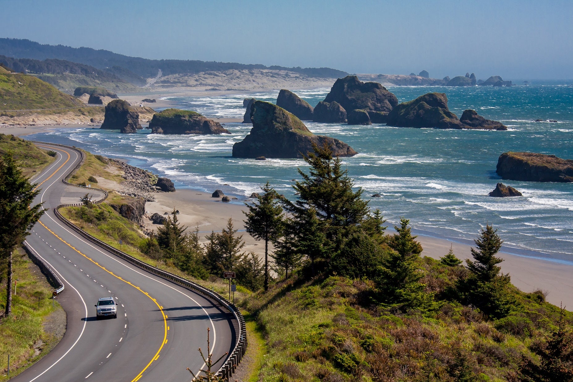
The final day covers about 60 miles, allowing time for frequent stops. South of Bandon, pause at coastal viewpoints near Port Orford before reaching Gold Beach. This town marks the start of the Samuel H. Boardman Scenic Corridor, one of the most dramatic sections of Oregon’s coast.
Numerous pullouts lead to short trails overlooking sea stacks, arches, and hidden coves. Natural Bridges is one of the most accessible stops and provides a clear view of rock formations carved by waves over time. Take your time here, as distances between pullouts are short.
Finish the segment at Harris Beach State Park Campground in Brookings. The campground sits above a rocky shoreline with tide pools and offshore sea stacks. It’s a natural stopping point before crossing into California.
Campgrounds to Consider Along This Segment
- Nehalem Bay State Park Campground is located on a long sand spit near Manzanita. Sites sit behind dunes with direct beach access and paved trails throughout the park.
- Beverly Beach State Park Campground provides forested sites close to Newport, with a pedestrian tunnel connecting camp to the ocean.
- South Beach State Park sits south of Newport near Yaquina Bay, offering large sites and access to biking and walking paths.
- Bullards Beach State Park Campground near Bandon combines river access, coastal hiking, and proximity to a historic lighthouse.
- Harris Beach State Park Campground in Brookings features rocky shoreline access and tide pooling opportunities near camp.
Top Things to Do Along the Oregon Coast Segment
Beaches, Headlands, and Short Hikes
Highlights include Haystack Rock at Cannon Beach, Cape Perpetua’s overlooks, and the pullout trails along the Samuel H. Boardman Corridor. Most stops require less than a mile of walking.
Historic and Educational Stops
Lighthouses such as Cape Meares, Yaquina Head, and Coquille River Lighthouse reflect the region’s maritime history. Museums in Astoria and Newport provide hands-on exhibits suitable for families.
Wildlife Viewing
Gray whales are often seen near Depoe Bay, while tide pools along the coast reveal sea stars, anemones, and small fish during low tides.
Practical Travel Tips for Astoria to Brookings
Weather can change quickly, so pack layers and rain protection year-round. Fuel is readily available in coastal towns but less frequently along the southern coast, so fill up in Gold Beach before continuing south. Tides affect beach access and safety, especially near sea stacks and tide pools. Cell service drops out frequently between towns, so download maps and campground details in advance. Oregon State Parks require parking permits for day use in some areas.
Additional Segments & Resources
This Crescent City-to-San Francisco guide is one part of the 19-day Pacific Coast Highway adventure. If you’re continuing onward, or if you started here in the middle, be sure to check out the other segment guides on The Dyrt for a complete picture:
- Segment 1: Olympic National Park, WA to Astoria, OR (4-day road trip)
- Segment 2: Astoria, OR to Brookings, OR (4-day road trip)
- Segment 3: Brookings, OR to San Francisco (4-day road trip)
- Segment 4: San Francisco, CA to Santa Barbara, CA (3-day road trip)
- Segment 5: Santa Barbara to San Diego (4-day road trip)
Safe travels and happy camping as you explore the Pacific Coast Highway!
The Dyrt is the only camping app with all of the public and private campgrounds, RV parks, and free camping locations in the United States. Download now for iOS and Android.Popular Articles:
Articles on The Dyrt Magazine may contain links to affiliate websites. The Dyrt receives an affiliate commission for any purchases made by using such links at no additional cost to you the consumer.