Campground photo 1
Campground photo 2
Campground photo 3

Top Dispersed Camping near Greenfield, CA

41 Reviews

Are you planning a dispersed camping trip to Greenfield? We've got you covered. With The Dyrt, it's easy to find peaceful dispersed camping near Greenfield. Search nearby dispersed campgrounds or find top-rated spots from other campers.

Best Dispersed Camping Sites Near Greenfield, CA (15)

  1. Camper-submitted photo from Keyesville Recreation Area Dispersed

    1.

    Keyesville Recreation Area Dispersed

    6 Reviews
    29 Photos
    173 Saves
    Lake Isabella, California

    Keysville (formerly Keyesville) is a historic mining area that offers a wide variety of recreational opportunities. Set in rolling terrain amidst a blue oak and foothill pine woodland, Keysville is dissected by the lower Kern River. A little exploration can turn up a wealth of historic resources, including a variety of mining structures and features, a historic fort, and the famous Walker Cabin. Keysville offers commercial and noncommercial white-water rafting opportunities as well as fishing, recreational gold panning, and dispersed camping. A network of over seventy miles of trails provides for mountain biking, equestrian, and motorized recreation use.

    Travel Responsibly - on designated roads and trails or in permitted areas

    Respect The Rights of Others - including private property owners and all recreational trail users, campers and others to allow them to enjoy their recreational activities undisturbed. Educate Yourself - by obtaining travel maps and regulations from public agencies, planning for your trip, taking recreation skills classes and knowing how to use and operate your equipment safely. Avoid Sensitive Areas - such as meadows, lakeshores, wetlands and streams, unless on designated routes. Do Your Part - by leaving the area better than you found it, properly disposing of waste, minimizing the use of fire, avoiding the spread of invasive species, restoring degraded areas and joining a local enthusiast organization.

    https://www.blm.gov/sites/blm.gov/files/documents/files/Keysville%20arch%20E%20low%20res.pdf

    • Pets
    • Fires
    • Phone Service
    • ADA Access
    • Dispersed
    • Trash
  2. Camper-submitted photo from Stine Cove Recreation Site

    2.

    Stine Cove Recreation Site

    11 Reviews
    26 Photos
    280 Saves
    Weldon, California

    POTENTIAL FIRE BANS - CHECK BEFORE CAMPING Last report - bans in effect til 11/2020 (reported 10/2020)

    Located on the east side of Lake Isabella off Sierra Way. Open camping; Free use area; Chemical toilets. No limit on trailer length. Open year round. Supplies at Kernville

    • Pets
    • Fires
    • Phone Service
    • Dispersed
    • Trash
    • Toilets
  3. Camper-submitted photo from Black Gulch South Dispersed Camping

    3.

    Black Gulch South Dispersed Camping

    1 Review
    2 Photos
    34 Saves
    Bodfish, California

    Campfire Permits required for campfires, barbeques, and camp stoves. Campfires and barbaques may be prohibited during fire restrictions, camp stoves allowed with current Califronia Campfrire Permit.

    • Dispersed
    • Trash
    • Toilets
  4. Camper-submitted photo from HWY 178 Pullout - Dispersed

    4.

    HWY 178 Pullout - Dispersed

    Be the first to review!
    9 Saves
    Bodfish, California

    Dispersed camping is camping outside of a designated campground. It is allowed in many areas of the Sequoia National Forest and Giant Sequoia National Monument.

    There are certain areas where dispersed camping is prohibited and these areas are posted.

    Dispersed camping is free but you must have a CAMPFIRE PERMIT. These can be obtained fore free at Readyforwildfire.org. Be aware of fire restrictions, typically enforced by mid-summer, banning open fires outside of designated campgrounds. More on campfire rules here.

    The maximum length of time you may camp in dispersed areas is 14 DAYS at a time and 30 DAYS in a year.

    Each year the number of people taking advantage of dispersed recreation opportunities has increased, making it more essential that these areas be left clean and undamaged.

    The following acts are PROHIBITED on the Sequoia National Forest and Giant Sequoia National Monument and are subject to a fine:

    1. Driving off designated roads inside the Monument.

    2. Leaving campfire unattended.

    3. Leaving trash buried, stashed or left in campfire ring. Abandoning or leaving personal property. PACK IT IN-PACK IT OUT.

    4. Cutting or otherwise damaging trees for use as a lean-to or a horse corral. Do not leave anything tied to trees.

    5. Destruction of government property such as signs, posters, gates, etc.

    6. Removing forest products without a permit.

    7. Discharging any firearm within 150 yards of any building, occupied area, across forest development roads, or body of water

    Here are some tips to appropriate dispersed camping: More information on dispersed camping here: https://www.fs.usda.gov/detail/sequoia/maps-pubs/?cid=fseprd883625

    • Dispersed
  5. Camper-submitted photo from Remington Hot Springs
  6. Camper-submitted photo from Black Gulch on Kern River
  7. Camper-submitted photo from Cottonwood Campground — Hungry Valley State Vehicular Recreation Area
  8. Camper-submitted photo from Los Padres NF - Dispersed Camp
  9. Camper-submitted photo from White River

    9.

    White River

    1 Review
    2 Photos
    13 Saves
    California Hot Springs, California

    Overview

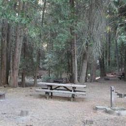
    The White River Campground sits in a stand of mature cedar along the banks of the White River at an altitude of 4,000 feet.

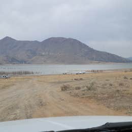
    The campgrounds are approximately 8 miles from the popular California Hot Springs.

    Recreation

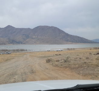
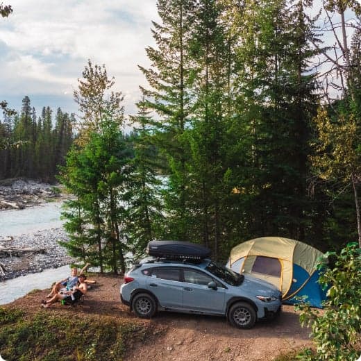
    Fishing and hiking, along with camp-side river wading, are popular pursuits. The river narrows to a creek-size width near the campgrounds.

    Facilities

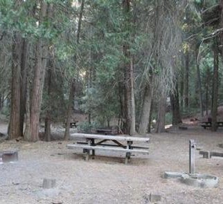
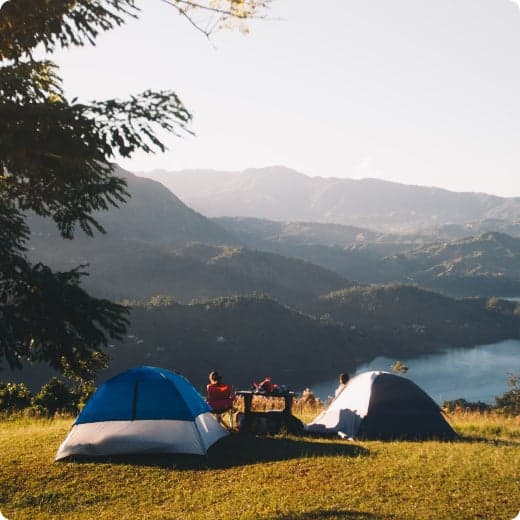
    This is a remote, tent-only site set back a distance from the road. Vault toilets, campfire rings and picnic areas are provided.

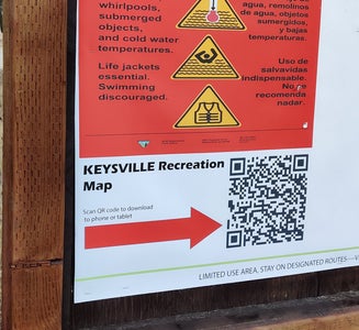
    This facility is operated by Sequoia Recreation, a division of California Land Management and comments are welcome; comment forms are available from campground hosts or online.

    Natural Features

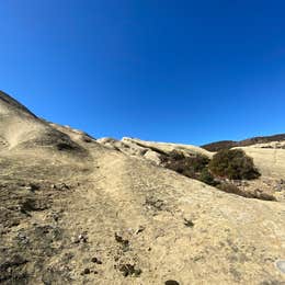
    The Sequoia National Forest, located at the southern end of the Sierra Nevada in central California, takes its name from the giant sequoia, the world's largest tree, which grows in more than 30 groves on the Forest's lower slopes.

    The Forest comprises about 1.1 million acres, and elevations range from about 1,000 to 12,000 feet, creating precipitous canyons and mountain streams with spectacular waterfalls such as Salmon Creek Falls and Grizzly Falls.

    Nearby Attractions

    Visitors enjoy exploring the nearby sequoia groves and hot springs.

    The Giant Sequoia Mercantile offers a wide variety of books, maps, gifts, local art, camping supplies and other merchandise.

    • Pets
    • Fires
    • Reservable
    • Dispersed
    • Trash
    • Picnic Table

    $26 - $34 / night

  10. Camper-submitted photo from Lane Ranch Campground — Hungry Valley State Vehicular Recreation Area

    10.

    Lane Ranch Campground — Hungry Valley State Vehicular Recreation Area

    Be the first to review!
    3 Saves
    Frazier Park, California

    Hungry Valley SVRA is the third largest unit of California State Park's Off-Highway Motor Vehicle Recreation Division. Located in the Tejon Pass north of Los Angeles and along the Interstate 5 corridor, Hungry Valley offers 19,000 acres and more than 130 miles of scenic trails for motorcycle, All-Terrain Vehicles (ATV), dune buggies, and 4x4 recreation. All levels of OHV operator skills will be challenged by the wide variety of terrain and trails at Hungry Valley SVRA.

    Elevations at Hungry Valley range from 3,000 to nearly 6,000 feet. Occasional snowfalls occur during the winter. Summers are most often hot, dry and dusty. The most pleasant times of the year for OHV fun are during the Spring and Fall months when the temperatures are mild and occasional rain showers make for good traction and reduced dust. Nighttime temperatures often drop below freezing in the Spring and Fall, as well as during the Winter.

    The wide variety of trails at Hungry Valley provides excitement for both beginner and experienced off-roaders. For experienced OHVers challenging trails can be found in the hills and sand washes of the back- country section of the SVRA. Beginners can enjoy the scenery and relative ease of the trails in the Native Grasslands Management Area. Trails in the adjoining Los Padres National Forest are recommended for experienced riders only.

    Recreational Land Management Providing long-term, sustained OHV recreation opportunity is a top priority in SVRA Management. Provisions in California law require actions to stabilize soils and to provide for healthy wildlife populations in OHV recreation areas. Projects are ongoing to stabilize soil areas by reshaping slopes, reseeding and replanting bare areas. Vegetation creates wildlife habitat while plant roots help stabilize the soil. Project areas are temporarily closed to OHV use through the use of barriers, such as fences, hay bales, brush piles and signing. Where possible, well-designed OHV trails are provided through project areas. Other project areas may be closed for a number of years before being opened again for OHV use. Your understanding and support in staying out of areas closed for restoration helps ensure OHV recreation opportunities for years to come.

    Where to get help The State Park Rangers who patrol Hungry Valley SVRA are peace officers, who are trained Emergency Medical Responders. Entrance station employees and park maintenance personnel can also summon medical help. If no State Park personnel are available, dial 911 from any telephone. Pay phones are located at many business locations in Gorman. Cellular telephone coverage is intermittent throughout most of the SVRA. There are no emergency medical facilities in Gorman. The nearest hospital to Hungry Valley SVRA is Henry Mayo Newhall Memorial Hospital, located approximately 30 miles to the south in Valencia. To drive to the hospital, take Interstate Highway 5 south to the McBean Parkway exit and turn left (east) on McBean Parkway. Henry Mayo Hospital is located approximately one mile from I-5 on the left-hand side at 23845 McBean Parkway.

    • Fires
    • RVs
    • Tents
    • Dispersed
    • Toilets
Showing results 1-10 of 15 campgrounds

Popular Camping Styles near Greenfield

Pet-friendly camping near Greenfield

Recent Dispersed Reviews In Greenfield

41 Reviews of 15 Greenfield Campgrounds