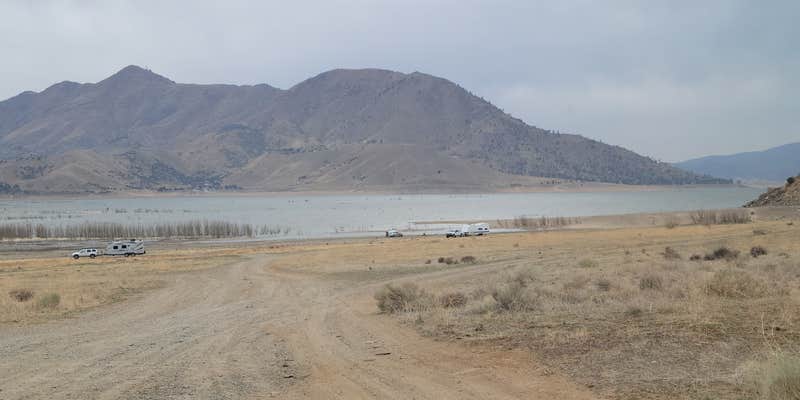
The open expanse along Lake Isabella's shoreline draws campers to this BLM-managed dispersed site, where gravel roads lead directly to camping spots just off the highway. Vidalia S. describes it as "free dispersed camping right off the highway, on the shore of Lake Isabella," with both grassy meadow areas for tents and flat gravel sections accommodating RVs of all sizes.
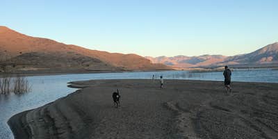
Lake levels fluctuate significantly due to dam repairs, creating an exposed beach environment that extends camping options but limits water activities. When water levels drop, areas that should be underwater become accessible camping terrain, though fishing becomes challenging as anglers must cast over exposed trees. The wide-open layout provides minimal privacy between sites but allows campers to spread out across the beach area and select spots based on their preferences for proximity to the water or road access.
Wildlife viewing opportunities include cattle that graze the area, plus eagles hunting ducks and pelicans gathering along the shoreline. Amber G. notes campers can "watch eagles prey on ducks, pelicans gather, hear the frogs croak" during their stay. The exposed location offers clear night sky views with minimal light pollution, though evening winds from the west can be strong enough to challenge tent setups.
Road access follows Sierra Way to the entrance, where vault toilets and dumpsters serve the camping area. Cell coverage varies by carrier, with T-Mobile providing reliable service while Verizon coverage proves spotty. The proximity to Highway 178 creates some traffic noise, and the exposed terrain offers little natural windbreak or shade beyond a few scattered trees.
Plan for windy conditions, especially during winter months, and bring your own firewood as none is available on-site.
Description
POTENTIAL FIRE BANS - CHECK BEFORE CAMPING Last report - bans in effect til 11/2020 (reported 10/2020)
Located on the east side of Lake Isabella off Sierra Way. Open camping; Free use area; Chemical toilets. No limit on trailer length. Open year round. Supplies at Kernville
RV Road Trip Guides


Map & DirectionsStine Cove Recreation Site is located in California near Kernville
Coordinates
35.678118934935284 N
118.40964061516493 W
Connectivity
 T-Mobile5GExcellent CoverageVerified by 37 usersLast on 7/23/26
 VerizonLTESome CoverageVerified by 4 usersLast on 7/23/26
- AT&T5GExcellent CoverageVerified by 2 usersLast on 6/4/26
Connectivity
- T-Mobile5GExcellent CoverageVerified by 37 usersLast on 7/23/26
- VerizonLTESome CoverageVerified by 4 usersLast on 7/23/26
- AT&T5GExcellent CoverageVerified by 2 usersLast on 6/4/26
Access
- Drive-InPark next to your site
- Walk-InPark in a lot, walk to your site.
Site Types
- Dispersed
Features
For Campers
- Trash
- Phone Service
- Toilets
- Alcohol
- Pets
- Fires
For Vehicles
- Big Rig Friendly
DISPERSED CAMPING
Enjoy dispersed camping on government land and leave no trace. Pack in and pack out. No (or limited) services at this camping area. Permit may be required.
PERMIT might be REQUIRED
We curate permit requirements across the US for our PRO members. Try PRO to see if Stine Cove Recreation Site needs a permit.
Drive Time
- 59 min from Bakersfield, CA
- 1 hr 56 min from Visalia, CA
- 2 hrs 4 min from Hanford, CA
- 2 hrs 44 min from Oxnard, CA


