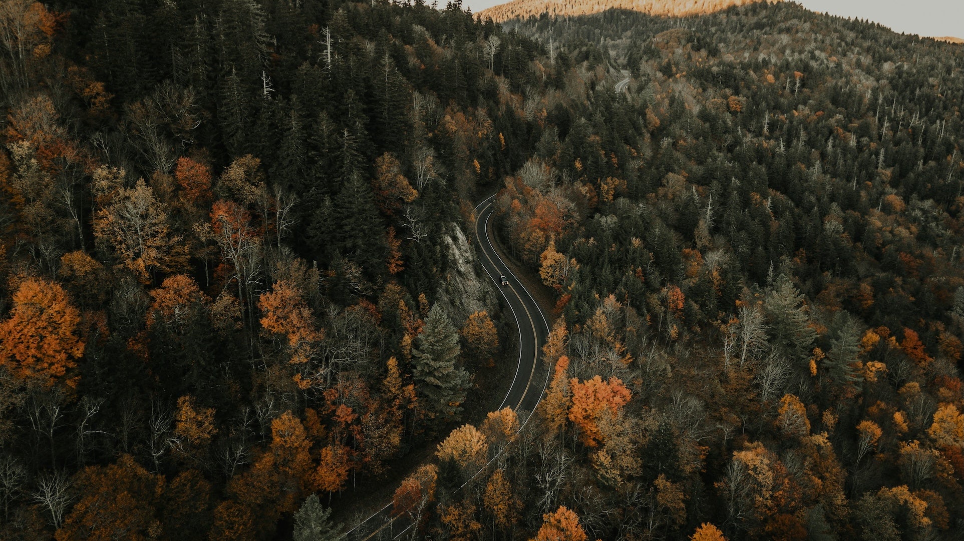
This 570-mile segment from Berea, KY to Yorktown, VA spans roughly nine hours of driving. A typical drive might start east from Berea (via I-75 N and I-64 E through Lexington and beyond) across Kentucky’s Appalachian foothills toward West Virginia, then continue on I-77 and I-81 through Virginia’s mountains and into the Piedmont, finally taking I-64 into Tidewater Virginia. Notable scenic stretches include the Daniel Boone National Forest and Red River Gorge (KY) and the Blue Ridge Parkway in Virginia, where a steep four-mile climb near Vesuvius (around 4,500 ft elevation) gives way to a long 45-mph descent to Afton. The Blue Ridge Parkway is maintained year-round but can close in winter for snow and ice.
Hazy mornings are common in spring and fall along the high country. Late spring through early fall is best for travel (wildflowers and full foliage) while winter should be avoided due to ice, fog, and parkway closures. Cell service is intermittent in forested areas – even Douthat State Park has spotty cell service. Plan fuel and supplies carefully in rural stretches, as gas stations are mostly in towns; hikers and wildlife abound, so watch for deer and black bears on winding roads.
Day-by-Day Itinerary
Day 1: Berea, KY to Breaks, VA (≈180 mi / 3½ hrs)
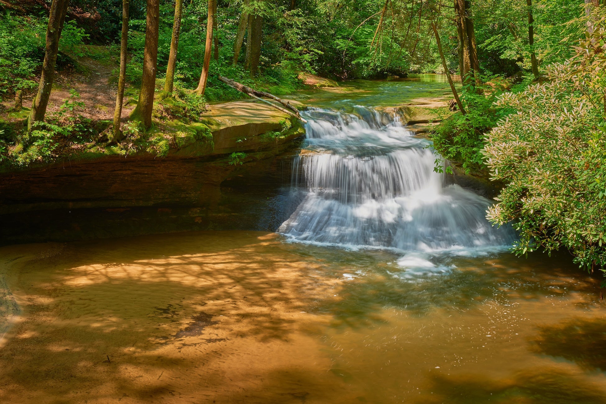
From Berea, head east into the Daniel Boone National Forest. A detour through Red River Gorge offers towering sandstone cliffs, natural arches, and forest trails – the Red River Gorge Campground near Stanton, KY, is tucked amid cliffs and praised for its hookups and clean facilities. After lunch (stop at one of the Gorge trailheads), continue via KY-15/KY-80 through Letcher County toward Virginia. Cross into Virginia near Elkhorn City and follow VA Route 80 to the Breaks Interstate Park (the “Grand Canyon of the South”). In the afternoon, hike into Breaks Canyon or relax on the lawn overlooking the gorge. The Breaks Interstate Park Campground has shady pull-through sites with full hookups and clean restrooms – campers rave about the sunsets over the canyon.
Day 2: Breaks, VA to Blacksburg/Christiansburg, VA (≈150 mi / 3 hrs)
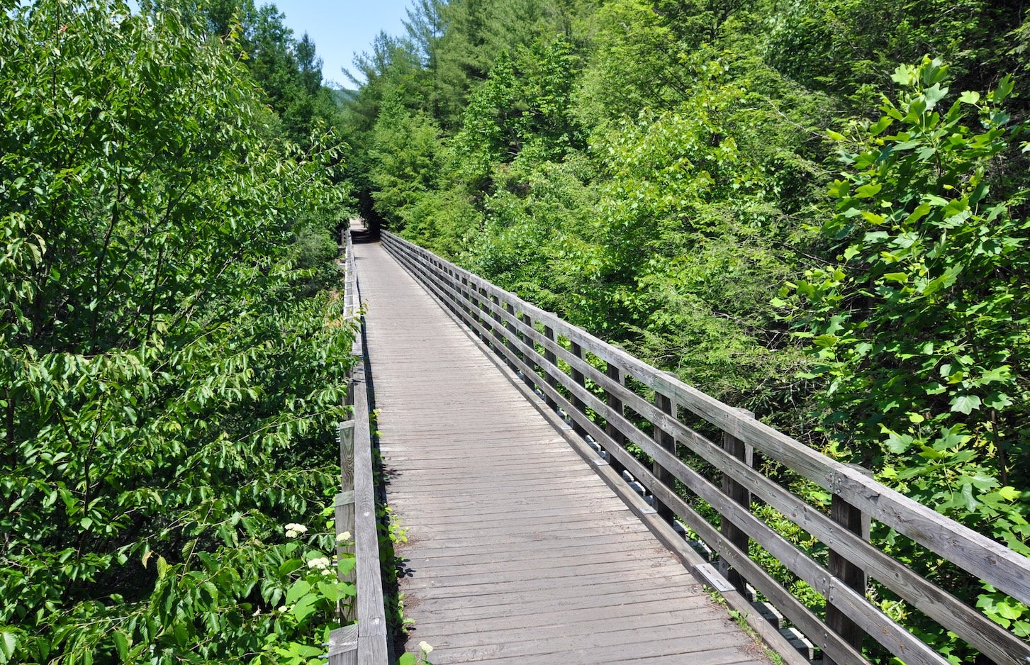
After a sunrise walk at Breaks, continue east on US-19/VA-80 toward Abingdon. You might detour briefly to see the small mining town of Pound or the Kentucky Coal Museum in Benham. In Virginia, consider a side trip along the Virginia Creeper Trail at Abingdon (a former railbed for biking/running). Then head north on I-77 to Wytheville and on VA-419 into the New River Valley. The afternoon could include a drive along scenic US-460 or a short hike in Jefferson National Forest (for example, find wildflower meadows at Price Mountain). End the day in the Christiansburg/Blacksburg area (Virginia Tech) with plenty of dining and lodging options.
Day 3: Blacksburg, VA to Charlottesville, VA (≈150 mi / 3 hrs)
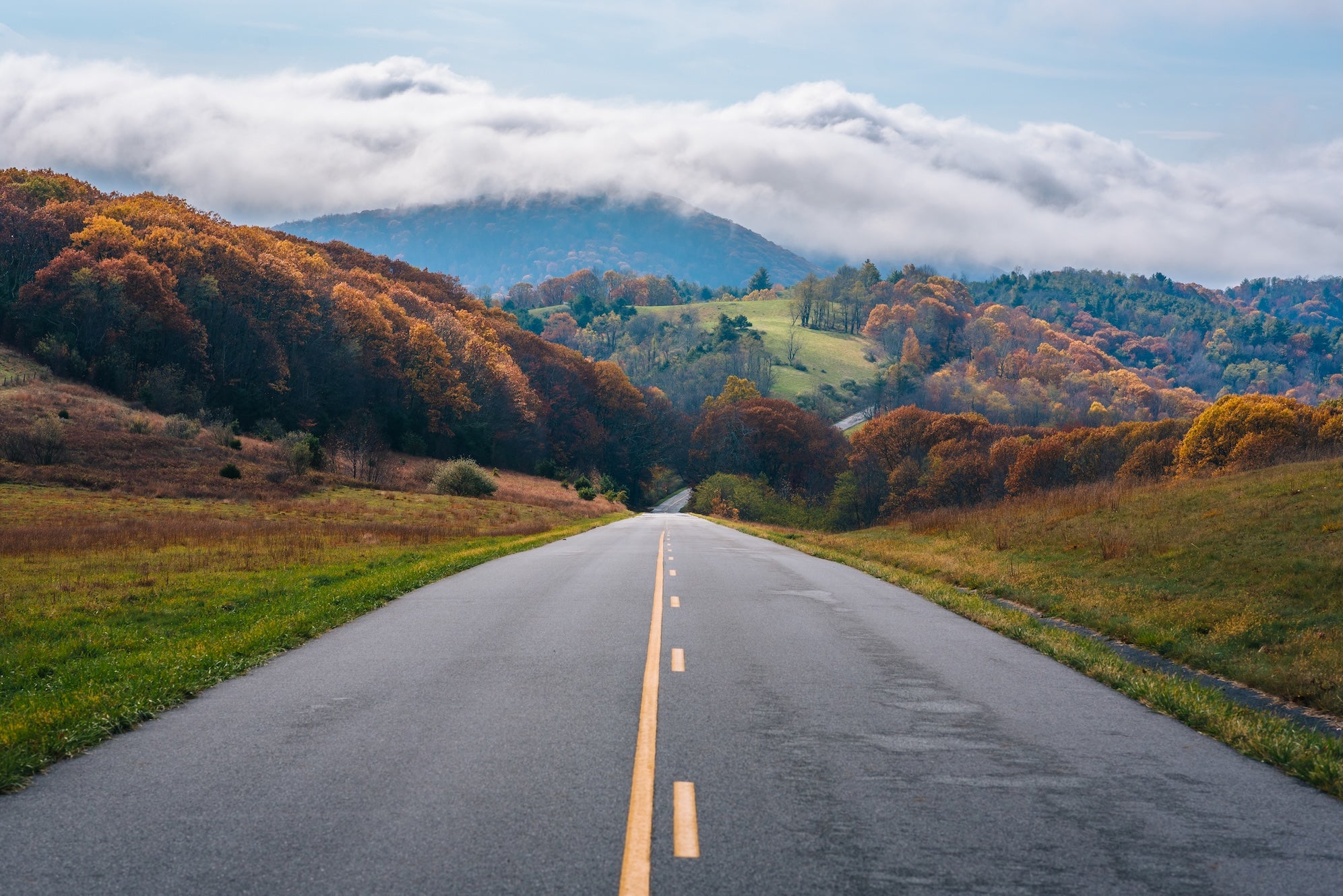
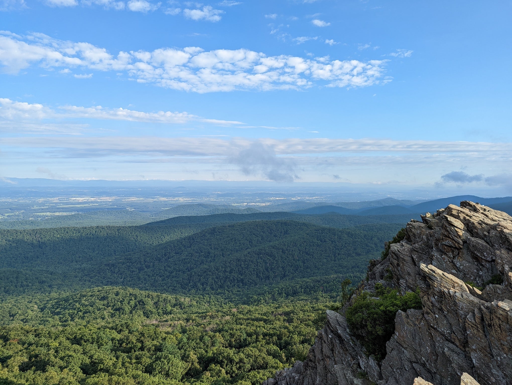
This day climbs into Virginia’s high country. Take US-460 east to pick up US-220 at Roanoke, then follow VA-42 north through rural farmland toward the Roaring Run or Crabtree Falls picnic areas. In the heart of the Blue Ridge, pick up the Blue Ridge Parkway at Afton (milepost 0). A favorite hike is the Humpback Rocks (just off the Parkway), or simply enjoy overlooks with the layered ridges stretching west. Descend to the Shenandoah Valley and head east on I-64 toward Charlottesville. Along I-64, you can detour to Monticello or Natural Bridge State Park if time allows. Otherwise, plan to reach the Albemarle County/Williamsburg region by evening.
Day 4: Charlottesville, VA to Yorktown, VA (≈140 mi / 2½ hrs)
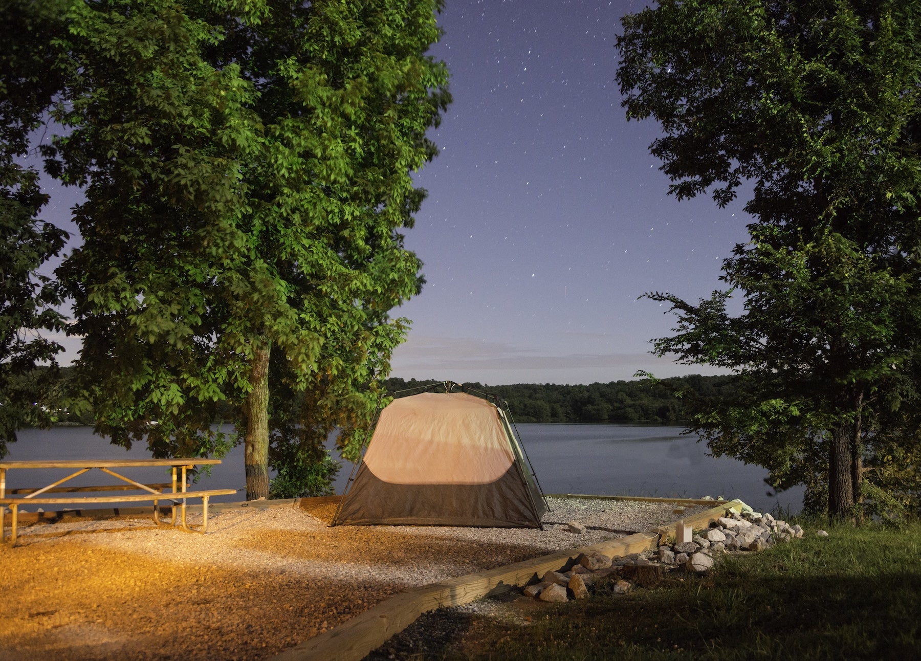
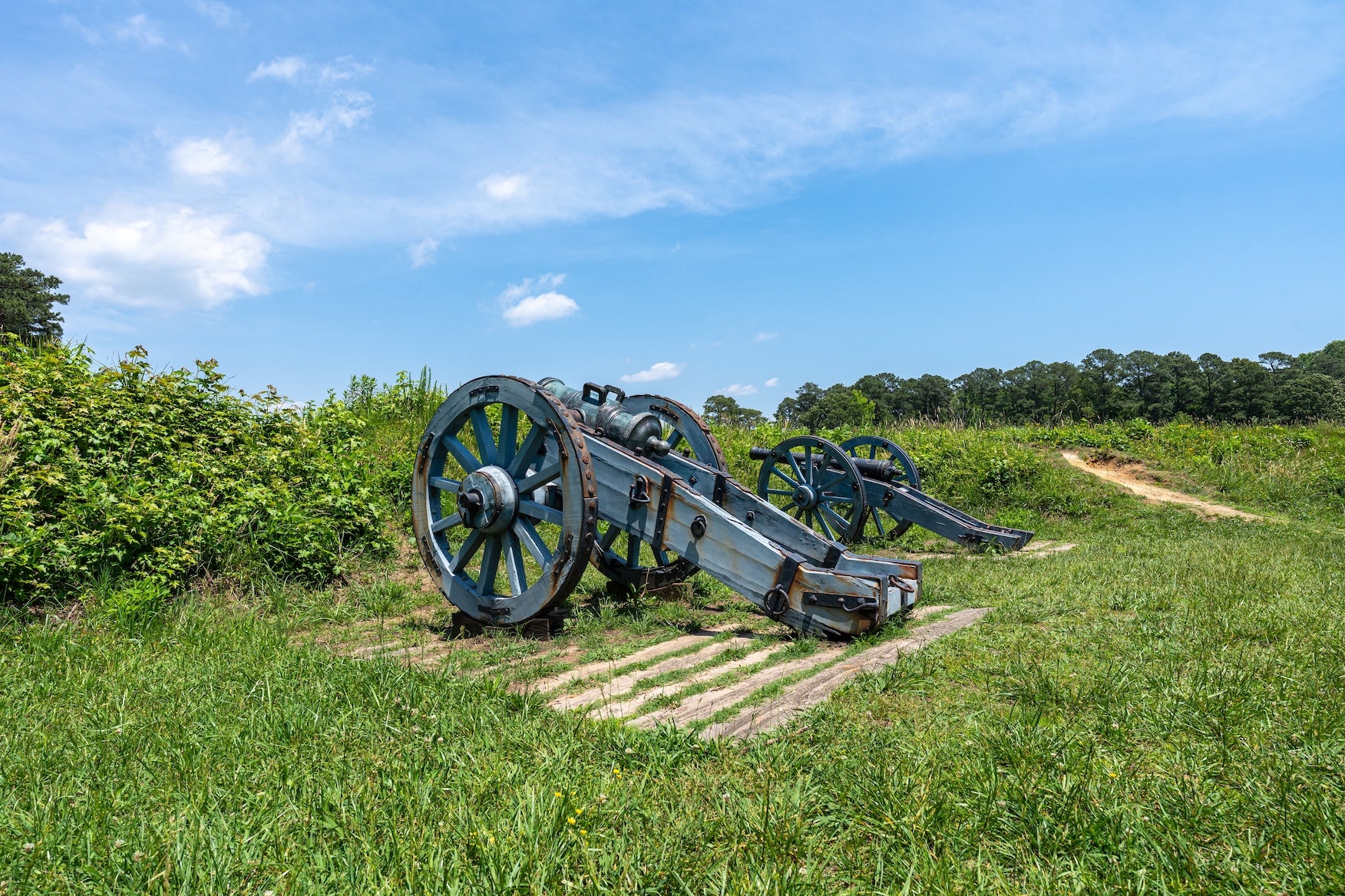
The final leg rolls east into Virginia’s coastal plain. From Charlottesville, take I-64 through Richmond (or US-250 via Goochland for a pastoral route) toward Williamsburg. Stop in Richmond if interested in the James River Park or Civil War sites. Near Williamsburg, pick up VA-199 or go directly south on I-64 to Jamestown/Yorktown. The journey ends in Colonial National Historical Park, where Washington and Lafayette forced Cornwallis’s surrender in 1781. Nearby Chickahominy Riverfront Park (above the James River) provides camping on Day 4; many sites are right on the river, with a pool and boat launch for summer fun. Its clean bathhouses and waterfront sites (with kayak launch) make it a relaxing final stop. In Yorktown, plan a walk on the Yorktown Battlefield and Colonial Parkway (23 miles linking Yorktown and Jamestown).
Campgrounds
- Breaks Interstate Park Campground (VA/KY border) – At the western edge of Virginia’s Appalachian plateau, this forest campground offers full-hookup RV sites under pine and maple. Reviewers praise the clean, heated bathhouse and friendly staff. Amenities include showers, drinking water, and playgrounds, and trails lead into dramatic Breaks Canyon. It’s just past the park office and is a great first- or second-night stop on this route.
- Chickahominy Riverfront Park (James City Co., VA) – A county park near Williamsburg, this campground sits at the confluence of Gordon Creek and the Chickahominy River. Waterfront RV sites have river views and direct kayak launches. Campers love the spotless, modern bathhouses and fenced swimming pool. With 100+ sites (waterfront and field), bike trails, boat ramps, a playground, and fishing piers, it’s an ideal base for visiting Colonial Williamsburg and Yorktown. Look for nesting ospreys or an early-morning boat parade on the river.
- Red River Gorge Campground (Slade, KY) – Nestled amid the Daniel Boone National Forest’s arches and cliffs, this rustic campground has electric and water hookups for both tents and RVs. Reviewers rave about its cleanliness and helpful hosts. Trails from the campground lead to famous landmarks like Natural Bridge and Star Gap Arch, making it ideal for hikers and climbers. The giant rock walls here frame backcountry campsites that feel remote, and cell service is generally nonexistent (download maps beforehand).
- Douthat State Park Campground (Millboro, VA) – In the Allegheny Mountains, this park campground has wooded sites (many level) with fire rings and picnic tables. Guests note the quiet lake beside the campground (rent a kayak or fish for stocked trout) and exceptionally clean bathhouses with hot showers. Hiking and biking trails abound, including an easy trail to Blue Suck Falls right from the campground loop. Families praise its playground and swim beach, and the park feels uncrowded even in summer.
- Carter Caves State Resort Park Campground (Olive Hill, KY) – Though slightly north of the main route, this state park in eastern Kentucky is worth a detour for its rare cave systems. The campground (for tents, RVs, and cabins) sits amid dense forest and gently rolling hills. Campers highlight the friendly rangers and spotless restrooms. Trails wind past rock gardens and caves named “Headache Rock” and “Cathedral,” and park tours explore dramatic underground chambers. Above ground, kids enjoy a playground, and families can picnic by creekside arch bridges.
- Claytor Lake State Park Campground (Dublin, VA) – Located on a large mountain lake just west of Blacksburg, Claytor Lake’s campground has 100+ sites (many back-in) with picnic tables and fire rings. Reviews praise the exceptionally clean restrooms and hot showers after a day on the water. The park’s hiking trails offer forest and lakeshore views, and the 4,500-acre lake is excellent for fishing, boating, or swimming. This park is especially popular with families (boat rentals and a marina are on-site). Although some campsites are open, most feel private among evergreens.
Attractions & Activities
This stretch is packed with mountain and coastal highlights. In Kentucky you’ll find world-class hiking at Red River Gorge and Cumberland Falls (the “Niagara of the South”). Daniel Boone National Forest trails climb red sandstone bluffs and rivers—don’t miss the Hellbender Bluffs overlook. In Virginia, explore the Appalachian Trail spurs and highland meadows around Grayson Highlands (wild ponies) and the picnic areas at Natural Tunnel State Park. The Blue Ridge Parkway (mile 0 at Afton to the south) and Skyline Drive (north of this segment) offer panoramic overlooks; the Parkway itself hosts spots like Humpback Rocks and Peaks of Otter. Water lovers can paddle the calm New River near Radford or the broad Claytor Lake at Dublin. Wildlife is abundant – keep an eye out for deer, black bears and bald eagles along river corridors.
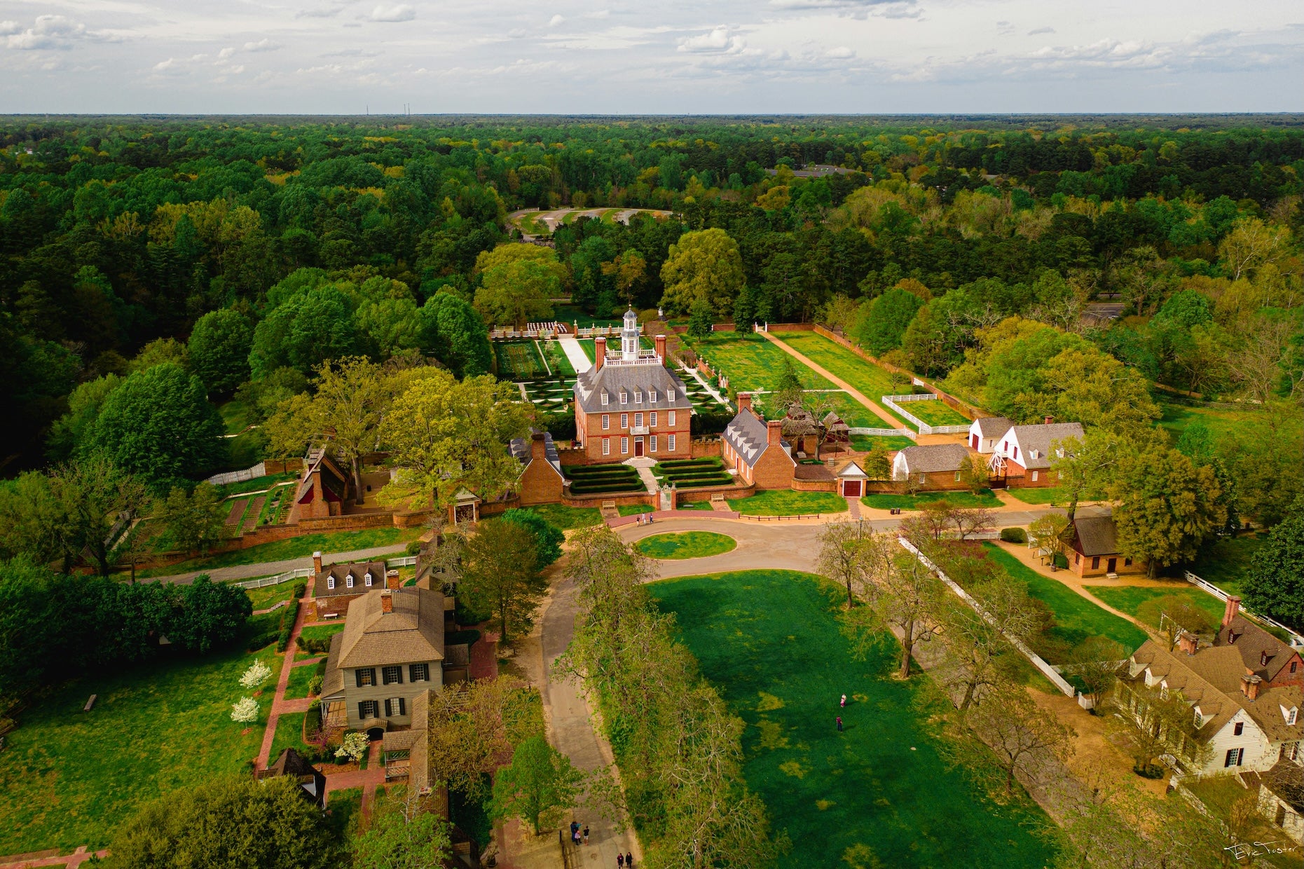
Culturally, this segment is rich in Appalachian heritage. Start in Berea (the “Folk Arts and Crafts Capital” of Kentucky) to visit galleries and traditional craft shops. In Southwest Virginia, towns like Abingdon and Floyd showcase Appalachian music and food, and the small coal towns near Breaks preserve mining history (the nearby Kentucky Coal Museum at Benham is one example). As you descend to Tidewater, Revolutionary War history takes over: Colonial Williamsburg (living-history museum) lies just south, and Yorktown Battlefield (NPS) marks where Cornwallis surrendered in 1781. The 23-mile Colonial Parkway is a scenic drive linking Yorktown to Jamestown, where America’s story began. Quirky side stops include Natural Bridge (a massive arch claimed by Thomas Jefferson) and Mabry Mill (historic gristmill on the Blue Ridge Parkway). Small attractions pepper the route: Lexington, VA’s American Shakespeare Center in Staunton, or the Old Silk Mill in Radford. And remember, the TransAmerica Trail’s Appalachian leg continues well beyond this guide – see our complete TransAmerica Trail overview for connections to Illinois and beyond, or consult the full TransAmerica Trail itinerary for plans on adjoining segments.
Practical Travel Tips
Plan ahead for spotty connectivity and sparse services. Much of eastern Kentucky and Southwest Virginia has limited cell coverage (for example, there’s virtually no signal at Douthat State Park). Download maps and print directions before leaving Wi-Fi areas. Fill up on gas when you can – the next station may be tens of miles away through the mountains. In late fall and winter be prepared for ice on forest roads; consult the Blue Ridge Parkway site for current closures. Wildlife hazards are real: deer and elk can leap onto mountain roads, especially at dawn and dusk, and black bears roam the highlands (store food in camps). Weather can shift quickly in the Appalachians – fog drifts into gaps, and afternoon thunderstorms are common in summer. Bring rain gear and layers, as temperatures can be 15–20°F cooler on mountaintops than in the valley. If visiting parks (like Breaks, Red River Gorge or Douthat) there are modest day-use fees or camping fees; bring cash or use online reservations ahead of peak season. Note that Colonial National Historical Park (Yorktown/Jamestown) charges admission for sites (though driving the parkway is free). In Virginia, speed limits drop on forest highways and parkways, so drive cautiously. With solid planning and a flexible schedule, this “Appalachian Mountains to Atlantic” stretch delivers both adventure and history at a relaxed pace.
The Dyrt is the only camping app with all of the public and private campgrounds, RV parks, and free camping locations in the United States. Download now for iOS and Android.Popular Articles:
Articles on The Dyrt Magazine may contain links to affiliate websites. The Dyrt receives an affiliate commission for any purchases made by using such links at no additional cost to you the consumer.