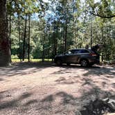
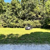
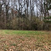
Boating and fishing draw most visitors to Chickahominy WMA, where a boat ramp at the end of the access road puts paddlers directly onto the Chickahominy River. The 5,217-acre property is heavily wooded, and camping areas consist of mowed grass pull-offs along the road, with no fire rings, picnic tables, or restrooms on site. No shade covers the main grassy sites. Verizon users report around two bars of cell signal. During hunting season, expect other users in the area, though Sundays are hunt-free. The road can get soft after rain, so check conditions before pulling off. Campers wanting developed facilities nearby can look at Chickahominy Wildlife Management Area Site (WMA) about a mile east, or browse campgrounds around Lightfoot for more options in the region.
Description
A new regulation (4VAC15-20-155) effective January 1, 2021 makes it unlawful to camp on Wildlife Management Areas (WMAs) without written authorization. Written authorization establishes a starting and ending date for each camping trip. In case of emergency, written authorizations also provide the Department with a list of campers who are expected to be occupying a WMA and who may need assistance.
The Chickahominy Wildlife Management Area is the only DWR management area in the coastal plain that consists mainly of woodlands and is managed primarily for upland wildlife rather than wetland species. This type of management, coupled with the area’s location along a major tidal river and creek, gives this Charles City County area a variety of habitat types that is unique to the Department’s Wildlife Management Area system. A sighting-in range located at the WMA provides hunters a place to hone their skills.
The management area gains its name from the Chickahominy River which forms the area’s eastern boundary. To the south, Morris Creek flows through the area and then along its southern boundary. Other smaller tidal creeks and marshy guts cut into the forests to provide additional wetland diversity. The upland, though mainly wooded with mixed hardwood and pine stands, also features cultivated, mowed and “old field” openings. The area’s 5,217 acres are contiguous although there are some interior, private properties. Nearly level, elevations range from about 25 to 50 feet.
Reservation Info
RV Road Trip Guides


Map & DirectionsChickahominy WMA is located in Virginia near Lightfoot
 Public Campground
Coordinates
37.3011588 N
76.89938128 W
Connectivity
 T-MobilePossible CoverageVerified by 23 usersLast on 10/23/26
 VerizonLTESome CoverageVerified by 1 userLast on 11/19/25
- AT&TLTESome CoverageVerified by 1 user
Connectivity
- T-MobilePossible CoverageVerified by 23 usersLast on 10/23/26
- VerizonLTESome CoverageVerified by 1 userLast on 11/19/25
- AT&TLTESome CoverageVerified by 1 user
Access
- Drive-InPark next to your site
Site Types
- Tent Sites
- RV Sites
- Standard (Tent/RV)
- Group
Features
For Campers
- ADA Access
- Phone Service
- Alcohol
- Pets
- Fires
For Vehicles
- Pull-Through Sites
FREE established camping
Enjoy camping on government land. Limited or no services at this camping area.
PERMIT might be REQUIRED
We curate permit requirements across the US for our PRO members. Try PRO to see if Chickahominy WMA needs a permit.
Drive Time
- 49 min from Richmond, VA
- 2 hrs 32 min from Lexington Park, MD