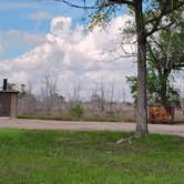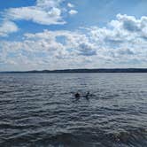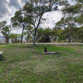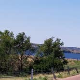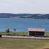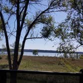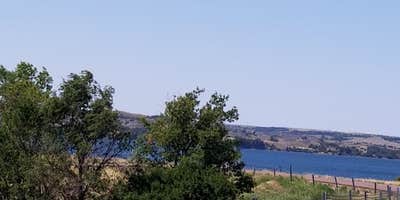
Fishing, swimming, and lake views draw campers to North Shore Recreation Area Army COE Campground, which sits on an embankment above Lake Sharpe near the Big Bend Dam. Most of the roughly 24 sites face the water, giving campers open sightlines over the reservoir. No hookups are available. Sites are gravel, generally level, and include fire rings and picnic tables, though not every site has both.
Direct water access from the sites is limited. A paved road leads to a round turnout at the southwest end of the park where campers with high-clearance vehicles can drive down, or anyone can walk, to reach a narrow beach suitable for swimming. The campground also allows boat-in access, making it a practical stop for those already out on Lake Sharpe. Nearby, Old Fort Thompson Road Dispersed — Sharpe Recreation Area and Left Tailrace provide additional options along this stretch of the Missouri River corridor.
Cleanliness is a recurring concern in reviews. Trash left by previous visitors, broken glass, and damaged fire pits have been noted across multiple visits, though the grass is regularly mowed and the Army Corps of Engineers does maintain the area. Biting flies are common, particularly in summer, and bug spray or a screen shelter is worth packing. Penelope G. notes there is "a pit toilet and trash can" on site, along with a small playground. Cell service is available. Fall visits tend to see lighter crowds and fewer insects.
Description
Map: https://www.nwo.usace.army.mil/Portals/23/siteimages/recreation/Sharpe.pdf
Lake Sharpe provides many opportunities for outdoor recreation. Recreation areas vary from primitive to highly developed areas like the Left Tailrace area located below the dam. Facilities at the Left Tailrace include campsites with electrical hookups, comfort stations with showers, a dump station, boat ramp, fish cleaning station, courtesy dock, picnic shelters, tables, grills, drinking water and playground.
Map & DirectionsNorth Shore Recreation Area Army COE Campground is located in South Dakota near Chamberlain
 Public Campground
Coordinates
44.06640707 N
99.47865597 W
Connectivity
 T-Mobile5GExcellent CoverageVerified by 16 usersLast on 10/23/26
- Verizon5GExcellent CoverageVerified by 1 userLast on 10/23/26
 AT&T5GGood Coverage
Connectivity
- T-Mobile5GExcellent CoverageVerified by 16 usersLast on 10/23/26
- Verizon5GExcellent CoverageVerified by 1 userLast on 10/23/26
- AT&T5GGood Coverage
Access
- Drive-InPark next to your site
- Boat-InSites accessible by watercraft.
Site Types
- Tent Sites
- RV Sites
- Standard (Tent/RV)
Features
For Campers
- Trash
- Picnic Table
- Phone Service
- Toilets
- Alcohol
- Pets
- Fires
For Vehicles
- Big Rig Friendly
Drive Time
- 2 hrs 21 min from Sioux Falls, SD
- 2 hrs 50 min from Rapid City, SD
- 3 hrs 23 min from Sioux City, IA
- 3 hrs 49 min from Bismarck, ND