This segment of Route 66 takes you from the banks of the Mississippi in St. Louis through Missouri’s Ozark hills, a brief dash across Kansas, and into the open plains of Oklahoma. Along these 500 miles, history and Americana are everywhere – limestone caverns turned tourist attractions, quaint downtowns with retro motels and murals, and roadside icons like giant sculptures and vintage gas pumps. You’ll trace both modern highways and preserved alignments of the Mother Road, experiencing a journey that blends natural cave wonders with classic Route 66 nostalgia. Plan for 3 to 4 days on the road to fully enjoy the caves, diners, small-town charms, and museums that make this heartland stretch of Route 66 special.”
| Total Distance | ~500 miles (805 km) |
| Drive Time | 8–9 hours (without stops) |
| States | Missouri, Kansas, Oklahoma |
| Key Routes | I-44 (modern Route 66 corridor), Historic US-66 side alignments |
| Recommended Duration | 3–4 days |
| Cell Service | Generally strong (spotty in rural Ozarks) |
| Fuel Stops | Frequent in towns; service plazas on toll turnpikes |
Route Overview
Modern Highways vs Historic Route: For most of this stretch, Interstate 44 parallels or overlaps old Route 66. You can often choose between the faster interstate or segments of the historic road that loop through small towns. Missouri’s portion has many well-marked Historic 66 alignments that feature unique stops (like old diners and a 1923 steel truss bridge at Devil’s Elbow). In Oklahoma, Route 66 largely follows OK-66 or service roads aside the turnpikes. Use I-44 when needed for efficiency, but don’t miss the signed detours where “Historic Route 66” veers off – they often lead to the classic downtowns, roadside attractions, and photo ops.
Geography and Terrain: Leaving St. Louis, the road enters the northern Ozarks – expect gentle, forested hills and limestone bluffs. The drive undulates past rivers and hollows, but elevations are modest (under 1,500 feet). Past Springfield, Missouri, the terrain evens out into prairie. By Oklahoma, you’ll notice broader plains and less tree cover. Road conditions are generally good, with the interstates smooth and two-lane historic sections well-maintained. Watch for occasional narrow bridges and reduced speed limits on the old road through small towns.
Major Landmarks: This segment is filled with Route 66 icons. Missouri brings you Meramec Caverns – a famous cavern system advertised on barn roofs for decades – and kitschy stops like the world’s former largest rocking chair in Fanning. Small towns such as Cuba, MO proudly display colorful murals recounting Route 66 history. In Kansas (only 13 miles of Route 66!), you’ll find restored 1930s era service stations and the last remaining Marsh Arch “Rainbow Bridge” in Riverton. Oklahoma’s stretch features gems like the Blue Whale of Catoosa (a giant smiling whale sculpture by a pond) and art-deco architecture in Tulsa. Near Oklahoma City, keep an eye out for segments of original Portland concrete pavement from the 1930s still visible along side roads.
Road Notes: In Oklahoma, I-44 becomes the Will Rogers Turnpike (from the Missouri border to Tulsa) and Turner Turnpike (Tulsa to Oklahoma City). These are toll roads – you can pay cash at plazas, or they accept PikePass. Services on the turnpikes are limited to service plazas (like the famous glass-arch McDonald’s at Vinita over I-44). If you prefer to avoid tolls, Old 66 (now OK-66) is accessible but will add time. Cell coverage is solid along interstates and around towns, but some rural bypasses in the Ozarks and remote stretches near the MO/KS border may have spotty reception. There are no especially long gaps between gas stations on this segment; nonetheless, it’s wise to top off in larger towns like Springfield or Tulsa before heading into more sparsely populated stretches.
Itinerary: Day-by-Day Highlights
Day 1 – St. Louis, MO to Onondaga Cave State Park (Leasburg, MO)
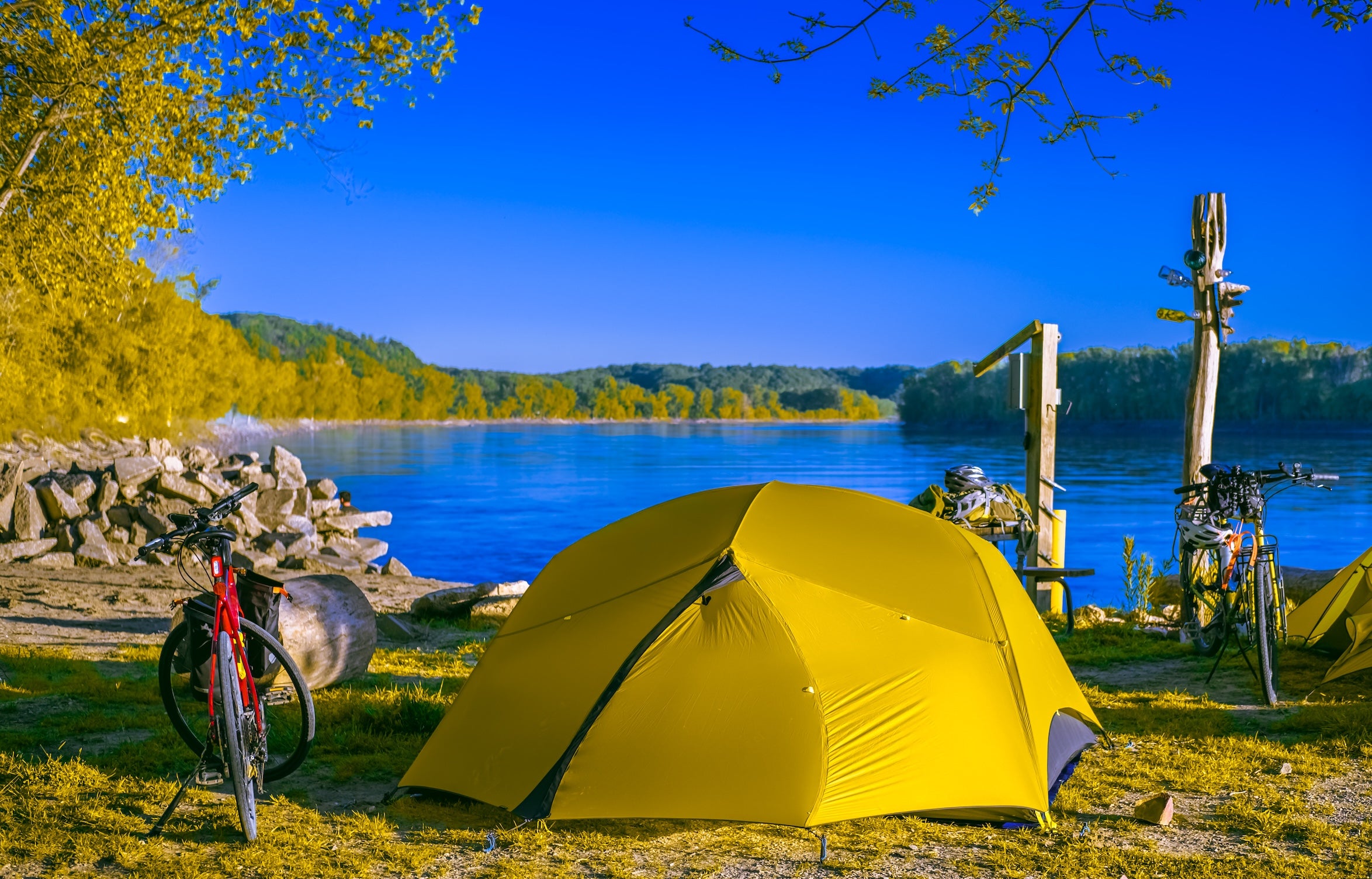
Morning (St. Louis to Sullivan, MO – ~60 miles): Begin in St. Louis and pick up Route 66 heading west. As you leave the city, you might detour to Route 66 State Park in Eureka, just off I-44. This park at the site of old Times Beach has a small museum of Route 66 memorabilia and offers a first taste of the Mother Road’s history. Continuing on, you’ll pass Six Flags St. Louis and then arrive near Sullivan. Just beyond Sullivan at Stanton is the turnoff for Meramec Caverns, a legendary tourist stop since the 1930s. If you have time, take a guided cave tour (1.5 hours) to see massive mineral formations and learn about the cave’s use as a Jesse James hideout. The cave stays a cool 58°F year-round; a welcome break on a hot day. There’s also a retro feel here – billboards for Meramec Caverns have dotted highways for miles, and the on-site zipline, candy shop, and canoe rentals capture old-school roadside fun. Meramec Caverns even offers a campground and RV park within walking distance of the cave tours for those who want an early stop.
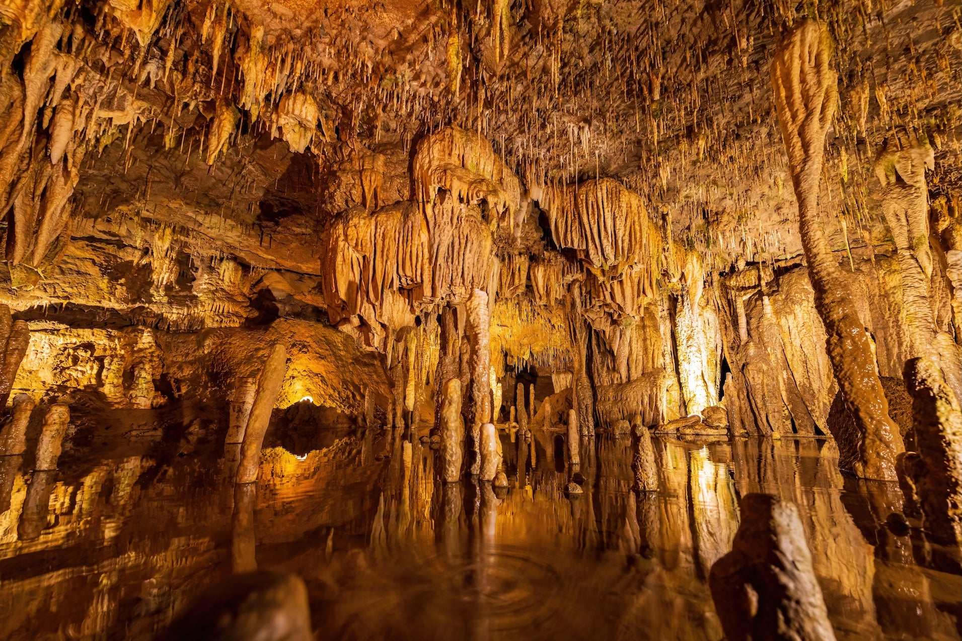
Interior view of the Meramec Caverns
Afternoon (Sullivan to Leasburg, MO – ~20 miles): Continue through rolling wooded hills toward Cuba, Missouri. In Cuba’s downtown, stretch your legs on the Route 66 Mural City tour – colorful murals on brick buildings depict local history and famous visitors. Don’t miss the giant vintage Wagon Wheel Motel neon sign, one of the oldest continuously operating motels on Route 66 (est. 1936). After a bite of Missouri barbecue or a slice of pie at Missouri Hick Bar-B-Que, head on west. Near Leasburg, you’ll reach Onondaga Cave State Park, your destination for tonight. Set up camp at the park’s shaded campground amid oak and hickory trees. Campers consistently praise this park for its clean facilities and level sites. If you arrive by mid-afternoon, catch an Onondaga Cave tour before closing time (tours offered daily April–October, last tour ~3:30pm). The 1.25-hour guided walk showcases impressive cave formations like the massive flowstone called The King’s Canopy. In the evening, enjoy a peaceful night by the campfire. The park is along the Meramec River, so you might hear owls and crickets – a tranquil end to Day 1.
Campground: Onondaga Cave State Park Campground – Full-service campground with showers, electric sites, and a riverside location inside the state park. It’s well-reviewed for its cave tours and shady, spacious campsites. *Note:* Grocery and fuel are available in the town of Sullivan (15 miles east), so stock up before settling in.
Day 2 – Leasburg, MO to Carthage/Joplin, MO
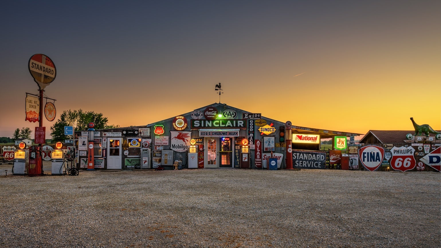
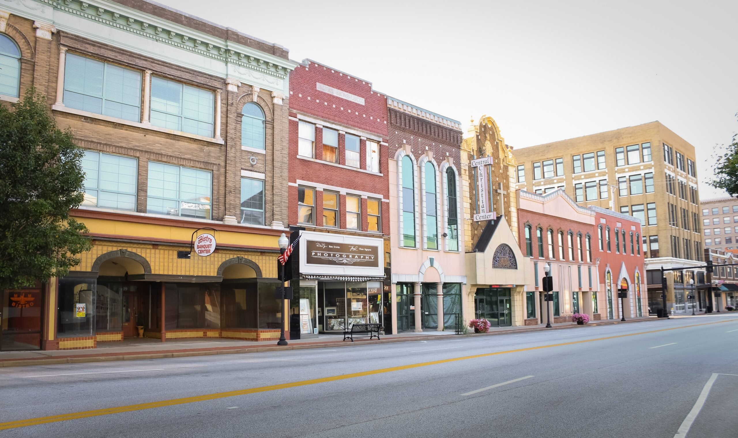
Morning (Leasburg to Springfield, MO – ~140 miles): Start early and enjoy the morning mist in the Ozarks as you drive west. Consider a detour through Devil’s Elbow along old Route 66 east of Waynesville – this winding old alignment leads to a historic green truss bridge spanning the Big Piney River, with high bluffs looming above. It’s a beautiful snapshot of 1940s-era Route 66 engineering and scenery. Back on I-44, roll into Lebanon, Missouri by late morning. Lebanon’s Route 66 Museum (inside the local library) is a free little museum worth a quick stop – it’s packed with vintage neon signs, gas pumps, and even a recreated 1950s diner booth. Kids and nostalgic adults alike enjoy it. Next, as you approach Springfield, you’ll pass the roadside relic Gary’s Gay Parita (at Paris Springs Junction on old 66) – a lovingly restored 1930s Sinclair gas station turned photo stop. It’s often open with a local greeter ready to chat about Route 66. In Springfield (known as the “Birthplace of Route 66”), grab lunch. You might seek out the original Steak ‘n Shake or George’s Restaurant for some classic diner fare. Springfield has plenty of services if you need supplies or an RV dump station. Before leaving town, check out Park Central Square downtown – a plaque here commemorates the city as the place where Route 66 got its name in 1926.
Afternoon (Springfield to Carthage/Joplin, MO – ~70 miles): West of Springfield, I-44 roughly follows old Route 66 through towns like Halltown and Paris Springs. If you’re eager for some quirky stops, look out for the World’s Largest Rocking Chair at Fanning (back near Cuba) if you missed it, or closer now, Uranus, Missouri – a kitschy “town” themed around a humorous name, complete with a fudge factory and sideshow museum (it’s just east of St. Robert, which you passed earlier, so only if you backtrack). Continuing west, plan a stop in Carthage, Missouri. Carthage’s town square features a stunning 19th-century Jasper County courthouse – worth a photo. Route 66 travelers also flock to the 66 Drive-In Theatre on the outskirts of Carthage (if it’s a summer weekend, you could catch a movie under the stars here). Also in Carthage is the historic Boots Court Motel, a 1939 art deco motel famously visited by Clark Gable – it’s being restored and is an option if you want a non-camping night in retro style. By late afternoon, you’ll reach Joplin, Missouri, which sits on the Missouri-Kansas border. Joplin has a vibrant Main Street with murals celebrating Route 66 and plenty of dining options for dinner. For an old-school experience, try Woody’s Smokehouse or Joplin Avenue Coffee Company for a pick-me-up. Tonight, camp either in Joplin or just beyond in Kansas or Oklahoma (depending on how far you want to push).
Campground: Camp Mi Casa on the Route RV Park – A convenient overnight just outside Carthage/Joplin, located right off Historic Route 66. This small private campground offers full hookups, tent spots, a pool, and a very clean bathhouse. It’s a relaxing spot to unwind after a long day, with friendly owners and even an outdoor movie screen for summer nights. *Alternate Camp:* For a rustic option, Baxter Springs Riverside Park in Kansas (about 15 miles past Joplin) offers inexpensive tent and RV camping under shady trees by the Spring River. It’s basic but scenic, and puts you closer to tomorrow’s attractions in Kansas.
Day 3 – Joplin, MO to Tulsa, OK
Morning (Joplin to Tulsa, via Kansas – ~110 miles): Say goodbye to Missouri and hello to Kansas – albeit briefly. Just west of Joplin, Route 66 clips the southeast corner of Kansas for 13 miles, but it’s a memorable stretch. In Galena, KS, stop at Cars on the Route, a restored Kan-O-Tex service station now a diner/gift shop. Out front you’ll find “Tow Tater,” a rusty tow truck that inspired Tow Mater from the movie *Cars*. Snap a fun photo and maybe grab a cold drink. A few blocks away, Galena’s Main Street has an antique storefront feel – check out the 1920s gas station at Front and Main (now a coffee shop) and some outdoor public art installations. Heading west, you’ll pass the small town of Riverton – don’t miss Eisler Brothers Old Riverton Store, a 1925 grocery and deli that’s been serving Route 66 travelers forever. It’s a great place to pick up a picnic lunch or some homemade fudge. Just beyond, take a short detour onto the original 1923 alignment to see the Rainbow Bridge over Brush Creek. This graceful white concrete arch bridge is the last of its kind on Route 66, a beautiful survivor of early road architecture. From here, continue into Baxter Springs, KS, a historic cow-town and the site of an 1863 Civil War battle. The Baxter Springs Heritage Center Museum (if open in the morning) has exhibits on local history and Route 66 – worth a quick walkthrough for history buffs.
Afternoon (Kansas state line to Tulsa, OK – ~90 miles): Cross into Oklahoma at Quapaw and note the welcome sign – Oklahoma boasts the longest stretch of Route 66. The road (now OK-66) leads through a series of small towns in former Quapaw tribal lands. In Miami, OK (pronounced “My-am-uh”), check out the elegant 1929 Coleman Theater downtown. Even if you just admire its Spanish colonial facade from outside, it’s a highlight of Miami’s Main Street. Grab lunch at Waylan’s Ku-Ku Burger in Miami – a vintage drive-in with a giant cuckoo bird sign – or save your appetite for Clanton’s Cafe in Vinita a bit further (famous for its chicken-fried steak, featured on TV). As you drive through Afton and Vinita, notice the landscape opening up; you’re leaving the hills behind. Just past Vinita on the turnpike, you’ll go under the huge arch of the Vinita Service Plaza – once billed as the world’s largest McDonald’s spanning a highway. In Chelsea, an old 1926 prairie-style Phillips 66 gas station still stands (now a cute tourism office). A worthwhile detour about 4 miles off-route at Foyil is Totem Pole Park, where the late Ed Galloway built a 90-foot concrete totem pole in 1948, whimsically painted and surrounded by other folk art totems. It’s a bizarre and wonderful roadside folk art stop – free and open sunrise to sunset. Back on Route 66, continue toward Catoosa.
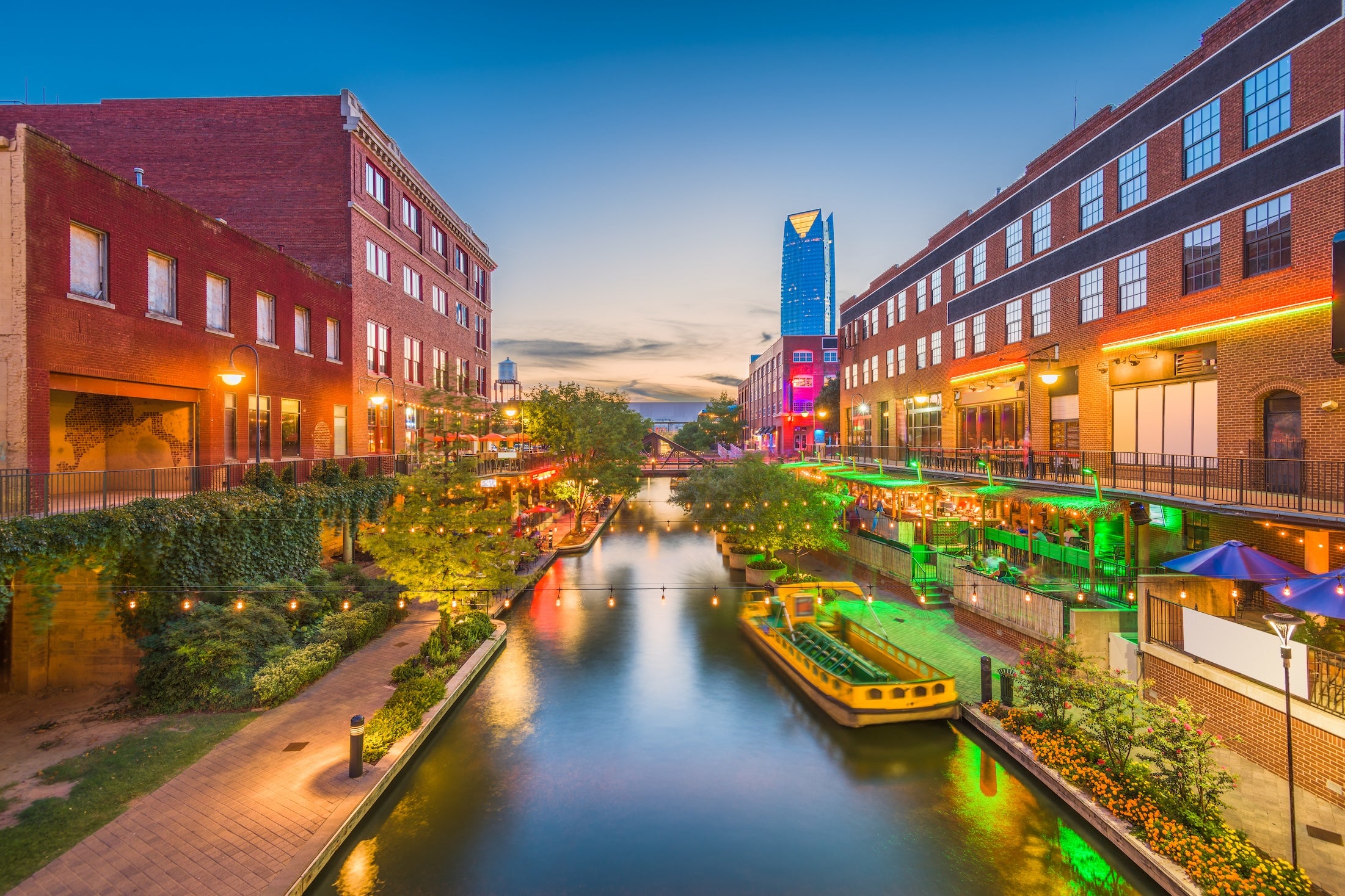
Late Afternoon (Catoosa to Tulsa – ~20 miles): One of the Mother Road’s most iconic, whimsical landmarks awaits in Catoosa, OK: the Blue Whale of Catoosa. This big bright-blue concrete whale has grinned at Route 66 travelers since 1972, when it was built as a swimming hole attraction. You can’t swim there today, but you can walk out onto the whale’s tail and feed the fish in the pond. Normally it’s a great picnic spot with a small gift shop. *(Note: As of late 2025, the Blue Whale park is undergoing renovations – including a new visitor center and repairs to the whale – with plans to reopen by summer 2026. If the park is still closed when you visit, you can view the whale from the fence and buy Blue Whale souvenirs at the nearby D.W. Correll Museum.)* From Catoosa it’s a short jaunt into Tulsa, Oklahoma, a vibrant city that Route 66 threads right through. As you enter Tulsa on 11th Street, you’ll notice neon signs for classic establishments like the restored Meadow Gold sign and vintage lodging like the Campbell Hotel. Tulsa is known for its art deco architecture – consider a quick drive through downtown to see gems like the Boston Avenue Methodist Church or Philcade Building in their 1920s glory. You might also swing by the outside of the Route 66 Historical Village in west Tulsa (an outdoor display with a giant oil derrick and train engine marking Tulsa’s oil-boom heritage). Tonight, Tulsa offers plenty of dining: try Tally’s Cafe on Route 66 for a hearty chicken fried steak and a dose of 1950s diner atmosphere, or head to the Mother Road Market – a food hall celebrating Tulsa’s modern foodie scene right on 11th St. (Route 66). Enjoy a well-earned city meal and maybe some live music in the Tulsa Arts District if it’s a weekend.
Campground: Twin Bridges Area at Grand Lake State Park – If you’d rather not stay in the city, this Oklahoma state park (about 30 minutes northeast of Catoosa, near Miami OK) offers a peaceful natural setting. It’s along the Neosho and Spring rivers and has 160+ campsites, fishing docks, and showers. It’s a detour back northeast, best used if you stopped earlier in the day and didn’t make it to Tulsa yet. Otherwise, around Tulsa itself you’ll mostly find RV parks. One option just west of Tulsa along Route 66 is Route 66 RV Park in Sapulpa – a simple, clean RV park with full hookups. For more nature, consider Keystone State Park (20 miles west of Tulsa) which sits on Keystone Lake and has both RV and tent sites, hiking trails, and lake views.
Day 4 – Tulsa, OK to Oklahoma City, OK
Morning (Tulsa to Chandler, OK – ~85 miles): Get an early start out of Tulsa to beat city traffic. West of Tulsa, Route 66 (OK-66) closely parallels the Turner Turnpike (I-44). You can decide to hop on the turnpike for a quicker drive (about 1 hour 45 minutes to OKC) or enjoy the quieter two-lane Route 66 which passes through a string of small towns. One must-stop in either case is Stroud, OK, roughly midway. In Stroud, treat yourself to a meal or slice of pie at the historic Rock Café, a Route 66 icon since 1939. The Rock Café’s owner was the inspiration for the character Sally in Pixar’s *Cars*. The café is known for its hearty breakfasts and “alligator burger” specialty. After Stroud, head toward Chandler. Just east of Chandler, you’ll find the scenic Bell Cow Lake – if you didn’t camp there, it’s still a nice detour for a lakeside view or short walk. In Chandler itself, the Route 66 Interpretive Center is a modern museum housed in a retro armory building – it features multimedia exhibits and even a small vintage-style theater where you can relax in classic car seats and watch short films about the Mother Road. It’s a low-key stop but educational and fun if time permits. Chandler also has several old service stations and a beautifully restored *Phillips 66 cottage-style* gas station (now a museum office) worth seeing for architecture buffs.
Afternoon (Chandler to Oklahoma City, OK – ~45 miles): The final leg into Oklahoma City is short, but there are a couple of classic Route 66 stops to catch. In Arcadia, OK, look for the round red barn just north of Route 66. The Arcadia Round Barn (built in 1898) is a peculiar and famous landmark – a perfectly round wooden barn that’s been restored and now serves as a museum and gift shop. You can go inside the upper loft to appreciate its unbelievable construction and acoustics. It’s open daily and runs on donations. Just down the road in Arcadia is POPS Soda Ranch, a modern attraction where a gigantic 66-foot soda bottle sculpture marks a gas station/diner that sells over 700 flavors of soda. It’s a great place for a quirky photo and to stock up on cold drinks or grab a quick lunch in the diner. From Arcadia, continue through the suburb of Edmond into Oklahoma City. As you enter Oklahoma City on 66 (which becomes NE 23rd Street), you’ll pass the tiny 1930 *Milk Bottle Grocery* – a little building with a giant milk bottle on top, another fun photo op. Congratulations, you’ve made it to Oklahoma City, the endpoint of this segment!
Evening (Oklahoma City): This road trip segment ends here, so you can choose how to wrap up. Oklahoma City offers a wealth of attractions if you plan to stay: the National Cowboy & Western Heritage Museum, Bricktown Canal district for dining, or the Oklahoma City National Memorial are popular options. If you’re continuing westward on Route 66, you might resupply in OKC – it’s a major city with all services. For campers, there are a few campgrounds on the outskirts; one convenient choice is Arcadia Lake (east side of the city, back by Arcadia) which has multiple camp areas on the lake and lets you enjoy a last night under the stars while still only 20 minutes from downtown. Alternatively, drive ~45 minutes west (slightly beyond OKC) to Red Rock Canyon Adventure Park in Hinton, OK. This unique park – formerly a state park – nestles campsites at the base of red sandstone cliffs and is noted for its short hikes and rock climbing. It’s a bit past OKC, but it positions you well if you’ll head on towards Texas the next day. Red Rock’s beautiful canyon campsites and shady cottonwood trees make it a favorite stopover for Route 66 travelers.
Activities and Attractions
Natural Highlights
- Meramec Caverns (Stanton, MO): A vast cave system in the Ozarks, famously advertised as Jesse James’ hideout. Guided tours (~1.5 hours) run year-round; temperatures inside are ~58°F. There’s an on-site zipline, canoe rentals on the Meramec River, and a campground. Expect tour fees around $25 for adults. Arrive early in peak summer as tours can fill up.
- Onondaga Cave State Park (Leasburg, MO): Missouri’s “cave state” shines here. Onondaga Cave is a National Natural Landmark featuring dripping stalactites and reflective pools. Daily tours April–Oct (about $23 for adults) cover a well-lit 0.75-mile path inside the cave. Above ground, the park has hiking trails and Meramec River access for fishing or paddling. The Oak Ridge Trail offers a mild 1.5-mile hike with river views.
- Devil’s Elbow (Pulaski County, MO): A scenic bend in the Big Piney River framed by tall bluffs and pine trees. An old Route 66 steel truss bridge from 1923 still spans the river here. Picnic by the water or take in the panorama from a hillside overlook on Timber Ridge. It’s especially pretty in autumn when the forest turns golden.
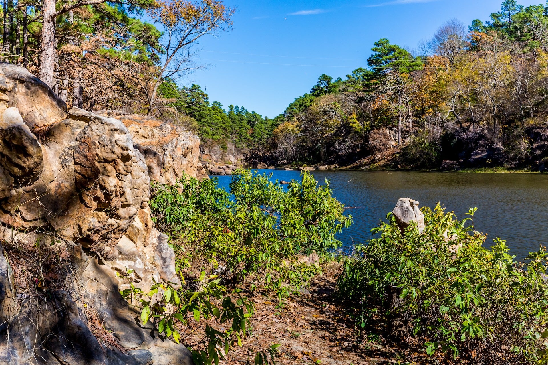
- Twin Bridges State Park (near Fairland, OK): A quiet park on the north end of Grand Lake o’ the Cherokees, named for the pair of river bridges at its entrance. Even if you don’t camp here, it’s a pleasant natural stop in northeastern Oklahoma. Enjoy a short stroll along the river, cast a line for bass or catfish (fishing is popular here), or watch for great blue herons. The area is lush and green in spring and offers a peaceful respite from driving.
- Red Rock Canyon (Hinton, OK): Just beyond Oklahoma City, this canyon park is worth a detour if time permits. Red Rock Canyon features crimson sedimentary cliffs encircling a wooded valley campground. A short nature trail leads along the canyon floor, and a more rugged trail ascends to the rim for views. It’s a known spot for rappelling and scrambling. In fall, the canyon’s tree canopy turns bright yellow against red walls. There’s a small entrance fee for day use if not camping. **Tip:** Watch for wildlife here – deer and wild turkey often wander near the campsites.
Cultural & Historic Sites
- Cuba Murals (Cuba, MO): The town of Cuba has embraced its Route 66 heritage through large outdoor murals. Park on Main Street and take a walking tour to see twelve vivid paintings depicting local history – from Bette Davis’ 1948 visit to scenes of vintage cars and Cuba’s bygone businesses. It’s public art that brings the Route 66 story to life on the town’s walls.
- 66 Drive-In Theatre (Carthage, MO): A classic 1949 drive-in movie theater along Route 66. It operates on summer weekends, showing double features at dusk. Even if you pass by during the day, the restored retro marquee and neon trim make for a nostalgic photo. If you’re lucky enough to catch a show, you’ll experience a slice of Americana – remember to tune your car radio to the movie audio and enjoy popcorn under the stars.
- Vintage Motels – Boots Court & Wagon Wheel: These historic motels offer a glimpse into 1940s road travel. Boots Court Motel (Carthage, MO) features Streamline Moderne architecture and is being beautifully restored; Clark Gable slept here in 1946. The Wagon Wheel Motel (Cuba, MO, opened 1936) is one of the oldest continuously operating on Route 66, with stone cabins and a famous neon sign. Even if you don’t stay overnight, a quick stop for photos is worthwhile, especially after dark when the neon is lit.
- Route 66 Museums: There are a few small museums dedicated to The Mother Road on this segment. The Route 66 Museum in Lebanon, MO is a free exhibit with classic cars, maps, and recreations of 1950s storefronts. In Oklahoma, the Route 66 Interpretive Center in Chandler uses multimedia to immerse you in road trip nostalgia – sit in vintage car seats and watch historical footage. While not as large as the museum in Clinton (west of OKC), these centers are charming tributes to the highway’s legacy.
- Coleman Theater (Miami, OK): A lavish 1,600-seat vaudeville theater from 1929, restored to its original glory. The exterior’s Spanish Mission-style design and the neon-lit marquee are eye-catching. If open, step into the lobby to see the ornate domed ceiling, gold leaf trim, and vintage poster displays. The theater often offers free tours during daytime hours. It’s a proud landmark of Miami and a reminder of the golden age of Route 66 towns.
- Arcadia Round Barn (Arcadia, OK): Built in 1898, this architectural oddity is exactly what it sounds like – a perfectly round barn. Farmers in the day believed a round barn could better withstand tornadoes. Today it’s a museum with Route 66 memorabilia and local history artifacts. Climb up to the loft to appreciate the intricate woodwork of the domed roof. The volunteers on site are full of great stories. Admission is free; donations appreciated. The barn’s unique shape makes it one of the most photographed buildings on Route 66.
Outdoor Recreation
- Floating and Paddling: The Meramec River, which parallels Route 66 in Missouri, offers excellent canoeing and tubing. Both Meramec State Park and Meramec Caverns have outfitters for float trips. On a hot summer day, a 2-3 hour float from Meramec Caverns to Sullivan is a refreshing break from driving – you’ll glide past forested banks and limestone bluffs, maybe spotting turtles and herons. Always check water conditions; spring rains can make currents swift.
- Hiking Trails: Stretch your legs on short hikes along the route. Onondaga Cave State Park has the Deer Run Trail (1.5 miles) that loops from the campground through woodlands above the cave – a good chance to see deer or wild turkeys. In Oklahoma, Red Rock Canyon’s Rough Horsetail Nature Trail (0.75 mile) winds along the canyon floor amid towering red rocks. If staying near Tulsa, Turkey Mountain Urban Wilderness is a local favorite – this park on the west side of Tulsa has a network of dirt trails overlooking the Arkansas River, great for a morning trail run or bike ride.
- Fishing and Swimming: Many campgrounds and parks have opportunities to cast a line or take a dip. Fishing is popular at Twin Bridges State Park (Grand Lake) for crappie and catfish, as well as at Bell Cow Lake near Chandler (largemouth bass). For swimming, some public parks maintain pools or swim areas – in Carthage, check if the municipal pool at Kellogg Lake is open, or in Oklahoma, Arcadia Lake has designated swim beaches to beat the heat. Always observe posted hours and safety rules.
- Golf and Disc Golf: If you travel with your clubs or discs, there are options: Cuba, MO has a 9-hole public golf course just off Route 66, and several towns (like Lebanon and Chandler) have parks with disc golf courses. Playing a quick round can be a fun way to interact with locals and enjoy a dose of normalcy on a long road trip.
Unique Roadside Stops
- Uranus Fudge Factory (St. Robert, MO): This irreverently named stop is a mini roadside attraction compound. It features a fudge and candy shop (with cheeky billboards like “Welcome to Uranus”), a sideshow museum, old-west style storefronts, and even a small outdoor shooting range. Love it or cringe at it, Uranus is memorable. It’s a quick hop off I-44 and provides a dose of humor and sugar for the road.
- World’s Largest (Former) Rocking Chair (Fanning, MO): At the Route 66 Fanning Outpost General Store stands a 42-foot tall rocking chair. It held the “world’s largest” title from 2008 to 2015. Though you can’t climb it, it’s a perfect silly photo op. The general store next to it sells sodas, snacks, and Route 66 souvenirs – a nice place to take a break and chat with fellow travelers.
- “Cars” Landmarks in Kansas: The short Kansas stretch inspired elements of Pixar’s *Cars*. Aside from Galena’s Tow Tater truck, look for the yellow Brush Creek bridge – its curved design reportedly influenced the animators for some of the film’s scenes. Baxter Springs has a vintage Independent Oil gas station that resembles the film’s “Ramone’s House of Body Art.” Kids might enjoy checking these off their list as you drive through. The towns have embraced the theme, so keep an eye out for characters painted on windows and vehicles decorated as Lightning McQueen.
- Totem Pole Park (Foyil, OK): A truly offbeat attraction, this park is the life’s work of a folk artist who created an array of concrete totems. The centerpiece totem pole is brightly painted with snakes, Native American figures, and wildlife – it’s like stepping into a fantasy. A small on-site museum (in a stone fiddle-shaped house the artist built) gives context and sells crafts. There’s no fee to wander the grounds; it’s a slight detour but one of those only-on-Route-66 finds.
- Blue Whale of Catoosa (Catoosa, OK): Worth mentioning again outside the itinerary – the Blue Whale is the quintessential quirky Route 66 landmark. Normally, travelers can walk into the whale’s head, have a picnic at the tables, and buy souvenirs at the shack. With renovations underway (check status before you go), the site is evolving but the charm remains. Don’t drive past Catoosa without at least waving to the happy Blue Whale, a symbol that you’re cruising the Mother Road.
- Milk Bottle Grocery (Oklahoma City, OK): As you enter OKC on 23rd Street, look for a tiny triangular building topped by a giant metal milk bottle. This little 1930 grocery building has a rotating advertisement on the bottle (for local dairies or brands). It’s a quick photo stop and heralds the end of this Route 66 segment. From here, you’re just minutes away from downtown Oklahoma City’s attractions and the continuation of Route 66 toward the Texas border.
Quick Tips for This Stretch
Navigation: Watch for Historic Route 66 signs especially in Missouri, where they mark older alignments through towns. A good map or GPS with Route 66 points is helpful, as the road switches names (State Hwy ZZ, Route 266, etc.). In cities like Tulsa, 66 may not be obvious – in Tulsa it follows 11th Street and then Southwest Blvd. When in doubt, follow the brown historic markers or use I-44 to reconnect between segments.
Fuel and Services: Missouri’s section has frequent services – nearly every town on old 66 has a gas station. In Oklahoma, if you stick to I-44 (turnpikes), services are only at service plazas (for example, the Vinita plaza between Joplin and Tulsa, and one near Stroud between Tulsa and OKC). These plazas have fuel, restrooms, and fast food. If you take old 66 through Oklahoma, you will pass through towns every 15-30 miles with local gas stations. No stretch on this route is more than ~40 miles without services, but at night some rural stations may be closed. As always on Route 66, it’s wise to fuel up when your tank gets below half, just for peace of mind.
Tolls: The Oklahoma turnpikes are toll roads. If you don’t have a PikePass or compatible transponder, be prepared with cash. As of 2025, the toll from the Missouri line to Tulsa is about $5 for a car, and Tulsa to OKC is around $5 as well (rates vary, and cash lanes give change). If you prefer to avoid tolls, OK-66 is the free alternative but will add roughly an hour extra and take you through local traffic. Some travelers enjoy the free road for its scenery and stops.
Weather & Seasons: Late spring and early fall are ideal. May and September bring mild temperatures (70s-80s °F) and mostly sunny skies – perfect for cave tours and campground nights. Summer (July-August) can be hot and humid in Missouri and Oklahoma, with temperatures often in the 90s °F plus high humidity. Expect afternoon pop-up thunderstorms in summer. If driving then, plan cave visits or museum stops for the heat of the day, and ensure your vehicle’s AC is in good shape. Winters can get cold; Missouri often sees freezing rain or snow in January/February. Oklahoma City occasionally gets ice storms. If traveling in winter, check road conditions, especially on smaller highways, and be prepared for short-term closures or slick bridges. Many attractions (especially water-related or outdoor ones) have limited hours in the off-season – for example, water parks or float trip outfitters typically close by October.
Wildlife & Road Hazards: Watch for deer, especially during dusk and dawn in forested stretches of Missouri. The I-44 corridor has fencing in some areas, but on old two-lane sections you might encounter deer crossing. Hitting one can ruin a trip – stay alert. In rural Oklahoma, armadillos and skunks are common roadkill; while they’re usually small enough not to cause damage, swerving to avoid them can be risky – better to slow down and pass carefully. Also be mindful of farm vehicles on the road in agricultural areas; tractors sometimes cross or drive short distances on Route 66 in Oklahoma.
Local Etiquette: Route 66 travelers are beloved in many of these small towns – you’ll often find folks eager to chat. Don’t hesitate to ask a local at a café about a town’s history or recommendations; you might learn about a hidden gem. When driving through small towns, speed limits often drop to 25 or 30 mph and are strictly enforced – these communities appreciate safety (and revenue from tickets). So take it slow and enjoy the downtown sights rather than rushing through.
Photography: Some of the best photo ops on this segment include the neon signs at dusk (Wagon Wheel Motel in Cuba, the Donut Drive-In sign in St. Louis if you went by there, etc.), the panoramic view at Devil’s Elbow, and the Blue Whale for sheer whimsy. If you’re a photographer, the Missouri Ozarks offer great morning light filtering through mist, and Oklahoma’s big-sky country yields colorful sunsets. For a classic shot, park near the Arcadia Round Barn and frame your car with the barn in the background. Remember to respect private property – many old Route 66 buildings (abandoned motels, etc.) can be tempting subjects but may have owners who don’t want people venturing too close.
Emergency Prep: You’re never too far from a town on this leg, but carry a basic emergency kit: water, snacks, first aid, and a spare tire. Cell coverage is mostly good (Verizon and AT&T have 4G along I-44; T-Mobile is improving but still had dead zones in rural Missouri). However, in valleys or the few very remote parts, a call might drop. Know that dialing 911 should work even on any available network. The major hospitals en route are in Rolla, Springfield, Joplin, Tulsa, and of course Oklahoma City. For minor issues, urgent care clinics can be found in those cities and often in smaller towns like Lebanon or Miami as well.
Note on Kansas: Because the Kansas portion is so short, don’t blink or you’ll miss some of its charm. Driving straight through Kansas takes only about 20 minutes. But take it slow and enjoy the novelty of covering an entire state’s Route 66 in under an hour. Kansas also operates a free Route 66 Visitors Center in Baxter Springs (in a former gas station) – it’s worth stopping for a chat and a free map or brochure. They often have unique Kansas Route 66 passport stamps or souvenirs since people find it fun to collect something from this brief stretch.
Extend Your Stay: If you have extra time, there are some great side trips from this segment. For example, from Springfield, MO you could detour south 45 minutes to Branson for live shows and theme parks, or to Ozark National Scenic Riverways (about 2 hours southeast) for pristine river floats and hikes. From Tulsa, an hour’s drive north takes you to Pawhuska and the Tallgrass Prairie Preserve, where bison roam wild. These aren’t on Route 66, but they showcase more of the Ozarks and Oklahoma’s landscapes if you’re interested. Build in detours only if your schedule allows – otherwise, the Mother Road has plenty to keep you engaged right on track!
Additional Resources
For broader context on planning a Route 66 adventure, check out The Dyrt’s Route 66 Road Trip Guide overview (full Chicago-to-Santa Monica guide) which links to this and other segment articles. It offers general tips on timing and must-see stops across all eight states of Route 66. As you move westward, you can continue with the next segment guide (Oklahoma City toward Texas and the High Plains) to keep your journey organized.
Official travel resources are helpful for up-to-date local information. Missouri’s tourism site has a dedicated Route 66 section highlighting attractions and eateries along the Missouri stretch. Likewise, Oklahoma’s tourism department (TravelOK) provides a free downloadable Route 66 guide and interactive map, which is great for finding museums, historical markers, and roadside oddities in Oklahoma. If you’re interested in the historical preservation side of things, the National Park Service’s Route 66 Corridor Preservation Program offers deep dives into the history and ongoing efforts to save historic landmarks.
Lastly, consider picking up a specialized Route 66 guidebook or app for turn-by-turn details. The Ez66 Guide by Jerry McClanahan is a traveler favorite, with maps and tips for every alignment (it can help you find gems like that portion through Devil’s Elbow or locate original pavement remnants). Online communities like the Historic66.com forum or Reddit’s r/Route66 can also be great for asking recent travelers about road conditions or recommendations – the Route 66 road tripping community is friendly and passionate about helping others have a great trip.
Enjoy the drive on this Middle-America leg of Route 66! From caves to culture to kitsch, the Mother Road from St. Louis to Oklahoma City offers a bit of everything. As John Steinbeck dubbed it, the “Mother Road” still beckons – and you’re now part of keeping that legacy alive on your road trip. Happy travels, and see you further on down Route 66!
The Dyrt is the only camping app with all of the public and private campgrounds, RV parks, and free camping locations in the United States. Download now for iOS and Android.Popular Articles:
Articles on The Dyrt Magazine may contain links to affiliate websites. The Dyrt receives an affiliate commission for any purchases made by using such links at no additional cost to you the consumer.