This Parkersburg, West Virginia to Kansas City, Missouri segment is one slice of the wider The Loneliest Road adventure on U.S. 50. You start in the Ohio River valley, roll through southern Ohio’s forested hills, cross Indiana and Illinois farmland, then finish in big-sky Missouri with an easy landing in Kansas City. It is a practical stretch for campers who like a mix of short hikes, quick history stops, and campgrounds that do not require a long detour off the route. Give yourself three days so you can stop in a few towns and still set up camp before dark. For a complete guide to the entire Loneliest Road, see our complete Loneliest Road road trip overview.
Segment Overview
From Parkersburg, U.S. 50 quickly trades riverfront views for rolling Appalachian foothills in Ohio, with frequent curves, short climbs, and wooded ridgelines. West of Cincinnati, the drive opens into broader agricultural country across Indiana and Illinois, where the road straightens and the horizon widens. Your biggest pace changes are the metro areas, especially Cincinnati and St. Louis, where traffic and lane shifts can add time. Late spring through fall is the easiest window for this segment if you want comfortable evenings at camp and reliable trail access, but summer humidity and thunderstorms can be intense. Winter travel is doable, but plan for ice and fog in the hills and for fast-changing road conditions around river valleys.
Quick stats for Parkersburg to Kansas City
| Trip detail | What to expect |
|---|---|
| Total distance | About 780 miles |
| Estimated drive time | About 12 hours, not counting stops |
| States | West Virginia, Ohio, Indiana, Illinois, Missouri |
| Primary routes | U.S. 50 most of the way, with metro bypasses near major cities |
| Recommended duration | Three days |
| Cell service | Good overall, spotty in hill country and some rural stretches |
| Fuel stops | Easy coverage, top off near Athens, Chillicothe, Cincinnati, Vincennes, St. Louis, Jefferson City, Sedalia |
Day by day Parkersburg to Kansas City plan
Day One: Parkersburg to Cincinnati camp base
Mileage and drive time: About 180 miles, plan on 3.5 to 4 hours of driving.
Route notes: Follow U.S. 50 west out of Parkersburg and settle into a curvier, hillier drive across southern Ohio. Expect frequent speed changes through small towns and a few slower sections where passing is limited.
Morning stops: Start with a quick riverfront walk in Parkersburg, then grab breakfast in Athens, Ohio. If you want a short leg-stretcher before lunch, detour a few minutes to Strouds Run State Park for an easy loop near Dow Lake.
Afternoon stops: Aim for Chillicothe for an early lunch and a low-effort history stop, then continue toward Cincinnati. If you have extra time, consider a brief detour to see the famous Serpent Mound earthwork, but treat it as a true add-on because it will shift your arrival time at camp.
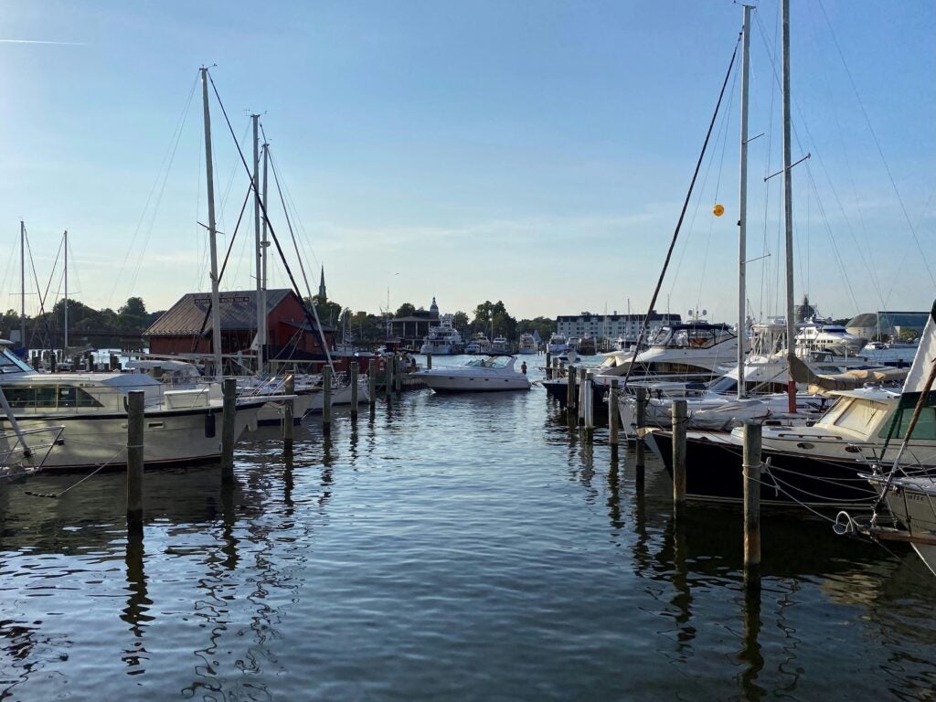
Overnight: Set up at a campground east of the city so you can avoid downtown traffic at the end of the day. East Fork State Park Campground is a solid option for tents and RVs and gives you a calmer evening near the lake.
Food and resupply: Stock up in Athens or Chillicothe if you want groceries at camp, then plan on dinner in the Cincinnati suburbs, where options and hours are reliable.

Day Two: Cincinnati to St. Louis by backroads
Mileage and drive time: About 340 miles, plan on 5.5 to 6.5 hours of driving.
Route notes: U.S. 50 continues through Indiana and Illinois with long, steady farm-country miles. It is an easier driving day than Day One, but it can feel slow if you hit school zones and town stoplights at the wrong time. Leave early to keep your afternoon flexible.
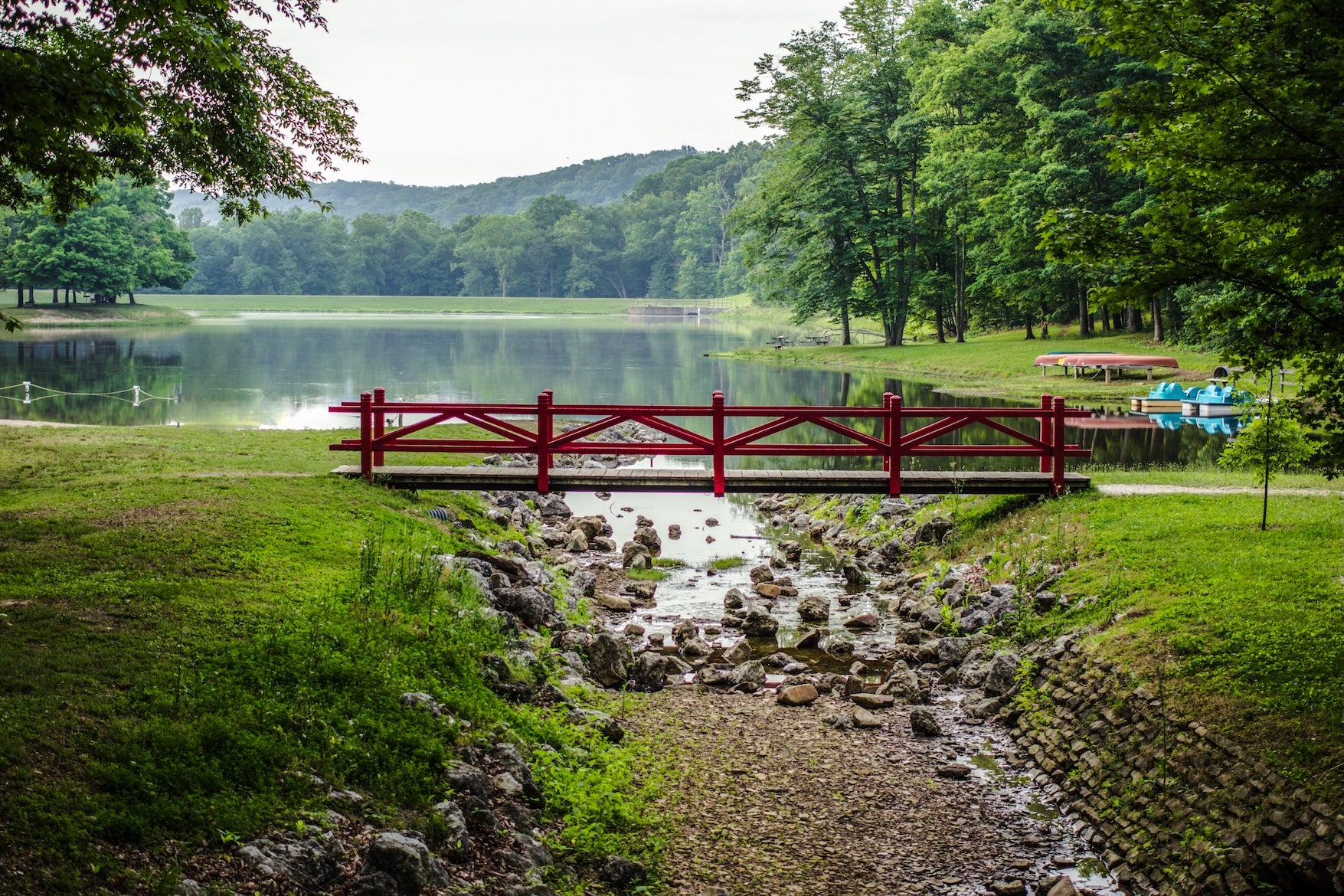
Morning stops: Start with a quick breakfast and coffee in town, then look for a trail hour at Versailles State Park. Even a short walk near the lake helps break up the long drive, and the campground area is a good place to reset before heading west.
Afternoon stops: Plan a longer midpoint stop in Vincennes, Indiana, for a brief downtown wander and a history break, then continue toward the St. Louis area. As you near the Mississippi, traffic thickens, and lane changes become more frequent, especially during weekday rush hours.
Overnight: Camp west of St. Louis so you are set up for an easier departure tomorrow. Dr. Edmund A. Babler Memorial State Park is a practical base with wooded campsites and quick access back to the highway corridor.
Food and fuel: Fuel is easy to find all day, but late-night options thin out in rural Illinois. Pick up dinner supplies before you cross into the St. Louis suburbs if you want a simple camp meal.
Day Three: St. Louis to Kansas City with a state park finish
Mileage and drive time: About 260 miles, plan on 4 to 4.5 hours of driving.
Route notes: Today is your Missouri day, with a faster rhythm on the highway network and more traffic as you approach Kansas City. If you want the most consistent pace, use the metro bypass routes around St. Louis, then choose between staying aligned with U.S. 50 for smaller towns or using the faster interstate corridor to save time.
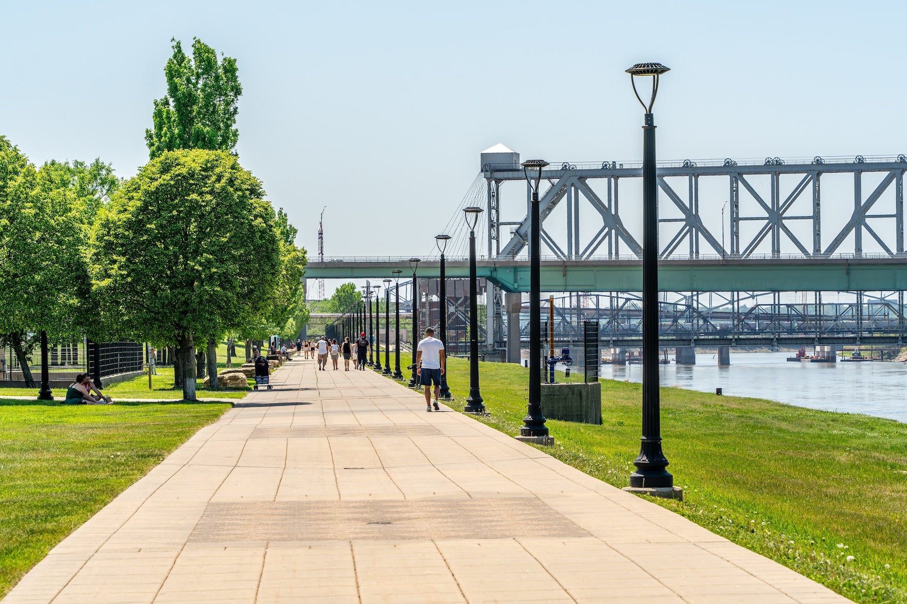
Morning stops: If you want a quick city stop without committing your whole day, visit the grounds and museum area at the Gateway Arch early, then roll out before parking gets stressful. After you clear the metro, stop in Jefferson City for a walk near the Missouri State Capitol and a riverside break.
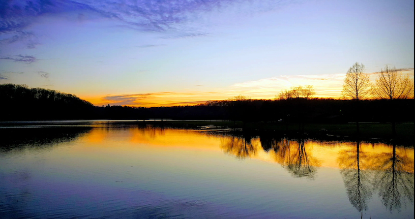
Afternoon stops: Break up the last miles with lunch in Sedalia or Warrensburg, then finish the segment with an easy camp setup near Kansas City. Knob Noster State Park is close enough to make a low-stress arrival, especially if you want a quieter night before exploring the city.
Overnight: Camp at Knob Noster State Park Campground, or if you prefer to be closer to Kansas City dining and museums, use Watkins Mill State Park as a last-night base.
If you prefer something more personal and rural, Green Acres at Red Brick Farmhouse offers a quieter farm-style stay in central Missouri. Set on private land with open skies and a slower pace, it feels more like staying with friends in the countryside than pulling into a large state park. It works especially well if you want space to unwind before finishing the drive into Kansas City.
Food and resupply: Jefferson City and Sedalia are dependable for groceries and fuel. Kansas City is the place to celebrate, but plan reservation times around traffic if you are arriving in the evening.
Campgrounds along the Parkersburg Kansas City route
North Bend State Park Campground sits northeast of Parkersburg and works well if you want to start this segment with a quiet night in the woods. Reviewers on The Dyrt often mention the shaded sites and a calmer setting that still feels close to town.
Hocking Hills State Park Campground is a strong early-segment stop if you want waterfalls, caves, and classic Ohio hiking without a complicated detour. It is typically a 4-star-plus favorite on The Dyrt, with a mix of family-friendly loops and easy access to trailheads.
East Fork State Park Campground, east of Cincinnati, gives you lake time and a quieter camp feel while still keeping city errands simple. Many campers like it as a practical base for a night because it balances nature with convenience.
Versailles State Park Campground is a good reset point on the Indiana portion of U.S. 50, especially if you want a quick hike before a longer driving push. The campground setup works for tents and RVs, and it is a solid choice when you want a state park night.
Eldon Hazlet State Recreation Area near Carlyle Lake is a smart Illinois option when you want water views and wide-open campsites that feel like a change of scenery from the road. It tends to draw strong reviews on The Dyrt for its lake access and easy camping logistics.
Dr. Edmund A. Babler Memorial State Park Campground is a wooded base near the St. Louis area that makes sense for travelers who want a camp night without a long detour. It is a convenient place to rest, cook a real meal, and avoid the city center.
Knob Noster State Park Campground is the overview campground for this segment and a natural finishing point before Kansas City. Expect a classic Missouri state park setup with a calm atmosphere, and plan ahead on popular weekends when sites fill quickly.
Watkins Mill State Park Campground sits north of Kansas City and pairs well with a final day of museums and food in town. The setting is quieter than staying in the city, and it is a good fit if you want one more night of trees before the next segment.
Top stops and things to do
Natural highlights near the route
Hocking Hills is the headline for short hikes, with classic routes around Old Man’s Cave, Cedar Falls, and Ash Cave. If you only have time for one, pick a single area and do a 1 to 2 mile loop so you can still keep your driving day on track.
Cultural and historic sites
In Parkersburg, Blennerhassett Island Historical State Park is an easy way to start the segment with local history and river views. Farther west, look for quick museum-style stops in Cincinnati, Vincennes, and St. Louis, especially if rain moves in and you want an indoor break.
Outdoor recreation that fits a road trip
East Fork Lake near Cincinnati is a straightforward option for fishing, paddling, and a low-key evening walk. In Missouri, you can add a short bike ride or riverside stroll near Jefferson City without committing to an all-day detour.
Unique stops worth parking for
If you enjoy quirky, quick pulls, Serpent Mound in Ohio is a memorable stop that does not require a long hike. In Kansas City, build in time for barbecue and one major museum so your arrival feels like a reward, not just a finish line.
Travel tips for this road trip segment
Plan your city timing. Cincinnati and St. Louis can add real minutes with rush-hour slowdowns and construction, so try to pass through mid-morning or early afternoon. Fog is common in river valleys, especially near the Ohio River and on humid summer mornings, and winter ice can linger in shady hill sections even when highways look clear elsewhere. Fuel coverage is generally good, but services thin out late at night in rural Indiana and Illinois, so top off before dinner if you are rolling into camp after dark. If you rely on cell service for navigation, download offline maps before leaving Parkersburg, then refresh them in larger towns like Cincinnati and St. Louis.
For official trail updates and seasonal alerts in Ohio’s top hiking area, check the Hocking Hills park page before you arrive: Hocking Hills State Park information.
Other segments and planning resources
This Parkersburg to Kansas City route is one segment of the full cross-country drive on The Loneliest Road. If you are stitching together the entire journey, start with our Loneliest Road road trip guide, then pair it with our other segment articles to build a full plan that matches your pace. For campground availability, maps, and offline-friendly trip planning, consider The Dyrt PRO. For responsible camping travel practices, the Leave No Trace Center for Outdoor Ethics is a solid refresher before you hit the road.
The Dyrt is the only camping app with all of the public and private campgrounds, RV parks, and free camping locations in the United States. Download now for iOS and Android.Popular Articles:
Articles on The Dyrt Magazine may contain links to affiliate websites. The Dyrt receives an affiliate commission for any purchases made by using such links at no additional cost to you the consumer.