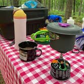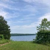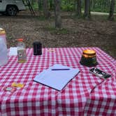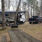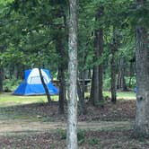
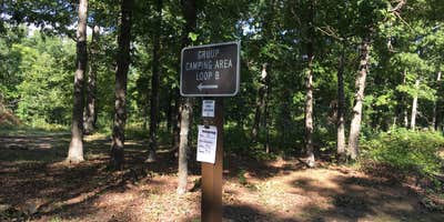
Mark Twain National Forest manages Council Bluff Recreation Area, a forested campground outside Belgrade, Missouri, where wooded sites and direct lake access draw a mix of tent campers and RV travelers. Sites are spread across a large loop with tree cover providing consistent shade throughout, and the spacing between sites gives the campground an uncrowded feel even on summer weekends. Campers with rigs up to 40 feet have made it work here, though overgrown limbs along the access road can be a problem for taller vehicles.
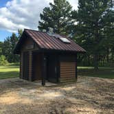
Water access is a recurring theme in reviews, and not always in a straightforward way. The lake is close enough to walk from most sites, and a swimming beach with pavilions and a shower house sits a short drive from the camping loops. However, water service at the campground itself has been unreliable, with at least one visit where campers had to source potable water from a nearby convenience store. The pit toilets get mixed marks on maintenance. Fishing and swimming are the main draws, and canoe and kayak rentals are available at the lake for a fee. Those exploring campgrounds around Mark Twain National Forest will find a range of options across the forest's dispersed and developed sites.
Courtney sums up the campground's appeal well: "Putting my hammock under the trees with a fan next to me was great." A 12-mile trail circles the lake, and feral hogs have been reported in the area, worth knowing before heading out on foot. Campers wanting a more primitive setup nearby can look at Big River Primitive Campground or Council Bluff - Wild Boar Ridge, which sits about a mile north.
Description
Overview
The Council Bluff Recreation Area is perfect for anyone looking to enjoy the outdoors. The Wild Boar Campground and sheltered picnic area, available for individual families or large groups, is next to the largest lake in the Mark Twain National Forest. The area provides ample opportunities for camping, picnicking, hiking, fishing, swimming and more.
Recreation
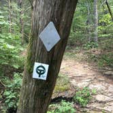
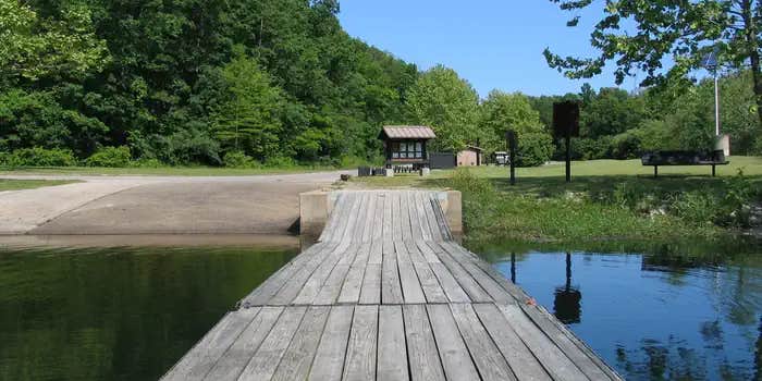
Boating is a popular pastime on the lake, but all boats on the lake must operate at a no-wake speed. Visitors can access the water via the two boat ramps located at the lake. Canoeing, swimming and fishing are also available. Anglers can expect a catch of a variety of freshwater fish, including bass bluegills, catfish and crappies. The 12-mile Council Bluff Trail encircles the lake, with spurs to the campground. Hikers can enjoy scenic views of the lake and a look at the Mark Twain wilderness. Waterfowl hunting is permitted on Council Bluff Lake and the nearby Enough Fields provide upland game opportunities. A variety of wildlife makes its home in the heavily wooded area.
Facilities
The Wild Boar Ridge Campground offers multiple single-family, large group and walk-in sites, available for tent and RV camping. Each is equipped with tables, lantern posts and campfire rings or campfire circles, with grills. The large group sites can accommodate up to 50 people and a nearby picnic pavilion can hold up to 75. The pavilion is paved, with a roof overhead and is equipped with multiple tables and grills. Accessible vault toilets and drinking water are provided. Electricity is not available, but some sites will accommodate RVs up to 40 feet in length. Some sites are available on a first-come, first-served basis. The beach provides accessible flush toilets, drinking water and coin-operated showers. A small play area with a slide and climbing structure is adjacent to the beach.
Natural Features
Located in southern Missouri, the Council Bluff Lake was created by a dam across Big River. It is 440 acres in size and 87 feet deep in some places. The Chapel Hill Beach is at the eastern end of the campground and provides 54,000 square-feet of sandy beach. Visitors can either walk or drive to the lake.
Nearby Attractions
The Trace Creek section of the Ozark Trail is located just west of the recreation area.
Fee Info
Group site rates: $50 - $100
RV Road Trip Guides

Map & DirectionsCouncil Bluff Recreation Area is located in Missouri near Belleview
 Public Campground
Directions
From Potosi, take Highway P south for 10 miles to C Highway junction. Continue on C Highway for less than a mile to DD Highway junction. Turn left on DD Highway and continue for approximately 7 miles to the recreation area entrance.
Address
STATE HWY. DD
Belgrade, MO 63622
Coordinates
37.7083333 N
90.9416667 W
Connectivity
 T-MobileNo Coverage
 VerizonLTESome Coverage
- AT&TNo Coverage

Connectivity
- T-MobileNo Coverage
- VerizonLTESome Coverage
- AT&TNo Coverage
Access
- Drive-InPark next to your site
- Walk-InPark in a lot, walk to your site.
- Hike-InBackcountry sites.
Site Types
- Tent Sites
- RV Sites
- Standard (Tent/RV)
- Group
Features
For Campers
- Trash
- Phone Service
- Reservable
- Drinking Water
- Toilets
- Alcohol
- Pets
For Vehicles
- Water Hookups
- Big Rig Friendly
Drive Time
- 1 hr 40 min from St. Louis, MO
- 1 hr 44 min from Cape Girardeau, MO
- 2 hrs 13 min from Jefferson City, MO
- 2 hrs 42 min from Columbia, MO