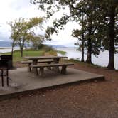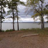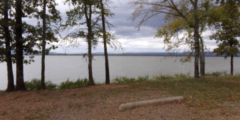
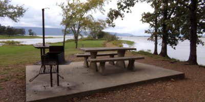
Managed by Oklahoma's Commissioners of the Land Office, Potato Hills South sits on Sardis Lake and runs from April 1 through September 29, with sites accommodating RVs up to 84 feet. Cell service is essentially nonexistent here, with neither AT&T nor Verizon reliably connecting. Sites are level, include picnic tables, grills, and fire pits, and the campground has a host on-site with self check-in. No showers are available at this location; the dump station and shower facilities are at the connected Potato Hills Central Campground nearby. Holders of a Golden Age or Access pass can apply a 50% discount. Campers wanting hookups with full amenities in one place may find campgrounds near Clayton worth comparing before booking.
Description
Overview
Located on the shoreline of Sardis Lake in beautiful southeast Oklahoma, Potato Hills South Campground offers outdoor recreation activities for all interests, whether its water sports in the expansive lake or hiking in the nearby Quachita Mountains.
Recreation
Sardis Lake is known for its fishing, producing several of Oklahoma's largest species of bass. Fishing enthusiasts can also expect to catch crappie, catfish and walleye. Boating, water sports and hiking top the list of recreational opportunities at the lake.
Facilities
Boat ramps are available for visitors, as well as a picnic area and playground that provide an ideal setting for parties or family get-togethers.
Natural Features
Sardis Lake is a reservoir fed by the waters of Jackfork Creek, a tributary of the Kiamichi river in the scenic foothills of the Ouachita Mountains. Hunters and wildlife enthusiasts will enjoy visiting the public hunting and wildlife propagation areas near Sardis Lake, which have been set aside on more than 8,000 acres of undeveloped land.
Nearby Attractions
Additional camping is also available at Potato Hills Central Campground. Nature trails are accessible near the campsite.
RV Road Trip Guides


Map & DirectionsPotato Hills South is located in Oklahoma near Clayton
 Public Campground
Directions
From US-69, turn south on Indian Nations Turnpike and continue approximately 26 miles. Turn east on State Highway 43 to Sardis Lake Office, and after about 33 miles turn north on State Highway 2 and continue two miles to the campsite.
Address
HC 60 Box4195
Clayton, OK 74536
Coordinates
34.625 N
95.325 W
Connectivity
 T-MobileNo CoverageVerified by 2 usersLast on 10/20/26
- VerizonNo Coverage
 AT&TLTESome CoverageVerified by 2 usersLast on 10/20/26
Connectivity
- T-MobileNo CoverageVerified by 2 usersLast on 10/20/26
- VerizonNo Coverage
- AT&TLTESome CoverageVerified by 2 usersLast on 10/20/26
Access
- Drive-InPark next to your site
Site Types
- Tent Sites
- RV Sites
- Standard (Tent/RV)
- Group
Features
For Campers
- Trash
- Picnic Table
- Reservable
- Drinking Water
- Electric Hookups
- Toilets
- Alcohol
- Pets
- Fires
For Vehicles
- Sanitary Dump
- Water Hookups
- 30 Amp Hookups
- Big Rig Friendly
Drive Time
- 1 hr 27 min from Fort Smith, AR
- 1 hr 48 min from Sherman, TX
- 2 hrs 16 min from Tulsa, OK
- 2 hrs 38 min from Texarkana, TX