
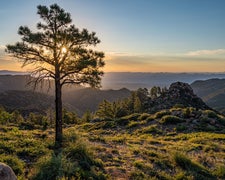
Sitting within the Pinaleño Mountains range of Coronado National Forest, this US Forest Service campground in Graham County gives campers access to one of Arizona's sky island ranges, where elevations climb sharply above the surrounding Sonoran Desert. No pets are permitted. The Columbine Corrals Campground - Coronado National Forest sits roughly 0.4 miles southwest, making it a nearby alternative for groups traveling with animals. Plan visits around spring or fall, as summer monsoons and winter snow can affect road conditions at elevation.
Description
The Pinaleño Mountains , are a remote mountain range in southeastern Arizona and are managed by the Safford Ranger District.
RV Road Trip Guides

Map & DirectionsPinaleño Mountains is located in Arizona near Thatcher
 Public Campground
Coordinates
32.64569912 N
109.8430004 W
Connectivity
 T-Mobile5GExcellent Coverage
 VerizonNo Coverage
 AT&TLTESome Coverage
Connectivity
- T-Mobile5GExcellent Coverage
- VerizonNo Coverage
- AT&TLTESome Coverage
Access
Site Types
- Tent Sites
Features
Drive Time
- 2 hrs 15 min from Sierra Vista, AZ
- 2 hrs 41 min from Tucson, AZ
- 3 hrs 32 min from Las Cruces, NM
- 3 hrs 44 min from Phoenix, AZ

