Part of Coronado National Forest, Cunningham Campground operates under US Forest Service management from mid-April through October. The site accommodates RVs up to 22 feet and provides basic amenities including restrooms, trash service, and designated fire rings. Pets are welcome throughout the campground.
The terrain combines forested areas with open spaces near a creek. Sites cost $15 per night during the operating season. For additional options in the region, campers can explore campgrounds around Coronado National Forest. The nearby Hospital Flat Campground sits just over a mile southeast for those seeking alternative Forest Service camping.
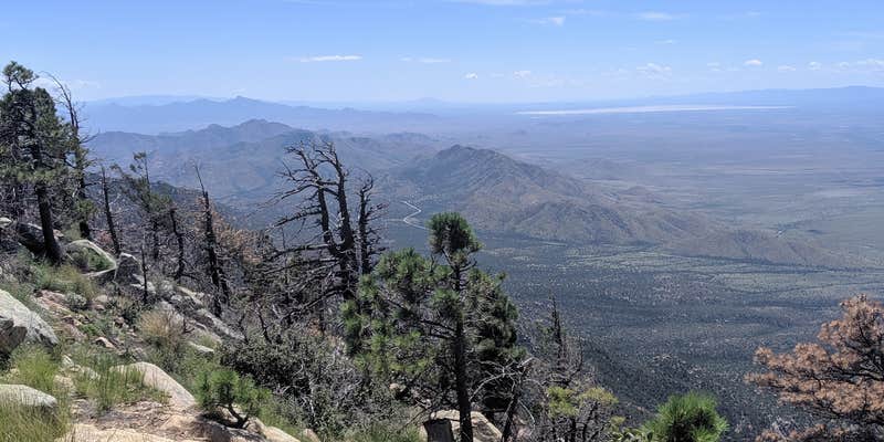
Description
Located high in the Pinaleño Mountains in an open, grassy stand of aspen and fir, this campground was constructed to provide a more primitive camping experience than most forest campgrounds. Campsites include a parking area and a fire grill. A public corral is available for riding and pack stock. Nearby there are plenty of foot and equestrian trails. The Grant Creek Trail starts at the campground edge and follows a scenic route down canyon to the site of old Fort Grant, once an important outpost in the days of warring between the Apaches and the U.S. Army. Today, the fort is an Arizona State Prison Facility. Also conveniently close by the campground is the Cunningham and Grant Hill Loop, a system of old logging roads and trails developed for mountain biking and hiking. Access to these trails is located across the Swift Trail (AZ 366) from the campground. Note: Black bear area.
RVs up to 22’; and vehicles with trailers less than 21’; are recommended. Vehicles with trailers longer than 26’; will have difficulty negotiating the switchbacks on the road up the mountain (AZ 366). Horse feed and water are not available. Pack and saddle stock are not permitted in campground. Limit 2 vehicles and 10 persons per site. 14 day stay limit
RV Road Trip Guides


Map & DirectionsCunningham Campground is located in Arizona near Thatcher
Directions
From Safford, drive south 8 miles on US 191 to AZ 366. Turn right (southwest) onto 366 and drive approximately 25.8 miles to the campground (between Grant Creek and Moonshine Creek). This route is usually accessible April 15th through November 14th, weather permitting.
Coordinates
32.68002091 N
109.89169 W
Connectivity
 T-MobileNo Coverage
- VerizonNo Coverage
- AT&TNo CoverageVerified by 2 usersLast on 7/22/26
Connectivity
- T-MobileNo Coverage
- VerizonNo Coverage
- AT&TNo CoverageVerified by 2 usersLast on 7/22/26
Access
Site Types
- Tent Sites
- RV Sites
Features
For Campers
- Trash
- Toilets
- Pets
- Fires
Drive Time
- 2 hrs 29 min from Sierra Vista, AZ
- 2 hrs 31 min from Tucson, AZ
- 3 hrs 45 min from Las Cruces, NM
- 4 hrs from Phoenix, AZ

