
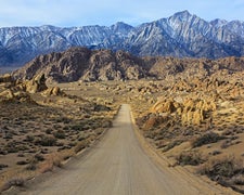
BLM Land managed by the Cedar City Field Office, Rock Corral sits near a creek outside Milford, Utah, with rough access road conditions that warrant preparation before arrival. Access is a known factor here. Campers should expect an unimproved route and plan vehicle clearance accordingly. Manderfield Road BLM Dispersed provides an alternative for those wanting a nearby option with different access conditions.
Description
Elevation 7000 feet. Day use, camping and group picnic area. The area around the site is extremely scenic, with a perennial stream running throughout. ACTIVITIES Climbing Camping Hiking Hunting Picnicking Wildlife Viewing
RV Road Trip Guides

Map & DirectionsRock Corral is located in Utah near Milford
 Public Campground
Directions
From Beaver head west on UT 21. One mile south of Milford, turn right at the sign and follow signs to Rock Corral.
Coordinates
38.37240082 N
112.83488028 W
Connectivity
 T-MobileNo Coverage
- VerizonNo CoverageVerified by 2 usersLast on 9/22/26
- AT&TNo Coverage
Connectivity
- T-MobileNo Coverage
- VerizonNo CoverageVerified by 2 usersLast on 9/22/26
- AT&TNo Coverage
Access
Site Types
- Tent Sites
Features
Drive Time
- 2 hrs 5 min from St. George, UT
- 3 hrs 9 min from Provo, UT
- 3 hrs 40 min from Salt Lake City, UT
- 3 hrs 47 min from Las Vegas, NV

