
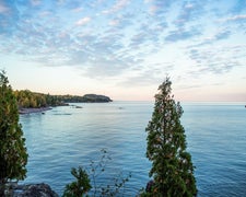
Tepee Lake Area sits within Ottawa National Forest near Iron River, Michigan, managed by the US Forest Service as an established campground with lake access nearby. The surrounding terrain is characteristic of Michigan's Upper Peninsula, with the national forest setting providing tree cover typical of the region. Campers wanting more developed alternatives in the area can look at Lake Ste. Kathryn Campground to the east, or browse tent camping near Ottawa National Forest for additional site types across the forest.
Description
Tepee Lake is easily accessible and fairly large lake that provides boaters and fishermen the opportunity to enjoy the outdoors and relax
RV Road Trip Guides

Map & DirectionsTepee Lake Area is located in Michigan near Trout Creek
 Public Campground
Directions
From Kenton, Michigan, take FSH 16 south for 7 1/2 miles and turn left at the Sign for the Lake.
Coordinates
46.38860043 N
88.88230467 W
Connectivity
 T-MobileNo Coverage
- VerizonNo Coverage
- AT&TNo Coverage
Connectivity
- T-MobileNo Coverage
- VerizonNo Coverage
- AT&TNo Coverage
Access
Site Types
- Tent Sites
Features
Drive Time
- 2 hrs 15 min from Wausau, WI
- 2 hrs 51 min from Green Bay, WI
- 3 hrs 1 min from Appleton, WI
- 3 hrs 8 min from Duluth, MN

