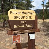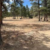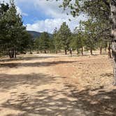
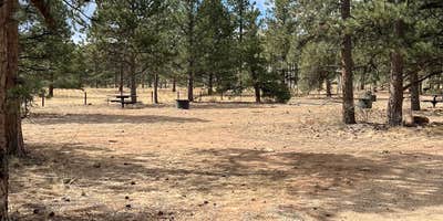
Group camping takes on a different character at this Forest Service site tucked into the Pike National Forest's wooded terrain. Pulver Mountain Group Site accommodates larger parties with water hookups and allows both campfires and pets, making it functional for extended group stays. The $167 fee reflects its group-specific design rather than individual site pricing.
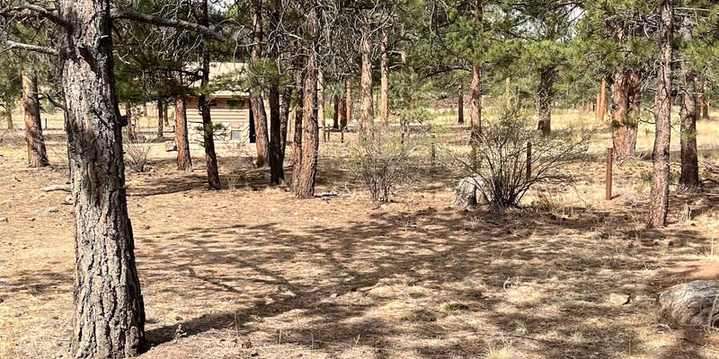
The forested setting provides natural screening between camping areas, while nearby water features add ambient sound to the mountain environment. Access requires driving in, and the terrain combines open spaces with tree cover. For groups planning extended stays in the area, places to camp around Lake George offer additional options within the broader region.
Description
Overview
_Pulver group site offers a private area with large pavilion with several tables and a large communal campfire pit. For your convenience, a double-stall vaulted restroom is provided. Within the group site are 6 individual campsites for your guest, each having their own table and campfire ring. Firewood is provided by roaming host who can be located nearby at Round Mountain campground. Access to the west field is by foot only and for your use of additional tents, recreation, or main even activities.
Recreation
- Being in the National Forest, nearby is Eleven Mile Canyon. The canyon is part of the historical Midland Railroad. You can drive along the railbed, following the the South Platte River for nine miles to the base of the dam of Eleven Mile Reservoir, while enjoying the beautiful scenery of the river and granite canyon. The open area of Eleven Mile Reservoir is state park whereas the canyon (National Forest) is reknown for the picturesque views, rock climbing, kayaking, and fishing. - Jefferson Lake is about 45 minutes north with spectacular wildlife, hiking, and hand launched boating. The depth of the lake is unknown and flows towards the basin of Pulver Group Site, into Tarryall Reservoir. The state park of Tarryall reservoir is visiting often for fishing by boat and shoreline. - Offroading is located just outside the gate to Pulver group site to the south. To the north, Badger Flats area offers a large area to explore and admire the beauty of sub-alpine terrain. This area shows remnents of early settlers and active ranching. (OHV must be trailered to/from).
Facilities
1 pavilion, 1 large group-campfire ring, Double-stall vaulted restroom, 6 moveable tables in pavilion, 6 stationary tables at individual campsites, 6 campfire rings, Private activity field, Firewood available via roaming hosts and management.
Natural Features
This fairly flat terrain is covered with natural grasses and speckled with pines providing plenty of shade. If solar and sunbathing is in your itinerary, a generous amount of sun is easily acquired as well.
Contact Info
For facility specific information, please call (661) 702-1420.
Nearby Attractions
NATIONAL FOREST AREAS: - Eleven Mile Canyon - Badger Flats - Wilkerson Pass - Manitou Lakes - Rampart Range - Deckers - Pikes Peak - Norht Catamount Reservoir - Clear Creek Reservoir - NATIONAL MONUMENT: - Florissant Fossil Beds STATE PARK AREAS: - Eleven Mile reservoir - Spinney Mountain Reservoir - Mueller State Park - Taryall Reservoir - Antero Reservoir, NEARBY TOWNS: - Lake George - Woodland Park - Cripple Creek - Fairplay
Warning 1 Alert is In Effect
There is 1 alert for this campground. Camp safely!
Warning 1 Alert is In Effect
There is 1 alert for this campground. Camp safely!
PIKE-SAN ISABEL NATIONAL FORESTS & CIMARRON AND COMANCHE NATIONAL GRASSLANDS** STAGE 1 FIRE PROHIBITIONS **** PROHIBITIONS**Pursuant to 16 U.S.C. 551 and 36 C.F.R. 261.50(a), the following are prohibited on the National Forest System (NFS) in the Leadville, Salida, San Carlos, Pikes Peak, South Park and South Platte Ranger Districts of the Pike-San Isabel National Forests & Cimarron and Comanche National Grasslands, described below and shown on the attached map incorporated into this Order as Exhibit A, hereinafter referred to as the Described Area:
- Building, maintaining, attending, or using a fire (including fires fueled by charcoal or briquettes), except if it is in
- A permanent metal or concrete fire pit or grate that the U.S. Forest Service has installed and maintained at its developed recreation sites (campgrounds and picnic areas);
- A device solely fueled by liquid or gas that can be turned on and off used in an area barren or cleared of all flammable materials within three feet of the device; or
- A fully enclosed metal stove with a chimney at least five feet in length and a mesh screen spark arrestor with a screen opening of a inch or less used in an area that is barren or cleared of all flammable materials within 10 feet of the device.36 CFR 261.52(a).
- Using an explosive. 36 C.F.R. 261.52(b)
- Smoking is prohibited, except in an enclosed vehicle or building, a developed recreation site, or while stopped in an area at least three feet in diameter that is barren or cleared of all flammable materials. 36 CFR 261.52(d)
- Welding, or operating acetylene or other torch with open flame, except if in a cleared area of at least 10 feet in diameter and a chemical pressurized fire extinguisher (with a minimum 8 oz. capacity and rating of Class 2A) is kept with the operator. 36 CFR 261.52(h) EXEMPTIONS Pursuantto36 C.F.R.261.50(e), thefollowingpersons areexemptfrom thisOrder:
- Persons with Forest Service Permit No. FS-7700-48 (Permit for Use of Roads, Trails, or Areas Restricted by Regulation or Order), specifically exempting them from this Order or a written determination by a Forest Service authorized officer that a permit is not required under 36 C.F.R. 251.50(e)(1) or (2).
- Any Federal, State, or Local Officer, or member of an organized rescue or firefighting service in the performance of an official duty. DESCRIBEDAREA All National Forest System lands, roads, and trails within the exterior boundaries of the Pikes Peak, South Platte, South Park, Leadville, Salida and San Carlos Ranger Districts of the Pike-San Isabel National Forests & Cimarron and Comanche National Grasslands, as depicted on the map attached as Exhibit A of this Order. PURPOSE Thepurposeof this Order is to protect natural resources and public health and safety. IMPLEMENTATION
- This Order shall be in effect from August 21, 2026, at 12:01 a.m. through August November 14, 2026, at 11:59 p.m., unless rescinded.
RV Road Trip Guides


Map & DirectionsPulver Mountain Group Site is located in Colorado near Lake George
 Public Campground
Directions
FROM THE EAST: - South of 24, about 5 miles west of Lake George (2 miles west of the turnoff to Round Mountain campground) - Between mile marker 257 & 258 - Turn left onto Forest Service Road 861 (indescript dirt road, signage will be placed soon.) - Follow about 1/4-mile, gate will be on right FROM THE WEST: - South of 24, about 3 miles from Wilkerson Pass - Between mile marker 257 & 258 - Turn right onto Forest Service Road 861 (indescript dirt road, signage will be placed soon.) - Follow about 1/4-mile, gate will be on right
Address
Forest Road 861
Lake george, CO 80827
Coordinates
39.026272 N
105.47156 W
Connectivity
 T-Mobile5GExcellent CoverageVerified by 2 usersLast on 10/6/26
 VerizonLTESome CoverageVerified by 1 userLast on 10/6/26
- AT&T5GExcellent CoverageVerified by 2 usersLast on 7/28/26
Connectivity
- T-Mobile5GExcellent CoverageVerified by 2 usersLast on 10/6/26
- VerizonLTESome CoverageVerified by 1 userLast on 10/6/26
- AT&T5GExcellent CoverageVerified by 2 usersLast on 7/28/26
Access
- Drive-InPark next to your site
Site Types
- Tent Sites
- RV Sites
- Standard (Tent/RV)
- Group
Features
For Campers
- Reservable
- Pets
- Fires
For Vehicles
- Water Hookups
Drive Time
- 1 hr 3 min from Colorado Springs, CO
- 1 hr 23 min from Pueblo, CO
- 1 hr 51 min from Denver, CO
- 2 hrs 15 min from Boulder, CO