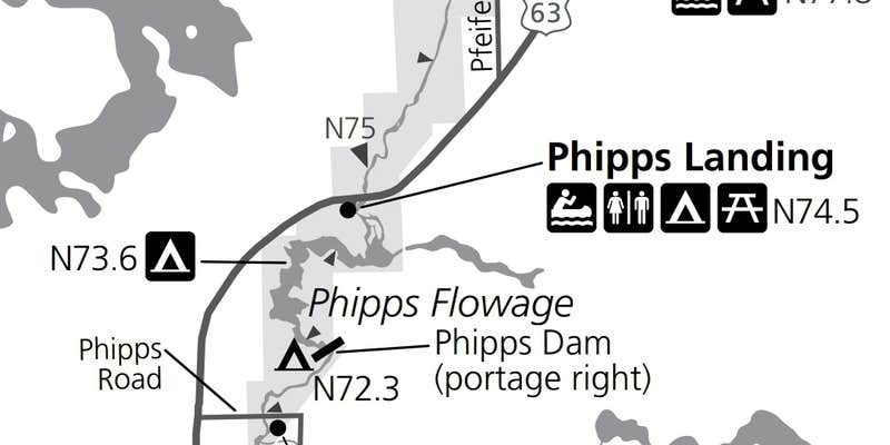
Phipps Landing sits along the Namekagon River within Saint Croix National Scenic Riverway, accessible by car, on foot, or by paddling downstream. The site has three tent sites total, two near the parking area and one larger group site set farther back. No trash bins are on-site, and water is not reliably available, so campers should bring their own or carry filtration. Some road noise from a nearby highway is audible. Camping is free and first-come, first-served. Paddlers continuing along the river can find campgrounds around Saint Croix National Scenic Riverway, or Arrowhead Resort provides a developed alternative nearby.
RV Road Trip Guides


Map & DirectionsPhipps Landing is located in Wisconsin near Hayward
 Public Campground
Coordinates
46.07200019 N
91.41700018 W
Connectivity
 T-Mobile5GGood Coverage
 VerizonLTESome CoverageVerified by 2 usersLast on 9/18/26
 AT&TNo Coverage
Connectivity
- T-Mobile5GGood Coverage
- VerizonLTESome CoverageVerified by 2 usersLast on 9/18/26
- AT&TNo Coverage
Access
- Drive-InPark next to your site
- Walk-InPark in a lot, walk to your site.
- Hike-InBackcountry sites.
- Boat-InSites accessible by watercraft.
Site Types
- Tent Sites
- Standard (Tent/RV)
- Group
Features
For Campers
- ADA Access
- Picnic Table
- Firewood Available
- Phone Service
- Drinking Water
- Toilets
- Alcohol
- Pets
- Fires
Drive Time
- 1 hr 19 min from Duluth, MN
- 1 hr 38 min from Eau Claire, WI
- 2 hrs 30 min from Minneapolis, MN
- 2 hrs 44 min from Wausau, WI