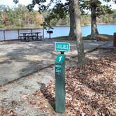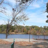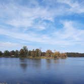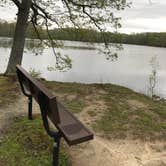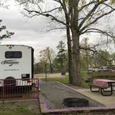
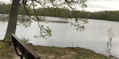
St. Francis National Forest's Bear Creek Lake Recreation Area sits along the water in eastern Arkansas, managed by the US Forest Service and open April through Labor Day. The campground has 14 full hookup sites, each with water views, and reviewers consistently note that facilities stay clean and well-maintained. A dump station is also on-site. Access involves a rough road, so drivers with larger rigs should approach carefully. Reservations are available, and given the small site count, booking ahead is advisable for summer weekends. Campers exploring camping near St. Francis National Forest will find Beech Point Campground immediately adjacent to the west.
Description
The 625-acre Bear Creek Lake Recreation Area has 30 miles of shore line and offers the following recreational opportunities: camping, picnicking, swimming, canoeing, fishing and hiking. Sitting atop Crowley’s Ridge, the recreation area offers three campgrounds, two picnic areas, a mile-long nature trail, a swim beach and a handicap-accessible fishing pier which all provide visitors a variety of recreational experiences. Bear Creek Nature Trail provides a one-mile loop winding through a forested area. There are excellent scenic views of the lake shoreline, including Beech Point, and interpretive posts that highlight ecology in action. Trophy Largemouth Bass, Red-eyed Bream and Channel Catfish are just a few of the many species of fish that you’ll find in the lakes and streams in the area. Fish Your National Forests: This site can be accessed by Passenger Car; Fish available include: Bass, Panfish; Types of fishing available include: Shore, Motorized boat, Float tube, Fly, Spin, Bait; ADA Accessible fishing access with fishing pier and boat launch The Bear Creek Lake Recreation Area is managed by the Mississippi River State Park. Please call the Mississippi River State Park - Marianna Office for any questions at 870-295-4040.
RV Road Trip Guides

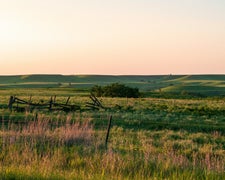
Map & DirectionsBear Creek Lake Recreation Area is located in Arkansas near LaGrange
 Public Campground
Directions
From Marianna take Arkansas 44 southeast for seven miles.
Coordinates
34.71221669 N
90.693816 W
Connectivity
 T-MobileNo Coverage
- VerizonNo Coverage
 AT&TLTESome CoverageVerified by 8 usersLast on 9/22/26
Connectivity
- T-MobileNo Coverage
- VerizonNo Coverage
- AT&TLTESome CoverageVerified by 8 usersLast on 9/22/26
Access
- Drive-InPark next to your site
- Boat-InSites accessible by watercraft.
Site Types
- Tent Sites
- RV Sites
- Standard (Tent/RV)
- Group
- Cabins
- Equestrian
Features
For Campers
- Market
- ADA Access
- Trash
- Picnic Table
- Firewood Available
- Reservable
- Showers
- Drinking Water
- Electric Hookups
- Toilets
- Pets
- Fires
For Vehicles
- Sanitary Dump
- Sewer Hookups
- Water Hookups
Drive Time
- 1 hr 17 min from Memphis, TN
- 1 hr 35 min from Jonesboro, AR
- 1 hr 45 min from Little Rock, AR
- 2 hrs 20 min from Jackson, TN