


Established Camping
Upper Soda Springs Campground - CLOSED
About
National Forest
Inyo National Forest
Bridge behind the campground is washed out.
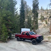
Narrow, single lane road. Only accessible in summer. Accessible by private vehicle only if camping.
Access
- Drive-InPark next to your site
Stay Connected
- WiFiUnknown
- VerizonUnknown
- AT&TUnknown
- T-MobileUnknown
Site Types
- Tent Sites
- RV Sites
- Standard (Tent/RV)
Features
For Campers
- ADA Access
- Trash
- Picnic Table
- Firewood Available
- Drinking Water
- Toilets
- Alcohol
- Pets
- Fires
For Vehicles
- Water Hookups
- Big Rig Friendly
 Traveler
Best campground in Inyo National Forest!!
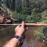
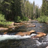
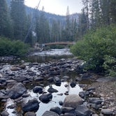
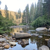
Fantastic campground right on the San Joaquin River and The Pacific Crest Trail. The sites are 1st come 1st served and no reservations! Elevation is 7,800ft with Lodgepole Pine, Western White Pine and Red & White Fir throughout. Fly fishing is fantastic all along the river and the hiking is world class. Facilities are excellently maintained with vault toilets and potable water available.
- (5) View All
 Guide
GuideAmazing Gem Tucked Far Away from the Mammoth madness!
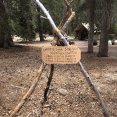
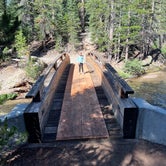
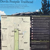
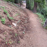
This campground was a great place for our family to hang out and hike for three days. So many cool trails lead right out from the campground and they’re cool with dogs too (on leases of course)! The camp host-Gary, was friendly, enjoyed his safety speech and helped us get acquainted with the grounds. You can walk to Devils Postpile (about 4 miles) from this campground. Only downside is that there is zero cell service!
 Guide
GuideGreat Spot
Great campsite. I camp with an 18ft bumper pull no issues getting around and they have RV water fill up station but no dump station. Campground has two hiking trails right from the campground which is neat. Also has a river that runs next to some of the campsites. Close to mammoth for mountain biking, hiking, horse back riding, fishing and so much more. I stayed there for 5 days and still felt like there was still stuff to do and places to see. If you like to fish would recommend fly fishing.
- (6) View All
Location
Upper Soda Springs Campground - CLOSED is located in California
Directions
From North Fork, CA, take Road 225 east 3.7 miles to a "Y" intersection. Bear left onto Scenic Byway (Forest Rt. 81) and go 30.7 miles to campground sign. Turn left at sign into campground.
Coordinates
37.65300042 N
119.07700067 W