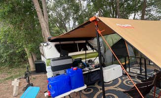
Dispersed camping areas near Springdale, Utah typically experience desert climate conditions, with extreme summer temperatures reaching 100°F and nighttime temperatures dropping significantly. The terrain consists mainly of slickrock, sandy washes, and juniper trees with minimal shade. Campers should prepare for significant temperature fluctuations, limited cellular coverage in certain locations, and primitive conditions with no developed facilities.
What to do
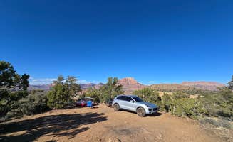
Mountain biking trails access: Gooseberry Mesa provides excellent access to renowned mountain biking trails. "Gooseberry mesa biking is incredible. The road to the mesa is very washboarded and will rattle the daylights out of your car. The sites are fairly spaced out and have great views," explains one camper at Gooseberry Mesa.
Stream cooling in summer: Several sites offer stream access for natural cooling during hot days. At North Creek Dispersed Camping, visitors note: "The stream is a great place to put some chairs and cool off. I will definitely be coming back here on my next Zion trip!"
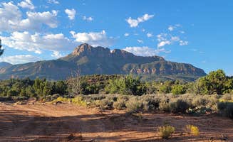
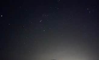
Stargazing opportunities: The remote locations offer excellent night sky viewing away from city lights. A visitor at Hurricane Cliffs described: "Beautiful, up on a hill with great views of the sunrise and sunset. Stunning views! The sunset, the moon, horizon to horizon of billions of seen stars, and a gorgeous sunset."
What campers like
Site privacy levels: Different areas offer varying degrees of seclusion. At Hurricane Cliffs BLM Dispersed, a camper observed: "The area is wide open, but enough spacing so you're not on top of your neighbor. The road is quite busy with people trying to find sites and you'll likely get dusted, but the campsites we saw were clean and the area felt safe."
Cellular connectivity: Many sites maintain workable cell service despite remote locations. A camper at Kolob Terrace Road mentioned: "We had a super sweet spot that was pretty secluded. Really sweet spot besides all the hay in some spots. Had to leave earlier than I wanted because of hay. Very allergic."
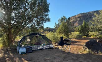
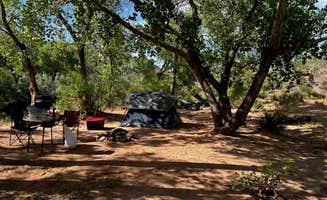
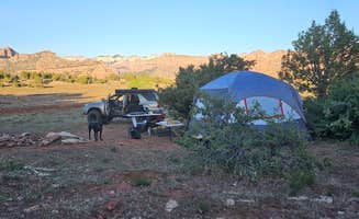
Natural features: Streams, rock formations, and views enhance the camping experience. "This site has numerous spots, most are close together but the campground was not full at all allowing plenty of space and privacy. There are sites on both sides of the creek," noted one visitor.
What you should know
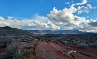
Road conditions vary significantly: Many access roads require careful driving. At Dalton Wash Dispersed, a camper reported: "This spot is so pretty, fairly remote, and cows in the area are nice. It's about a 4.5-mile drive on unpaved road with about a mile of that in a steep incline, I was able to make it up with my prius, but if you have bad breaks, be wary."
Crowding during peak seasons: Sites fill quickly during tourist season. "Get there early, they seem to fill up fast. I got one of the last spots in the area around 4PM. Wind was strong until about 6PM, then it was mellow the rest of the night," advised a Hurricane Cliffs visitor.
Extreme weather challenges: Wind and temperature issues affect many sites. "Very unclear. No one was here and the signs were very vague saying 'public land' and also 'PRIVATE NO CAMPING' just be warned it's a bit confusing," cautioned a LaVerkin Overlook visitor.
Tips for camping with families
Fire regulations awareness: Fire restrictions vary between locations. "This has been a great spot with lots of places to camp. Along this road there are several dispersed camp sites but this ground has some trees with shade if you go further in. I stayed here for 3 nights and really enjoyed my time," reported a North Creek camper.
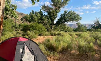
Shade availability: Limited tree cover affects comfort in summer months. At Hurricane Cliffs BLM dispersed #54, a visitor found: "Big open area you can just pull off really anywhere. A few other campers were set up when we pulled in, making it feel safer than just being alone lol 360 views and amazing stars at night!"
Potable water planning: No water sources exist at these sites. "We found a wonderful spot on top of a hill. The road can be very rough in places but great views," noted a BLM Road camper.
Tips from RVers
Site leveling challenges: Many areas require careful setup due to uneven ground. "You def need a higher up car to get to where I went. I have a Honda HRV and took it really slow and didn't have any issues. I got to the location and kept going and found a shaded area at the bottom of a hill," shared a camper at rustic camping near Springdale.
Turning radius considerations: Limited turnaround areas exist on narrow roads. "We got our 33 footer in with a little work," noted one North Creek visitor describing their experience.
High clearance requirements: Some access roads demand appropriate vehicles. "Accessibility was good (old broken up paved road that turns to gravel so no 4x4 needed). Some road noise. Main area has various campsites off the main road so not a ton of privacy but great open views!" shared a visitor at BLM Road #71 Gravel Pit Dispersed.


 Scout
Scout