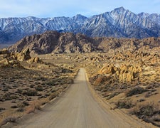
Free dispersed camping along Sheep Bridge Road provides 40-plus numbered sites spread across several miles of unpaved roads managed by the Bureau of Land Management. The main road handles most passenger cars, though secondary roads leading to individual sites require higher clearance vehicles to avoid bottoming out on rocky terrain.
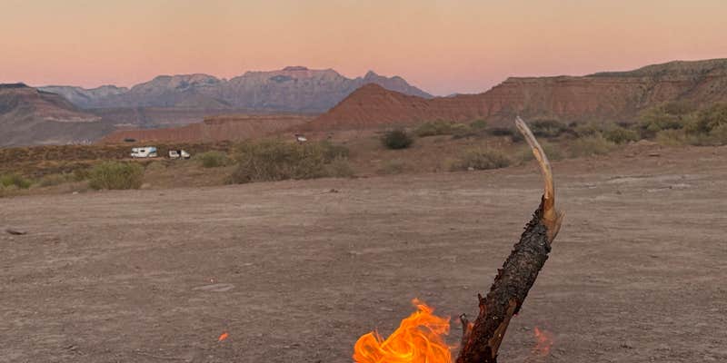
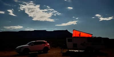
Sites accommodate everything from tents to large RVs, with fire pits and spacing of roughly 100 yards between neighbors. The open desert landscape offers no natural shade, making afternoon temperatures intense during summer months. Clinton H. notes the area provides "quiet and safe place to stay" with expansive night skies. Most campers report strong cell service from major carriers, with some reviewers getting 4-5 bars without signal boosters.
The washboarded access road creates a dusty, bumpy ride averaging 10 mph, with fine red silt settling on gear and vehicles throughout stays. Traffic picks up in evenings as campers search for available sites, and morning mountain bikers add activity to the area. Sites fill by evening during peak seasons, particularly in spring and fall when temperatures moderate.
Located 20-30 minutes from Zion National Park's west entrance, the campground serves as a staging area for park visits. Hurricane and La Verkin provide nearby resupply options, while Virgin River Falls Park along the access road offers swimming opportunities. Sites numbered in the 40s require the roughest road access but provide more distance from highway noise audible from higher-numbered locations.
The 14-day stay limit allows extended visits, though enforcement appears minimal according to multiple reviews. Campers can explore campgrounds around Virgin for additional options in this popular recreation area. The combination of free camping, reliable cell service, and proximity to major attractions makes this suitable for budget-conscious travelers and digital nomads seeking extended desert stays.
Description
Unlike the other trail systems in St. George Field Office area, the Hurricane Cliffs Trail System wasn't developed because of its awesome slick rock or incredible views, and it isn't inside a protected area such as a Reserve or Area of Critical Environmental Concern. This trail system developed because it's an area that is just plain fun to mountain bike.While not the legendary riding of the Gooseberry Mesa National Recreation Trail (under whose shadow this trail system sits), the Hurricane Cliffs Trail System has its own rewards. From smooth, rolling terrain to rough, rocky slabs, there are over 36 miles of great riding single-track in the system.Be sure to check each trail you plan to visit as there are user group restrictions. For example, the Canal Trail is only open to hikers, and equestrians are restricted to existing roads and the Chinatown Wash.
RV Road Trip Guides

Map & DirectionsHurricane Cliffs BLM Dispersed is located in Utah near Virgin
Directions
Hurricane Hills Trailhead: From Interstate 15 Exit 16, head east on State Route 9 to Hurricane City for 9.5 miles. Turn right on Main Street. Take the first left onto State Route 59 and at 0.75 miles turn left into the trailhead. (To reach Canal Trail, hike 1.8 miles on the Rim Trail before turning left onto the Canal Trail.) Virgin Dam Trailhead:From Interstate 15 Exit 16, head east on State Route 9 to Hurricane City for 9.5 miles. Turn right on Main Street. Take the first left onto State Route 59 and at 3.1 miles turn left on the gravel road (marked by a very large gravel turnout on the shoulder of SR 59). Travel 1.9 miles and turn left. At 0.2 miles turn right. Continue for another 1.3 miles the trailhead.
Coordinates
37.19531296 N
113.21835867 W
Connectivity
 T-Mobile5GExcellent CoverageVerified by 31 usersLast on 7/24/26
 VerizonLTEGood CoverageVerified by 36 usersLast on 7/24/26
- AT&T5GExcellent CoverageVerified by 16 usersLast on 7/24/26
Connectivity
- T-Mobile5GExcellent CoverageVerified by 31 usersLast on 7/24/26
- VerizonLTEGood CoverageVerified by 36 usersLast on 7/24/26
- AT&T5GExcellent CoverageVerified by 16 usersLast on 7/24/26
Access
- Drive-InPark next to your site
- Walk-InPark in a lot, walk to your site.
Site Types
- Tent Sites
- RV Sites
- Dispersed
- Group
Features
For Campers
- Phone Service
- Alcohol
- Pets
For Vehicles
- Big Rig Friendly
DISPERSED CAMPING
Enjoy dispersed camping on government land and leave no trace. Pack in and pack out. No (or limited) services at this camping area. Permit may be required.
PERMIT might be REQUIRED
We curate permit requirements across the US for our PRO members. Try PRO to see if Hurricane Cliffs BLM Dispersed needs a permit.
Drive Time
- 27 min from St. George, UT
- 2 hrs 6 min from Las Vegas, NV
- 4 hrs from Flagstaff, AZ
- 5 hrs 12 min from Prescott Valley, AZ


