Off-road vehicle enthusiasts will find extensive trail networks radiating from Poverty Flat BLM Road #70 Dispersed Camping Area, located minutes from Zion National Park's east entrance. This free dispersed camping area sits on BLM land accessed through a gate that campers must open and close. The road deteriorates as it progresses, with the first 1.4 miles manageable for passenger vehicles towing smaller trailers, though conditions become challenging when wet.
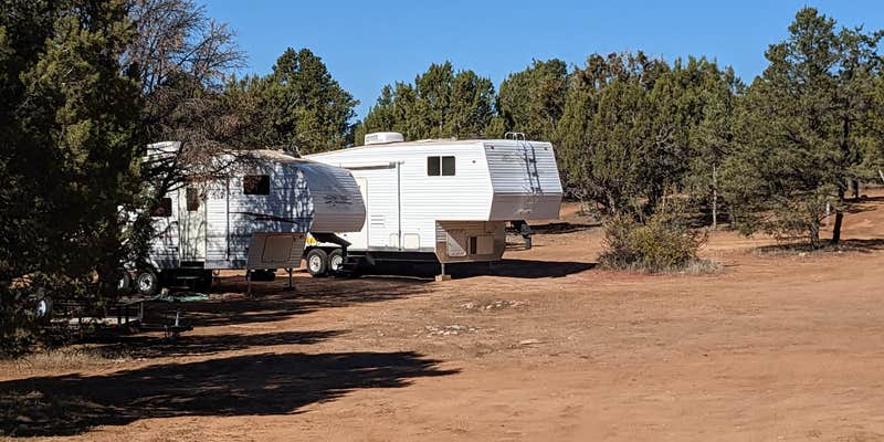
Multiple campsites spread along the sandy road feature existing rock fire rings and juniper-pinyon forest cover that provides shade but limits solar panel effectiveness. Campers consistently report finding deer remains and bones scattered throughout the area, evidence of active predator presence including large feline or canine tracks in the red sand. Several reviewers mention encountering buffalo herds in the vicinity. Don&Becca W. notes the "Area was all red sand but there were plenty of trees for shade."
Cell coverage varies by location, with Verizon users reporting 2-3 bars at sites closer to the entrance. No facilities exist here - no water, restrooms, tables, or trash collection. Dogs from nearby private property may bark through the night at sites closer to the road entrance. The area serves hunters during season and attracts long-term campers.
For developed amenities, Zion RV and Campground (Hi-Road) offers full hookups west of Mount Carmel Junction.
Description
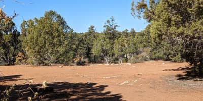
The Poverty Kiosk offes an unimproved staging area and a map kiosk. Water and other amenities are not available. This area is also used for grazing. Please be cautious and respectful of the wildlife and range improvements.
RV Road Trip Guides

Map & DirectionsPoverty Flat BLM Road #70 Dispersed Camping Area is located in Utah near Mount Carmel Junction
Directions
Travel along Highway 9, 0.7 miles past the Zion Mountain Ranch, there will be a cattle guard on the south side of the road. Turn south there onto the Poverty Road, or BLM route 70, and continue for about half of a mile to reach the Poverty Kiosk. All you will find at the kiosk is a Kanab Field Office Transportation Map. It is recommended that only ATVs/UTVs travel beyond the Poverty Kiosk. The route becomes extremely narrow and difficult for street vehicles, even if you have a four-wheel-drive, high-clearance vehicle. BLM route 70 is impassable when wet due to the clay based soil, which creates deep, slippery mud. For more information, detailed maps, and current conditions, contact the Grand Staircase-Escalante National Monument Visitor Center in Kanab, UT.
Coordinates
37.235247 N
112.813613 W
Connectivity
 T-MobileNo CoverageVerified by 7 usersLast on 6/24/26
 VerizonLTEGood CoverageVerified by 24 usersLast on 6/24/26
 AT&T5GExcellent CoverageVerified by 4 usersLast on 6/24/26
Connectivity
- T-MobileNo CoverageVerified by 7 usersLast on 6/24/26
- VerizonLTEGood CoverageVerified by 24 usersLast on 6/24/26
- AT&T5GExcellent CoverageVerified by 4 usersLast on 6/24/26
Access
- Drive-InPark next to your site
Site Types
- Tent Sites
- RV Sites
- Dispersed
Features
For Campers
- Phone Service
- Alcohol
- Pets
For Vehicles
- Big Rig Friendly
DISPERSED CAMPING
Enjoy dispersed camping on government land and leave no trace. Pack in and pack out. No (or limited) services at this camping area. Permit may be required.
PERMIT might be REQUIRED
We curate permit requirements across the US for our PRO members. Try PRO to see if Poverty Flat BLM Road #70 Dispersed Camping Area needs a permit.
Drive Time
- 1 hr 15 min from St. George, UT
- 2 hrs 57 min from Las Vegas, NV
- 3 hrs 35 min from Flagstaff, AZ
- 4 hrs 48 min from Prescott Valley, AZ


