

Matthew G. Guide
Guide
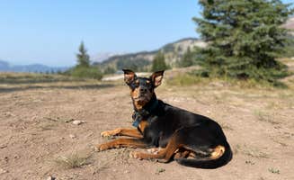
Cascade (colorado)
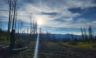
One of our favorites
This is probably my family's favorite area to camp in Colorado. Off the beaten path enough that traffic is minimal. But nice and close to some great four wheel and off roading areas.
Rocky Mountain National Park's Moraine Park Campground permits pets on leashes, allowing campers to bring their dogs while exploring the park's designated pet-friendly areas. The campground provides electric hookups, picnic tables, and reservable sites accessible by both tent and RV campers. Similarly, Mueller State Park Campground welcomes pets with designated pet-friendly sites and offers a range of accommodations including tent camping, RV spots, cabins, and glamping options. Sites at this highly-rated park (4.6/5 stars) feature electric hookups, picnic tables, and fire rings. Chatfield State Park Campground near Littleton accommodates pets with full hookup RV sites including 50-amp service, though alcohol is prohibited within the park boundaries. Most campgrounds require pets to remain leashed at all times and owners to clean up after their animals.
Black Canyon of the Gunnison National Park provides pet-friendly camping options at South Rim Campground, featuring electrical hookups and thirty-amp service for RV campers. Dogs must stay on leash and are limited to developed areas of the park, including campgrounds and paved roads, but not backcountry trails. For those seeking more rustic experiences, several dispersed camping areas accept pets, including Black Canyon Dispersed Camping near Montrose and Sacred White Shell Mountain near Mosca. These free sites offer minimal amenities but allow fires and pet access without reservation requirements. Campers report that some dispersed sites near popular attractions fill quickly, especially on weekends. The road to Sacred White Shell Mountain accommodates larger RVs and provides sufficient space between campsites for privacy with pets.
$35 - $70 / night
"Took the kids camping in Colorado for the first time and we had a blast. It rained on us a lot but it didn't stop us. Took a great hike up deer mountain....stunning views. Can't wait to go back."
"Very enjoyable spot, close access to trails and entrance and exit of the park."
$20 - $80 / night
"It's a biologically diverse area in Southern Colorado, where high winds that blow through the Rockies deposit sand at the Southernmost tip . We made camping reservations about six months in advance."
"Access to dunes trails, and off road track. Dump station nearby visitor center with free air station. T-Mobile available at most sites, but good by the visitor center and primitive road access."
$36 - $200 / night
"As it is very close to the city, the temperature stays consistent with Denver temps. So in the summer, it will not be as cool as some mountain spots."
"The dog park is by far the best. Off leash- so much room; well taken care of and big lake for the dogs to swim. And it’s close to Denver - so we go here weekly!"
$22 / night
"This is an occasional quick hit for us, close to where we live. NO OPEN WOOD FIRES due to natural tinder-box ecosystem. Excellent plumbed restrooms."
"This is one of my favorite campgrounds, because Colorado National Monument is so stunning."
$20 - $34 / night
"We had deer around our campsite (we had to have our dog on a leash because at that time of year the deer have babies and get fiesty."
"The South Rim Campground is similar to other national park campground in that it provides convenient access to park activities and trails, but it stands apart due to the fact that the camping fees are"
$20 / night
"This was our last night camping in Colorado and it was beautiful!"
"I just really enjoy the layout of this campground, the nice big bear boxes, and the park ranger who has a cat in his truck sometimes when he cruises around."
"Didn’t say pet friendly on the reviews but my dog and I found a nice little secluded campsite off to the right and down a less jagged road. Be careful."
"Great location right next to the park! There are plenty of sites and the views are beautiful. Entrance was slightly rutted so make sure you can off-road just a bit!"
$28 - $270 / night
"Pets are not allowed on the trails & they do have rangers hiking looking for rule breakers. "
"This Colorado state park brings visitors year-round for all types of recreation. We have traveled here several times, both tent camping and in our camper."
$35 - $70 / night
"Firewood sold next to the entrance by the same husband and wife that have been selling firewood there for 35 years. There is a shed full of firewood."
"The spaces are large, but quite close to one another with few trees for privacy. Each site here is variable, with some open with no trees and others nestled in some mature trees."
"The best part about this area, aside from the views & the sunsets, is the access to the sand dunes natl park."
"You’re down the road from the dunes and about 30 minutes outside Alamosa and other stores. I used the dump station at the sand dunes canoe ground. It was only $8 to fill up water and dump."
This is probably my family's favorite area to camp in Colorado. Off the beaten path enough that traffic is minimal. But nice and close to some great four wheel and off roading areas.
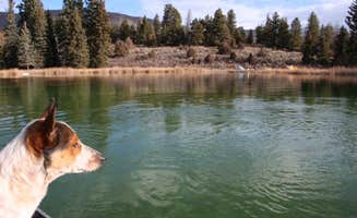
Great spot for car camping in Colorado except its distance from Denver. It’s a trek! Takes at least 4 hours (that’s if you’re lucky). Lots to do. Great fishing, beautiful hiking trails to a water fall, and trails for the RZR near by.
Loved this place!!! Very clean, friendly and have huge sites. Looks fairly new. It’s close to everything including sites. The mountains are beautiful. Night sky was jaw dropping. The resort was very quiet which was SO nice and relaxing. We didn’t use any amenities but I have no doubt they would be flawless. Grand Junction is worth a 2 night stay it has some incredible things to see. Good restaurants and we had perfect weather. It’s very pet friendly and even have small pet runs in some sites which we got. Nice dog park too. Grand Junction itself is very pet friendly.
This was our last night camping in Colorado and it was beautiful!
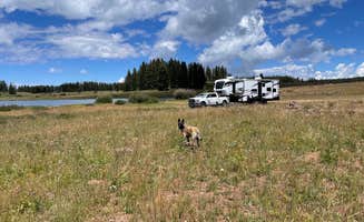
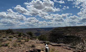
This is one of my all-time favorite places to hike and camp in Colorado. I have not yet stayed in any of the campgrounds but have backpacked to the top of the American Lakes Trail. Not only is this hike fantasticly beautiful and full of wildlife (tons of moose especially) but there is great dispersed camping along the trails. You simply cannot find more scenic and free camping in Colorado. I would highly recommended camping anywhere in State Forest State Park!
Also, there are quite a few huts, cabins and yurts that can be rented year round in SFSP!
Great place to camp in Colorado to avoid weekend crowds. Wide open, off the beaten path as far as Colorado goes.
first place I went camping in Colorado and I loved it so much I paid for an extra day. it rained on the last day but it was still wonderful. felt lost in the mountains and loved it
Took the kids camping in Colorado for the first time and we had a blast. It rained on us a lot but it didn't stop us. Took a great hike up deer mountain....stunning views. Can't wait to go back.
We hit this place coming from the northern Colorado border with Wyoming on a Sunday night. I've grown up and camped in Colorado my whole life, this place was 10/10, and one of my favorite spots ever! With hiking, biking, and fishing, you could spend some time here!
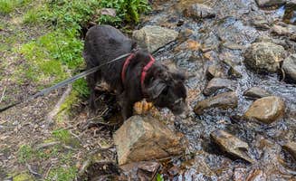
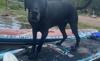
Colorado offers a fantastic array of camping options for pet owners, allowing you to enjoy the great outdoors with your furry friends by your side.
Frequently Asked Questions
What are the best dog-friendly dispersed camping areas in Colorado?
Colorado offers excellent dispersed camping options for dog owners. Road 240 - Dispersed is considered one of the best kept secrets for dispersed camping, featuring wooded spots with plenty of shade and river access. The road has numerous camping spots all the way up to the lake. Another fantastic option is State Forest State Park with its primitive sites, offering beautiful hiking trails and abundant wildlife viewing opportunities. For less crowded experiences, consider Buffalo Pass area which provides wide-open spaces off the beaten path. Remember to keep your dog leashed in most areas, pack out waste, bring plenty of water, and respect wildlife and other campers.
Are there pet-friendly campgrounds in Colorado with short or no hiking required?
Moraine Park Campground in Rocky Mountain National Park is ideal for pet owners seeking minimal hiking requirements. The campground offers drive-in sites with nearby amenities, stunning mountain views, and pet-friendly policies, though dogs must remain leashed and aren't allowed on most trails within the park. Monument RV Park in Fruita provides easy access without extensive hiking, featuring clean facilities and proximity to pet-friendly areas. For those preferring RV camping, several Colorado RV parks offer accessible sites with minimal walking required to reach facilities. Always check specific pet policies before booking, as restrictions may apply in certain areas or during wildlife activity seasons.
Are there any luxury or glamping options in Colorado that allow dogs?
Colorado offers several upscale pet-friendly camping options. Canyon View RV Resort provides a luxury experience with huge, clean sites and beautiful mountain views while welcoming furry companions. The resort offers a quiet, relaxing atmosphere with stunning night skies. Mountain Time RV Park & Cabins (formerly Tall Texan) is praised as one of Colorado's most beautiful RV camps and accommodates pets while providing cabin options for those seeking glamping experiences. Many glamping sites in Colorado require advance reservations, especially during peak seasons, and may have specific pet policies including additional fees, designated pet-friendly units, or restrictions on size/breed. Always confirm pet policies when booking luxury camping accommodations.
What amenities should I look for at dog-friendly campgrounds in Colorado?
When selecting dog-friendly campgrounds in Colorado, look for these essential amenities: designated pet areas, access to water sources for drinking and cooling off, and waste disposal stations. Spruce Lake RV Park offers excellent location near Rocky Mountain National Park with beautiful river access perfect for pets. Freeman Reservoir Campground provides hiking, biking, and fishing opportunities in a pet-friendly environment. Consider campgrounds with spacious sites offering shade and natural barriers between neighbors to minimize pet interactions. Some premium locations feature fenced areas where dogs can play off-leash. Always prioritize campgrounds with nearby veterinary services for emergencies and confirm pet policies regarding leash requirements, restricted areas, and any breed or size limitations.
Keep Exploring