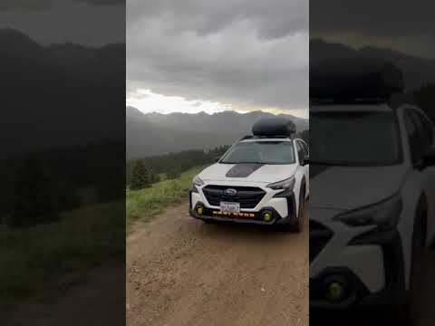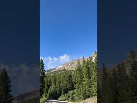
Free camping along Boreas Pass Road runs through numbered, designated sites within White River National Forest, with established fire rings at each spot and marked site numbers to help campers orient themselves on arrival. The road itself is a flat dirt surface with potholes and rocky sections, and most vehicles handle the lower sites without difficulty. One reviewer drove up in a Jetta. The upper stretch, roughly 12 miles in, turns significantly rougher and may require higher clearance.
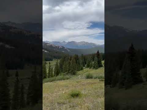
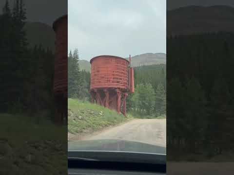
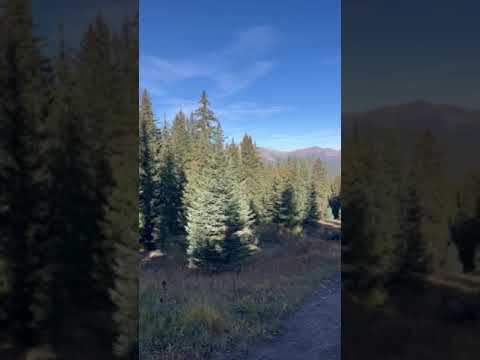
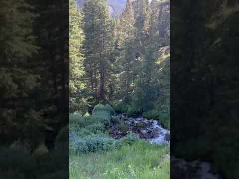
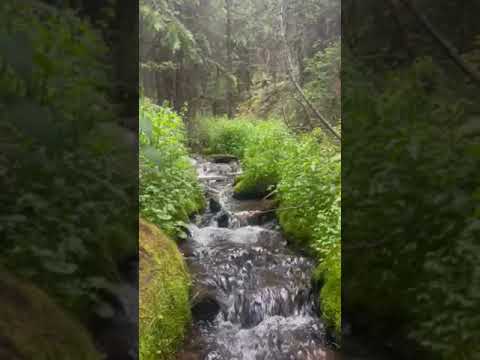
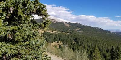
Sites vary considerably in size and position. Many of the lower numbered spots sit directly roadside with limited parking and minimal separation from passing traffic, while sites in the 21-23 range sit higher up and open toward broad mountain sightlines. Reviewers consistently point to site 21 as having the most expansive views, though it offers little buffer from road traffic. Campers willing to drive further past the water tank tend to find larger, more private setups. A short walk downhill from some sites leads to a small stream, audible from camp.
Crowds are a real factor here. All 23 sites were reported full on a Sunday afternoon in July, and fall weekends draw heavy leaf-peeping traffic along the road, generating dust and noise throughout the day. Midweek arrivals in summer have found multiple open spots even by late afternoon. Cassandra C. notes the area has "a lot of traffic coming and going all day and even at night." Elevation is also worth noting: altitude discomfort has been reported even among Front Range residents.
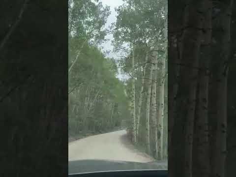
September brings the aspen color change, which draws significant vehicle traffic but also rewards campers with yellow foliage across the hillsides. Early October can be cold overnight and windy, though sites remain in use. Moose activity has been reported near the upper sites. Campers should pack out all trash, as litter has been an issue at some spots. Breckenridge Overlook sits nearby for those wanting an alternative if sites here are full, and Boreas Pass Dispersed site 10 offers additional options further along the corridor.
This area works well for self-sufficient campers comfortable with a busy road corridor who prioritize open mountain views and free access over seclusion or quiet.
Description
This designated dispersed camping area along County Road 10 has 23 sites.
**Please note: Camping is ONLY allowed in areas designated by a sign. ** Camping in undesignated spots could result in a citation from the U.S. Forest Service. Not adhering to camping duration maximums or using U.S. Forest land for residential purposes could result in a citation from the U.S. Forest Service.
Please refer to special orders and contact the USFS Offices with questions: https://www.fs.usda.gov/Internet/FSE_DOCUMENTS/fseprd842796.pdf
Regulations pertaining to designated dispersed camping are as follows:
Camp only in designated sites.
No camping at trailheads.
Food and garbage must be properly secured in bear-resistant containers or inside vehicles in sealed containers.
Pack out all waste: human, garbage, paper, organics, etc.
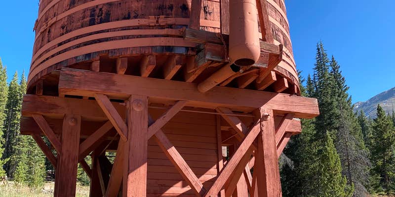
There are many dispersed camping opportunities in the forest ranging from backpacking to car-camping along designated Forest Roads. Visitors are encouraged to minimize resource impacts by utilizing established sites rather than creating new ones. Dispersed camping sites along Forest Roads are shown on Motor Vehicle Use Maps, which are available free of charge at ranger district offices.At the start of the tour you immediately have spectacular views of the Blue River Valley and the majestic Tenmile Range. The road, managed by Summit County, follows the old South Park and Pacific Railroad bed, climbing on a gradual 3% grade. The road climbs past Bakers Tank to the summit of Boreas Pass at the Continental Divide. The road then continues down the other side of Boreas Pass for another 10.4 miles to the town of Como in Park County. From 1872 to 1938 the road was used as a narrow-gauge railroad and gained fame as the nation’s highest narrow-gauge railroad, running from Como to Breckenridge. This is a great road to view Fall colors. This road is open to highway legal vehicles only during May-October, and closed to motorized vehicle access seasonally at Summit County discretion, generally October to May.
Reservation Info
This road is closed to motorized vehicle access seasonally at Summit County discretion, generally October to May.
RV Road Trip Guides


Map & DirectionsBoreas Pass Road Designated Dispersed Camping is located in Colorado near Blue River
Directions
From I-70 take Exit 203, Frisco / Breckenridge, and travel south on HWY 9 through Frisco toward Breckenridge. At the southern town limits of Breckenridge turn left on Boreas Pass Road (County Road 10). Follow Boreas Pass Road approximately 3.5 miles to the Bakers Tank trailhead and parking lot on your left. The Bakers Tank Trailhead is the parking area for non-motorized road users.
Address
680 Blue River Parkway
Breckenridge, CO
Coordinates
39.45140459639322 N
106.01462669914707 W
Connectivity
 T-MobilePossible CoverageVerified by 19 usersLast on 7/30/26
 VerizonLTEGood CoverageVerified by 29 usersLast on 7/30/26
 AT&TLTESome CoverageVerified by 3 usersLast on 7/30/26
Connectivity
- T-MobilePossible CoverageVerified by 19 usersLast on 7/30/26
- VerizonLTEGood CoverageVerified by 29 usersLast on 7/30/26
- AT&TLTESome CoverageVerified by 3 usersLast on 7/30/26
Access
- Drive-InPark next to your site
- Walk-InPark in a lot, walk to your site.
Site Types
- Tent Sites
- Dispersed
- Group
Features
For Campers
- Phone Service
- Alcohol
- Pets
- Fires
For Vehicles
- Pull-Through Sites
DISPERSED CAMPING
Enjoy dispersed camping on government land and leave no trace. Pack in and pack out. No (or limited) services at this camping area. Permit may be required.
PERMIT might be REQUIRED
We curate permit requirements across the US for our PRO members. Try PRO to see if Boreas Pass Road Designated Dispersed Camping needs a permit.
Drive Time
- 1 hr 32 min from Denver, CO
- 1 hr 42 min from Boulder, CO
- 2 hrs 5 min from Colorado Springs, CO
- 2 hrs 18 min from Fort Collins, CO