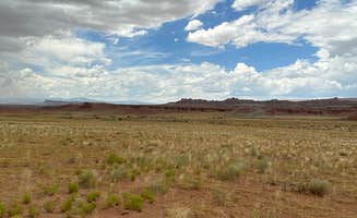
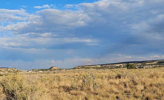
The San Rafael Swell region near Orangeville offers numerous dispersed camping opportunities on public lands managed by the Bureau of Land Management. This high desert terrain sits at elevations ranging from 4,000 to 7,000 feet, creating significant temperature variations between day and night. The area's distinctive geological formations include deep canyons, colorful rock layers, and unique sandstone features that attract visitors seeking solitude in less crowded alternatives to Utah's national parks.
What to do
Mountain biking along canyon rims: Goodwater Rim East Dispersed Camping serves as an excellent base for accessing the mountain bike trail system. "This is one of the two dispersed camping areas associated with the mountain bike trail that goes around the rim of the little Grand Canyon," reports one camper, noting that there's "a centralized pit toilet that you might have to drive a mile or two" from some sites.
Rock climbing and bouldering: New Joe's Bouldering Area Campground offers proximity to popular climbing areas. A camper notes there are "plenty of activities to do in the area" including "Climbing (Bouldering)" and "Site seeing (Not far from The Wedge)."
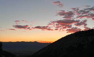
Stargazing in dark skies: The remote location provides exceptional night viewing opportunities. At Little Grand Canyon Dispersed Camping, one visitor shared, "you will never see a more beautiful night sky," while another described it as "the most beautiful night skies I've ever seen."
What campers like
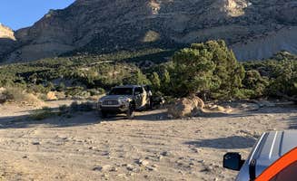
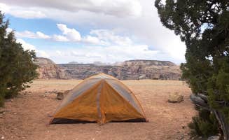
Canyon rim camping spots: Many dispersed sites offer direct views into the canyon. One camper at Little Grand Canyon Dispersed Camping described "over 30 firepits along this section of road, most with gorgeous views of the canyon," while another mentioned "dispersed camp spots, some REALLY primo ones on edge of canyon with dramatic views."
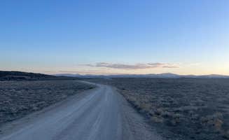
Relatively accessible roads: Most main access roads are well-maintained. At Wedge Overlook, a camper noted, "Road access is a wide graded gravel road from Castle Dale," and another mentioned, "The road leading in is about 20 miles so make sure you have everything you need, but if not there is a town about 40 minutes away."
Uncrowded camping during weekdays: For those seeking solitude, timing matters. A visitor at Wedge Overlook mentioned it's "very peaceful and quiet during the week, however it fills up quickly on the weekends," and another at Buckhorn Draw noted, "Was really busy during the weekend but slowed down a lot during the week."
What you should know
Seasonal temperature variations: Plan your visit according to the season. A camper at Wedge Rim Overlook Campground cautioned about the canyon edge, noting "caution is needed for these places, especially at night. It's a 1200-foot almost sheer drop to the river bottom."
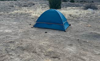
Limited amenities at most sites: Facilities vary significantly between locations. At Buckhorn Draw Designated Campsite #13, a reviewer notes it has a "table and fire ring but no water, no dumpster, no toilet, no cell signal," while another describes it as having a "long access road goes around an eroding gully that could be an issue if raining."
Fee structure changes: Some formerly free areas now charge fees. New Joe's Bouldering Area Campground has evolved to "designated campsites, a picnic table, large deep fire rings, pit toilets and no trash service. Also no water... Camp fee is now $15 per night. We used a senior pass and paid $7.50."
Tips for camping with families
Choose established sites for amenities: Families may appreciate areas with more facilities. At Buckhorn Draw Wickiup Site Dispersed Camp, a camper mentioned, "The site is very big. It is quiet and clean," noting the spacing between sites provides privacy even when busy.
Watch for challenging terrain: Some sites require careful navigation. At Wedge Rim Overlook Campground, a visitor warned, "The area west of the entrance road junction has plenty of space and sites, but the road is rough/rocky," adding that "some sites are literally right on the edge of the canyon."
Pack for temperature swings: Prepare for significant day-to-night temperature changes. A camper at Little Grand Canyon Dispersed Camping visited "in mid-March. The weather worked out perfectly," while another noted October temperatures of "80 during the day and 40s at night, so dress accordingly."
Tips from RVers
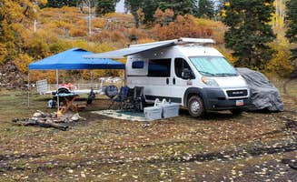
Know your vehicle limits: Not all sites accommodate larger rigs. At Buckhorn Draw Designated group Campsite #16, a reviewer mentioned it's suitable for big rigs but cautioned it's a group site with a "$50" fee, though it's "one of the best due to the cottonwood trees for shade."
Scout ahead for level areas: Many sites have uneven terrain. At Wedge Overlook, one camper noted that "some were pretty big and could accommodate an RV," and mentioned that "the ground is hard for tent stakes."
Plan for weather impacts on access roads: Rain can make roads impassable. A visitor to Buckhorn Draw Wickiup Site warned, "The road getting in has a bit of wash board so just take it slow," though they noted that even after rain "it was not muddy and no problem getting in and out."