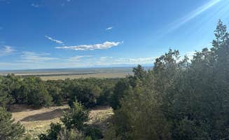
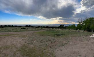
Primitive camping near Westcliffe, Colorado ranges from 8,000 to 11,000 feet in elevation, with temperatures dropping significantly at night even in summer months. The area sits on the eastern edge of the Sangre de Cristo range with numerous forest service roads offering access to undeveloped camping. Most dispersed sites don't have cell service, and summer afternoon thunderstorms are common between 2-5pm.
What to do
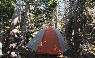
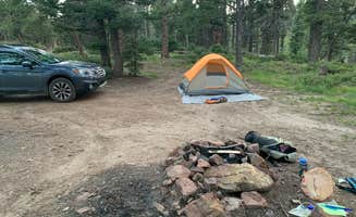
Alpine hiking trails: Several campgrounds provide direct access to mountain trails, including the Willow Creek Trail which features "[approximately] 15 or so dispersed camp sites along the forest road up to the parking lot for Willow Lake trail. Easy access to sites, easy access to trail head. Restrooms also available at trailhead" according to camper Silouan A.
Mountain biking routes: The rough roads around Hermit Pass OHV provide challenging terrain for experienced riders. One camper notes, "Your vehicle will prob need new brakes after this trip. Super beautiful but the road never eases up."
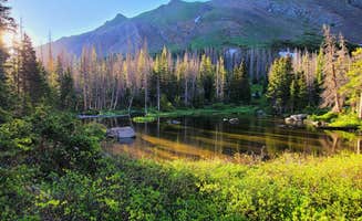
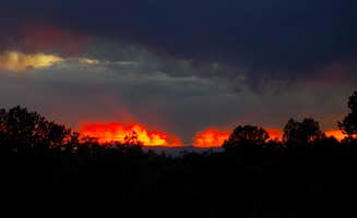
Stargazing opportunities: The area has minimal light pollution. At Cotton Creek Trailhead, camper Stacey F. observed "Once the wind settled, there were more stars than I've ever seen in my life. Endless views and endless stars - can't beat it!"
What campers like
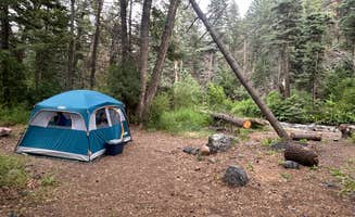
Solitude and space: The dispersed camping areas around Westcliffe offer privacy compared to established campgrounds. At Dispersed Sand Area 1, camper Phil G. reported "The spots are spread out enough to where I did not see or hear a soul while camping 2 nights. A large gathering of mountain goats hanging out along the road was a fun surprise!"
Wildlife encounters: The mountains around Westcliffe harbor diverse wildlife. At Dispersed Sand Area 1, one visitor mentioned "hearing the creek roaring in the background and feeling the sun on my skin surrounded by cactus" while another camper spotted mountain goats along the access road.
Easy town access: Despite feeling remote, many campsites are relatively close to amenities. Jake M. noted that while camping at Dispersed Sand Area 1, they were "Close enough to town where we hit up the local brewery for drinks and food. Short drive from here to willow creek trailhead."
What you should know
Vehicle requirements: Many primitive campsites require high-clearance vehicles. At Cloverdale Mines, camper Shivors notes "Entry road has multiple water runoff ditches that make the road best for vehicles with decent clearance. If dry 4x4 not necessary."
Seasonal challenges: Summer brings significant insect activity. Cooper P. from Dispersed Sand Area 1 warns "mosquitoes were absolutely awful so be prepared (mid July)." Similarly, Phil G. described the mosquitoes as "horrendous" and noted they "could ruin someone's ability to enjoy the beauty."
Permit requirements: Some areas require permits beyond standard recreational passes. For backcountry camping at The Dunefield in Great Sand Dunes National Park, "camping requires a free permit from the visitor center. These are limited and available on a first-come, first-served basis."
Tips for camping with families
Easy access options: For families with young children, choose sites with shorter approaches. Cloverdale Mines offers relatively accessible dispersed camping where Stephani noted "We have neighbors 100 yards away and others further, so you won't have the whole wilderness to yourself, but that might be comforting!"
Weather preparation: Mountain weather changes rapidly. When camping at Cotton Creek Trailhead, bring layers as Angela E. observed "The sky is GORGEOUS... I've never seen so many stars!" but temperatures drop significantly after sunset.
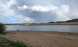
Water safety considerations: Some water sources may not be safe for recreation. At Lake Deweese, Kyli H. warns "DO NOT let kids or dogs in water, as there is a level red warning for toxic algae!!"
Tips from RVers
Site accessibility: For RVs, carefully research road conditions before attempting access. At Crestone Needle Trail, Mark P. found success: "I stayed on a pad that was build along with the road. Loved the views. The area is very interesting. Crestone is a tiny town with just about anything you might want within a walk from where I parked."
Turnaround planning: Some forest roads narrow significantly, making turnarounds difficult. When traveling steep forest roads, identify potential turnaround points before proceeding too far, as some routes like South Colony Basin offer limited options for larger vehicles.
Water conservation: No water sources exist at most dispersed sites, so bring sufficient supplies. For desert camping at The Dunefield, one camper recommended "bring way more water than you think you'll need" noting they each brought "about a gallon of water each, and by the time we hiked out the next morning we were down to the last couple of ounces."