Best Dispersed Camping near Jamestown, CO
Searching for a dispersed campsite near Jamestown? With The Dyrt, it's easy to find peaceful dispersed camping near Jamestown. Search nearby dispersed campgrounds or find top-rated spots from other campers.
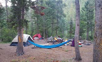
Five miles north of Nederland, National Forest System Road (NFSR) 226, commonly known as Gordon Gulch, turns east off of Colorado Highway 72. NFSR 226 intersects other forest roads: NFSR 314, 228, 233 and their off-shoots. There are 15 numbered, designated campsites scattered along the road system within 1.5 miles east of Highway 72. Camping is permitted in designated sites only. Take care when driving in this area. Snow and mud can persist through most of the year. The free Boulder Ranger District Motor Vehicle Use Map displays National Forest System (NFS) routes open to motorized travel and is available online and at the Boulder Ranger District offfice.
Streams; treat water for drinking.
With a few exceptions, dispersed camping is allowed on National Forest System lands. Restrictions protect resources, minimize road damage, and reduce conflicts between landowners and visitors. Camping is limited to 14 consecutive days in one location. After 14 days, the campsite must be moved a minimum of three miles. Camping can then continue for another 14 days. Camping is restricted to 28 days in any 60-day period. Some areas may require the use of designated campsites, and some areas, such as Indian Peaks Wilderness, require camping permits. More than 40% of lands within Boulder Ranger District's boundaries are private property. It is your responsibility to know if you are on private or public land.
West Magnolia Trailhead provides access to eight miles of singletrack trails for hiking, biking and horseback riding west of the Peak-to-Peak Highway south of Nederland. An additional eight miles of Forest Roads are open seasonally (check the Road Status Table before your visit) to motorized and non-motorized activities. Along these roadways are designated campsites. Camping is allowed within 50 feet of the campsite markers. There are no facilities of any kind. The free Boulder Ranger District Motor Vehicle Use Map displays National Forest System (NFS) routes open to motorized travel and is available online and at the Boulder Ranger District offfice. Recreational shooting closures exist in this area. Click here for more information.
NOTE: Campers who build any fires face fines up to $5,000 and/or up to six months imprisonment for open fire violations.
Leave No Trace must be observed, as in any outdoor space.
In any season this area is prone to very strong dry winds that can pick up a hot coal from a campfire that has lain dormant for as much as three days and ignite dry vegetation, causing horrific devastation. People from outside Colorado may not understand how tinder dry this area can be. 197 homes in this area have been destroyed by wildfires. All of these fires were started by humans.
Local residents overlook this area and if they see visible flame or smoke they will call the Boulder County sheriff. Any campers who require a campfire are recommended to disperse camp near Sugarloaf Mountain where fires are permitted.
Free camping (dispersed) is allowed on most national forest lands except in highly developed areas - such as trailheads, campgrounds and picnic sites - and in some of our most visited places. Be sure to check for regulations in advance and look for signs in the area to indicate if camping is allowed.
Some areas allow camping in designated sites only.
Know Before You Go
Check the weather and road closures before heading up. Follow Leave No Trace principles. There are no facilities or trash receptacles. Pack out what you pack in. Make sure camping is allowed. Many lands within the national forest boundary are private or otherwise owned. Check that you’re on National Forest lands: maps. Don't stay too long. Camping is limited to 14 days within any continuous 30-day period at any location within the same 20-mile radius. See Order Plan on building a campfire? Campfire restrictions can occur any time of year. Check for fire restrictions and if you build a campfire, know how to extinguish it.
Dispersed camping is prohibited within ¼ mile of either side of South St. Vrain Creek beginning at the Ceran St. Vrain trailhead and ending ¼ mile from the intersection of South St. Vrain Creek and National Forest System Road 252.1. MAP: https://trails.colorado.gov/trailheads/ceran-2341
The easy Ceran Saint Vrain Trail follows the South Saint Vrain Creek downstream for 1.9 miles. The trail ends at National Forest System Road 252, a rough four-wheel drive road. This road climbs 0.5 miles northwest to a four-way intersection from which it is a steep half-mile to the left up to Miller Rock. Miller Rock is a scenic high-point that offers 360-degree views.
Motorized vehicles prohibited. Dispersed camping is allowed at sites that are least 200 feet away from the trailhead, trail and creek. Campfires are permissible unless seasonal restrictions are in effect (contact district office). Fishing and hunting are allowed in accordance with regulations established by the Colorado Parks & Wildlife.
$1 / night
Free camping (dispersed) is allowed on most national forest lands except in highly developed areas - such as trailheads, campgrounds and picnic sites - and in some of our most visited places. Be sure to check for regulations in advance and look for signs in the area to indicate if camping is allowed.
Some areas allow camping in designated sites only.
Know Before You Go
Check the weather and road closures before heading up. Follow Leave No Trace principles. There are no facilities or trash receptacles. Pack out what you pack in. Make sure camping is allowed. Many lands within the national forest boundary are private or otherwise owned. Check that you’re on National Forest lands: maps. Don't stay too long. Camping is limited to 14 days within any continuous 30-day period at any location within the same 20-mile radius. See Order Plan on building a campfire? Campfire restrictions can occur any time of year. Check for fire restrictions and if you build a campfire, know how to extinguish it.
I have camped here twice so far. The first time I came was a Tuesday-Friday in late Sept, and I did not see a single other person! It was fabulous. I came back with a friend in late October, and the roads were extremely compromised (2-3ft deep mud puddles) so we did not camp near the river but it was still lovely. The sites are clearly marked and easily accessible. The river area is very green, but keep in mind that the mountains in front of you have been stripped due to fire. There is some road noise audible at these sites and I’d estimate about 8-10 planes flew overhead a day.
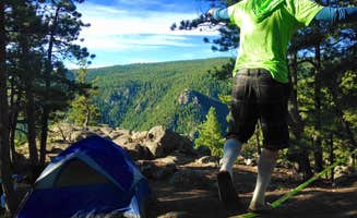
Kirby Gulch is a fantastic spot for anyone seeking a peaceful, off-the-grid camping experience near Grant, Colorado. Situated off Route 1038, this dispersed camping area offers stunning views of the surrounding mountains and easy access to outdoor activities like hiking and wildlife watching.
The campsites are well-spaced, providing plenty of privacy, and the area is generally clean, thanks to considerate campers. Since it’s a dispersed site, there are no amenities like water or toilets, so make sure to come prepared. A high-clearance vehicle is recommended for accessing some of the sites, especially after rain or snow.
What makes Kirby Gulch truly special is its tranquility. You can enjoy the sound of the wind through the trees, the crisp mountain air, and dazzling stargazing at night. It’s also a great starting point for exploring nearby trails or simply soaking in the serene environment.
If you’re comfortable with primitive camping and leave-no-trace principles, Kirby Gulch is a hidden gem worth checking out.
Bumpy ride up, but we were able to do it in our car SLOWLY. Absolutely beautiful place. Lots of campsite options. I was under the impression fires were allowed, as there were fire pits, but signs everywhere stating no campfires. Columbine Lake is a pretty hefty hike from the trailhead, but so worth the view. Had the entire place to ourselves pretty much all Friday. Beautiful beautiful beautiful
The place fills up on the weekend. I drove through most of the trail system and did not find a spot. Came back during the week and took a closer spot so as not to risk it. Trash is everywhere. Multiple poop spots are within 100ft of the fire pit with copious amounts of used tp lying around. Trees are slashed, cut, and the forest is not doing well. There are multiple long term campsites here so watch out for squatters. I stayed near the start and then a bit deeper, which prompted me to take photos. I forget the site numbers but honestly it’s not looking good in most places. At the very back are what look like a few nicer spots because they are hard to get to with a non off-road vehicle. It breaks my heart how this campground exists.
Couldn’t find any spots over the weekend. Drove through the whole campground. There is an absurd amount of trash everywhere, especially at closer campsites. There are multiple ‘long term’ campsites by the looks of the trash, gear, and supplies left out. The forest is not in good shape either.
Came back mid week and stayed at site #4 because it was close and I did not want to roll the dice on not securing a spot again.
Keeping it brief: -I thought someone had been through my campsite when I was sleeping due to things moved -I might have met the squatter at the site. Couldn’t be sure, but determined there were red flags after talking to the guy and did not want to stick around to find out -so much trash it breaks my heart
The county needs to do something about this campsite and the similar one North of Ned.
Great location with single tracks for hiking and mountain biking. Camping spots are well-marked. WiFi was decent. The sad part was the trash left behind from former encampments in some of the camping spots.
Two beat up, broken down cars at the entrance. Road is very rough, full of potholes from the start. Did not feel comfortable staying here.
Beautiful, but really need a compact 4x4 to get into and out of parking lot and there are tent sites only. We almost didn’t make it out with our 24 ft van (checked it out but didn’t stay overnight). Very crowded on a Saturday at 4:30pm.
Idk who did this but luckily there is service but anything nearby is outta the way. Says need permit online access filled it all out $10 plus camping. Dispersed without wheels requires a $4 fee too
Not super busy! Lots of open spaces when we arrived around 6pm.
This spot was really easy to get to and had at least one bar of service for Verizon and T Mobile. The spot was nice and secluded, but there was some trash left behind from previous campers:(
My husband bought a new tent so we just wanted to find something kinda close to Denver but still beautiful for just a quick overnight trip. Our goal was Chinns lake but stupid Apple Maps took us here instead. It was still beautiful and there were a handful of spots still open for us. I wouldn’t recommend for a big group unless you get there early and claim the whole top but we really enjoyed it! The lake was low but still beautiful.
We camped here after a Red Rocks show. The spot is a great area. About 20 minutes off of I-70. There are many pull offs along this road that could theoretically be good camp sites. However there are “no camping” signs, which is why I gave it 3 stars. Everything is great besides that: beautiful stars, good tent site, safe parking area.
The spot we chose is a bit farther down the road than the one listed here. It’s in between the bend in the road. We parked at the pull off and walked down a small hill to find a good tent site and a fire ring.
Also be aware it’s pretty chilly compared to just a few miles up the road. It was in the mid 30s at night.
-Moderate to heavy foot traffic -Busy, mostly big groups staying at sites having their own fun but plan ahead for finding a site -Friendly and respectful people -Very well maintained sites, trails, signage, and other infrastructure -I’d recommend at least AWD but 2wd should absolutely be able to go on the main road and access most sites (2-4) wil require awd/4wd
Plenty of spots available. But land and trees are decimated from fire in 2020. But hey it’s a free spot to sleep
We camped a very short walk from the parking lot. Amazing camp site with not many people around.
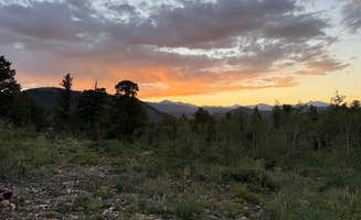
Wish I had more time to spend at this spot! The views are amazing! The road up was designed for more of an off-road rig. Fire ban was in effect. Just like the rest.. you will here atvs all night ripping trails in the distance. And the trains !! Still a great area!!
Overall a very fun spot if you have a vehicle with some ground clearance to get to the nice sites by the reservoir. My Peak Edition Atlas handled it well. Only complaint is the damn project at Gross reservoir is a 24 hour site and the lights are ridiculously bright.
I went up Pole Hill road in a 2018 Toyota Tacoma TRD off-road and it took everything in me to not scrape or bottom out. Lifted 4x4 is highly recommended.
Once you get past the off-road portion, the camping is amazing.
I have lived in the Boulder/Nederland area for over 30 years and have always enjoyed this part of the state. The West Magnolia area has great potential for dispersed camping. My wife and I tried to camp here this past week after not having camped at this location for many years. As others noted, it could make for a convenient base camp for tons of activities in the area.
Unfortunately, we were unable to find any usable campsite. All sites were occupied, even during the middle of the week. Many of those sites were occupied by long term campers as made clear by the multiple tents and bags of trash piled up. A couple primo sites had been abandoned by long term campers who left their trash, broken tents and chairs, food containers and other refuse in the campsites. It was really creepy coming upon these sites. Sadly, West Magnolia has become an extreme heavy use/abuse area. As someone who has spent years in the outdoors for days and weeks at a time, I would even question the health and safety of staying in some of these heavily used sites due to obvious lack of care and stewardship (think human waste close to camp). If you decide to camp here, and can find a suitable site, please be mindful of keeping yourself and gear away from potential health hazards.
West Magnolia is still a nice place to hike and bike, but I cannot recommend it for overnight camping.
We parked in the parking lot and walked into the valley. After a while we found quite a lot of options with fireplaces already there. So you should mostly find something.
It is quiet, but also a popular spot for hikers so early in the morning, some people arrived. But you can camp far enough in the valley and away from the trail. Water is available if you have a purifier or filter system.
We came here after failing to find a dispersed location closer to Silverthorne. It turned out to be a hidden gem with lots of secluded sites. Plus the drive in/out is super easy (apart from the final road to the campsite; that requires a 4WD vehicle, without question) - it was more-or-less the same drive time as original choice. Just without the hassle of navigating a busy one-way dirt road.
Great campsite, enough room for 2 maybe 3 vehicles at campsite 21. Road is not too rough, would recommend 4wd if raining or snowing. There are some deep holes when coming in if raining. We did air down due to the rain and snow while we were there.
No one around
There is no discernible reason that the road is closed 2 miles before where this app says the site is. Internet search says it should be open til middle of November unless there is some weather or other issue. Lovely weather, locked gate.
Great views and easy enough to get to with any vehicle. Near some foot trails and some offroading, but there were signs of homeless people that had been there all summer. Trash scattered in areas and some semi permanent camp setups that were kinda trashed. Trains pass at all hours of the day, so be ready for that. Beautiful area, though, and would go back even with the trash. No fires allowed, but definitely signs of fireworks..
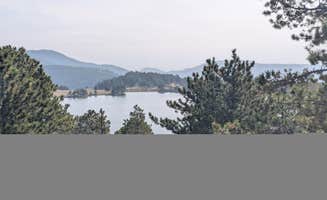
There are tons of options along the shore of the lake in this area. We kayaked into our campsite from Sunset Point campground on Labor day weekend and didn't have any issues finding a spot. There was lots of boat activity during the day but it slowed down in the evening.
Discover the beauty of dispersed camping near Jamestown, Colorado, where nature enthusiasts can enjoy serene landscapes and a variety of outdoor activities. With numerous options available, campers can find the perfect spot to unwind and connect with nature.
Frequently Asked Questions
Which is the most popular dispersed campsite near Jamestown, CO?
According to TheDyrt.com, the most popular dispersed campground near Jamestown, CO is Gordon Gulch Dispersed Area with a 3.6-star rating from 49 reviews.
What is the best site to find dispersed camping near Jamestown, CO?
TheDyrt.com has all 110 dispersed camping locations near Jamestown, CO, with real photos and reviews from campers.