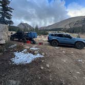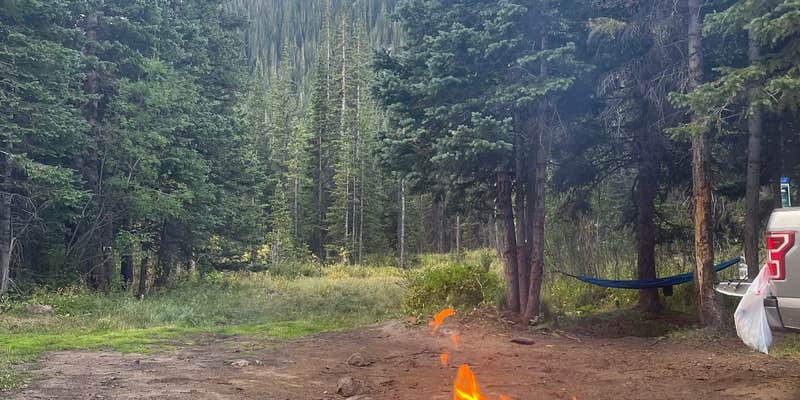
This free dispersed camping area requires a high-clearance 4WD vehicle to reach most sites along the rocky access road. Located within the Arapaho and Roosevelt National Forests, the trail extends from Empire up to Fall River Reservoir, with numerous unmarked camping spots scattered along the route.
The road presents a significant challenge with rocks, water crossings, and potholes that demand careful navigation. Andrew W. notes there are "lots of rocks, bumps, and pools of water to travel through to get anywhere." While some Subaru drivers attempt the journey, most successful campers arrive in trucks or SUVs with substantial ground clearance. The first mile or two passes through residential areas where camping is prohibited.
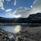
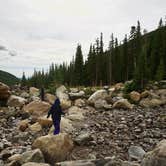
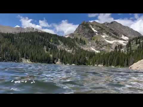
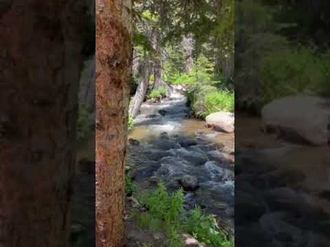
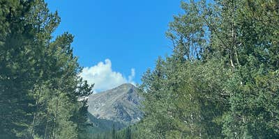
Sites become available after the residential section, with options continuing all the way to the reservoir itself. Many spots sit directly alongside rushing creek water, providing natural white noise and convenient water access for filtering. The reservoir holds brown trout and cutthroat, attracting anglers who report successful fishing trips. A trail circles the lake, and hikers can explore waterfalls that feed into the reservoir. Weather changes rapidly at this elevation, with afternoon thunderstorms common during summer months.
Mosquitoes can be intense near the water, particularly during evening hours. Previous campers sometimes leave trash behind, including broken glass that requires careful site inspection upon arrival. Cell service remains spotty with only occasional single-bar coverage. Despite being relatively close to Highway 70, the location feels removed from urban areas. For those seeking easier access, Chinns Lake Dispersed Camping offers similar dispersed camping with slightly better road conditions nearby.
Description
Dispersed Camping information: https://www.fs.usda.gov/Internet/FSE_DOCUMENTS/fseprd577265.pdf
With a few exceptions, dispersed camping is allowed on national forest public lands. Camping in the national forest at one location is limited to 14 consecutive days. The campsite must then be moved a minimum of three miles. Camping can then continue for an additional 14 days. Camping is restricted to a maximum of 28 days in any 60-day period.
More than 40% of lands within the Arapaho National Forest boundary are private or otherwise owned. A map showing land ownership is recommended. It is YOUR responsibility to know if you are on private, city, county, state, national park or national forest land.
Pack out all trash. There are no services.
Practice Leave No Trace ethics
RV Road Trip Guides


Map & DirectionsFall River Reservoir Dispersed Camping Trail is located in Colorado near Empire
Directions
I-70 westbound, take exit #238 Fall River Road. Drive approx. 6 miles to the 2nd switchback and turn left on the dirt road, Rainbow Road. Continue on this road until you see the sign and split for Fall River Reservoir to the right and Chinns Lake to the left.
Coordinates
39.81918270922694 N
105.68887192056769 W
Connectivity
 T-Mobile5GExcellent CoverageVerified by 7 usersLast on 7/22/26
 VerizonLTESome CoverageVerified by 6 usersLast on 7/22/26
 AT&TNo CoverageVerified by 3 usersLast on 7/22/26
Connectivity
- T-Mobile5GExcellent CoverageVerified by 7 usersLast on 7/22/26
- VerizonLTESome CoverageVerified by 6 usersLast on 7/22/26
- AT&TNo CoverageVerified by 3 usersLast on 7/22/26
Access
- Drive-InPark next to your site
Site Types
- Tent Sites
- Standard (Tent/RV)
- Dispersed
- Group
Features
For Campers
- Alcohol
- Pets
- Fires
DISPERSED CAMPING
Enjoy dispersed camping on government land and leave no trace. Pack in and pack out. No (or limited) services at this camping area. Permit may be required.
PERMIT might be REQUIRED
We curate permit requirements across the US for our PRO members. Try PRO to see if Fall River Reservoir Dispersed Camping Trail needs a permit.
Drive Time
- 1 hr 19 min from Denver, CO
- 1 hr 29 min from Boulder, CO
- 2 hrs 1 min from Greeley, CO
- 2 hrs 5 min from Fort Collins, CO