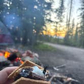
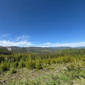
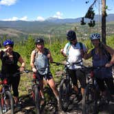
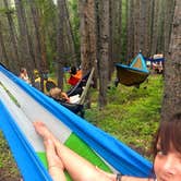
Free dispersed camping along Rollins Pass Road draws a steady mix of mountain bikers, hikers, and off-road enthusiasts to this stretch of Roosevelt National Forest above Fraser. Access varies depending on which gates are open: the road can be reached from the Lakota Trail neighborhood or from Highway 80, but upper sections with more established fire rings are only accessible when seasonal gates are unlocked, typically between mid-June and mid-September. Campers should check the official Rollins Pass website before heading up, as designated spots are marked on the county map and the area is considered sacred land with strict leave-no-trace expectations.
Road conditions are a real factor here. Approaching from Winter Park, the route involves sharp rocks and deep ruts that challenge even four-wheel-drive vehicles. The spots with fire rings fill quickly, especially on weekends, so arriving early matters. Alex S. sums up the atmosphere as "beautiful and busy," which captures the tradeoff well: open sightlines toward the surrounding peaks, but consistent off-road traffic and weekend crowds that bring noise and, at times, fires during active burn bans.
Tent space is limited due to dense tree cover, making hammock setups more practical in many spots. Cell service exists but runs spotty. The pass sits at the start of single-track trails descending toward Winter Park, and James Peak and St. Mary's Glacier are reachable from nearby trailheads. Campers who want a different setup nearby can look at East Portal Trailhead Dispersed, Roosevelt NF or Corona Pass Road (FR 149) Dispersed, Arapaho NF for comparable dispersed options along the divide.
Description
Trailhead located on the Continental Divide and on the Grand/Boulder County line. There is parking for about 15 vehicles. The trailhead provides access to the Indian Peaks and James Peak Wilderness Areas, James Peak Special Interest Area, the Continental Divide National Scenic Trail, and the Moffat Railroad historical sites.
RV Road Trip Guides


Map & DirectionsRollins Pass Dispersed Camping is located in Colorado near Fraser
 Dispersed Camping
Directions
From Winter Park, CO, drive south on US Highway 40 approximately one mile to County Road 80 (Forest Road 149) and turn left. Drive 15 miles to the Continental Divide. No motorized route connects across the Continental Divide. One may hike or bicycle across and around the collapsed Needle's Eye Tunnel to Forest Road 149 that leads to Rollinsville, CO.
Coordinates
39.93512838 N
105.68208582 W
Connectivity
 T-MobileNo Coverage
 VerizonLTESome Coverage
- AT&TNo Coverage
Connectivity
- T-MobileNo Coverage
- VerizonLTESome Coverage
- AT&TNo Coverage
Access
- Drive-InPark next to your site
- Walk-InPark in a lot, walk to your site.
Site Types
- Dispersed
Features
For Campers
- Firewood Available
- Phone Service
- Alcohol
- Pets
- Fires
DISPERSED CAMPING
Enjoy dispersed camping on government land and leave no trace. Pack in and pack out. No (or limited) services at this camping area. Permit may be required.
PERMIT might be REQUIRED
We curate permit requirements across the US for our PRO members. Try PRO to see if Rollins Pass Dispersed Camping needs a permit.
Drive Time
- 2 hrs 25 min from Denver, CO
- 3 hrs 7 min from Greeley, CO
- 3 hrs 11 min from Fort Collins, CO
- 3 hrs 58 min from Boulder, CO