Best Camping near Beulah, CO
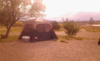
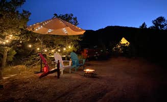
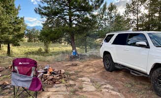
Looking for the best campgrounds near Beulah, CO? Enjoy the scenic camping, fun activities, and sights and sounds of Beulah. Search nearby campsites and find top-rated spots from other campers.
Great Sand Dunes National Park and Preserve is in the San Luis Valley of south-central Colorado at an elevation of 8,175 feet. The dunes lie on the eastern edge of the valley at the base of the Sangre de Cristo Range. The dunefield is part of the nearly 150,000 total acres of the park and preserve that also protects alpine lakes, tundra, six peaks over 13,000 feet, ancient spruce and pine forests, large stands of aspen and cottonwood, grasslands, and wetlands. The park is part of a fragile, dynamic system that influences and sustains the tallest dunes in North America. President Herbert Hoover established the park unit as a national monument by presidential proclamation on March 17, 1932 through the Antiquities Act. The Works Progress Administration constructed the Superintendents Residence, now listed on the National Register of Historic Places. But otherwise, GRSA did not see a great deal of development during the New Deal. Park development did not occur in earnest until Mission 66. During this period, the NPS was able to construct a Visitor Center, the Pinon Flat Campground (88 sites), a picnic area, five comfort stations, six single family residences and a triplex, while also building or improving roads and trails through the park. The Visitor Center shows the motivation of the Western Office of Design and Construction to configure designs to corresponding regions using principles of regional modernism. Built in the Pueblo Revival style, the Visitor Center mimics adobe construction through modern materials and forms blended with traditional materials and forms seen during the CCC-era in Cecil Dotys work. Following Mission 66, Congress designated nearly 91% of the monument as wilderness in 1976, which certainly limited the parks ability to further develop visitor and administrative facilities. GRSA became a national park and preserve in 2000, which also included a transfer of land from the Rio Grande National Forest.The dunes have long stood as a landmark for travelers from ancient North Americans to Southern Ute, Jicarilla Apaches, Navajos, early explorers, gold miners, homesteaders, ranchers, farmers and migrant field workers, to you - today's park visitor.
Great Sand Dunes' wide range of natural features provides endless outdoor recreational activities. The park is perfect for kids, who love exploring the dunefield on foot or by sled. Medano Creek, at the base of the dunes, is a popular place in the summertime. Kids and adults alike love to splash in the cool water. Many kid-friendly, ranger-led activities and a junior ranger program are available. Many miles of hiking and backpacking trails lead through the park's forests and alpine terrain, including the Mosca Pass Trail, Dunes Overlook/Sand Ramp Trail and Indian Grove Trail.
Great Sand Dunes are the magnificent centerpiece of a natural system that includes high mountain peaks, sparkling streams, vast grasslands and lush forests. The campground is situated among pinon pines and sagebrush beneath the majestic Sangre de Cristo Mountains. Most sites have beautiful views of the snow-covered peaks. A wide variety of grasses and wildflowers can be found throughout the area, and mule deer are commonly seen in and around the campground.
Zapata Falls is just south of the national park off Highway 150. A short but slippery 1/2-mile hike leads to a 25-foot high cascade. Simply driving to the trailhead provides an excellent view of the entire dunefield and San Luis Valley, especially at sunrise or sunset. San Luis State Wildlife Area is located at the western edge of Great Sand Dunes National Park. It features a large natural lake popular for boating, water skiing, sailing, windsurfing and fishing.
This is not a staffed facility. Campground hosts may be available for assistance. Visitors are responsible for knowing their site number and proceeding to the correct site after 2:00 PM. Early check in is not available. A no-show visitor is one who does not arrive at the campground during their reservation, and does not cancel their reservation. Because this is an unstaffed location, the site will be held for the duration of the reservation and the visitor will not receive a refund for time not spent in the site. Due to the limited number of sites in Pinon Flats Campground, please cancel or change your reservation if you can not use it, so other campers have an opportunity to stay. Rules and Reservation Policies
$80 / night
$25 - $169 / night
A short drive up the gravel road that leads to the Bureau of Land Managements Zapata Falls Campground (CG) will let visitors to the area see the San Luis Valley and Great Sand Dunes National Park & Preserve from a whole new perspective. The campground offers birds-eye views of the valley floor below, the San Juan Mountains to the west, the adjacent Great Sand Dunes National Park and Preserve, and several 14ers and many other towering peaks of the Sangre de Cristo Mountain range that Zapata Falls CG sits on not to mention spectacular sunrises, sunsets and night skies! Zapata Falls CG has 23 single campsites, 1 group site and 1 camp host site nestled among pi__on pines along two one-mile long loops. The sites on one loop are designed for tent campers. Parking spurs on the second loop vary a little in length but in general can handle RVs, towed campers, or other configurations of vehicles up to about 50 feet long. A new trailhead in the campground supplies a link to the South Zapata Creek Trail and the Sangre de Cristo Wilderness. A second trail, next door to the campground in the day-use area, leads visitors on a mildly steep half-mile hike to Zapata Falls, which gives the campground its name.
Zapata Falls Recreation Area is a destination known for its waterfall viewing and sweeping vistas of the San Luis Valley, its soaring mountain ranges, and the adjacent Great Sand Dunes National Park. From the waterfall, the trail continues onto the Rio Grande National Forest, for those seeking a backcountry experience in the high country above and the Sangre de Cristo Wilderness. Recreation Sites Standard Nonelectric Rv Nonelectric Group Tent Only Area Nonelectric Overnight
Zapata Falls Special Recreation Management Area The Zapata Falls Special Recreation Management Area (SRMA) is rich in history and geology and offers opportunities to hike, camp, mountain bike and view spectacular scenery. Zapata Falls and the 628 acres surrounding them are State Trust Lands owned by the Colorado State Land Board and are also a designated Colorado Natural Area. They are cooperatively managed with the Bureau of Land Management. History The name _ Zapata _ is the Spanish word for shoe and is tied to the history of settlement in the San Luis Valley. In 1864, Mexican families established the community of Zapata at the western base of the Sangre de Cristo Mountains and raised sheep and other livestock. In the 1870s, cattleman consolidated land holdings and established one of the San Luis Valleys first and largest cattle ranches know as Zapata Ranch, which remains an active ranch today. Geology Zapata Falls SRMA perches on the edge of an active rift valley. The San Luis Valley was formed when geologic activity along the Rio Grande Rift, a giant crack in the earths top layers, caused the rugged Sangre de Cristo Mountains to rise and the flat plain of the San Luis Valley to sink. Bedrock lies 5,000 to 13,000 feet below the valley floor, beneath layers of gravel, soil, and water. Approximately two million years ago, alpine glaciers inched down the steep slopes of the Sangre de Cristo Mountains. Water flowing from the glacier and snowfields in the valley above found a weak spot near the end of a moraine a huge rock pile deposited thousands of years ago by a glacier. For thousands of years, water has carved its path, forming Zapata Falls. Dont Take the Plunge at Zapata Falls The cold waters of South Zapata Creek drop more than 25 feet through a narrow, rocky canyon. Please use extreme caution when hiking or wading around the base of Zapata Falls. In spring and summer, the water is cold, the current may be strong, and the rocks are slippery. In winter, climbing to the base of the falls is a slick proposition. Zapata Creek freezes into a sheet of ice blanketed by snow. Beware, the ice may not be thick enough to support your weight. There is no view of the falls from above; trying to climb the rocky walls is dangerous to you and to people below you. The falls are home to the black swift, a rare and elusive bird that nests only in the misty reaches of waterfalls. Stay on the trails to keep from disturbing the birds nesting in the cliffs.
Zapata Falls Trail To reach Zapata Falls, you will need to take a short but arduous hike to Zapata Creek. The falls are upstream from where the trail meets the creek. The only way to view the falls is to get your feet wet by wading carefully upstream to the base of the falls. Length: 1/2 mile each way Elevation: 9,000 to 9,400 feet Connections: South Zapata Lake Trail (U.S. Forest Service Trail #852) Other Nearby Attractions: NPS-Great Sand Dunes National Park and Preserve. USFS-Rio Grande National Forest and Sangre de Cristo Wilderness. BLM-Blanca Wetlands Recreation Area. USFWS-Baca and Alamosa National Wildlife Refuges. Great Sand Dunes Oasis-Restaurant, gift shop, and lodge (near GRSA Park entrance). Ft. Garland Museum and Cultural Center. Colorado Gators Reptile Park. UFO Watchtower. Sand Dunes Hot Springs Pool. Other Nearby Campgrounds: Pinyon Flats CG, Great Sand Dunes NPP
Camping opportunities abound at Lathrop. Lathrop’s two campgrounds have 103 sites that can accommodate motor homes, trailers and tents, and offer either a basic or improved camping experience. Improved Sites provide 20/30/50 amp electricity at the site, but do not provide water or sewer hookups. Piñon Campground is ideal for large camping units. Click the "Fees" link on the left side of this page for campsite prices.
Winter camping is available.
$36 / night
Nestled among aspen and tall Douglas fir trees, St. Charles Campground is in a quiet part of the Lake Isabel Recreation Area. Located on the banks of St. Charles Creek, the campground is popular with campers who enjoy the sounds of water tumbling through the shaded boulders.
Lake Isabel is stocked with brown and rainbow trout. The accessible lakeshore path provides ample fishing spots. Brook trout can be found in St. Charles Creek. Several trails begin at the recreation area. Hiking opportunities include the Snowslide Trail and the Cisneros Trail. Both trails are also open to motorcycles, and Cisneros is a challenging ATV route.
The campground sits a mile west of Lake Isabel in the Wet Mountains, a beautiful range in the San Isabel National Forest. At an elevation of 8,600 feet, Lake Isabel was designed and constructed in the 1930s as a recreational haven from the dusty plains far below. Rugged mountain peaks in the area provide water for the abundant wildlife and fish populations.
A nearby lodge offers paddle and rowboat rentals, groceries and a restaurant. Golf courses are about 15 minutes away.
Cancellations Individual Campsites: Cancellations up to 2 days before a reservation start date incur a $10.00 cancellation fee. A visitor who cancels a reservation the day before or on the day of arrival will pay a $10.00 service fee AND forfeit the first night's use fee including tax and applicable add-on for a campsite. Cancellations for a one-night reservation will forfeit the entire amount paid and will not be subject to an additional service fee. No-Shows A no-show visitor is one who does not arrive at a campground and does not cancel the reservation by check-out time on the day after the scheduled arrival date. Staff will hold a campsite until check-out time on the day following the arrival date. No-shows are assessed $20.00 service fee and forfeit the first night's rate, taxes and applicable add-on for a campsite. Refunds Visitors may submit a refund request through their Recreation.gov profile within 7 days of the end date of their reservation. Refunds will not be issued after the 7 days has ended. Refunds for debit or credit card payments will be issued as a credit to the original bank or credit card used to pay. For check or cash purchases, Recreation.gov will mail a Treasury check for refunds of cash, check, or money order payments to the address associated with the reservation. Treasury check refunds may take up to 6-8 weeks to arrive. In the event of an emergency closure, the Recreation.gov team or facility manager will refund all fees and will attempt to notify you using the contact information within the Recreation.gov visitor profile.
$25 / night
Aspen Acres is a small, quiet RV campground located in the less traveled San Isabel mountain range, only 25 minutes from I-25 at 9200 ft(Google Map HERE) Our R.V. sites all provide standard hook ups and are gravel and grass. We don't believe in asphalt and concrete pads up here in the mountains. Each site has water, electric(30 amp), and all but 7 have sewer. There are 8 cabins, a park model for large family's, 5 outfitter tent sites, and a handful of tent spaces. Wifi is available for those who want to connect. Oh, did we mention you don't have to go over any mountain passes to get here?
This campground is usually open Memorial Day weekend through Labor Day weekend with full service and, depending on snow conditions, is usually open through the middle of October with reduced service. Available activities include hiking, fishing, bicycling, motorcycle, and ATV. Fishing in Ophir Creek. A short drive will take you to various trailheads.
Available activities include hiking, fishing, bicycling, motorcycle, and ATV. Fishing in Ophir Creek. A short drive will take you to various trailheads.
Cancellations Individual Campsites: Cancellations up to 2 days before a reservation start date incur a $10.00 cancellation fee.__ A visitor who cancels a reservation the day before or on the day of arrival will pay a $10.00 service fee AND forfeit the first night's use fee including tax and applicable add-on for a campsite. Cancellations for a one-night reservation will forfeit the entire amount paid and will not be subject to an additional service fee. No-Shows A no-show visitor is one who does not arrive at a campground and does not cancel the reservation by check-out time on the day after the scheduled arrival date. Staff will hold a campsite until check-out time on the day following the arrival date. No-shows are assessed $20.00 service fee and forfeit the first night's rate, taxes and applicable add-on for a campsite.____ Refunds Visitors may submit a refund request through their Recreation.gov profile within 7 days of the end date of their reservation. Refunds will not be issued after the 7 days has ended. Refunds for debit or credit card payments will be issued as a credit to the original bank or credit card used to pay. For check or cash purchases, Recreation.gov will mail a Treasury check for refunds of cash, check, or money order payments to the address associated with the reservation. Treasury check refunds may take up to 6-8 weeks to arrive.__ In the event of an emergency closure, the Recreation.gov team or facility manager will refund all fees and will attempt to notify you using the contact information within the Recreation.gov visitor profile.
$24 / night
Great Sand Dunes National Park and Preserve is in the San Luis Valley of south-central Colorado at an elevation of 8,175 feet. The dunes lie on the eastern edge of the valley at the base of the Sangre de Cristo Range. The dunefield is part of the nearly 150,000 total acres of the park and preserve that also protects alpine lakes, tundra, six peaks over 13,000 feet, ancient spruce and pine forests, large stands of aspen and cottonwood, grasslands, and wetlands. The park is part of a fragile, dynamic system that influences and sustains the tallest dunes in North America. President Herbert Hoover established the park unit as a national monument by presidential proclamation on March 17, 1932 through the Antiquities Act. The Works Progress Administration constructed the Superintendents Residence, now listed on the National Register of Historic Places. But otherwise, GRSA did not see a great deal of development during the New Deal. Park development did not occur in earnest until Mission 66. During this period, the NPS was able to construct a Visitor Center, the Pinon Flat Campground (88 sites), a picnic area, five comfort stations, six single family residences and a triplex, while also building or improving roads and trails through the park. The Visitor Center shows the motivation of the Western Office of Design and Construction to configure designs to corresponding regions using principles of regional modernism. Built in the Pueblo Revival style, the Visitor Center mimics adobe construction through modern materials and forms blended with traditional materials and forms seen during the CCC-era in Cecil Dotys work. Following Mission 66, Congress designated nearly 91% of the monument as wilderness in 1976, which certainly limited the parks ability to further develop visitor and administrative facilities. GRSA became a national park and preserve in 2000, which also included a transfer of land from the Rio Grande National Forest.The dunes have long stood as a landmark for travelers from ancient North Americans to Southern Ute, Jicarilla Apaches, Navajos, early explorers, gold miners, homesteaders, ranchers, farmers and migrant field workers, to you - today's park visitor.
Great Sand Dunes' wide range of natural features provides endless outdoor recreational activities. The park is perfect for kids, who love exploring the dunefield on foot or by sled. Medano Creek, at the base of the dunes, is a popular place in the summertime. Kids and adults alike love to splash in the cool water. Many kid-friendly, ranger-led activities and a junior ranger program are available. Many miles of hiking and backpacking trails lead through the park's forests and alpine terrain, including the Mosca Pass Trail, Dunes Overlook/Sand Ramp Trail and Indian Grove Trail.
Great Sand Dunes are the magnificent centerpiece of a natural system that includes high mountain peaks, sparkling streams, vast grasslands and lush forests. The campground is situated among pinon pines and sagebrush beneath the majestic Sangre de Cristo Mountains. Most sites have beautiful views of the snow-covered peaks. A wide variety of grasses and wildflowers can be found throughout the area, and mule deer are commonly seen in and around the campground.
Zapata Falls is just south of the national park off Highway 150. A short but slippery 1/2-mile hike leads to a 25-foot high cascade. Simply driving to the trailhead provides an excellent view of the entire dunefield and San Luis Valley, especially at sunrise or sunset. San Luis State Wildlife Area is located at the western edge of Great Sand Dunes National Park. It features a large natural lake popular for boating, water skiing, sailing, windsurfing and fishing.
This is not a staffed facility. Campground hosts may be available for assistance. Visitors are responsible for knowing their site number and proceeding to the correct site after 2:00 PM. Early check in is not available. A no-show visitor is one who does not arrive at the campground during their reservation, and does not cancel their reservation. Because this is an unstaffed location, the site will be held for the duration of the reservation and the visitor will not receive a refund for time not spent in the site. Due to the limited number of sites in Pinon Flats Campground, please cancel or change your reservation if you can not use it, so other campers have an opportunity to stay. Rules and Reservation Policies
$80 / night
$25 - $169 / night
A short drive up the gravel road that leads to the Bureau of Land Managements Zapata Falls Campground (CG) will let visitors to the area see the San Luis Valley and Great Sand Dunes National Park & Preserve from a whole new perspective. The campground offers birds-eye views of the valley floor below, the San Juan Mountains to the west, the adjacent Great Sand Dunes National Park and Preserve, and several 14ers and many other towering peaks of the Sangre de Cristo Mountain range that Zapata Falls CG sits on not to mention spectacular sunrises, sunsets and night skies! Zapata Falls CG has 23 single campsites, 1 group site and 1 camp host site nestled among pi__on pines along two one-mile long loops. The sites on one loop are designed for tent campers. Parking spurs on the second loop vary a little in length but in general can handle RVs, towed campers, or other configurations of vehicles up to about 50 feet long. A new trailhead in the campground supplies a link to the South Zapata Creek Trail and the Sangre de Cristo Wilderness. A second trail, next door to the campground in the day-use area, leads visitors on a mildly steep half-mile hike to Zapata Falls, which gives the campground its name.
Zapata Falls Recreation Area is a destination known for its waterfall viewing and sweeping vistas of the San Luis Valley, its soaring mountain ranges, and the adjacent Great Sand Dunes National Park. From the waterfall, the trail continues onto the Rio Grande National Forest, for those seeking a backcountry experience in the high country above and the Sangre de Cristo Wilderness. Recreation Sites Standard Nonelectric Rv Nonelectric Group Tent Only Area Nonelectric Overnight
Zapata Falls Special Recreation Management Area The Zapata Falls Special Recreation Management Area (SRMA) is rich in history and geology and offers opportunities to hike, camp, mountain bike and view spectacular scenery. Zapata Falls and the 628 acres surrounding them are State Trust Lands owned by the Colorado State Land Board and are also a designated Colorado Natural Area. They are cooperatively managed with the Bureau of Land Management. History The name _ Zapata _ is the Spanish word for shoe and is tied to the history of settlement in the San Luis Valley. In 1864, Mexican families established the community of Zapata at the western base of the Sangre de Cristo Mountains and raised sheep and other livestock. In the 1870s, cattleman consolidated land holdings and established one of the San Luis Valleys first and largest cattle ranches know as Zapata Ranch, which remains an active ranch today. Geology Zapata Falls SRMA perches on the edge of an active rift valley. The San Luis Valley was formed when geologic activity along the Rio Grande Rift, a giant crack in the earths top layers, caused the rugged Sangre de Cristo Mountains to rise and the flat plain of the San Luis Valley to sink. Bedrock lies 5,000 to 13,000 feet below the valley floor, beneath layers of gravel, soil, and water. Approximately two million years ago, alpine glaciers inched down the steep slopes of the Sangre de Cristo Mountains. Water flowing from the glacier and snowfields in the valley above found a weak spot near the end of a moraine a huge rock pile deposited thousands of years ago by a glacier. For thousands of years, water has carved its path, forming Zapata Falls. Dont Take the Plunge at Zapata Falls The cold waters of South Zapata Creek drop more than 25 feet through a narrow, rocky canyon. Please use extreme caution when hiking or wading around the base of Zapata Falls. In spring and summer, the water is cold, the current may be strong, and the rocks are slippery. In winter, climbing to the base of the falls is a slick proposition. Zapata Creek freezes into a sheet of ice blanketed by snow. Beware, the ice may not be thick enough to support your weight. There is no view of the falls from above; trying to climb the rocky walls is dangerous to you and to people below you. The falls are home to the black swift, a rare and elusive bird that nests only in the misty reaches of waterfalls. Stay on the trails to keep from disturbing the birds nesting in the cliffs.
Zapata Falls Trail To reach Zapata Falls, you will need to take a short but arduous hike to Zapata Creek. The falls are upstream from where the trail meets the creek. The only way to view the falls is to get your feet wet by wading carefully upstream to the base of the falls. Length: 1/2 mile each way Elevation: 9,000 to 9,400 feet Connections: South Zapata Lake Trail (U.S. Forest Service Trail #852) Other Nearby Attractions: NPS-Great Sand Dunes National Park and Preserve. USFS-Rio Grande National Forest and Sangre de Cristo Wilderness. BLM-Blanca Wetlands Recreation Area. USFWS-Baca and Alamosa National Wildlife Refuges. Great Sand Dunes Oasis-Restaurant, gift shop, and lodge (near GRSA Park entrance). Ft. Garland Museum and Cultural Center. Colorado Gators Reptile Park. UFO Watchtower. Sand Dunes Hot Springs Pool. Other Nearby Campgrounds: Pinyon Flats CG, Great Sand Dunes NPP
Backcountry dispersed camping in Great Sand Dunes National Park offers an unforgettable and truly unique wilderness experience. If you’re seeking solitude and raw, untamed landscapes, this is the perfect spot to pitch your tent. With no designated sites, you have the freedom to find your ideal spot beyond the busy dunes and under an expansive star-filled sky.
The journey begins with a hike deep into the park’s rugged terrain, where you’re surrounded by towering sand dunes, alpine forests, and sweeping views of the Sangre de Cristo Mountains. The lack of light pollution makes stargazing an absolute highlight—this is one of the best places to witness the Milky Way.
Keep in mind, this is true backcountry camping: no facilities, no water sources, and you must pack out all waste. Permits are required, so be sure to plan ahead. The environment can be challenging, with extreme temperature swings and strong winds that shift the sand beneath your feet. Good preparation and Leave No Trace practices are a must.
The rewards are well worth the effort. From sunrise hikes to the serene sound of nothing but wind across the dunes, this camping experience immerses you in nature’s raw beauty like few others can. It’s an adventure you’ll carry with you long after you’ve left the dunes behind.
Highly recommend skipping the tent and sleeping under the stars!
This is a lovely campground, overlooking Colorado Springs. There are some pull through sites and many back in. The wind can be a little fierce. The showers and other facilities are clean and well-maintained, and my only complaint is the showers are more lukewarm than hot.
Beautiful location. Clean, modern restrooms. Well maintained services building with showers and laundry. Nice level sites.
Clean campground and restrooms. Great views of Spanish peaks
Small park, plenty of room to relax. Trash receptacles close. Creek on the south side of park. Many pit toilet. Camp host during operation. Both times we stayed here the host was very helpful and friendly.
Was able to find a really nice open spot with amazing views of the mountains. Was big and spacious enough for me and my friend to camp in our vans. No one around for miles!
Gated off. Not accessible
Nice CG with a lot of amenities for kids. Large sites, good FHUs. We booked a pull through - level gravel (shame they don't rake the sites between stays). A lot of constant road noise from I-25. Great riparian area with trails outside of the CG. We would stay here again.
The sky is GORGEOUS. The road is very rocky & very rough, so you'll want to have decent clearance and be prepared to take it slow. I've never seen so many stars!
We went on a Saturday and it wasn’t crowded at all. The dispersed sites aren’t far from the road since most of the road goes down a valley with hills on both sides however there’s a nice creek running down the whole way. Definitely check it out if you don’t mind a colder night in a valley. Not much room to explore outside your vehicle unless you’re okay walking down the dirt road to see other sites and views.
The road is a well maintained gravel road. There are quite a few available spots for folks with 4x4 drive or tent camping. I would NOT suggest this for larger rvs. I travel in a camper van and the spots I could use were more limited but still a few available.
Honestly, just the drive is worth it. The scenery is amazing. You’re winding down the road next to a creek (was dry when I was there) in between mountains. It’s absolutely amazing.
Zero signal. Like absolutely none.
There is a rest stop a few miles in with basic toilets. Nothing special but really nice option to have.
Close proximity to the dunes, allows you to access at night and throughout the day to experience the range of landscapes the park provides.
The camp site has flushing toilets and drinking water.
Would highly recommend if you can snag a site.
I walked up the road about three miles on the way to the lake because the beginning of the road was way to rough for my van with large rocks about 6 inch diameter. There were lots of people disperse camping on the hilside above Como Road.
Couldn’t get to trail head due to private gate blocking the road.
Was pretty busy, hard to find a spot at first but found a campsite across the stream that you cross a log on. Beautiful drive to get to.
Drove ~3 miles along the service road to find our spot, it was the second pull off “open-area” with several fire pits to choose from. Road was a little bumpy but would be fine with a 2WD. Gorgeous, secluded spot next to the creek. No Verizon service.
Pretty smooth mountain road, lots of site options. We found one that was down back from the main road and near the creek. Needed 4WD to get down there, but other sites 2WD would be fine. Appears to be a local cow wandering around, she approached our campsite but went the other way.
We had a great time. Our family and another reserved two sites next to each other. The pools on site were perfect for the kids. On site mini golf was a blast. The views in the campground were awesome. Aside from the aforementioned, there was a small store on site with ice and wood (can't bring your own wood) and the food they served at the mess hall was fire.
We had a good time.. activities were fun and location is beautiful!
This place was great! We originally planned just to do a daily soak before heading to our next campsite but ended up just staying here because we enjoyed it so much. The camp sites were simple but great and you have total access to all hot springs, bathrooms, showers, sauna, AND a communal outdoor kitchen. We participated in the clothing optional experience but didn’t feel like we had to. Great people all around from guests to staff. Highly recommend!
Locked gate at indicated entry point.
Beautiful views of the dunes and the mountains! Bathrooms were super clean and convenient. Highly recommend!
This was my boys and my time first “real camping” with a tent and this was the perfect campground to get started with! Staff were super friendly. Site sells firewood and kindling, every site had its own fire pit, and amazing views were present at every area on camp. Showers and toilets were a little old but were clean and well maintained! Don’t pass this one up!
loved this spot even stayed a couple extra days right by nice size creek the cooler weather was nice and meant not alot of bugs. more traffic on road than expected but not bothersome. people close by but not close enough to hear or bother you in anyway. site was clean. there were more shaded ones but we chose next to water. were a couple empty close by on a holiday weekend.
Stayed One night for Tent Camping, came with everything needed. Clean bathroom and showers. Great scenery and amazing night sky view.
We love to come here to get great views of the Spanish Peaks. This time we had site 93 that faced away from the peaks. Still gorgeous but is a subtle way.
We had to change plans last minute and arrive here on short notice. They had sites to accommodate us and they were very welcoming. This was hands down the nicest privately owned rv park/campground we have ever stayed at! The bathroom suites have recently been remodeled and they are so nice! Best shower of our 10 day road trip. Nice laundry facilities, community rec room, hot tub, and even a hiking trail to the top of the mountain. Highly recommend.
Camping near Beulah, Colorado, offers a mix of stunning landscapes and outdoor adventures. Whether you're looking to hike, fish, or just relax under the stars, there are plenty of campgrounds to choose from.
Camping near Beulah, Colorado, has something for everyone, from stunning views to family-friendly activities. Just be prepared for the elements and plan accordingly!
Frequently Asked Questions
What camping is available near Beulah, CO?
According to TheDyrt.com, Beulah, CO offers a wide range of camping options, with 130 campgrounds and RV parks near Beulah, CO and 34 free dispersed camping spots.
Which is the most popular campground near Beulah, CO?
According to TheDyrt.com, the most popular campground near Beulah, CO is Arkansas Point Campground — Lake Pueblo State Park with a 4.3-star rating from 39 reviews.
Where can I find free dispersed camping near Beulah, CO?
According to TheDyrt.com, there are 34 free dispersed camping spots near Beulah, CO.
What parks are near Beulah, CO?
According to TheDyrt.com, there are 13 parks near Beulah, CO that allow camping, notably PSICC and Great Sand Dunes National Park And Preserve.