Camping sites near Leslie, Arkansas center primarily on Buffalo National River and Ozark National Forest areas. The landscape features limestone bluffs, dense hardwood forests, and elevations ranging from 800 to 2,200 feet. Water levels in the Buffalo River fluctuate seasonally, with spring bringing higher, faster currents while late summer sees calmer, lower water conditions suitable for novice paddlers.
What to Do
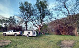
Canoeing trips: Float outfitters operate near Buffalo Point for various trip lengths. "We stayed 4 nights (Thu-Mon) in June and went on a canoe trip on Saturday. Our float trip was amazing and we were on our way back to our vehicle on the 3 pm bus (trip was Dillard's Ferry to Rush)," reports Susan R. from Buffalo Point.
Cave exploration: Tour Blanchard Springs Caverns for $10 admission. "Cavern Tours are very cool! Keep food stuffs put away. Bring Bug spray...Lots," advises Jarrod L. from Blanchard Springs Recreation Area. The caverns offer both standard tours and more adventurous options.
Waterfall hunting: Multiple falls within 30-minute drives. "Many waterfalls nearby usually very peaceful," notes Nikki M. about the Richland Creek Recreation Area. Six Finger Falls and Falling Water Falls are accessible by vehicle with short walks from parking areas.
What Campers Like
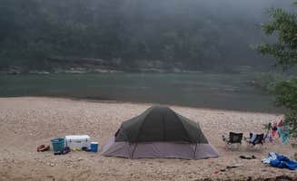
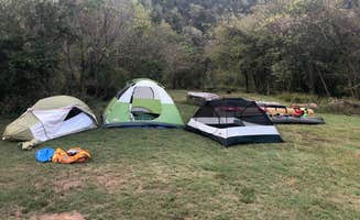
Clear swimming holes: Natural pools throughout the region provide relief from summer heat. "There is a paved walk down to the river from B Loop. We found a cool cave at the far right end of the rock beach. The water was absolutely beautiful Thursday-Saturday," describes Susan R. about Buffalo Point.
Wildlife viewing: Dawn and dusk offer best opportunities. "Deer were everywhere and the Indian Rockhouse hike was really great. I will def be back in warmer weather to float the river which it was low for the winter. Falls colors everywhere and great weather," shares Heath L. about his stay at Buffalo Point.
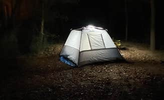
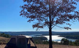
Night sky viewing: Minimal light pollution at remote sites. "We enjoyed a nice walk along the water, views of the sunset from a small cliff, and a peaceful night with out cell service! Highly recommended for those who are looking to get away from reality!" explains Kaylee W. about her experience at Tyler Bend Campground.
What You Should Know
Road conditions: Access varies significantly between campgrounds. "The dirt road leading in is well maintained," notes Josh B. about Richland Creek Recreation Area, while another camper warns: "If you travel the north road from the campground for about 3.5 miles you will get decent service from AT&T but I don't know about the other carriers."
Seasonal operations: Most facilities close during winter months. Buffalo Point operates from March 15 to November 14, while primitive sites like Richland Creek Recreation Area remain accessible year-round though without maintenance during off-season.
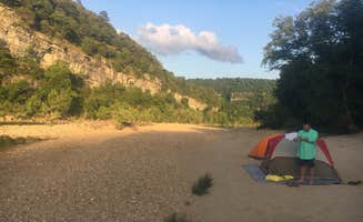
Water levels impact activities: Spring rains can cause rapid changes. "We got on the river about 10:45 am. By 8 pm Saturday, the water at the beach area was completely brown and we could tell the water was up a LOT. We saw a park ranger on Sunday and asked about the water level and she said it had gone up 12 feet by Saturday night," recounts Susan R. about Buffalo Point.
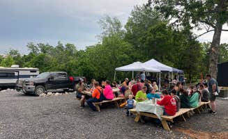
Noise levels vary: Some campgrounds enforce quiet hours better than others. "This campground had the potential to be amazing- it's beautiful, is right next to the river with amazing views of the stars, and has several hikes close by. But the camp hosts and rangers don't enforce any sort of quiet time or people capacity rules," reports Amanda W. about Buffalo Point.
Tips for Camping with Families
Easy access swimming: Designated areas suitable for children. "Good place to camp and very nice employees! Very clean campground and very clean bathrooms," notes Corbin I. about Maumee. The campground offers direct river access with shallow areas.
Short hiking options: Several trails under 1 mile. "We did the Over Look trail and it was pretty well maintained. We also went to the Rush Ghost Town and did the short loop to check it out," shares Susan R., describing family-friendly activities near Buffalo Point.
Spacious sites: Look for campgrounds with room between neighbors. "The camp sites were very roomy! Clean bathrooms. Hikers' paradise! Love it here!" exclaims Leah H. about Blanchard Springs Recreation Area.
Tips from RVers
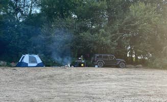
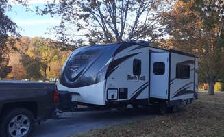
Limited hookup options: Plan for self-sufficiency. "We stayed at a no hook ups site overlooking the water in the E loop site 17. Many of the waterfront sites were closed because they were underwater. Well spaced sites. $16 night, hence four stars w no hookups," explains Jess C. about Choctaw Recreation Area.
Size restrictions: Many camping areas unsuitable for larger rigs. "Not great for big rigs, a lot of the sites are too small," warns Lucy P. about Tyler Bend Campground. Sites at Buffalo Point may accommodate larger vehicles in specific loops only.
Loop selection matters: Research site angles and sun exposure. "Be sure and view the campsite online and consider the direction of the site. Some get full sun in the morning but most are shaded in the evening due to the mountain," advises Wayne J. from Buffalo Point.


 Ranger