Hikers seeking access to waterfalls and creek swimming will find Richland Creek Recreation Area positioned along a rushing waterway in the Ozark National Forest. The campground sits at the end of a gravel road system that requires careful navigation, particularly after rain when washouts and deep potholes can challenge low-clearance vehicles.
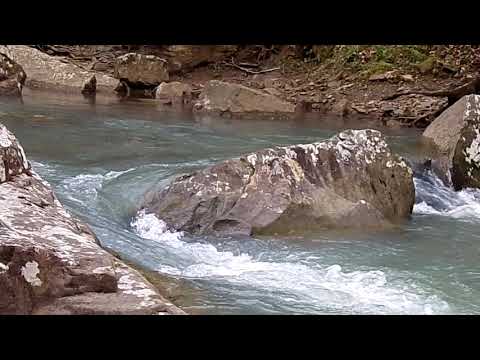
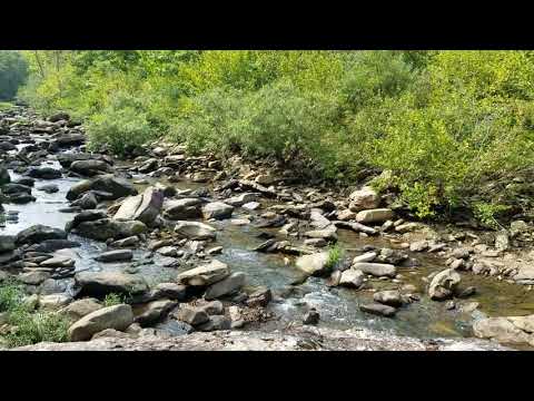
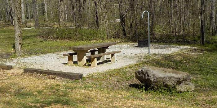
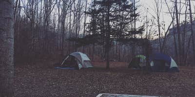
The established campsites form a loop with vault toilets and fire pits, though dispersed camping spots along the access road offer more privacy near the water. Patricia notes "You have the rushing river below your campsite and the mountains all around." The creek provides constant white noise and cooling opportunities, with several swimming holes accessible by short walks from camp. Clear water runs over rock formations, creating natural pools that campers use for relief from summer heat.
Twin Falls serves as the primary hiking destination, requiring a 2.5-mile trek that includes creek crossings and challenging terrain. The trail connects to other waterfalls in the area, including Falling Water Falls and Six Finger Falls. Campers report the hike takes most visitors 3-4 hours round trip, with some sections requiring carrying small children. Spring visits offer higher water flow but colder temperatures for swimming.
Road conditions demand attention from all visitors. Matt B. mentions the access requires "miles of gravel roads" with no cell phone service throughout the area. The Forest Service charges $10 per night when fee collection is active. Campers planning longer stays should prepare for primitive conditions with no water hookups or shower facilities. For additional camping options in the region, see places to camp near Witts Springs. The campground operates year-round, though spring and fall provide the most comfortable temperatures for hiking and water activities.
Description
Overview
This location is available on a first-come, first-served basis only. Visitors are required to physically arrive at the campground to purchase and claim a site. Once on-site, you may be able to pay for your campsite(s) by scanning a QR code using the Recreation.gov mobile app, and the Scan and Pay feature. If this option is available, you will need to first download the free Recreation.gov mobile app https://www.recreation.gov/mobile-app prior to your arrival as some remote areas have limited or no cellular service.
RV Road Trip Guides


Map & DirectionsRichland Creek Recreation Area is located in Arkansas near Witts Springs
Coordinates
35.79697 N
92.93411 W
Connectivity
 T-MobileNo Coverage
- VerizonNo Coverage
- AT&TNo Coverage
Connectivity
- T-MobileNo Coverage
- VerizonNo Coverage
- AT&TNo Coverage
Access
- Drive-InPark next to your site
- Walk-InPark in a lot, walk to your site.
- Hike-InBackcountry sites.
Site Types
- Tent Sites
- RV Sites
- Standard (Tent/RV)
- Group
Features
For Campers
- Trash
- Toilets
- Alcohol
For Vehicles
- Sanitary Dump
Drive Time
- 2 hrs 6 min from Little Rock, AR
- 2 hrs 10 min from Fort Smith, AR
- 2 hrs 23 min from Fayetteville, AR
- 2 hrs 45 min from Hot Springs, AR