Dispersed camping options near Morrilton, Arkansas concentrate primarily in the Ouachita National Forest with several undeveloped sites within a 30-45 minute drive. Most primitive camping areas sit at elevations between 500-1,200 feet, providing cooler summer temperatures than lowland areas. Winter camping remains accessible on most forest roads, though seasonal precipitation can create challenging conditions on unpaved access routes.
What to do
Hiking accessible trails: Several dispersed sites connect directly to hiking paths. At Forest Service RD 132 Ouachita National Forest, campers can access mountain vista points with minimal effort. One visitor noted, "Near Oak Mtn Vista overlook. Great spot; fantastic unobstructed view of the hills to the south."
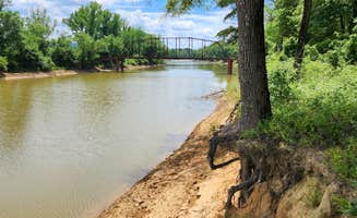
Creek exploration: Water features enhance many campsites. At Brown Creek Rd/FR805 Dispersed, a small seasonal creek flows behind the site. A camper described it as "Peaceful at night. The only sounds came from the birds, the breeze and the creek."
Wildlife observation: Dawn and dusk provide opportunities for wildlife viewing. Many sites support diverse animal populations. One camper at Harris Brake Lake mentioned, "absolutely beautiful place the fireflies here are amazing! Nobody else was camping here which made for some quiet nights."
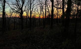
Star viewing: Clear nights offer excellent stargazing at secluded sites. Many forest locations have minimal light pollution. A camper at Forest RD 132 explained, "Lots of trees surrounding the site with an open sky above for star gazing."
What campers like
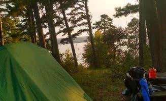
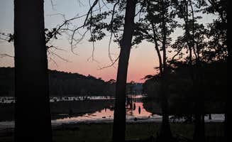
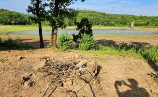
Lakeside views: Water views rank highly in camper reviews. At Harris Brake Lake, one visitor shared, "I really enjoyed this site. I stopped on a weekday and I was the only one there. It was nice watching the sun set over the lake."
Privacy and solitude: Midweek camping offers the most seclusion. One visitor at Harris Brake Lake noted, "No amenities but it's quiet and pretty and free. The sunset was gorgeous. We are the only ones here."
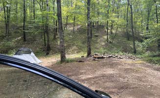
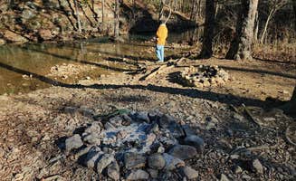
Well-maintained fire rings: Most dispersed sites feature established fire rings. At Tackett Mountain Road Dispersed, a camper found "a clean rock fire ring" and mentioned the site is "a nice place to simply hang out in."
Free camping access: All dispersed sites in national forests offer no-cost camping. A camper at Camp Robinson Dispersed Site appreciated that "The road back to it is well maintained and we had good cell reception with AT&T and Spectrum. The sunset was beautiful. Peaceful and quiet."
What you should know
Vehicle access considerations: Forest road conditions vary widely. At Brown Creek Cascade Dispersed Campsite, a visitor observed that "2-wheel drive passenger cars can make it to the site," though another camper noted difficulty finding decent firewood nearby.
Campsite availability patterns: Weekends see higher usage, especially in spring and fall. A visitor to Camp Robinson Dispersed Site warned, "I woke up at 11am to someone driving in then 12:30am then at 1:30 a loud truck came in slinging rocks."
Seasonal insect populations: Summer brings increased insect activity. One camper at Camp Robinson Dispersed Site advised, "I definitely put on bug spray right away. Nice place to sleep and get back on 40East in the morning."
Site maintenance varies: Some dispersed areas show signs of previous use. A Harris Brake Lake camper reported, "There was a ton of trash, including broken bottles and broken pans, near each site which was very unpleasant to see and camp near."
Tips for camping with families
Site selection for safety: Choose sites with level ground away from road traffic. At Forest Service RD 132, families appreciate that the "Large site if you are sleeping on the ground bring plenty of padding it is rocky and not very flat."
Wildlife education opportunities: Many sites provide natural learning environments. A Harris Brake Lake camper shared, "We did not swim or fish in the water, but the lake is beautiful and there is a decent looking boat launch on the property."
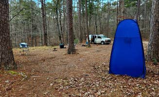
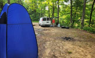
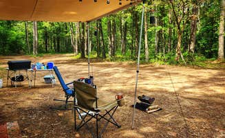
Preparation for limited amenities: Pack all necessities for primitive camping. Camp Robinson Dispersed Site offers minimal facilities, with one camper noting, "Great spot to pitch a tent by lake Conway. Isolated but not too far out."
Ticks and pest management: Check for ticks regularly during warmer months. A Harris Brake Lake visitor warned, "There is a lot of ticks here i pulled 7 off of me and my dog in one night. other than that it was wonderful."
Tips from RVers
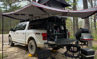
Size restrictions: Most dispersed sites accommodate smaller vehicles only. At Brown Creek Cascade Dispersed Campsite, a reviewer noted the site is "suitable for tent camping, car camping, camper vans & truck campers. Two vehicles can easily fit on this level site."
Leveling challenges: Bring leveling blocks for uneven terrain. A Harris Brake Lake camper advised, "We have a 25' travel trailer and didn't need to do any backing up to get in or out. Full cell signal with XFINITY mobile."
Water management: No water sources are available at dispersed sites. Plan accordingly for drinking and washing needs. A visitor to Harris Brake Lake mentioned, "No amenities but it's quiet and pretty and free. We are the only ones here."
Road navigation: Forest roads require careful driving. One camper at Harris Brake Lake suggested, "Got here during sunset and it was beautiful but the gravel roads are invisible at night so definitely have some daylight ahead of you."


 Legend