Dispersed camping near Ozark-St. Francis National Forests provides access to over 1.2 million acres of Arkansas wilderness spanning elevations from 600 to 2,700 feet. Summer temperatures average 85-95°F with high humidity while winter nights can drop below freezing. Seasonal thunderstorms create flash flood conditions on forest roads, particularly during spring and early summer months.
What to do
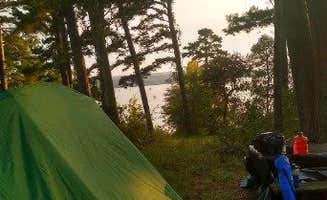
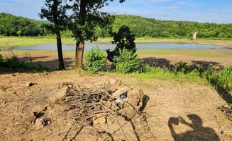
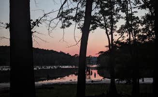
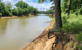
Waterfront fishing spots: Harris Brake Lake features multiple shoreline camping areas with good bass fishing access. "Just a picnic table no other amenities and the view is amazing great place to stay for free," notes Harris Brake Lake visitor Sara W.
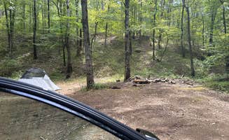
Hike to cascades: A short quarter-mile trail leads to Brown Creek Cascade from the Brown Creek Cascade Dispersed Campsite. "The South Fork of Brown Creek runs behind this campsite. Located next to the trailhead for Brown Creek Cascade - a short 1/4 mile hike (includes a creek crossing)," reports Fred S.
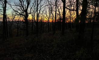
Mountain views: Forest roads provide access to elevated viewpoints. At Forest Service RD 132, one camper notes, "Near Oak Mtn Vista overlook. Great spot; fantastic unobstructed view of the hills to the south. Some shade in the summer. Fantastic view during the winter season."
What campers like
Solitude: Many dispersed sites offer genuine seclusion. At Camp Robinson Dispersed Site, campers enjoy peaceful evenings. "The birds and frogs sang all evening," writes Julie A., while another notes, "Peaceful and quiet."
Seasonal wildlife viewing: Spring and early summer bring firefly displays at certain locations. "Absolutely beautiful place the fireflies here are amazing! Nobody else was camping here which made for some quiet nights," reports Julian P. at Harris Brake Lake.
Budget-friendly options: All dispersed sites in the national forests are free with no reservation requirements. "It was gorgeous and obviously well taken care of. We were by ourselves the whole night! Designated fire pits and an awesome view of the lake," says a camper at Harris Brake Lake.
What you should know
Road conditions vary significantly: Forest roads may require appropriate vehicles. David H. warns about access to Forest Service RD 132 Ouachita National Forest: "Google told me it had a faster option and I stupidly accepted. The dirt road starting at HWY-7 is virtually impassible to get to this campground."
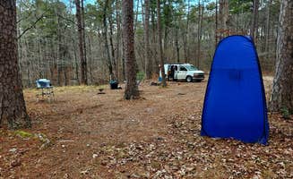
Wildlife encounters: Ticks are prevalent in warmer months. "There is a lot of ticks here I pulled 7 off of me and my dog in one night," reports one Harris Brake Lake visitor.
Trash management challenges: Pack in/pack out rules aren't always followed. One camper reported: "There was a ton of trash, including broken bottles and broken pans, near each site which was very unpleasant to see and camp near."
Limited privacy at road-accessible sites: Many spots are visible from forest roads. Fred S. notes at Brown Creek Rd/FR805: "The site is clearly visable from the forest road; no privacy, and dust may be an issue during the dry season."
Tips for camping with families
Pre-arrival timing: Arrive during daylight hours to locate suitable sites. "Got here during sunset and it was beautiful but the gravel roads are invisible at night so definitely have some daylight ahead of you," advises Ashley T. at Harris Brake Lake.
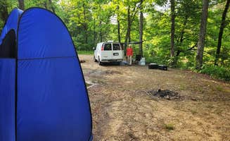
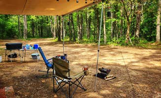
Campsite surface preparation: Many dispersed sites have uneven, rocky ground. At FR132/152 T-Junction Dispersed, Fred S. describes "a level dirt site with some embedded rocks jutting up," while Jacob F. recommends: "If you are sleeping on the ground bring plenty of padding it is rocky and not very flat."
Local traffic awareness: Certain sites experience vehicle traffic throughout the night. At Camp Robinson Dispersed Site, one camper reported: "I woke up at 11am to someone driving in then 12:30am then at 1:30 a loud truck came in slinging rocks and a guy was screaming out the window."
Tips from RVers
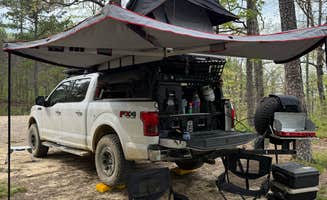
Size limitations: Most dispersed sites accommodate smaller rigs only. At Tackett Mountain Road Dispersed, Fred S. describes "a small dispersed campsite with a level dirt surface, just big enough to accommodate one vehicle - truck camper and smaller."
Leveling requirements: Many forest sites require substantial leveling. "Not level; some leveling is required. Dirt surface with exposed embedded rock," notes a reviewer about Forest Service RD 132.
Access points: Several sites have multiple entry options. At Harris Brake Lake, Samuel S. reports: "We had a really great night here. The place was mowed, there was a picnic table and firepit. I am towing a 19' travel trailer. And someone else is here with a 22'. There are a few places to park with no need to backup."


 Legend