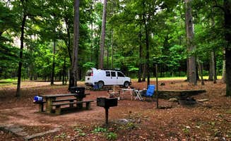
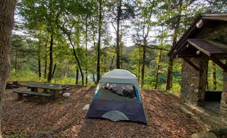
Best Camping near Russellville, AR

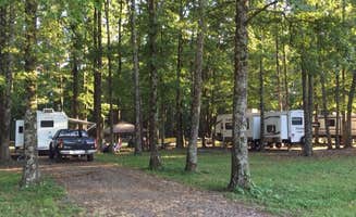
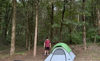
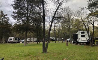
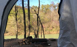
Join the fun near Russellville. With tons of outdoor activities and scenic camping, this is an excellent vacation spot for all kinds of travelers. There are tons of hikes and other fun activities to partake in. Experience some of the most stunning views that Arkansas camping has to offer. Find the best campgrounds near Russellville, plus reviews and photos from other campers like you.

Best Camping Sites Near Russellville, AR (173)

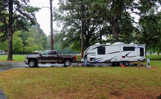
    Camper-submitted photo from Petit Jean State Park — Petit Jean State Park
    Camper-submitted photo from Petit Jean State Park — Petit Jean State Park
    Camper-submitted photo from Petit Jean State Park — Petit Jean State Park
    Camper-submitted photo from Petit Jean State Park — Petit Jean State Park
    Camper-submitted photo from Petit Jean State Park — Petit Jean State Park
    Camper-submitted photo from Petit Jean State Park — Petit Jean State Park

    1.

    Petit Jean State Park — Petit Jean State Park

    98 Reviews
    541 Photos
    618 Saves
    Adona, Arkansas

    The campgrounds feature a total of 125 campsites (including 26 pull-through sites). Thirty-five of the sites—the Class AAA sites—have 30 and 50 amp electrical, water, and sewer hookups. The 90 Class B sites offer 30 amp electrical and water hookups. All sites are reservable. Campsites are divided into four campground areas. Each includes a modern bathhouse with hot showers and flush toilets. Area "A" is near Lake Bailey and include sites along the lakeshore. Areas "B," "C," and "D" are located on the south side of Ark. 154 in wooded settings.

    Other campsite choices in the main camping area include a 44-unit Rally-style Area with 20 amp electrical service available for camping clubs.

    A trailer dump station is centrally located near the Rally-style camping area.

    Petit Jean is Arkansas's only state park with its own airport.

    • Pets
    • Fires
    • Electric Hookups
    • Phone Service
    • Reservable
    • ADA Access

    $25 - $40 / night

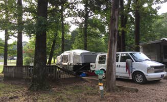
    Camper-submitted photo from Russellville Campground — Lake Dardanelle State Park
    Camper-submitted photo from Russellville Campground — Lake Dardanelle State Park
    Camper-submitted photo from Russellville Campground — Lake Dardanelle State Park
    Camper-submitted photo from Russellville Campground — Lake Dardanelle State Park
    Camper-submitted photo from Russellville Campground — Lake Dardanelle State Park
    Camper-submitted photo from Russellville Campground — Lake Dardanelle State Park

    3.

    Russellville Campground — Lake Dardanelle State Park

    16 Reviews
    42 Photos
    14 Saves
    Russellville, Arkansas

    This park is located in two areas on Lake Dardanelle, a 34,300-acre reservoir on the Arkansas River. The main site is in Russellville where you’ll find the Sport Fishing Weigh-in Pavilion, a fishing pier, swimming beach, boardwalk, trail, and visitor center with five aquariums, and the Lakeview Room meeting facility. Park interpreters lead a variety of programs and lake tours. There are 57 campsites in the Russellville area of the park (16 Class AAA, 14 Class AA, and 27 Class B) with 18 Class B sites in the Dardanelle area of the park.

    • Pets
    • Fires
    • Electric Hookups
    • Phone Service
    • Reservable
    • ADA Access
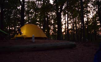
    Camper-submitted photo from Mount Magazine State Park Campground
    Camper-submitted photo from Mount Magazine State Park Campground
    Camper-submitted photo from Mount Magazine State Park Campground
    Camper-submitted photo from Mount Magazine State Park Campground
    Camper-submitted photo from Mount Magazine State Park Campground
    Camper-submitted photo from Mount Magazine State Park Campground

    4.

    Mount Magazine State Park Campground

    31 Reviews
    168 Photos
    202 Saves
    Blue Mountain, Arkansas

    Nestled between the Ozark National Forest to the north, and the Ouachita National Forest to the south, Mount Magazine State Park boasts the highest point in the state of Arkansas: Mount Magazine at 2753 feet. Located just 100 miles northwest of Little Rock, this area has been a recreation destination since the late 1800s. Recreation at Mount Magazine really started booming in the 1930s and 40s with the construction of a lodge, campgrounds and trails. Visitors came to beat the heat of the surrounding valleys, as well as to enjoy the panoramic views, abundant wildflowers, autumn color, and numerous opportunities to play outdoors. The area finally became a state park in 1998.

    Whether you prefer a posh lodge or cabin, a fully-equipped RV pad, or a rustic campsite, there’s a place for you to stay and play at Mount Magazine. The park’s campground offers 18 spacious sites with full or partial hookups. Amenities include flush toilets, hot showers and a dump station. Campers are required to store food and trash properly to minimize black bear encounters. For more luxuriant accommodations, the park’s lodge offers 60 guest rooms and spa suites with a variety of comforts, as well as 13 full-equipped cabins with up to three bedrooms. Not in the mood for hot dogs over the campfire? The large dining room at the Skycrest Restaurant serves daily meals while overlooking the Petit Jean River Valley.

    When you’re ready to play on Mount Magazine, you can do it by foot, wheels or wings. Hikers have access to 14 miles of trails, ranging from 1 to 3 miles, with connecting options for going farther. The 34-mile Huckleberry Mountain Trail is great for mountain biking and horseback riding. For gravity-defying activities, the park offers more than 100 climbing routes on its southern bluff, as well as a hang gliding launch point over the Petit Jean River Valley. Less strenuous activities include bird and wildlife watching, guided ranger walks, historic site tours and various interpretive programs and outdoor skills workshops. There’s also spectacular leaf-peeping in the fall when the forest takes on its vibrant autumn transformation.

    • Pets
    • Fires
    • Electric Hookups
    • Phone Service
    • Reservable
    • ADA Access

    $35 / night

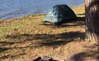
    Camper-submitted photo from Long Pool Recreation Area
    Camper-submitted photo from Long Pool Recreation Area
    Camper-submitted photo from Long Pool Recreation Area
    Camper-submitted photo from Long Pool Recreation Area
    Camper-submitted photo from Long Pool Recreation Area
    Camper-submitted photo from Long Pool Recreation Area

    5.

    Long Pool Recreation Area

    15 Reviews
    50 Photos
    256 Saves
    Hagarville, Arkansas

    Overview

    This location is available on a first-come, first-served basis only. Visitors are required to physically arrive at the campground to purchase and claim a site. Once on-site, you may be able to pay for your campsite(s) by scanning a QR code using the Recreation.gov mobile app, and the Scan and Pay feature. If this option is available, you will need to first download the free Recreation.gov mobile app https://www.recreation.gov/mobile-app prior to your arrival as some remote areas have limited or no cellular service.

    • RVs
    • Tents
    • Group
    • Standard (Tent/RV)
    • Trash
    • Firewood Available
    Camper-submitted photo from Piney Bay
    Camper-submitted photo from Piney Bay
    Camper-submitted photo from Piney Bay
    Camper-submitted photo from Piney Bay
    Camper-submitted photo from Piney Bay
    Camper-submitted photo from Piney Bay

    6.

    Piney Bay

    12 Reviews
    52 Photos
    56 Saves
    Hagarville, Arkansas

    Overview

    Download a Piney Bay park map HERE__ Piney Bay Campground sits along Dardanelle Lake in western Arkansas. Campers come here to get a break from the city and take advantage of the ample swimming, boating and fishing opportunities.

    Recreation

    Picnicking, boating and fishing are favorite pastimes. The lake is brimming with white bass, largemouth bass, bream, crappie and large catfish.

    Facilities

    Picnicking, boating and fishing are favorite pastimes. The lake is brimming with white bass, largemouth bass, bream, crappie and large catfish.

    Natural Features

    Situated between the Ozark and Ouachita National Forests, Dardanelle Lake creates an excellent setting for nature lovers. The lake stems from the Arkansas River and spans 40,000 acres. Wooded area and hills surround the lake. The region is a favorite destination for bald eagles in wintertime.

    Nearby Attractions

    Bona Dea Trails and Sanctuary, with nearly 86 acres of wetlands and low woods, provide an ideal habitat for native wildlife. Visitors can explore the area on the six-mile trail system.

    • Pets
    • Fires
    • Electric Hookups
    • Phone Service
    • Reservable
    • RVs

    $75 / night

    Camper-submitted photo from Haw Creek Falls Camping
    Camper-submitted photo from Haw Creek Falls Camping
    Camper-submitted photo from Haw Creek Falls Camping
    Camper-submitted photo from Haw Creek Falls Camping
    Camper-submitted photo from Haw Creek Falls Camping
    Camper-submitted photo from Haw Creek Falls Camping

    7.

    Haw Creek Falls Camping

    22 Reviews
    81 Photos
    552 Saves
    Pelsor, Arkansas

    As of Oct 2021 - Haw Creek Falls—Located on Hwy 123, this newly designated Point of Interest will be accessible year-round. Removal of the gate across the low-water bridge and suspension of fees will be immediately implemented, and camping will still be allowed in designated campsites. A slow transition of amenities such as picnic tables, fire rings, and lantern posts will be removed over time as they become unusable or unsafe. Trash services will be managed by the user as “pack it in, pack it out.” Active partner groups and volunteers are helping extend the life of current amenities, excluding trash services. Several volunteer workdays have been hosted at this site in the last several months, which have proven to be immensely beneficial to keeping this primitive area operational. Please note, this area is subject to flash flooding and visitors are responsible for monitoring conditions and taking precautionary measures. Removal of the gate does not indicate the area is always safe during changing weather conditions. Surrounded by a beautiful mature hardwood forest, this campground is located on a small mountain stream with picturesque falls, rocks, and a bluff. Big Piney Wild and Scenic River are nearby. There is an accessible trail to the Haw Creek Falls. Camping - 9 family units. Camping trailers are allowed but no special facilities are available. Access to the Ozark Highlands Trail. The recreation area is closed following the 3rd week of December and reopens the 3rd week of March. Please note that the campground is closed when heavy rain is forecast. Campground and Day-Use Area Rules

    • Pets
    • Fires
    • Tents
    • Group
    • Standard (Tent/RV)
    • Picnic Table
    Camper-submitted photo from Bayou Bluff Point of Interest (POI)
    Camper-submitted photo from Bayou Bluff Point of Interest (POI)
    Camper-submitted photo from Bayou Bluff Point of Interest (POI)
    Camper-submitted photo from Bayou Bluff Point of Interest (POI)
    Camper-submitted photo from Bayou Bluff Point of Interest (POI)
    Camper-submitted photo from Bayou Bluff Point of Interest (POI)

    8.

    Bayou Bluff Point of Interest (POI)

    10 Reviews
    38 Photos
    95 Saves
    Hector, Arkansas

    Effective October 2021, Bayou Bluff became a Point of Interest. The fees are suspended for camping and day use and is now open all year. Upper loop is closed to camping and will be eliminated completely. Use of the vault toilet, large pavilion, three shelters, and a small pavilion will remain. The pavilions are managed on a first-come, first-service basis. Trash services are managed by visitors as "pack-it-in, pack-it-out," and Leave No Trace ethics are posted on information kiosks.

    Active partner groups and volunteers are helping extend the life of the current amenities, excluding trash services.

    • Pets
    • Fires
    • Tents
    • Group
    • Picnic Table
    • Toilets
    Camper-submitted photo from Old Post Road
    Camper-submitted photo from Old Post Road
    Camper-submitted photo from Old Post Road
    Camper-submitted photo from Old Post Road
    Camper-submitted photo from Old Post Road
    Camper-submitted photo from Old Post Road

    9.

    Old Post Road

    5 Reviews
    18 Photos
    39 Saves
    Dardanelle, Arkansas

    Overview

    Download an Old Post park map HERE__ Old Post Road is a camping hotspot at Dardanelle Lake, with numerous opportunities for boating, biking, hiking and birding.The river valley is a favorite winter destination for bald eagles.

    Recreation

    Boating and fishing are the top activities, and a boat ramp is provided for convenient lake access. Soccer and baseball fields and tennis courts offer additional recreation opportunities, and a biking trail also starts at the campground.

    Facilities

    Boating and fishing are the top activities, and a boat ramp is provided for convenient lake access. Soccer and baseball fields and tennis courts offer additional recreation opportunities, and a biking trail also starts at the campground.

    Natural Features

    Perched between the Ozark and Ouachita National Forests, Dardanelle Lake creates an excellent setting for nature lovers. The lake, sourced by the Arkansas River, spans 40,000 acres and boasts 315 miles of shoreline. A variety of hardwoods surround the lake shore.

    Nearby Attractions

    The nearby Holla Bend National Wildlife Refuge offers excellent wildlife viewing and photography.

    • Pets
    • Fires
    • Electric Hookups
    • Phone Service
    • Reservable
    • RVs

    $50 - $75 / night

Showing results 1-10 of 173 campgrounds

Pet-friendly camping near Russellville

Recent Reviews In Russellville

696 Reviews of 173 Russellville Campgrounds


  • Camper-submitted photo from Mulberry Mountain Lodging & Events
    September 12, 2024

    Mulberry Mountain Lodging & Events

    Hidden Gem

    The campground is a hidden gem. The RV and primitive camping are clean and well-maintained. The bathroom/shower requires a passcode to enter and is always clean to use. It's a great escape for off-roading and overloading. Be sure to stop by the Oark Cafe in Oark, Arkansas, which is a 25-minute drive from the campground. They serve one of the best burgers in Arkansas (Wednesday-Sunday).

  • Camper-submitted photo from Mulberry Mountain Lodging & Events
    September 12, 2024

    Mulberry Mountain Lodging & Events

    Mulberry Mountain Lodging and Campground

    Very nice campground, mostly flat land for RV and primitive campground. The bathroom/shower house is very clean to use. This area is great for getaways, off-roading, or overloading.

  • Camper-submitted photo from Brown Creek Cascade Dispersed Campsite
    August 20, 2024

    Brown Creek Cascade Dispersed Campsite

    Nice weekend

    Didn’t have to drive too far down the road found a spot on the left. Nice stone camp fire circle, good flat spot for my tent, which is a four person. Bring a chair if you want a comfortable seat, also hard to find decent wood to burn, had to walk a bit to find. Not many cars drive down the road, saw some people hiking, also Sunday morning there were hunters out, so hearing gunshot pretty close to camp. All in all though it is good to be with nature and I’d go back to this spot or find another one on the road. I didn’t go very far down the road have more to explore!

  • Camper-submitted photo from Cove Lake Complex
    July 25, 2024

    Cove Lake Complex

    Hidden gem in the Ozarks

    Fantastic smaller campground minutes from Mount Magazine. It seems to be overshadowed by much larger, better known places like Devils Den, so it's fairly quiet even when it's 'busy.' We also learned that it has new management as of this year (2024), a young family that's extremely hands-on.

    We stayed as a group (three families with 7 kiddos total, ranging from 6-15), across two adjacent sites: 1 & 3. You could see the lake from our sites, but they don't sit right over the lake like some do. With so many kids in our group, we actually wanted that. Sites are extremely spacious and well spaced from each other, and would feel even more private later in the season when the trees are full. Bathrooms are simple pit toilets, but clean and well-maintained. 

    Boat rentals right onsite, concessions, even a small beach area! We will 100% be back. No cell service whatsoever with Verizon.

  • Camper-submitted photo from Jack Creek Dispersed, Ouachita National Forest, AR
    July 22, 2024

    Jack Creek Dispersed, Ouachita National Forest, AR

    Large wooded dispersed campsite near creek

    Coordinates: 35.02281, -93.81060. Located 2.5 miles past the entrance of the Jack Creek Recreation Area, and almost 1 mile past the turn off to the shooting range. Jack Creek Road is a mixed dirt/gravel road, wider than a single track; it is well maintained with some minor erosion in a few places. The campsite is well off of Jack Creek Road, down an undesignated dirt track, offering a lot of privacy. Access is easy although the dirt track may be muddy during the wet season. This is a large wooded dispersed campsite that has a short path down to Jack Creek. Depending on the water level, fishing and wading are possible at the creek. The site has a level dirt surface which can accommodate 4 rigs - truck camper size and smaller. Tent and hammock camping are possible. The site has a clean rock fire ring. There is a lot of shade during the summer. Solar charging is possible in an open field at the entrance of the site. This is a wonerful site to camp in. Jack Creek Recreation Area and the Sugar Creek hiking trail are a short drive away. I received no t-Mobile cell service.

  • Camper-submitted photo from Jack Creek Rd Pull Thru Dispersed, Ouachita National Forest, AR
    July 21, 2024

    Jack Creek Rd Pull Thru Dispersed, Ouachita National Forest, AR

    Small Pull Thru Site with Easy Access

    Coordinates: 35.02422, -93.81997. Located 2 miles past the entrance of the Jack Creek Recreation Area, and 1/3rd mile past the turn off to the shooting range. It is a small pull though campsite with a small rock fire ring, close to Jack Creek Road (forest road); there is very little privacy from the forest road. Jack Creek Road is a mixed dirt/gravel road, wider than a single track; it is well maintained with some minor erosion in a few places. This campsite can receive dust from passing vehicles. The site can easily accommodate 2 vehicles, truck camper size and smaller, parked one behind the other. The site is shaded with a level dirt surface. Small tent & hammock camping is possible near rock fire ring which is located between the pull through driveway and the forest road. Easy access into the site. There is no T-Mobile cell service. There is nothing special about this campsite; no recreation, such as hiking trails, in the immediate vicinity. Jack Creek Recreation Area and the Sugar Creek hiking trail are a short drive away.

  • Camper-submitted photo from Jack Creek Road Dispersed, Ouachita National Forest, AR
    July 19, 2024

    Jack Creek Road Dispersed, Ouachita National Forest, AR

    Large wooded site just off Jack Creek Road

    Not sure if the pin location is accurate, so here are the coordinates: 35.02802, -93.82913.  Located 1.3 miles past the entrance of the Jack Creek Recreation Area. It is a large site with a large rock fire ring, set back a little from Jack Creek Road (forest road). Jack Creek Road is a mixed dirt/gravel road, wider than a single track; it is well maintained with some minor erosion in a few places. The campsite has a mostly level dirt surface that can accommodate 2 vehicles - truck camper size and smaller. Tent and hammock camping is possible. The site is mostly shaded in the summer. There is an old undesignated track near the rear of the site; this may lead down to Jack Creek, but I was not able to verify this due to large mud puddles on the track. There was a little bit of trash at the site, but not too bad. I received no T-Mobile cell service. There is nothing special about this campsite; just a nice place to camp in for a night or two. Jack Creek Recreation Area and the Sugar Creek hiking trail are a short drive away.

  • Camper-submitted photo from Redding Campground
    July 19, 2024

    Redding Campground

    Nice secluded site

    Only 1 other camper the night I stayed, but some people used the river access during the day. Access to Spy Rock trail, but the vast amount of cobwebs made it seem like it’s not used much. Actually wish it hadn’t been so empty, since I was a bit sketched out to camp alone with only 1 other person around. Clean bathroom. Hot in July, but cooler than it was on I-40 due to higher elevations.

  • Camper-submitted photo from Outlet Area
    July 18, 2024

    Outlet Area

    RV and Big Rig Friendly Campground along Petit Jean River

    The Petit Jean River, flowing from an outlet, divides this US Army Corp of Engineers campround into two areas. There are 38 campsites, with electricity and water hookups. This includes three multi-family sites. Fees range from $18 to $40. Reservations are made on recreation.gov or by calling 877-444-6777. First come, first served sites may be available outside the reservation season. The campground description at recreation.gov indicates that the campground is located on Blue Mountain Lake, but there is no lake access from here. A drive to Waveland Park is required for Blue Mountain Lake recreation. Most sites are waterfront; a few are just a short walk away from the Petit Jean River. Most sites have picnic table shelters. There are 12 sites and a restroom/shower house along the north bank of the river. The remaining campsites, along with a restroom/shower house, are on the south side of the river. The sites on the north side, except site #6, are in a open area offering little shade. The sites on the south side are along a forest and are more shaded. There is no privacy between campsites; several sites, especially on the south side, are close to each other. The north side restroom/shower house was closed. The south side restroom/shower house was very clean. The roads accessing and in the campground are paved. The campground is setup to accommodate RVs and big rigs, although tent camping is possible. Fishing in the river appears to be the main recreation activity. Walking access to the river bank is provided by stairs. Two playgrounds are at the south side camping area.

  • Camper-submitted photo from Girard Rd/Forest Road 20 Dispersed, Ouachita National Forest, AR
    July 17, 2024

    Girard Rd/Forest Road 20 Dispersed, Ouachita National Forest, AR

    Somewhat private dispersed site off of unbusy forest road

    Coordinates: 35.02531, -93.88228. Located just off of Girard Road (Forest Road 20) - a maintained gravel/dirt forest road. This road is mostly a single track - narrow with some minor erosion in a few places. A lifted 4x4 vehicle is NOT needed to drive to the site. The dispersed site is located 1.3 miles south of the turnoff to Jack Creek Recreation Area. This site is set off from the forest road on a narrow undesignated dirt track which is easy to miss. It is a small site with enough room for one vehicle - truck camper size and smaller. The site is mostly level on a dirt surface with a rock fire ring. It is mostly shaded, although solar recharging may be possible during the afternoon with solar panels being placed on the access track in front of the site. Tent and hammock camping are possible. Received a strong T-Mobile 5G signal here. Except for some peace and quiet, there is nothing remarkable about this particular campsite. However, is is located in the Jack Creek area of the Arkansas Ouachitas. This area has a few nice swimming holes and hiking trails which one can drive to. OHV recreation is also possible in the area.

  • Camper-submitted photo from Ashley Creek Recreation Area
    July 17, 2024

    Ashley Creek Recreation Area

    Pretty Location, Free Primitive Camping

    I didn't camp here, but thought I leave an updated review. Previous review still applies. This is a free primitive campground, but a permit is required to camp here; see COE Web site for info. There is a very clean portable john with tp in the campground. It appears that the campsites themselves have not been maintained in a while, although the campgound itself looks nice, with a view of the lake. Some of the sites are close together offering no privacy. I received T-Mobile cell service. Convenient boat ramp nearby. I wouldn't make this campground a multi-day vacation destinition, but it's convenient for an overnight stay and for those using the lake for recreation.

  • Camper-submitted photo from Haw Creek Falls Camping
    July 16, 2024

    Haw Creek Falls Camping

    Free camp, moderately popular

    For actual camping there was maybe 2 other campers in the area but during the day LOTS of people coming to swim ( and leaving trash 🤮 ) The water was beautiful, eating dinner by the falls has become one of my new favorite camping memories in arkansas. Lots of snakes and saw a feral cat but so pretty, and the bathroomS were absolutely disgusting and full of trash

  • Camper-submitted photo from Toad Suck
    July 14, 2024

    Toad Suck

    good

    Excellent job on this post! Your analysis is thorough and very helpful blob opera. I appreciate the effort you put into sharing this valuable information. Thanks for contributing!

  • Camper-submitted photo from Tackett Mountain Road Dispersed, Ozark NF, AR
    July 10, 2024

    Tackett Mountain Road Dispersed, Ozark NF, AR

    Nice site to hang-out in

    The pin location may not be accurate, so here are the coordinates: 35.44497, -92.76914. This is a small dispersed campsite with a level dirt surface, just big enough to accommodate one vehicle - truck camper and smaller. Tent and hammock camping is possible. The site is tucked into the trees, and it has a clean rock fire ring. The site is located on a dirt track - Forest Road 93021L, which is off of Tackett Mountain Road - Forest Road 1319. The site offers privacy from Tackett Mountain Rd, but it is close to Forest Road 93021L. Tackett Mountain Rd is a wide, well maintained, gravel forest road. Access to 93021L off of Tackett Mountain Road is up a slight incline with some gravel cover. Once up the incline, the track becomes dirt, goes through a clearing and heads into the woods where the dispersed site is located on the right. One can camp in the clearing; there is a small rock fire ring that is overgrown with grass and weeds, but the site in this review is nicer. The clearing was logged long ago where one may find some pieces of firewood. Some solar charging may be possible depending on the time of day and if the solar panels can be set up along the track in front of the site. There are no hiking trails here, although one can take a stroll along FR90231L which is less than a half-mile long. Even though there is not much to do around here, it's a nice place to simply hang out in. I liked it.

  • Camper-submitted photo from Brock Creek Lake View Dispersed, Ozark NF, AR
    July 9, 2024

    Brock Creek Lake View Dispersed, Ozark NF, AR

    Lake View Dispersed Camping

    Coordinates: 35.49123, -92.80548. Large open dispersed site set back from Charleston Road, just north of Bell Rd (Forest Road 1334). Located in a popular national forest OHV and multi-use trails area. Charleston Road is a wide, well-maintained gravel road. Access to the site from Charleston Road is on a 400 foot long narrow dirt track; pinstripping is possible. The dispersed site has a dirt surface with some embedded rocks. It's on a rise above the lake, offering a nice view. Solar recharging is possible in this open site. The site is on what appears to be a parking area along an old dirt track; this track appears as an older section of Charleston Rd on some maps. There is a dirt ramp into the lake. There is room for multiple rigs at the campsite. Some leveling may be required depending on the spot the vehicle is parked. There are two rock fire rings - one large and one small. Tent Camping is possible near the fire rings. The lake was drained at the time of my visit; otherwise, it's a really nice view.

  • Camper-submitted photo from Charleston - Bell Roads Dispersed, Brock Creek Lake, Ozark NF, AR
    July 8, 2024

    Charleston - Bell Roads Dispersed, Brock Creek Lake, Ozark NF, AR

    Dispersed Camping Close to Brock Creek Lake

    Coordinates: 35.49101, -92.80686. Large wooded dispersed site with easy access off of Charleston Road, just north of Bell Rd (Forest Road 1334). Located in a popular national forest OHV and multi-use trails area. This site is along side a rocky dry creek and is a short walk away from Brock Creek Lake. The site is a mostly level dirt surface with a rock fire ring. Tent camping is possible. A few vehicles, campervan and smaller, can fit near the fire ring. There are other spots just outside of the wooded area, closer to the lake, where a few more rigs can set up camp. This is all contingent upon the lake level; this area can flood. The lake at the time of my visit was drained. The trees at this site may limit the use of solar power, although solar panels can be set up in a clearing closer to the lake. The established primitive Brock Creek Lake Recreation Area campground is nearby.

  • Camper-submitted photo from Mount Magazine State Park Campground
    July 8, 2024

    Mount Magazine State Park Campground

    Nice Two Day Place

    There is not a lot to do, and it is pretty far from the city. However, there are big RV sites and amazing sunsets. There is also a lake nearby. 

    Dog friendly.

    There are lots of nature trails, but none very long.

    Lots of ticks, tricky to get good starlink connection.

  • Camper-submitted photo from Brock Creek - Charleston Rd Dispersed, Ozark NF, AR
    July 7, 2024

    Brock Creek - Charleston Rd Dispersed, Ozark NF, AR

    Nice Dispersed Site Above Brock Creek

    Not sure if the location pin is correct, so here are the coordinates: 35.49995, -92.80930. A large, wooded dispersed site situated above Brock Creek off of Charleston Road in a popular national forest OHV and multi-use trail area. Charleston Road is a wide, well maintained gravel road. The dispersed site can accommodate 2 or 3 vehicles - campervan size and smaller. There are 2 access driveways into the site. Access for a truck camper is tight due to the location of trees on the site. Access for 2WD low clearance vehicles may be rough due to some erosion. The dispersed site is a dirt surface with some embedded rocks jutting out. Some leveling may be required depending where the rig is parked. Tent camping is possible. There is a vehicle turnaround at the rear of the site. The site is shaded, so solar charging is limited. Except for a little bit of glass and some bullet shell casings scattered about, the site was clean at the time of my visit. The site has a large rock fire ring. There is a wide track that leads off the site toward the south along and above the creek. This track does not appears on any of the current forest service maps (including MVUM) that I have, so I'm assuming that it is not a legal motorized vehicle track. The track is hikeable. The site is convenient to OHV and multi-use trails. It was a pretty site during my summertime visit, but I bet it's beautiful during the Fall season. It is set back from Charleston Road. It is a really nice spot.

  • Camper-submitted photo from Group Dispersed, Charleston Road, Ozark NF, AR
    July 6, 2024

    Group Dispersed, Charleston Road, Ozark NF, AR

    Large Group Dispersed Camping

    Coordinates: 35.50873, -92.81549. Group dispersed site located less than a 1/4-mile south of the Zing Trailhead on Charleston Road. Charleston Road is a wide, well maintained gravel road located in a popular national forest OHV area. This dispersed site is a level with a dirt and grass surface. The site can accomodate multiple vehicles; tent camping is possible. There is a large rock fire ring at the rear of the site. The site is open with little shade, making recharging with solar panels possible. Other than accommodating a group of OHV and offroad enthusiasts, and stargazing at night, there is nothing remarkable about this campsite.

  • Camper-submitted photo from Charleston Road Dispersed, Ozark NF, AR
    July 4, 2024

    Charleston Road Dispersed, Ozark NF, AR

    Convenient to National Forest OHV Area

    Pin location may not be correct, so here are the coordinates: 35.52534, -92.83158. Located on Charleston Road in a popular national forest OHV area - 1/2 mile southeast of the Mountain Man Trailhead. Charleston Road is a well maintained gravel road. The site is at the beginning of an old unnamed, closed, dirt track - close to Charleston Road. The site has a dirt surface; not quite level, but more level toward the rear. It is a pull-in site which can accommodate one campervan and smaller. Tent camping is possible. The site is mostly shaded. There is poison ivy around the perimeter of the site. The site includes a large rock fire ring. Except for a little bit of trash in the fire ring, the site was pretty much clean. The old track is gated just past the site,; the track is hikeable, leading up to the northern-most Stoebuck Mountain (there are two "Stoebuck Mountains" in this area). Except for being convenient to OHV trails, there is nothing remarkable about this dispersed site. It is good for an overnight stay.

  • Camper-submitted photo from Sam's Throne Recreation Area
    July 4, 2024

    Sam's Throne Recreation Area

    Cute spot!

    Quiet and beautiful spot in AR! Patchy cell service and no water hookups, but there are bathrooms, lots of privacy, fire pits, and trails connected to the sites! Highly recommend a visit here

  • Camper-submitted photo from Austin Trailhead Dispersed, Wilderness Trail Rd, Ozark NF, AR
    July 2, 2024

    Austin Trailhead Dispersed, Wilderness Trail Rd, Ozark NF, AR

    Dispersed camping convenient to OHV/multi-use national forest trails

    Not sure if the pin location is correct, so here are the exact coordinates: 35.53654, -92.80322.  Small dispersed campsite just off Wilderness Trail Road. Wilderness Trail Road is a wide gravel country road located in a popular national forest OHV area. More specifically, the site is located on multi-use/OHV trail Brock Creek #42, Forest Road 2321 - just a few hundred feet south of Wilderness Trail (not in the trailhead parking lot, where camping is not allowed). Its a small, level dirt site, mostly shaded in a small clearing in the trees, close to the track - not private. It has a small rock fire ring. Tent camping is possible. It's a pull-in site which can accommodate one vehicle - truck camper and smaller. Except for being convenient to OHV trails, there is nothing remarkable about this dispersed site.

  • Camper-submitted photo from FR132/152 T-Junction Dispersed, Ouachita NF, AR
    June 23, 2024

    FR132/152 T-Junction Dispersed, Ouachita NF, AR

    Convenient Dispersed Camping 2 Miles from Lake Sylvia

    Large dispersed campsite located 2 miles west of Lake Sylvia State Park, where Forest Road 152 meets Forest Road 132. Clean site with one rock fire ring. Can fit a couple of vehicles. Because of the position of the trees on the site, maneuvering a truck camper into the site may be a challenge; don't recommend anything larger. Tent camping is possible. This is a level dirt site with some embedded rocks jutting up. Nice wooded area around site to stroll through. Seasonal track FR132C is adjacent to the site; this track is hikeable. Since the site is at the intersection of popular forest roads, there will be vehicles driving by. The site is set back enough that dust may not be a concern. No T-Mobile cell service. This is convenient, pretty campsite.

  • Camper-submitted photo from Crystal Ridge RV Park at Ron Coleman Mine
    June 23, 2024

    Crystal Ridge RV Park at Ron Coleman Mine

    Quiet grounds and perfect for a trip for crystal digging

    The campground is on the small side, but with a nice shower area and coin laundry. The paved areas (including the Rv pads) are a bit rough, but ok. Leveling pads were needed for our site . Lots of crystals just laying around also. Something out of the control of the campground, but the Oakworms were crazy. That’s not rain you hear falling from the trees! lol Stay under the awning.

  • Camper-submitted photo from FR132 Small Dispersed, Ouachita NF, AR
    June 22, 2024

    FR132 Small Dispersed, Ouachita NF, AR

    Overnight Dispersed Site

    Coordinates: 34.85431, -92.88115. Small dispersed campsite in the woods just off of Forest Road 132. Close to the forest road; easy access. There is a clean rock fire ring. Good campsite for a quick overnight stay. The surface of the site is dirt with a little bit of pea gravel. This site is only big enough for one rig, truck camper and smaller size. Pitching a tent is possible in a small clearing to the left of the rock fire ring. Slight downward slope but not bad. Shaded in summer. Nice wooded area. No T-Mobile cell service. There are no hiking trails nearby or remarkable natural features here, but the forest at this site is pretty. This is a nice site in the autumn.


Guide to Russellville

Camping near Russellville, Arkansas, is a fantastic way to enjoy the great outdoors. With beautiful landscapes and a variety of campgrounds, there’s something for everyone, whether you’re into tent camping, RVing, or glamping.

What to do

  • Hiking and Nature Trails: Many campgrounds offer trails for hiking. At Petit Jean State Park, one visitor mentioned, “Beautiful, stunning, and can’t wait to visit again!”
  • Fishing and Water Activities: If you love fishing, Lake Catherine State Park Campground is a great spot. A camper shared, “Every site on the water has a small dock you can fish off.”
  • Wildlife Watching: Campers at Gulpha Gorge Campground have enjoyed the peaceful surroundings. One reviewer noted, “Very quiet despite being totally full with RVs.”

What campers like

  • Clean Facilities: Campers appreciate well-kept restrooms and showers. A visitor at Lake Ouachita State Park Campground said, “The bathhouses were super clean with showers.”
  • Spacious Sites: Many campgrounds offer roomy sites. One camper at Maumelle Park mentioned, “The campsites are pretty spacious for tents with their own fire rings too.”
  • Friendly Staff: Campers often highlight the helpfulness of campground staff. A visitor at COE Lake Ouachita Crystal Springs Campground said, “The camp hosts and park rangers were nice, friendly and helpful.”

What you should know

  • Limited Amenities: Not all campgrounds have full amenities. For instance, at Gulpha Gorge Campground, one camper noted, “Clean restrooms, no showers.”
  • Road Noise: Some campgrounds are near busy roads. A reviewer at Lake Catherine State Park Campground pointed out, “The only downside I could find was I10 is close enough to be heard.”
  • Primitive Camping: If you’re looking for a more rustic experience, Ozark Campground offers a more basic setup. One camper mentioned, “Spots are on grass and pretty shady.”

Tips for camping with families

  • Kid-Friendly Activities: Look for campgrounds with activities for kids. At Petit Jean State Park, a reviewer said, “Everyone was super nice,” making it a welcoming spot for families.
  • Plan for Bugs: Some areas can be buggy, especially near water. A camper at Lake Ouachita State Park Campground noted, “Bugs were not bad at all.”
  • Bring Outdoor Games: Campgrounds often have open spaces for games. One camper at Maumelle Park suggested, “Definitely would stay again!”

Tips from RVers

  • Check Site Size: Make sure your RV fits the site. A reviewer at Gulpha Gorge Campground mentioned, “Sites 2-7 are adjacent to the road, not desirable.”
  • Wi-Fi Availability: Some campgrounds have decent Wi-Fi. A visitor at Lake Ouachita State Park Campground said, “Good Verizon signal.”
  • Be Prepared for Road Noise: If you’re sensitive to noise, consider this before booking. A camper at Mount Nebo State Park mentioned the nearby highway noise.

Camping around Russellville, AR, offers a mix of beautiful scenery and outdoor fun, making it a great choice for families and RVers alike.

Frequently Asked Questions

  • What camping is available near Russellville, AR?

    According to TheDyrt.com, Russellville, AR offers a wide range of camping options, with 173 campgrounds and RV parks near Russellville, AR and 45 free dispersed camping spots.

  • Which is the most popular campground near Russellville, AR?

    According to TheDyrt.com, the most popular campground near Russellville, AR is Petit Jean State Park — Petit Jean State Park with a 4.8-star rating from 98 reviews.

  • Where can I find free dispersed camping near Russellville, AR?

    According to TheDyrt.com, there are 45 free dispersed camping spots near Russellville, AR.

  • What parks are near Russellville, AR?

    According to TheDyrt.com, there are 30 parks near Russellville, AR that allow camping, notably Nimrod Lake and Ozark-St. Francis National Forests.