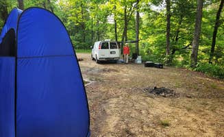
Primitive camping near Russellville, Arkansas offers secluded options in the Ozark National Forest without designated facilities or services. The terrain features rolling hills and limestone formations with elevations ranging from 400 to 2,500 feet. Summer temperatures regularly exceed 90°F while winter nights often drop below freezing, requiring proper seasonal preparations for dispersed camping.
What to do
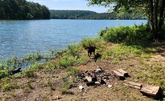
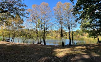
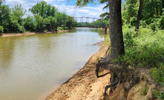
Fishing access points: Harris Brake Lake provides multiple bank fishing spots with lake views. One visitor noted, "I stopped on a weekday and I was the only one there. It was nice watching the sun set over the lake." This free area includes several established spots along the shoreline.
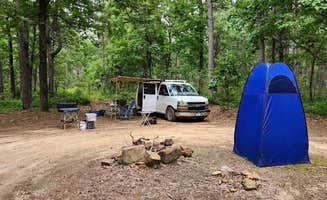
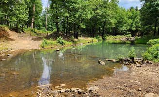
Wildlife observation: Tackett Mountain Road Dispersed offers excellent wildlife viewing opportunities. Located on Forest Road 93021L, this site provides a secluded setting. A reviewer mentioned, "This is a small dispersed campsite with a level dirt surface, just big enough to accommodate one vehicle - truck camper and smaller. Tent and hammock camping is possible."
Hiking trails: Meadows Knob Road Dispersed provides access to unmarked hiking trails. A camper shared, "There is a 2-track for hiking that leads down into Graves Creek Canyon and some unnamed waterfalls. The hike along this track is nice." The trailhead starts directly from the campsite area.
What campers like
Peaceful settings: Many free camping areas near Russellville offer quiet environments away from crowds. At Harris Brake Lake, a camper observed, "absolutely beautiful place the fireflies here are amazing! Nobody else was camping here which made for some quiet nights."
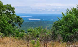
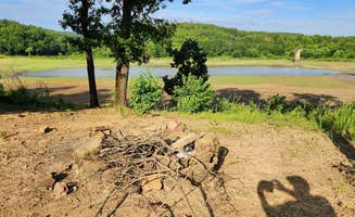
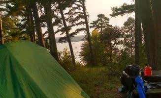
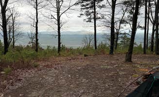
Lake views: Brock Creek Lake View Dispersed provides elevated perspectives of the water. A visitor described it as "a large open dispersed site set back from Charleston Road" with "a nice view" since it's "on a rise above the lake." The site allows for multiple vehicles on its dirt surface.
Sunsets: Evening views are frequently mentioned in reviews of lakeside camping areas. A Harris Brake Lake camper shared, "No amenities but it's quiet and pretty and free. The sunset was gorgeous. A little bit of a drive off of I40 but it's a fantastic spot. We are the only ones here."
What you should know
Limited maintenance: Sites require self-sufficiency and preparation. At Cane Creek Recreation Area, a reviewer warned, "Quiet, not maintained but not in bad shape. The building part is still true, that is the old toilet building is full of trash." They added practical advice: "No water, trash, or toilets. Town is a nice 15 minute country drive."
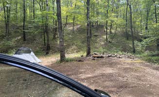
Accessing remote sites: Many dispersed camping areas require navigating unpaved routes with potential challenges. At Adams Mountain Road, a camper explained, "In the Piney Creek WMA, part of the Ozark National Forest north of Hector, Arkansas. Large camping area at a high clearance ATV trailhead, FR1322A, just off Adams Mountain Road (gravel road)."
Weather considerations: The Ozarks experience rapidly changing conditions. One Cane Creek Recreation Area reviewer advised, "Have a weather app, if you're not local storms here are fast to arrive and violent compared to other parts of the country."
Tips for camping with families
Site selection: Choose areas with space for activities and exploration. At Spring Lake FR96001F, a visitor noted it's "a large loop at the end of a short narrow Forest Road 96001F" that "can accommodate a few rigs" and offers "a beautiful view of the lake. Easy walking access to the bank for fishing."
Wildlife awareness: The forest areas contain abundant wildlife. A Harris Brake Lake camper shared, "the fireflies here are amazing!" but also warned "there is a lot of ticks here i pulled 7 off of me and my dog in one night."
Emergency preparation: Remote dispersed camping requires extra planning. At Buzzards Rock Dispersed, a camper noted, "There is AT&T and T-Mobile LTE service," which is important for emergency communications when camping with children in areas without facilities.
Tips from RVers
Leveling requirements: Most free camping sites have uneven terrain. At Harris Brake Lake, one RVer advised, "We have a 25' travel trailer and didn't need to do any backing up to get in or out. Full cell signal with XFINITY mobile. 2 picnic tables and spots for fire overlooking lake. Ample places to park."
Self-containment essential: Since these areas lack facilities, RV systems must be fully functional. A Cane Creek Recreation Area reviewer emphasized, "Excellent free campground if you are self contained. No water/electric or toilet. Secluded and safe. The sheriff drove through several times in the two days I was there."
Vehicle clearance considerations: Access roads often present challenges for larger rigs. About Middle Fork Dispersed Site, one visitor explained, "Located on Middle Fork Road, about a 1/4 mile in from AR Hwy 27, near Hector, AR. The site is on national forest land and appears to be popular. It's large enough for 3 car/truck/campervan rigs."

 Legend