

E
Eric H. Scout
Scout
Wonderland RV Park
Nice spot
Fairly private for a camp ground, at least where we parked, next to the dog park. Great spot within walking distance of restaurants, clean, dog friendly
156 campgrounds · Check availability for any dates.
Millsite State Park Campground permits pets in all camping areas while offering full hookups for RVs, sanitary dump stations, and shower facilities. The pet-friendly sites include tent and RV options, with campsites situated along Millsite Reservoir. Rochester Rock Camping and BLM Dispersed Exit 108 sites allow pets with more primitive accommodations, providing free camping options without amenities like water or electricity. These dispersed camping areas feature fire rings but lack toilets, trash collection, or drinking water. Campers appreciate that Rochester Rock sites remain quiet and uncrowded, with many reporting they had entire areas to themselves during their stays. The Dyrt includes reviews of pet-friendly campgrounds near Emery, Utah.
Ferron Reservoir Campground in Manti-La Sal National Forest maintains pet-friendly policies while providing vault toilets and drinking water for campers at 10,000 feet elevation. Dogs must be leashed at all campsites, including Miller Canyon Exit #99 Dispersed, where pets can explore the wide-open "grey moonscape" terrain. Several campers report excellent stargazing conditions at the dispersed sites, noting minimal light pollution creates exceptional night sky viewing. Weather considerations remain important when camping with pets in this region, as temperatures at higher elevations like Ferron Reservoir can drop into the 30s overnight even when lower elevations experience summer heat. Dispersed camping areas near Last Chance Road experience significant mosquito activity during summer months, making them potentially uncomfortable for pets and their owners.
"They were redoing the Dam while we were there last, so we couldn’t enjoy the lake. We did, however, head up the mountain and had some good success fishing close by."
"I selected the Millsite Campground because of its proximity to the Moore Cutoff road’s interesting geology, located a few miles away."
from $25 - $30 / night
Check Availability"There's a trail out to a petroglyph site which was really neat. We hiked out in the morning and didn't encounter anyone else. The gravel road to the parking area is really smooth."
"Yes, it is close to 70, but noise is not bad. Open land all to ourselves."
"A mile from the highway, you can barely hear it or see it. In late April, we had one neighbor a half-mile away, and saw nobody come by our camp in two days."
"I arrived at the campsite around 5pm in my Mazda CX-5 on a Tuesday, not a single person in sight."
"One of our favorite campgrounds in southern Utah nestled in the Capitol Reef National Park."
"Should've planned my stay around harvest time! Very close to the Cohab canyon trail, one to hike for sure! Be sure to stop by the lil cabin nearby delectable pies and a bit of history."
from $25 / night
Check Availability"The goblin Valley Campground is located within goblin Valley State Park in Utah."
"There is no parking next to the site, but it is small walk to the site. The tent sites are spaced far apart and some are tucked behind the Goblins."
from $45 - $200 / night
Check Availability"Ferron Campground is located across the lake from the southwest campground near the guard station."
"Google strikes again and had me exit and drive 11 miles on a dirt road with carved out tunnels, I70 underpasses and a steep climb. Overall not a terrible drive but would prefer a shorter drive."
"Close to the highway, far enough to not really hear it."
"After visiting two very popular Utah parks -- Zion and Bryce Canyon -- Capitol Reef was a breath of fresh air."
"I love dispersed camping...especially in Utah. The red cliffs and astounding. It is pretty easy finding a nice place to make home right outside of the park."


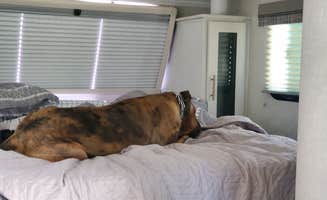
Fairly private for a camp ground, at least where we parked, next to the dog park. Great spot within walking distance of restaurants, clean, dog friendly
Enjoyed our stay here. Clean, full hook ups, nicely landscaped, with a nice dog run for the pets. Close to the National Park.
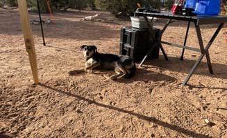
Everything is new. They still building the office / common room. The private bathrooms and showers are great. Everything is spotless clean. Laundry room only has 2 washers & 2 dryers. Fine now as this RV park is pretty empty. It also has several A-frame little cabins. Maybe a little dusty as they are finishing up all the gravel work. Hookups are good. Pads are level. Every spot has a picnic table & fire pit. Dog park kind of small. All dirt. Lots of areas to walk dogs. Verizon has 3 bars. WiFi is great, but not many campers here.
A couple miles to town. Off the highway. Very quiet. Very dark at night so really nice for stargazing.
And the mountain views are beautiful on 2 sides!
We definitely will stay again if we in the area.
We love going to this Park in Castle Dale. Castle Dale has so much to offer us because we have 3 kids and there is so much to do in the area. Our kids are 9, 7 and 3 1/2 so it makes things very convenient and easy for us to go there and we can rent ATV's locally as well and there is a lot of close by site seeing.
The park has a new owner and they have been consistently improving the parks. We were there about a month ago and they just opened up the laundry facility and club house, I hear they are going to add a dog park , provide propane sales and even have charging stations for EVs. Love that they are making these improvements shows that they really care
We loved this site! There are a lot of little canyon trails to explore for all ages! Super close to both Goblin Valley and Little Wildhorse Canyon! Highly recommend the Little Wild Horse Canyon / Bell Canyon hike. Bring lots of water and make sure your pets stay hydrated as well! Went over Memorial Day weekend 2021 and it was not as busy as I expected it to be!
Very tidy RV park with various accommodations including dry sites (which we used), tent sites, cabins, and regular RV sites. Saw every size rig. Bathrooms at far end of park are larger and newer. Clean showers. Small pool and on-site BBQ Restaurant. Jeep rentals, pet areas, playground and cool gift shop. Awesome unobstructed views from sites on outer perimeter. We were in D2. Only drawback is you're pretty close to your neighbors. All sites have picnic benches. Large grass area near pool and restaurant.
We happened upon this campground and luckily there was one spot left - site 1. We caught a beautiful sunset against the red cliffs as we set up camp. Our tent was close to a little stream that was really pleasant to listen to as we fell asleep. The flush toilets were very clean and well maintained. And we had a camp cat show up! Never had a feral cat join us for a cook out before. We loved this site and would definitely recommend it.
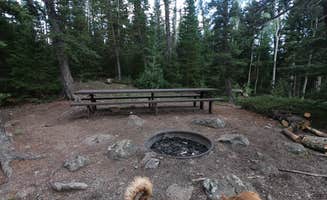
The goblin Valley Campground is located within goblin Valley State Park in Utah. This is pretty much in the middle of nowhere between Hanksville and Green River on a 12 miles off detour off Highway 24. The park itself provides access to a rare and bizarre landscape of rock formation some assembling goblins mushrooms and other spires which is pretty unique to the area. The campground is nestled on the edge of some of these rock for atto a in a really scenic location. Covered picnic tables fire rings we’re also provided and a paved driveway and tent pads were also provided. No water, electric hook-ups. However, despite a fairly steep price for a standard non-electric site ( $30) minimal facilities were offered. The bathrooms and showers were closed for the season (it was late December) ang there was only access to a pit toilet near the yurts a little walk away from the campsites. There were flushing toilets a couple of miles away at the visitor center and a at the major view point over the valley of goblins. no cell reception on either Verizon or AT&T.
We camped here in May, 2024, on our way north, traveling through Utah. What looked like a nice campground from the Utah State Park website was not a nice campground. Firstly, the bathrooms were not clean. Second, this seems to be a hang-out for the locals in Huntington, especially the teens. Third, what few trees there are, are half-dead from not being watered. There is evidence that a lot have been cut down, probably because they died entirely. It is a mystery that a state park, with a reservoir, does not water the grass and trees in the campground! Fourth, and most importantly, there is semi-truck traffic on the highway that borders the campground, about every 5-10 minutes, day and night, no exaggeration! Drive a few hours northeast and camp at Green River State Park in Green River, UT. That is truly a nice, park-like setting, away from the noise of I-70.
Dispersed camping areas near Emery, Utah provide access to the varied terrain of central Utah at elevations ranging from 4,000 to 10,000 feet. The region experiences dramatic temperature fluctuations, with summer days reaching 90°F while higher elevations can drop into the 30s overnight. Several sites offer opportunities for primitive camping with limited amenities but exceptional isolation.
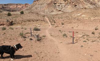
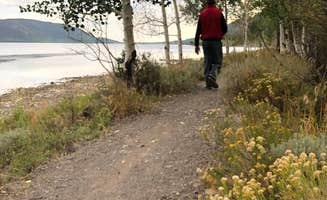
Explore petroglyphs nearby: At Rochester Rock Camping, visitors can access ancient rock art via a short trail. "There's a trail out to a petroglyph site which was really neat. We hiked out in the morning and didn't encounter anyone else," reports one camper. The site is approximately one mile round trip from the camping area.
Enjoy reservoir activities: Millsite State Park Campground offers water recreation on its reservoir. One visitor notes, "They have paddle boarding on the reservoir which we didn't have time to do." The campground is positioned at the mouth of Ferron Canyon, providing both water activities and hiking opportunities.
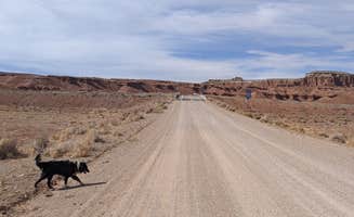
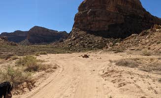
Experience desert landscapes: The dispersed sites near Miller Canyon offer distinctive moonscape terrain. "Wide open area south of Freeway exit 99, Miller Canyon Road. Going to the south the pavement ends and you are in a grey moonscape BLM land," explains one reviewer who appreciated the unusual geology.
Exceptional stargazing: Miller Canyon Exit #99 Dispersed receives praise for its dark skies. "The night sky was probably one of the best I've seen with almost no light pollution," states a camper. Several sites in the area offer clear night viewing with minimal artificial light interference.
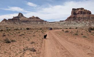
Isolation and quiet: Many dispersed camping areas provide seclusion. At BLM Dispersed Exit 108 Lone Tree Road, visitors report complete solitude: "Totally alone and loving it. Far enough off the road, but still good service." Another camper mentioned, "In late April, we had one neighbor a half-mile away, and saw nobody come by our camp in two days."
Geological features: The region's unique rock formations create distinctive camping backdrops. "The red and grey rock mountains are indescribably peaceful," notes one reviewer describing the surroundings at Millsite Reservoir, where campers can observe the striking contrast of rock layers.
Road conditions vary significantly: Some dispersed sites require careful navigation. "If they're real sandy or muddy than plan on 4WD. But plenty of space before those obstacles," advises a camper about BLM Dispersed Exit 108. Many roads deteriorate further from the highway.
Limited amenities: Most dispersed camping locations lack basic facilities. "This is pure desert dispersed exploration camping," explains a camper at BLM Exit 108 Lone Tree Road. Prepare to be self-sufficient with water, waste management, and supplies.
Weather extremes: The climate near Ferron Reservoir Campground presents challenges. "Remote (about an hour on a one-lane dirt road) and quiet with beautiful scenery," shares a camper, but the high elevation means temperature swings can be dramatic. The reservoir sits at approximately 10,000 feet, requiring proper cold-weather gear even in summer.
Choose established sites with shade: For camping with children, consider Millsite State Park's more developed facilities. "Really pretty geology and views! Some hiking right on site, bring a kayak," notes a camper. The shaded sites help manage heat during summer months.
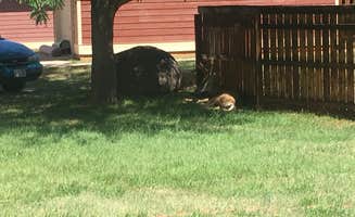
Watch for wildlife encounters: Fruita Campground offers family-friendly wildlife viewing opportunities. "There were abundant mule deer that walked through the campsite," reports a visitor. Children can observe wildlife from a safe distance at dawn and dusk.
Consider elevation for comfort: When camping with children, elevation affects comfort significantly. "Ferron sits right on the top of the Manti-La Sal mountain range that divides the state in two," explains a camper who visits annually for family reunions. Higher elevations provide cooler temperatures during summer heat.
Assess access roads carefully: RV owners report varied experiences with the region's roads. "The gravel road to the parking area is really smooth," notes a visitor to Rochester Rock Camping, making it accessible for most vehicles. However, other dispersed sites require more caution.
Level site availability: At Capitol Reef National Park Dispersed Camping, RVers find suitable spots despite the terrain. "A mix of larger, open sites that will accommodate larger rigs, and smaller, more private sites," reports a camper. The entrance requires navigation around rocks, so approach slowly.
Cell service considerations: Connectivity varies throughout the region. "Decent cell signal and a hiking trail right out of our site," notes a visitor to Capitol Reef dispersed areas. Many campers report better coverage with AT&T and T-Mobile than Verizon at certain locations near Emery.
Frequently Asked Questions
Which is the most popular dog-friendly campsite near Emery, UT?
According to TheDyrt.com, the most popular dog-friendly campground near Emery, UT is Millsite State Park Campground with a 4.3-star rating from 10 reviews.
What is the best site to find dog-friendly camping near Emery, UT?
TheDyrt.com has all 156 dog-friendly camping locations near Emery, UT, with real photos and reviews from campers.
Keep Exploring