Snowbird Mesa
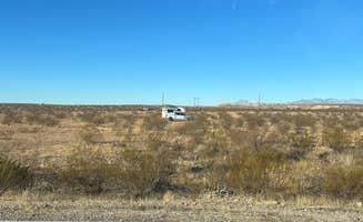
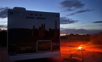
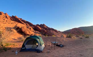
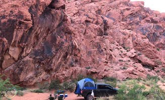
Wide open with tons of space, some nice were crazy windy but others were calm. Enjoyed the stay here, try to arrive during the day to find the best camp site with your preferred view. The further in you go the road got a bit rougher
Dispersed camping options surround Bunkerville, Nevada on Bureau of Land Management (BLM) public lands, with several free sites located along the Virgin River and within nearby recreation areas. Notable areas include Virgin River Camp, Cedar Pockets Pass Road dispersed camping, and Black Rock Road dispersed sites. These primitive camping areas primarily support tent and RV camping with minimal development, following BLM dispersed camping guidelines that permit stays on undeveloped public land away from designated recreation sites.
Many access roads require careful navigation due to rough, washboard conditions and occasional deep ruts. Most sites lack amenities, with no drinking water, hookups, toilets, or trash services available. High clearance vehicles are recommended for several areas, particularly Whitney Pockets and routes leading closer to water at Stewart's Point. A visitor noted, "The roads were pretty rough so be prepared for that," while another mentioned, "Make sure you go all 3 miles until you reach the big classic BLM Public Lands sign after which is the start of your options." Fire restrictions vary seasonally, with most sites allowing campfires when conditions permit.
The landscape features dramatic desert terrain with mountain views and access to recreational opportunities at nearby Lake Mead National Recreation Area. Several dispersed sites provide relatively quiet camping despite proximity to highways. Campers frequently mention the stark beauty and solitude available, though environmental conditions can be challenging. "The area is harsh rocky and limited for other things to do like biking and hiking," noted one review of Snowbird Mesa. Cell service varies by location and provider, with areas like Stewart's Point offering fair to good coverage for most carriers. Summer temperatures regularly exceed 100°F, making spring and fall the preferred seasons for camping in this region.
"Lots of flat space parking. No amenities and some freeway noise."
"We extended our boondocking by using our tote when we went to the state park and dumped in their RV dump. They have water too. Solar was greatly here. I would stay away in warmer seasons though."
"I spoke to the ranger and found out that checkout in the park was 2 pm. You pretty much have to catch someone leaving to get a spot in the park. We were relieved to find so many other options nearby."
"Found a semi secluded area within 200 yards of the entrance. Access is very good with pavement to the entrance and flat desert road going all over the hillside."
"Not far from freeway, flat and open. Lots of room for big rigs and turning around. Arrived after dark and no trouble pulling in and parking"
"Fun place to drive on the dirt roads "
"This location takes you to the beginning of the road into this area. Right off, there are large pull-through campsites with fire pits. As these were all taken, I pushed further in."
"The ground going to the water is rutted and steep and soft sand in parts. We saw several trucks drive down there without any problems. The two miles off the highway is paved, but in poor condition."
"One of many dispersed camping spots on Lake Mead."
"These are open BLM camp sites.. one of around 25 or so in the immediate area. None of these camp sites have amenities, no water, no power, no bathrooms.. just open camping. "
"Nice localisation, quiet, right outside Valley of fire state park ! Great view and weather. Dirt road not to rough !"
"Perfect dispersed camping spot outside Valley of Fire State Park and close to Lake Mead. Either up the road is Poverty Flats, but we found this to be waaaay less crowded and equally awesome."
"We turned onto waterline made an immediate right onto dirt road. Drove 100 yards and pull off on the right. Nothing to see from the pic except the hard dirt road for most vehicles."
"We were looking for a dispersed area to camp after going to Valley of Fire State Park and finding it full. This area was just off to the right on highway 169 a mile or two north of Logandale."
"This area is just east of Mesguite Nevada along Gold Butte Road (old mining road that goes many miles into the NE area of Lake Mead. No water, power or cell phone connection in most areas. "
"I drive by this stop and intended to stay here for a night but the sites were all full. I parked for a few hours and had lunch and then headed into Valley of Fire for a hike. "
"Has a BLM mess free parking 2 miles south. And has a pet parking lot to feed. Don’t see a lot of trash. Has 2 vaulted toilets and picnic area for groups"
Wide open with tons of space, some nice were crazy windy but others were calm. Enjoyed the stay here, try to arrive during the day to find the best camp site with your preferred view. The further in you go the road got a bit rougher
This is great dispersed camping. There’s decent internet/cellular coverage for the area. The sites are quite large and open, so even when it’s busy there’s typically space for everyone. It’s typical pack in-pack out, so bring whatever you need, as there’s no services or trash/recycling here. If you’re completely self-sufficient you have a great spot here.
Easy in and out
There were a few roads to chose and we were able to find a shady one with plenty of room. There were others nearby but everyone was respectful and it was a nice stopping point to camp!
Im currently tent camping out of my car and managed to make the place work. Sand obviously made it more difficult, but was doable. Accessible by RWD but be careful of patches of deeper sand. If you drive far enough away, highway isnt much of an issue past midnight- plus the moon makes the place look great at night.
Open desert with some hills and mountains in distance. Site is off first main road pull off to the right from main road. Hard packed gravel and sand. Drive for thirty seconds to a minute to find large flat campsite with campfire ring. Very quiet. Lots of stars. Some light pollution from Vegas visible to the southwest. Only ones here midweek.
Get off the road with white knuckles and take a break. That’s it.
Sites are big, has a cover over picnic table. Grill to cook on. Only reason a 4 … people should pick up after they use a site. Some noise from business across road.
Even though this place is very rocky it was a great place to stay outside of the park. It was $1 million dinner views
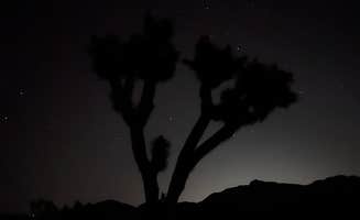
Dispersed camping near Bunkerville, Nevada offers free overnight accommodations on public lands managed primarily by the Bureau of Land Management. Located at elevations ranging from 1,200 to 2,500 feet, this desert region experiences winter lows around 30°F and summer highs regularly reaching 110°F. Most dispersed sites feature compacted clay soil with scattered creosote bush and occasional Joshua trees dominating the landscape.
Hiking in surrounding canyons: At Cedar Pockets Pass Road - Dispersed Camping, visitors can access nearby trails. "There is now a marked Cedar Pocket Wash Trail Head with a camp area setup just before the trail head where we camped in 2018," notes one camper who found enjoyable hiking opportunities within walking distance of their site.
Explore historic sites: Gold Butte Road near Whitney Pockets, Nevada offers access to cultural features. "The area also has several great petroglyph sites. Great for ATV or side by sides.. lots of equestrian riders in the area as well," according to a visitor who explored the historic mining region.
Swimming in Virgin River: While water levels fluctuate seasonally, Virgin River North provides river access points. Camping is available on "flat desert road going all over the hillside" with "lots of camping areas to choose from," making it convenient to find spots near water access points.
Accessibility for quick overnight stays: Many campers appreciate how easy it is to access dispersed sites near Bunkerville for short stays. Near Dispersed Camping North of Logandale, one visitor noted, "We turned onto waterline made an immediate right onto dirt road. Drove 100 yards and pull off on the right," highlighting the convenience for travelers needing a simple stopover.
Proximity to Valley of Fire State Park: When the state park campgrounds fill up, dispersed sites offer alternatives. A camper at Sand Mine Road #110 Dispersed Camping shared, "This was the perfect overnight spot as we got in too late for a camp spot on Valley of Fire State Park. It was wide open with a fire ring and great views."
Solitude and separation from other campers: Despite being free public land, many sites offer privacy. "There are beautiful views. Lots of flat space parking," observed one camper at Virgin River Camp, while another at Sand Mine Road mentioned it was "less crowded and more spread out" than neighboring areas.
Road conditions vary significantly: Many access roads deteriorate seasonally. At Stewart's Point Dispersed Camping — Lake Mead National Recreation Area, campers warn about "a bumpy drive down a chopped up paved road" and note that "the roads and sites get sketchy and soft further down you go to the water."
Wind exposure can be intense: With minimal natural windbreaks, sites experience strong gusts. At Snowbird Mesa, one visitor called it "hurricane ridge" and warned, "It is windy!" Another camper at Stewart's Point observed "white caps on the water because of wind" during their stay.
Trash management issues: Some areas suffer from improper waste disposal. A visitor to Virgin River North reported finding "lots of camping areas to choose from. Most near the entrance are surrounded by garbage. Areas further out are much cleaner."
Scout for kid-friendly exploration areas: Several sites offer natural features children enjoy exploring. One family at Sand Mine Road #110 "camped next to a little canyon which was fun to explore with the kiddo when we were just hanging around the campsite."
Plan for extreme temperature fluctuations: Desert temperatures drop dramatically after sunset even in warmer months. Bring appropriate clothing layers and sufficient water for everyone. One camper noted the area is "harsh rocky and limited for other things to do like biking and hiking."
Choose sites away from shooting areas: Some BLM land near Bunkerville permits target shooting. A family camping north of Logandale mentioned, "This is an area where people come to shoot guns and ride 4-wheelers. That doesn't make it sound super peaceful and private but it was such a large area, everything was spread out."
Optimal positioning for solar and wind: When setting up at Snowbird Mesa, a reviewer advised, "Take a look at prevailing winds if you have slide toppers and park accordingly... Solar was greatly here. I would stay away in warmer seasons though."
Size limitations for deeper sites: While many areas accommodate large vehicles near entrance points, access becomes more challenging further in. At Whitney Pockets, an RVer warned "Most can accommodate around 30 feet or less. Must have good suspension... road into the area is partially paved but has many deep potholes."
Finding level spots: Several dispersed camping areas feature uneven terrain requiring careful site selection. One RVer at Poverty Flat (Snowbird Mesa) shared, "Ground is flat and rocky, so bring a camp carpet," suggesting preparation for the hard surface conditions common throughout the area.
Frequently Asked Questions
Which is the most popular dispersed campsite near Bunkerville, NV?
According to TheDyrt.com, the most popular dispersed campground near Bunkerville, NV is Virgin River Camp with a 4.3-star rating from 4 reviews.
What is the best site to find dispersed camping near Bunkerville, NV?
TheDyrt.com has all 34 dispersed camping locations near Bunkerville, NV, with real photos and reviews from campers.
Keep Exploring