Best Dispersed Camping near Queen Creek, AZ

Dispersed camping opportunities surround Queen Creek, Arizona, primarily within Tonto National Forest and on Bureau of Land Management (BLM) lands. Several primitive camping areas are located in the nearby Superstition Mountains, including Bulldog Canyon, Peralta Road, and Hackamore Road dispersed camping zones. Cottonwood Canyon Road and Superstition Mountain State Trust lands also permit primitive camping. Most sites require either a Tonto National Forest permit or an Arizona State Trust Land recreational permit, though some BLM locations allow free camping with no permit requirements. The terrain features saguaro cacti, desert washes, and panoramic mountain views characteristic of the Sonoran Desert landscape.

Access to many dispersed sites requires high-clearance vehicles, particularly for areas beyond the first quarter-mile of dirt roads. Some locations like Bulldog Canyon require a special permit and gate code to enter, while Peralta Road camping necessitates an Arizona State Trust Land permit ($20 annual fee). Road conditions vary from maintained gravel to rough washboard with occasional deep ruts. Most areas have no amenities—no drinking water, toilets, trash service, or designated fire rings. Campers must follow strict pack-in/pack-out principles and check seasonal fire restrictions, which change frequently in this arid environment. The standard 14-day camping limit applies to most public lands in the region.

The Superstition Mountains provide a dramatic backdrop for primitive camping experiences, with extensive hiking opportunities throughout the area. Wildlife sightings including wild horses have been reported near Bulldog Canyon. Cell service is generally reliable across most locations, particularly with Verizon, though coverage can be spotty in more remote sites. Weekends often bring increased ATV and dirt bike activity, especially in Bulldog Canyon and along Peralta Road. "The dirt road was great for a morning run or bike ride," noted one visitor to Cactus Forest. Another camper cautioned about Peralta Road, reporting that "the views are amazing but so is the traffic. But around 9pm it quiets down."

Best Dispersed Sites Near Queen Creek, Arizona (50)

    1. Bulldog Canyon Dispersed Camping - North Entrance

    27 Reviews
    Fort Mcdowell, AZ
    23 miles
    Website
    +1 (480) 610-3300

    $10 - $80 / night

    "I use the north entrance off Bush highway. I've camped here 5 or 6 times. No water or bathrooms. Leave no trace. You need a permit and gate code. Most ATVers but not loud during the week."

    "Pretty passable dirt road (our G20 camper van had no problems). Sunsets were so so pretty and for us Washingtonians, camping in the desert amongst the saguaros was 👌🏼."

    2. Hackamore Road Dispersed

    11 Reviews
    Apache Junction, AZ
    18 miles
    Website
    +1 (623) 580-5500

    "It's on BLM land, so you are out of the reach of the Arizona Land Permits.

    The road is a bit tricky."

    "It’s got great views of the mountains, TONS of awesome trails to walk/ride love the access to the little ghost town nearby."

    3. Cottonwood Canyon Rd. Dispersed

    11 Reviews
    Queen Valley, AZ
    20 miles

    "Can get dusty from riders if you stay near the front. If you take some time to come scout it out you can find some great spots."

    "Great trails! Big rig friendly boondocking. Busy dirt road, as there is an active mine off the road. Loud dump trucks and dusty, but a beautiful desert oasis, nonetheless."

    4. Peralta Road Dispersed Camping

    9 Reviews
    Gold Canyon, AZ
    18 miles
    Website
    +1 (602) 542-4631

    "Drive through the town of Gold Canyon AZ, and you quickly leave behind the sprawl of suburban Phoenix, but embrace the sprawling landscape of the Sonoran Desert which is brimming with life in the spring"

    "But around 9pm it quiets down. Sites are close to the road for the most part unless you have a high clearance vehicle. Lots of hiking in the area. Trail head at end of road gets very busy."

    5. Superstition Mountain AZ state trust dispersed

    6 Reviews
    Queen Valley, AZ
    21 miles
    Website

    "Several miles of dispersed campsites along a gas line road south of the Superstition Mountains. Lots of folks out there on a weekend after a few good rain storms."

    "We car camped for the weekend here. Liked how the spots are spaced out. Other than road traffic during the day it’s nice and quiet"

    6. Gold Canyon Dispersed Site

    1 Review
    Queen Valley, AZ
    17 miles

    "Beautiful area, easy to get to, someone did come by to check permits (Arizona Land Trust permits, only $20 per family per year I think)."

    7. Dispersed Site Near Tonto National Forest

    4 Reviews
    Apache Junction, AZ
    18 miles
    Website
    +1 (623) 580-5500

    "Site is close to road but also amenities like Cafe and restaurants. Has 5bar Tmobile service. 5 miles Walmart and just down road from Tonto national park."

    8. Bulldog Canyon Dispersed Camping - West Entrance

    5 Reviews
    Apache Junction, AZ
    20 miles
    Website
    +1 (480) 610-3300

    "Thanks to the efforts of the environaz- mentality of the last 40 years there are horribly few true sanctioned OHV areas for folks to legally use and enjoy offroad Motorsports, neither FREE or PAID.   "

    9. Cactus Forest Dispersed

    33 Reviews
    Marana, AZ
    49 miles
    Website

    "This area is about 30 minutes away from Rilloto for supplies. Picacho Peak State park is 20 minutes away for hiking. Overall, it is a quiet area with beautiful views."

    "Classic BLM-style camping, meaning no amenities, dispersed, and pack out all waste.

    This campground’s name is quite apt; it is indeed a cactus forest, and a beautiful one at that."

Show More
Showing results 1-10 of 50 campgrounds

2025 Detourist Giveaway

Presented byToyota Trucks

Review Campgrounds. Win Prizes.

Enter to Win


Dispersed Camping Reviews near Queen Creek, AZ

223 Reviews of 50 Queen Creek Campgrounds


  • CThe Dyrt PRO User
    Mar. 2, 2024

    Schoolhouse Point Dispersed

    Free Lakeside camping

    Pretty, dispersed camping near schoolhouse Point in Roosevelt lake. On the road down to the state campground there are two dispersed camping areas on the left easily visible on the left side, (the gps point may not be accurate, I made it after I left) if you pass both there's an easy turn around at the boat ramp even for big rigs. Some dips coming off the paved road but very easy access overall, might be tight for really big rigs. Probably 20+ sites at each of the two pull offs, most have fire rings and decent shade. Couple minutes drive to the boat ramp at schoolhouse Point which has bathrooms, dumpsters, and both drive in and walk-in lake access. Currently (as of 3/24) no potable water even at the paid campground at the end of the road, you can either pump from the lake if you have a filter or Tonto national monument about 10min up the road has a water spigot before the pay gate. 14 day limit per usual for national forests but a really lovely spot to call home for a while! Lots of great hiking nearby as well as swimming and boating on the lake

  • Greg L.The Dyrt PRO User
    Jan. 19, 2022

    Sonoran Desert National Monument Camp

    Free dispersed BLM exit #140

    This is a free dispersed camping area in the BLM Sonoran National Monument. Take Interstate 8, Exit #140 and take gravel road to south. The gravel road is rough washboard first section, then gets narrower and just rough. Camping areas seem to be just within less than a mile of the Interstate so truck noise will be an issue. No services for 30 mi back to Gila Bend or 20 mi back to Stanfield. No water, trash, tables. Cell signal is excellent on all carriers. This area is more difficult to access with a TT or RV due to the rougher narrow roads, compared to the Vekol Rd camping area at exit #144.

  • Beth G.The Dyrt PRO User
    Feb. 23, 2020

    Cactus Forest Dispersed

    Feels secluded, but close to I-10 and Tucson

    We were surprised on the number of people who ventured out to this BLM spot off Park Link Road in the Cactus Forest over a rainy weekend in Tucson.

    The first dozen dispersed spots were full with camper vans, small trailers and trucks. We continued to drive down the gravel dirt road to a more secluded spot. We didn’t see anyone in our one-night stay beside a mountain biker in the morning.

    Even though It was raining in the area for about 24 hours before we travelled to the campsite, we didn’t have any issues navigating the 1.5 miles down to the site we chose. The truck has some mud in it and the 4x4 wasn’t needed (but made it easier). I would recommend a high clearance vehicle to reach the further back spots. Also, the road was narrow, our F250 brushed a few bushes on the way.

    Most dispersed sites had a fire ring (check locally fire conditions first). I’d suggest bringing in fire wood unless you just want to burn the few fallen twig and limbs. It’s a cactus forest- so the terrain is mostly saguaros, chollas, Palo verde trees and shrubs.

    Our site had a beautiful view of the sunset and a view of Picacho Peak in the distance. We visited in February and the weather was nice (on the chilly side) for our roof top tent. I wouldn’t come here in the summer unless we had a rig with air conditioning. Impressive view of the stars at night. Some traffic noise from I-10.

    No water, toilets, or trash. So be prepared to take out what you bring in. We had 2 bars of LTE slcell service with T-Mobile.

    It’s BLM land close to Tucson, so locals use the area for gun target practice. We heard gun shots until the sunset and starting again the morning. It was basically non-stop. If you want a place to shoot, this would be a good spot to camp.

    🌵 Saguaro Facts: Saguaros can live to be 150-200 years old and grow as tall at 40 feet. A 10 year old saguaro Is about 1.5 inches tall (please watch where you drive, park and step). At 80 years old, it’s around 6 feet tall and starts to bloom. The best time to see saguaro blooms is mid-May through mid-June. At age 95-100, it’s around 15 feet tall and starts to grow it’s first arm. 🌵

  • Greg L.The Dyrt PRO User
    Jan. 22, 2022

    BLM Sonoran Desert National Monument - Road #8042 Dispersed Camping Area

    Overlander High Clearance only

    This BLM dispersed camping area access is about MP 147.5 in the eastbound lanes of Interstate 8. This is a two track road that leaves the highway and goes thru a gate, and EXTREME CAUTION is advised slowing down and leaving the freeway due to no off ramp or signs here to alert traffic behind you. Not recommended for RVs or TTs due to the risky access off the interstate. Best suited for Overlander types and high clearance trucks/vans. This area was a pleasant surprise and the access road #8042a is best due to good gravel surface and interesting camping areas. Suggest going on #8042a for 1.2 miles to the abandoned windmill/tank area. There is a large rock borrow pit midway if you are a shooter. This windmill area is behind a ridge from I 8 and reduces the highway truck noise.

    Free dispersed camping, no water. Info kiosk at pin location. Note that this area is isolated with little traffic and other campers and would not advise solo camping due to warnings about illegal smuggling. Go with buddies and go heavy.

  • Harriet D.The Dyrt PRO User
    Dec. 16, 2023

    Superstition Mountains -- Dispersed Sites along Hwy 88

    Not great for tent campers!

    Beautiful area, but I would only recommend it for high clearance vehicles and people who are NOT tent camping. The ground is very rocky and we couldn't find a great place to get a tent staked down in the windy conditions, so we left. Minimal coverage from wind and sun or for bathroom use. 

    Keep in mind that AZ-88 is CLOSED to motor vehicles slightly after Tortilla Trailhead, so you cannot get to Roosevelt Lake easily from here. There are pit toilets at the road closure area and you can turn around easily there.

  • Nolan S.The Dyrt PRO User
    Jun. 10, 2019

    Mesquite Wash Dispersed

    Mesquite Wash/Sycamore Creek

    Mesquite Wash is located approximately 20 miles northeast of Fountain Hills, Arizona. Follow the Bee Line Highway, SR 87, a few miles past the Four Peaks turn off. Watch for the Mesquite Wash sign. The main area is on the west side of the highway and is used primarily by off road vehicles. The east side of the highway is quieter and has several pull offs available for dispersed camping.

    There are no facilities; no restrooms, hookups, or trash. Pack it in, pack it out. The best time to go is in the winter months but with the weather being pretty fair it’s not too bad. You can have a fire but it depends on fire danger for the day. Pretty much if it’s hot and or dry, you won’t be able to have a fire.

    It is free and first come first serve, although there are plenty of spots to go around!

    All that being said, this is one of the most beautiful spots in the Sonoran desert! There are so many amazing views! Great for hiking or off roading.

    Side note: Please clean up after yourself! Forest Service has put so many restrictions on this area because people leave their trash out there.

  • Greg L.The Dyrt PRO User
    Jan. 18, 2022

    BLM Sonoran Desert National Monument - Vekol Road Dispersed Camping Area

    Vekol Exit 144 free BLM dispersed

    This is free dispersed camping on the BLM Sonoran National Monument. At Interstate 8, Exit 144 go south. BLM starts in about .6 mile. Note that the gravel road then will pass thru some pvt land that the Dyrt does not show, before the BLM again at the road fork to the Vekol Ranch (2.1 miles in from hwy). See attached screenshot from the BLM monument map. Lots of sites scattered along the main graded gravel road. There is an info kiosk at junction of road going to the Vekol Ranch. Most of the campers seem to be in this area to avoid interstate truck noise. Excellent cell signal on all carriers. No water, marked sites, tables, fire rings or trash dumpsters. Nearest services are in Sanfield (poor), Maricopa (best) or Gila Bend (fuel, RV stuff) so come prepared. Maricopa has a Fry's Market and gas. Sanfield has a Family Dollar and Circle K gas. Gila Bend has most services but not a major food market. Not much Sonoran cactus vegetation by the kiosk sign in in this area, no cholla and very few Saguaros, area is just a wide flat creosote palo verde sandy plain.

    Update: if you go another mile or two south (uphill) on the main road you can camp at the #8007b and #8007c road spurs and #8045 spur. More Sonoran vegetation there and very scenic...lots of Saguaro cactus to camp with on flat open desert pavement. Farther away from the hwy noise is a plus!

    If you are concerned about potential safety issues from illegal smuggling warnings, then staying down close to BLMat the .6 mile mark is likely best.

  • Shari  G.The Dyrt PRO User
    Apr. 25, 2021

    Peralta Road Dispersed Camping

    Quiet, Gorgeous, Tons of Hiking!

    Drive through the town of Gold Canyon AZ, and you quickly leave behind the sprawl of suburban Phoenix, but embrace the sprawling landscape of the Sonoran Desert which is brimming with life in the spring. The unpaved road leads to multiple pull-offs and side roads where you can find the perfect spot to tuck away and camp for as long as you like.  Embrace the sun and bring your solar panels and plenty of cold drinks -- you'll be rewarded with amazing sunrises and sunsets and all the peace and quiet you can stand.  You may get lucky and find some partial shade under a Palo Verde, too.

    Though adjacent to Tonto National Forest and the Superstition Mountains Wilderness Area, the camping along Peralta Rd. is on Arizona State Lands. Use of this land, for any reason or purpose, requires a special individual permit. These annual permits are available online, https://asld.secure.force.com/recreationalpermit/ and cost $20 (plus $1 online processing fee). The permit is good for 1 year (deal of the century!) and allows access to any other Arizona State Lands where a permit is required. 

    While there are no services available at any of the camping spots, water, gas, or groceries are a short drive back into town. The hiking, and biking opportunities are amazing right around camp via the numerous and unlabeled OHV trails, or a short drive to the Peralta Canyon trailhead. This Forest Service parking area requires either a Tonto Pass, or Interagency Pass, or$10 day pass (available through a self-pay kiosk) serves as the start of many trails that will lead you into the gorgeous Superstition Mountains. Both the road, parking areas and trails are super busy on the weekends, so plan accordingly. During the popular hiking months, Forest Service Volunteers will regulate the parking area, so don't think that you'll get away without buying a pass. The ticket is more expensive.

  • Ariel & John  W.The Dyrt PRO User
    Nov. 12, 2020

    Tonto National Forest Dispersed Camping at Lake Roosevelt

    Great boondocking on Roosevelt Lake

    One of our all-time favorite boondocking spots. There are many forests roads off 188 on the southern shore of Lake Roosevelt where dispersed camping is allowed. Some have spectacular views of the lake but are high up and difficult to get to. We found the most easily accesible dispersed camping off Forest Rd 83 between the national monument and little town of Roosevelt. There are large level sites here right off the forest road. As you go further up the forest road, sites get smaller but more private.

    This is all working open range with lots of stock. We woke up many mornings to cattle rooting through our stuff and one morning to a real roundup with cowboys on horses. Amazing. There are lots if Saguaro and jumping Cholla cactus around as well as rattlers and scorpions so be alert.

    We stayed nearly three weeks here and will go back. Lots to do around and across the lake.

    No amenities but there is a dumpster at the head of FS83. Otherwise nearest towns are Punkin Center to the west and Roosevelt to the east, Globe being the nearest large town about 40 min away.

    Note there is also dispersed camping off 88 along the Salt River, also worth taking s look. No cell service along 88, no amenities and roads get much more steep and difficult.


Guide to Queen Creek

Dispersed camping areas near Queen Creek, Arizona primarily extend across the eastern regions of the Sonoran Desert, with elevations ranging from 1,400 to 2,800 feet. Winter temperatures typically fall between 40-70°F, while summer temperatures regularly exceed 100°F from May through September. Flash flooding can occur during monsoon season (July-September), creating temporary water crossings and changing road conditions on unpaved access routes.

What to do

Mountain biking on desert trails: Bulldog Canyon offers extensive riding options with varying difficulty levels. "The dirt road was great for a morning run or bike ride," notes one visitor about the area's accessibility for recreation. A permit is required but easily obtained through email to the ranger station.

Wildlife viewing at dawn/dusk: Many campers report seeing diverse desert wildlife, particularly at Hackamore Road Dispersed. "We came out when it was covered in grass but I can imagine it might get pretty dusty if there isn't any grass. There's basically no shade to speak of but plenty of bushes/cacti etc for privacy," reports one camper who experienced "camp raided by quail early in the morning and we had some cows visit."

Stargazing after 9pm: Cottonwood Canyon Rd. Dispersed offers excellent night sky viewing opportunities due to minimal light pollution. "We camp with a TT and had a great time," reports Jeffrey P., noting that while OHVs use the area during the day, the site becomes notably quiet in the evening.

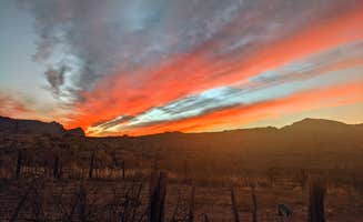
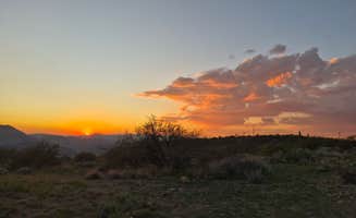
Desert photography at sunrise: The Superstition Mountains provide dramatic backdrops for photography, especially from Cactus Forest Dispersed. "We enjoyed waking up to the literal forest of cactus," shares Emma A., comparing the experience to "being able to backcountry camp in Saguaro NP."

What campers like

Accessible primitive camping: Despite being close to urban areas, some sites maintain a remote feel. "I love that it's not far out of town but an easy place to forget you live in town," notes Whitney W. about Bulldog Canyon, where permits are free but required.

Space between campsites: Many dispersed areas offer privacy between sites. At Cactus Forest, "The cactuses and shrubs provided enough privacy between each site for it to feel like it was just us out there, and shielded us from the road as well," according to Suzie K.

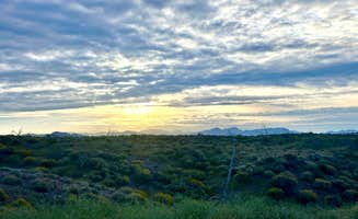
Desert ecosystem exploration: The unique Sonoran Desert landscape features prominently in camper reviews. "Absolutely beautiful landscape to walk around with Saguaros and Chollas everywhere," notes one camper about Superstition Mountain AZ state trust dispersed, though they caution to "Watch out for cactus pieces on the ground when you drive in!"

Cellular connectivity: Unlike many remote camping areas, several sites maintain usable cell service. "Cell phone coverage is good with Verizon," reports Jose G. about the Bulldog Canyon area, making these locations suitable for remote workers or those needing to stay connected.

What you should know

Permit requirements vary by location: Arizona State Trust Land permits cost $20 annually per family and are required for camping at Peralta Road and other state trust locations. For Bulldog Canyon Dispersed Camping - North Entrance, permits are available through email: "Easy to get a permit from the ranger station. Just email your name, address, phone number and driver's license number to sm.fs.mesa_ohs@usda.gov and you'll get your permit within 2 days for free."

Road conditions determine accessibility: Many access roads require high clearance vehicles. "The road is a bit tricky. I got here pretty smooth on my RWD Xterra, so while 4WD isn't necessary, I wouldn't come out here without high clearance and decent suspension," advises Francis D. about Hackamore Road.

OHV traffic impacts noise levels: Expect increased noise on weekends from off-highway vehicles. "This place is most used by OHVs so it can get noisy on the weekends," warns Jose G. about the Bulldog Canyon area.

Site selection timing matters: Arriving early improves your chances of securing preferred sites. "We had to drive a ways in to find a site but arrived right as the sun was setting so I imagine most folks were already set up for the night," notes Aliza N. about her experience at Bulldog Canyon.

Tips for camping with families

Desert hazard awareness: The natural environment requires vigilance with children. At Hackamore Road Dispersed, "Roads are a little rough, just take it slow. There are a lot of sites, lots of utvs and folks riding horses out here," reports Dexter V. The combination of vehicular traffic and desert terrain creates potential safety concerns.

Wildlife encounters: Children may enjoy observing desert wildlife from a safe distance. "Camp was raided by quail early in the morning and we had some cows visit but they didn't come too close," reports a camper at Cottonwood Canyon, describing the natural interactions possible.

Cactus safety protocols: Establish clear rules about touching desert plants. "It's incredibly prickly everywhere. Imagine that, prickly in the cactus forest? You'll want to avoid wearing sandals too," warns Rocco from Cactus Forest, adding that "I found myself with a piece of a cactus stuck to my foot and then when trying to remove it I got my hand stuck to the cactus that was stuck to my foot. Tools were required."

Morning activity planning: Early day activities avoid peak heat. "Beautiful desert scenery with view of mount lemmon. Easy to pull into with trailer," notes Jazmyn R. about Cactus Forest, suggesting the visual interest for children during cooler morning hours.

Tips from RVers

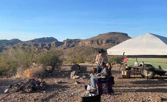
Site selection for larger rigs: Some areas accommodate larger RVs better than others. "We parked a 36ft Toyhauler and a 39ft Toyhauler in the first campsite from the entrance," shares Ronnie G. about Superstition Mountain AZ state trust dispersed, noting "A lot of RV/off road vehicle traffic during the day but very quiet at night."

Leveling challenges: Prepare for uneven terrain at most rustic camping sites near Queen Creek. "After we got the rig into position, I had to level out some spots with a shovel so the jacks and our blocks would be level when the rig's weight was on them," reports Will and Lucinda B. about their experience at Peralta Road.

Road condition assessments: Route planning should include current road information. "Road coming is not as bad some say, the company that works down this road keeps it maintained," notes Steve T. about Cottonwood Canyon Road, countering some negative reviews about access.

Advance scouting: When possible, scout locations before bringing large rigs. "Had the wife scout out a spot on her motorcycle and sidecar," shares Will and Lucinda B., demonstrating a practical approach to finding suitable rustic camping spots near Queen Creek.

Frequently Asked Questions

How does Queen Creek dispersed camping compare to Cave Creek?

Queen Creek and Cave Creek dispersed camping areas offer different experiences. The Queen Creek area features options like Peralta Road Dispersed Camping with stunning Sonoran Desert landscapes and multiple pull-offs for privacy. The area quickly transitions from suburban sprawl to natural desert terrain. Cave Creek dispersed camping tends to be at higher elevations with different vegetation and terrain. Superstition Mountains Dispersed Sites along Hwy 88 are beautiful but recommended only for high-clearance vehicles and non-tent camping due to rocky ground and windy conditions. Queen Creek generally offers easier access from Phoenix, while Cave Creek provides more elevation change and cooler temperatures.

Is boondocking allowed in Queen Creek and what are the rules?

Boondocking (dispersed camping without hookups) is allowed in designated areas near Queen Creek, but you must follow specific rules. At Bulldog Canyon Dispersed Camping, you'll need a permit and gate code to access the camping area. The standard 14-day stay limit applies to most dispersed sites in the region. Pack out all trash, bring your own water, and practice Leave No Trace principles. For areas like Mesquite Wash Dispersed, located northeast of Fountain Hills off SR 87, camping is permitted but be aware the area is popular with off-road vehicles. Always check current regulations with land management agencies before setting up camp.

Where can I find BLM dispersed camping near Queen Creek?

Several BLM dispersed camping areas are available near Queen Creek. The Sonoran Desert National Monument Camp offers free camping accessible via Interstate 8, Exit #140. Take the gravel road south, though be prepared for rough washboard conditions. Another option is BLM Sonoran Desert National Monument - Vekol Road Dispersed Camping Area, accessible from Interstate 8, Exit 144. The BLM land begins about 0.6 miles south of the exit. Both locations offer true dispersed camping experiences with no facilities, so bring everything you need including water and pack out all waste.