Dispersed camping sites near Queen Creek, Arizona range from desert terrain to mountainous areas with elevations between 1,500-4,000 feet. The region experiences hot summers with temperatures often exceeding 100°F and mild winters with occasional frost. Most primitive campsites require high-clearance vehicles due to rough access roads and have seasonal fire restrictions during drought conditions.
What to do
Mountain biking access: McDowell Regional Park offers excellent mountain biking directly from the Ironwood Campground. According to Jeff B., there are "Excellent mountain biking and hiking trails right out of the campground." The park features various trail difficulties suitable for beginners to advanced riders.
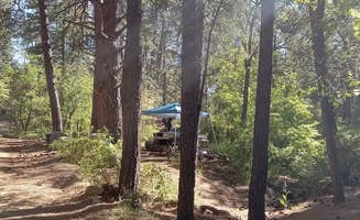
Hiking opportunities: Numerous hiking trails surround the primitive campsites at Peralta Regional Park. Julie F. notes it's "Very close to popular hiking trails. We enjoyed the rustic campsite." For a different experience, Sulphide Del Rey Campground offers pine-surrounded trails with Rachel W. describing it as "Beautiful campground on a hill surrounded by pines."
Wildlife viewing: The canyon waterways near Queen Creek provide unique wildlife viewing opportunities. At The Point Campground, paddlers can observe desert wildlife while traveling to campsites. Bighorn sheep sightings are common in the canyon areas, particularly during morning and evening hours when animals are most active.
What campers like
Dark skies for stargazing: Campers at Sulphide Del Rey Campground appreciate the exceptional night sky viewing. Rachel W. shares, "Perfectly dark except for stars between the trees and your fire." The campground sits at higher elevation away from city lights, creating optimal stargazing conditions.
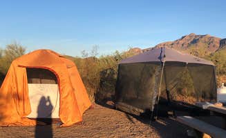
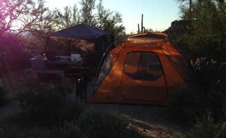
Spacious, separated sites: At McDowell Regional Park, campers enjoy well-spaced camping areas. Bill notes, "Sites are fairly well spread out," while Albert V. adds, "The sites are spaced out and in general it's very quite." This separation provides better privacy than many other desert camping areas.
Natural surroundings: The Point Campground offers unique desert canyon surroundings accessible only by water. The boat-in location features covered picnic tables and established fire pits in a remote setting. The peaceful atmosphere attracts campers seeking solitude away from crowded campgrounds.
What you should know
Road conditions: Access roads to many dispersed campsites near Queen Creek require appropriate vehicles. At Hackamore Road Dispersed area, multiple campers warn about challenging roads. Jeff D. states, "It's a good spot, but the road is atrocious. I nearly ripped off my equalizer system." Similarly, James B. reports the road is "full of pot holes and almost impassable."
Recent closures: Before traveling to dispersed camping areas, verify current status. As of March 2024, Hackamore Road Dispersed camping area was temporarily unavailable according to Freddie F., who reported, "This area and the whole bulldog canyon are are closed for construction." Peralta Regional Park also experienced changes with Caitlin noting, "as of May 2025, they have dug TRENCHES in front of every single dispersed camping site."
Water requirements: No drinking water exists at most dispersed tent campsites near Queen Creek. Pack 1 gallon per person per day minimum, with additional water recommended during summer months when temperatures frequently exceed 100°F. Most sites have no water sources for filtering or purification.
Tips for camping with families
Playground access: McDowell Regional Park-Ironwood provides family-friendly amenities including a playground. Mark L. mentions, "We stayed in site 27 which was close to the kids playground." The park offers shorter hiking options suitable for children with Mark noting, "We did do a short 3 mile hike and it was very nice on the Granite and then Wagner trail."
Safety considerations: When camping with children at Sulphide Del Rey, Rachel W. cautions, "Please be careful with fires, keep them small, because there's already clear fire damage all around the area." The remote location means families should arrive fully prepared as Rachel advises, "Do pack everything you need, don't plan to drive back into town if you can help it."
Site selection for tents: Finding flat tent sites can be challenging at certain locations. At Diversion Dam, Krista Z. warns, "The open areas are fairly rocky," and notes limited shade coverage. Rachel W. shares a similar experience at Sulphide Del Rey: "I will say there is very little parking and a couple sites have very little flat ground for tents."
Tips from RVers
Clearance requirements: RVers should carefully consider vehicle clearance before attempting access roads to dispersed camping areas. At Hackamore Road, Paranormal N. warns, "So unless you have high clearance. Stay away. We have a 40ft school bus and we'll if not for the potholes Everywhere it's the horrid uneven land." They clarify, "if you are not RV camping then you'll be 100% okay."
Alternative RV options: For those with standard clearance RVs seeking tent campsites near Queen Creek, Arizona, Michael L. notes that Sulphide Del Rey has "Not very much room for a trailer, mostly tent camping." He adds a practical note about connectivity: "Did get cell phone service there though," which may appeal to those needing to stay connected.


 Ranger